

With hundreds of km of hiking trails to choose from, it can be challenging to decide where to hike in Andorra.
But the good news is, it’s pretty hard to go wrong with any hike around here. One of our favourite things about Andorra is the variety of hiking trails and scenery. You can hike up to the rocky peaks, visit alpine lakes, admire wildflower meadows, or get lost in lush forests.
In this guide, you won’t find an exhaustive list of all the hikes in the country (it would be endless!), but 15 cherry-picked routes that we’ve hiked over the years and cover all hiking levels, from beginners to seasoned hikers.
This guide has all the important information you need about each route. So, all you need to do is choose your next adventure, lace up your hiking boots, and hit the trail!
* Post written for the first time in May 2023 and updated in March 2026.
⚠️ Important!
Andorra is a fantastic place to visit year-round. However, we recommend visiting from mid-June to mid-October for summer hiking and lake adventures. Remember that some higher-elevation trails can hold onto snow even into the beginning of July.
Beginner-friendly hiking routes in Andorra
These hiking routes in Andorra are perfect for the whole family, beginners, or when you want to take things easy. They’re lovely walks with no more than 300 m of elevation gain, which usually take between 1 and 3 hours.
Ruta del Ferro
📍Starting point: Mina de Llorts
↔️ Distance: 4.24 km (one way)
⬆️ Elevation gain: 126 m
🟢 Level: Easy
🧭 Wikiloc route
Ruta del Ferro (Iron route) is an easy walk that combines nature and culture. Along the trail, you’ll discover the importance of the metal industry in Andorra through sculptures that explain the extraction, transformation, and sale of iron in Andorra. The statues are made, of course, of iron!
This route begins at Mina de Llorts, an old iron mine that is 30 m deep and can be visited in summer.
After a leisurely walk along the flat first part of the trail and a slightly uphill second part, you’ll reach La Cortinada. Here, you can immerse yourself in the local culture by visiting a church and two old mills.
When it’s time to head back, you have two options: retrace your steps along the same path, or hop on the bus of the Ordino Parish, which connects La Cortinada with Mines de Llorts.
👌🏼 Our tip
Hungry after the hike? Cross the street in front of the Llorts mines and grab some food at the cosy restaurant Braseria La Neu (open from 1 to 3:45 pm). It couldn’t be easier!
We’ve eaten there several times and love it. The food delicious and the decor makes you feel at home from the moment you step in.
Bear in mind that it tends to be crowded, especially in summer, so booking in advance is better.
🥾 Want to make this route longer?
Once you reach La Cortinada, you can continue walking until Ordino, following the Camí Ral. We highly recommend it.
If you’ve parked the car in Llorts, you can take the bus from Ordino to get back to the car.
Llac d’Engolasters and Circuit de les Fonts
📍Starting point: Engolasters parking lot
↔️ Distance: 5.61 km (circular)
⬆️ Elevation gain: 136 m
🟢 Level: Easy
🧭 Wikiloc route
Engolasters Lake is one of the most well-known and accessible lakes in Andorra. But not because of it is less beautiful.
The lake itself is worth a visit, but what we really love are the surroundings: lush green forests, picnic areas, and a lookout that overlooks the country’s capital.
Only 10 minutes by car separate the city centre of Andorra La Vella from the lake. Because of this and its accessibility (the parking lot is only a short walk from the lake), it tends to be pretty crowded in summer.
The hike we propose combines circling the lake with a walk through the forest and exploring the Circuit de les Fonts later. This is a flat circuit through the woods with a lookout and a picnic area. So, the route is definitely varied!
Moreover, if you want to complete your day, there are several activities you can do without moving the car at all.
Fans of climbing will find their place in the Circuit de les Fonts, which has several climbing routes along the trail. If you would rather ride your bike, there is a bike park next to the parking lot.
Finally, children (and adults, too!) can have fun at Bosc Aventura. It’s an adventure park with four aerial circuits featuring zip lines, bridges, and other cool obstacles.
 Camí del Gall sign
- Camí del Gall
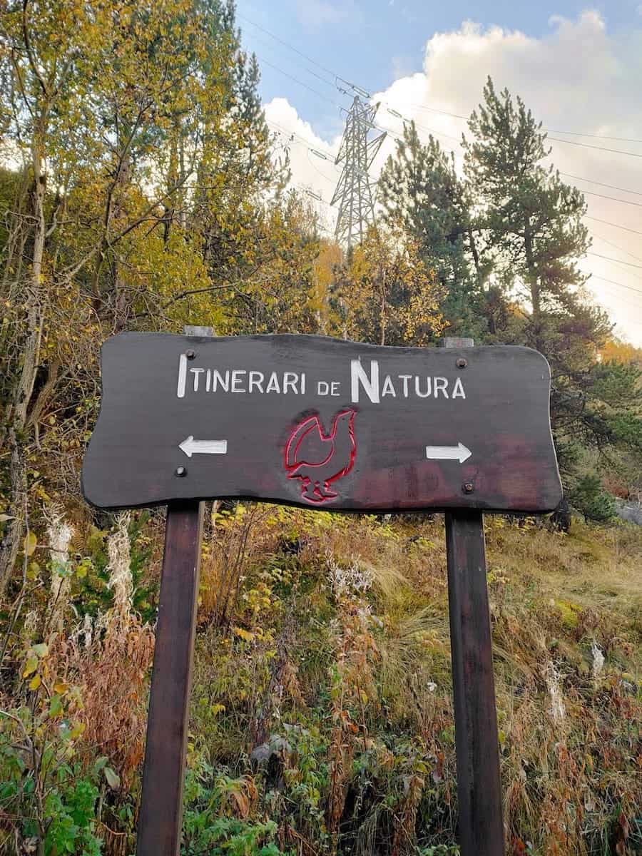
Camí del Gall
📍Starting point: Canillo
↔️ Distance: 5.86 km (one way)
⬆️ Elevation gain: 285 m
🟢 Level: Easy
🧭 Wikiloc route
This walk is easy, beautiful, and fun.
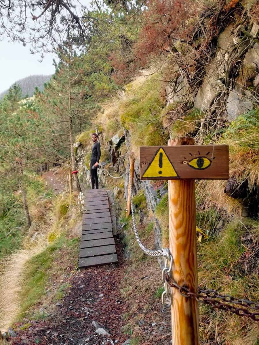
It starts in Canillo and is signposted with a red rooster. Along the route, you’ll find a Romanic church and several lookouts, perfect for admiring the surrounding villages and mountains.
Although easy, the walk is definitely entertaining! It has a tunnel, some wooden bridges, and a section equipped with chains.
The route ends in Soldeu, another mountain village. You can either return walking through the same path or take the buses L3 or L4 connecting both villages (the stops in Canillo are Plaça de l’Areny or El Molí).
🧒🏼 Going with children?
If you want to make the walk more effortless, you can do it in reverse by starting from Soldeu and ending in Canillo. This way, the whole route will be downhill instead of uphill.
🥾 Looking for more easy hikes?
It wasn’t easy to choose only three of them, so we decided to write a whole blog post only with beginner-friendly hikes.
Intermediate hiking routes in Andorra
Those hiking routes in Andorra are perfect for people in good shape or who want to take on a challenge. You don’t need to be a seasoned hiker, as the terrain is not technical. But you need to be used to exercise and, above all, have motivation!
They’re all high-altitude hikes with an elevation gain between 500 and 800 m, which usually take between 3 and 5 hours.
Estanys de Juclar
📍Starting point: Centre d’Interpretació de la Vall d’Incles
↔️ Distance: 4.6 km (one way)
⬆️ Elevation gain: 465 m
🟠 Level: Easy-Intermediate
🧭 Wikiloc route
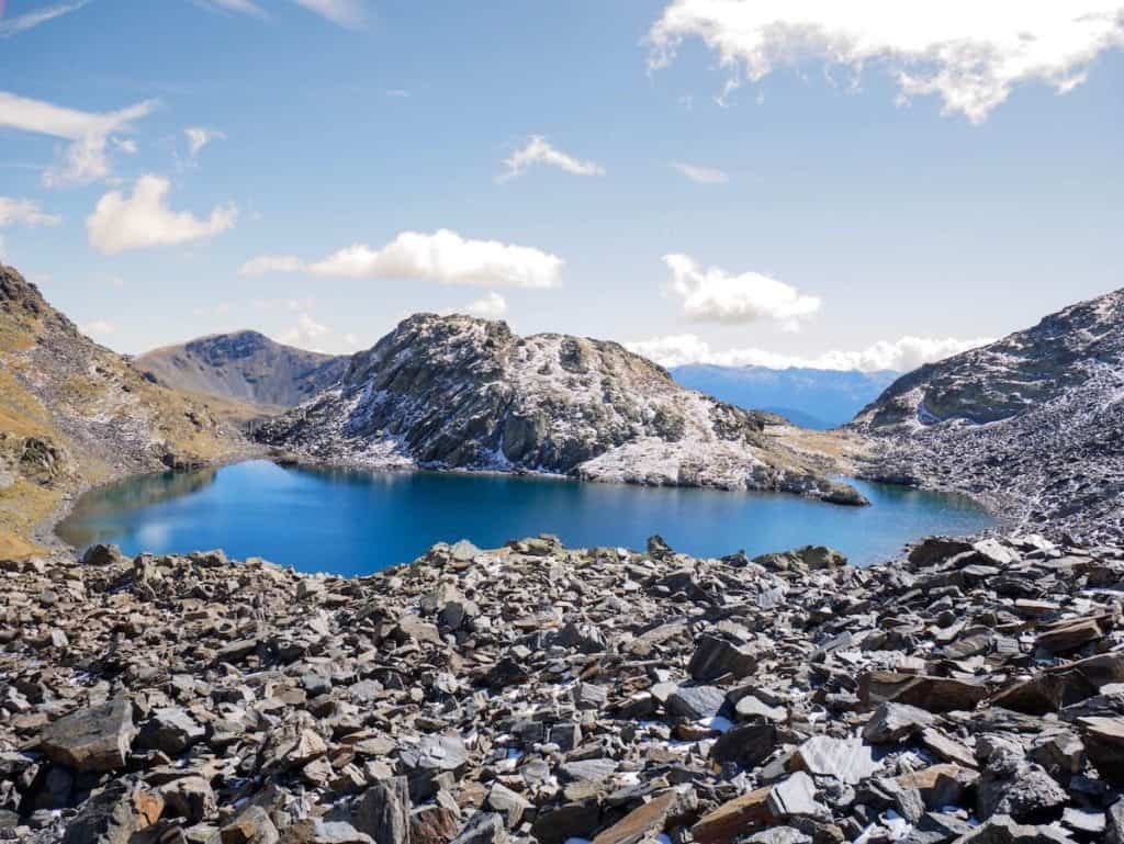
Estanys del Juclar is a classic Andorran hike for a good reason. The trail to the Juclar Lakes is the most popular in Vall d’Incles, one of the country’s most breathtaking valleys.
It winds through forests, waterfalls, and stone bridges before arriving at two gorgeous alpine lakes surrounded by craggy mountain peaks.
If you’re up for a drink to boost your energy, there’s a mountain hut next to the first lake. Staying at the hut is also an excellent option if you plan on sleeping in the middle of the mountains but don’t fancy sleeping in a tent.
Keep in mind that this isn’t the hike we would choose to escape from crowds. But it is an excellent one to work on your cardio and hiking legs while climbing the switchbacks to the lakes.
⚠️ Important!
It’s only possible to park in the Centre d’Interpretació de la Vall d’Incles from mid-Sep to mid-June. During summer, the road is closed to vehicles from 9 am to 6 pm. So you’ll have to park at the parking lot Vall d’Incles and walk on the road or through the forest (which takes 45 min to 1 h).
Another option is to take the electric train to the starting point. You can buy the tickets at the info booth beside the parking lot.
 Circ de Tristaina
- Mirador Solar de Tristaina
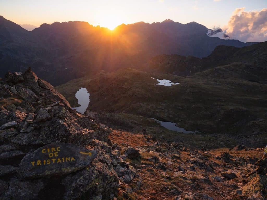
Mirador solar de Tristaina and Llacs de Tristaina
📍Starting point: Ordino Arcalís parking lot
↔️ Distance: 6.15 km (circular)
⬆️ Elevation gain: 511 m
🟠 Level: Easy-Intermediate
🧭 Wikiloc route
Although it’s the newest lookout in Andorra, the Mirador Solar de Tristaina is already quite popular. It’s located at the peak of Peyreguils, so you’ll get epic views of the surrounding mountains and several alpine lakes.
The hike to the lookout is steep, but the panoramic views are absolutely worth the effort.
There are several ways to get to the lookout. Our favourite (and the most epic) is to hike to the Tristaina lakes, then go up to the lookout, and go down passing by the Creussans lake. This way, you get to pass by four stunning alpine lakes.
Remember that the area is pretty crowded in summertime because people can get to the lookout via a cable car. Therefore, we recommend doing it early in the morning or late in the afternoon.
👌🏼 Our tip
If you’re up for a sunset adventure, we can’t recommend this hike enough. We did it last summer, and OMG! The sunset from the lookout is just spectacular. Also, the way down is relatively easy, even if you do it when it’s dark. Remember to take a headlamp and some layers, as it gets colder when the sun disappears.
⚠️ Important!
It’s only possible to park in the Ordino Arcalís parking lot from mid-September to mid-July.
During summer, the road is closed to vehicles from 8:30 am to 5:30 pm, so you’ll have to park at this parking lot and walk through a path next to the road (which takes 30 to 45 min) to the starting point.
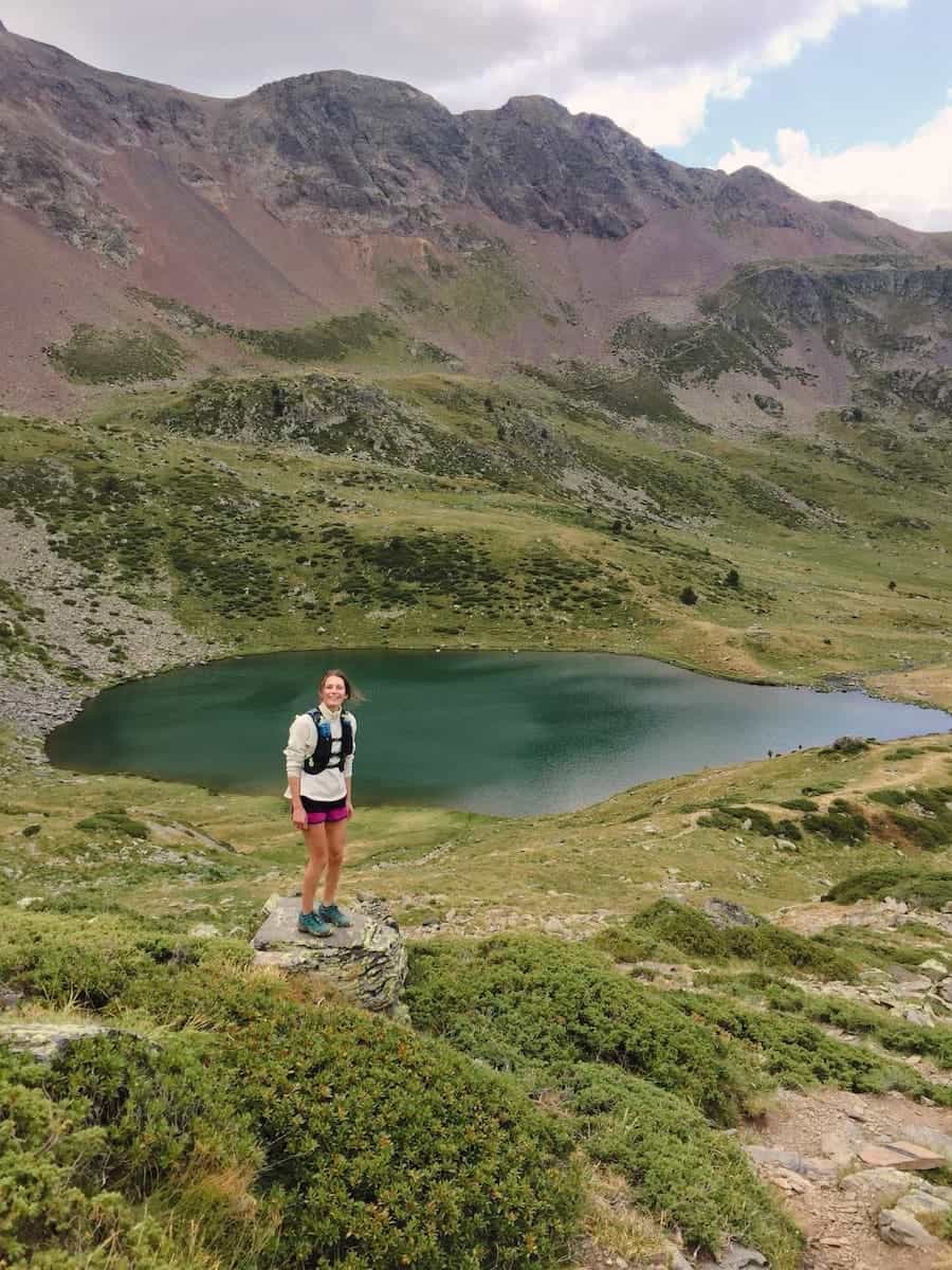
 Estany de l’Isla
 Estany de l’Isla
Estany de l’Isla and Estany de Cabana Sorda
📍Starting point: Parking lot Vall d’Incles
↔️ Distance: 12 km (circular)
⬆️ Elevation gain: 701 m
🟠 Level: Intermediate
🧭 Wikiloc route
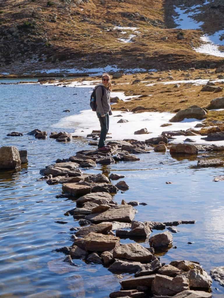
In our opinion, this is a highly underrated hike in the Vall d’Incles. Although the Cabana Sorda lake is pretty well-known, few hikers venture to the Estany de l’Isla lake… and they don’t know what they’re missing!
Estany de l’Isla (Island Lake) is a beautiful alpine lake with a little islet in the middle, hence the name. You can get there by crossing the lake via a rocky path (a great way to test your balance!).
After that, add a visit to the nearby lake Cabana Sorda, and you have a stunning circular route. Hiking both lakes makes a good combo for spending a day exploring this breathtaking valley.
During the hike, expect a strenuous climb, mainly through rocky terrain, until reaching Estany de l’Isla.
Estanys de la Vall del Riu
📍Starting point: Carretera dels Plans de Ransol
↔️ Distance: 5.86 km (one way)
⬆️ Elevation gain: 720 m
🟠 Level: Intermediate
🧭 Wikiloc route
Go for this hike if you’re looking for scenic landscapes and epic views of Ransol Valley, alpine meadows, and the Grandvalira ski resort.
Your adventure starts in Els Plans. There, the trail starts behind charming stone houses with red windows, reminiscent of a scene from Heidi.
The initial section of the hike is a gentle meander, following dry stone walls and crossing a serene river. As you progress, the path leads you into a picturesque pine and aspen forest, gradually ascending with each step.
Soon, you’ll pass a non-guarded mountain. Continue over a scree until finally reaching two small lakes and a big one, Estany Gran de la Vall del Riu. This is one of Andorra’s largest lakes, with a surface of 4 hectares.
This hike is less popular than others in Andorra. So it’s perfect to escape the crowds that tend to flock to Vall d’Incles or Llacs de Tristaina.
- Casamanya Peak
- Casamanya hike
Pic de Casamanya
📍Starting point: Coll d’Ordino
↔️ Distance: 3.75 km (one way)
⬆️ Elevation gain: 750 m
🟠 Level: Intermediate
🧭 Wikiloc route
A classic among locals, this hilly peak is a relatively easy adventure for the warmer months. The hike presents no technical difficulty except for the cumulative gain.
The views from the top are absolutely mind-blowing because the peak is located in the heart of the country. So you can admire all the surrounding mountain ranges.
We’ve done it so many times we’ve lost count! With our families, to watch the sunset, as a training for a trail running race…
Our favourite thing about Casamanya is the variety of landscapes: green forests at the beginning that disappear later, giving way to otherworldly rounded hills.
If you’re interested in this hike, check out our in-depth Casamanya guide. It includes information on how to get there, what to expect, and what to pack for this adventure.
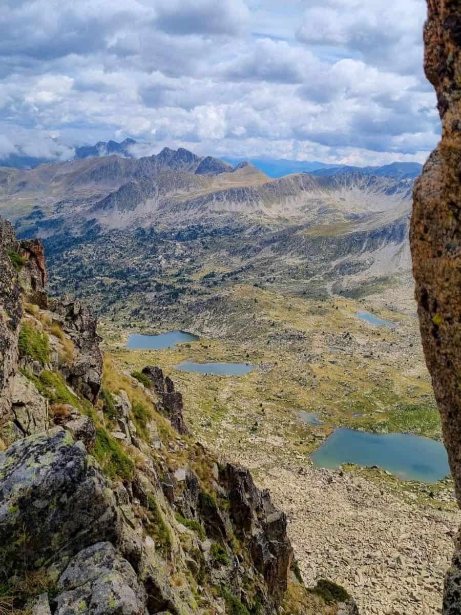
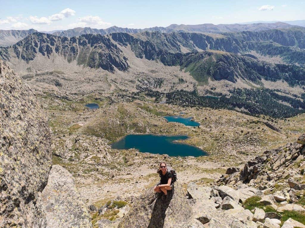
Estanys i Pic de Pessons and Estanys de la Solana
📍Starting point: Grau Roig parking lot
↔️ Distance: 12.12 km (circular)
⬆️ Elevation gain: 792 m
🟠 Level: Intermediate
🧭 Wikiloc route
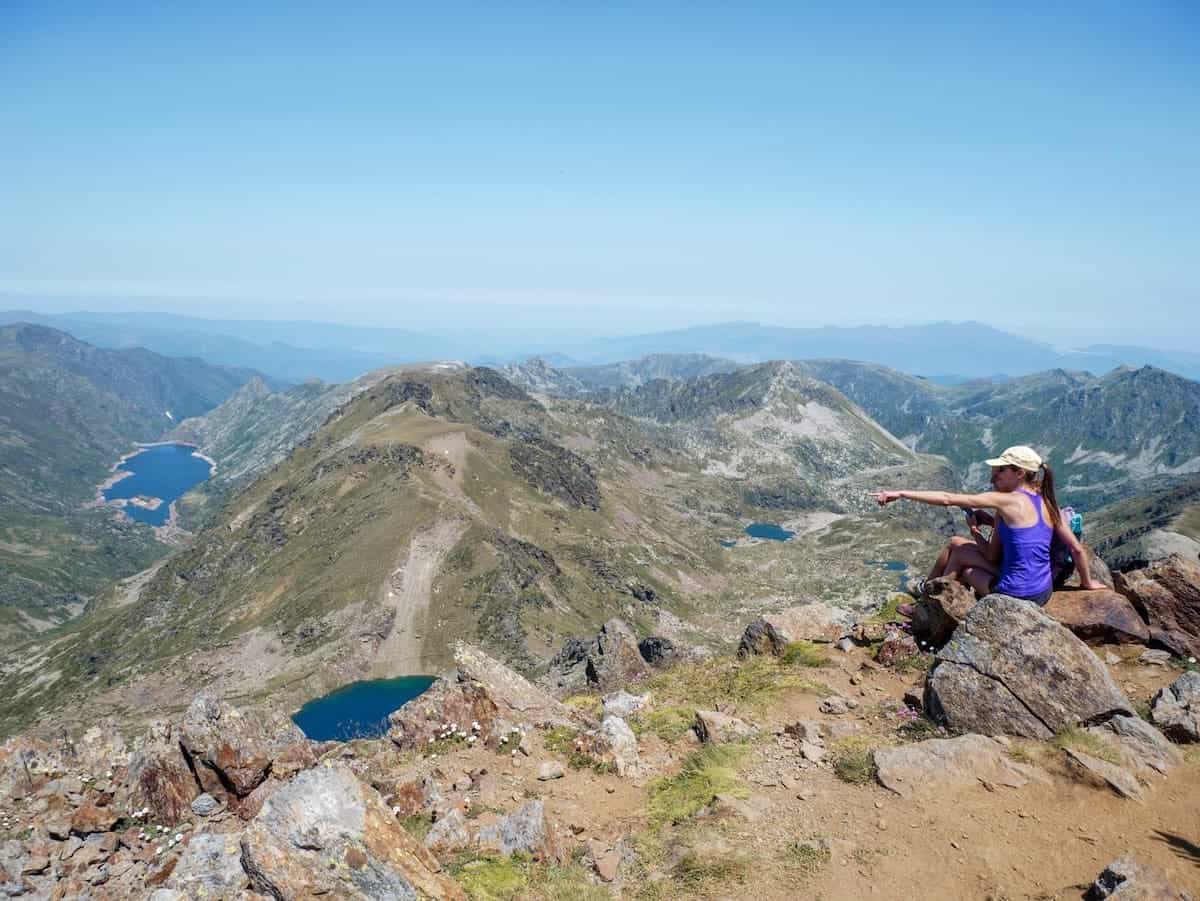
Love mountain lakes? Then, this hike is for you!
Pessons are six alpine lakes, one after the other, located in a breathtaking granitic glacial cirque and surrounded by mountains more than 2.800 m high.
The beginning of the hike can be crowded in summer because it’s an easy path suitable for everyone. Also, it unwinds through the ski resort, so it isn’t very interesting. But don’t despair! As soon as you start climbing, things get better. You’ll leave most people behind, and the landscape will change completely. The further you get, the lonelier you’ll be!
This hike covers a decent amount of elevation gain, so we would say it’s moderate, but it leans towards strenuous.
We know the climb is challenging, but we can’t recommend getting to Pessons Peak enough. From there, you’ll have views of all six lakes and other alpine lakes nearby. It’s stunning and worth all the effort!
To make it more entertaining, the way down can be down a nearby path, allowing you to admire two more lakes: Estanys de la Solana.
⚠️ Important!
If you’re thinking about hiking to the Pessons Peak, keep in mind that you can find snow up til the end of June.
Challenging hiking routes in Andorra for seasoned hikers
Those hiking routes in Andorra are perfect for seasoned hikers and people in good physical shape.
They are all high-altitude hikes with an elevation gain of more than 1000 m, which usually take between 6 and 10 hours to complete.
Be ready for some technical sections on these routes, where you might need to scramble or climb over rocks, adding an extra layer of adventure to your hike.
⚠️ Important!
We recommend hiking these routes from the end of June to mid-October, as there is still snow at the beginning of June.
 Estanys d’Ensangents
- Alt del Griu peak
Estanys d’Ensangents and Alt del Griu
📍Starting point: Cortals d’Encamp
↔️ Distance: 5.96 km (one way)
⬆️ Elevation gain: 985 m
🔴 Level: Challenging
🧭 Wikiloc route
Alt del Griu is, without any doubt, one of our favourite hiking routes in Andorra. It has 2.879 m of altitude, so it’s a natural lookout with incredible views of the Ensangents Lakes, the Casamanya peak, and the Colells glacial cirque.
The trail to the top isn’t technically tricky because you don’t need to scramble over rocks. However, as we’re talking about the sixth-highest peak in Andorra and the highest one in the parish of Encamp, you can imagine the elevation gain is considerable.
It’s one of those hikes where the journey is as impressive and breathtaking as the destination. You’ll admire alpine lakes, green meadows, black pine forests, and wildflowers. Lots of colourful wildflowers!
Also, the hike passes by the Ensangets hut, a non-guarded mountain shelter located in an idyllic setting.
Estanys de l’Angonella
📍Starting point: Llorts
↔️ Distance: 5.45 km (one way)
⬆️ Elevation gain: 1015 m
🔴 Level: Challenging
🧭 Wikiloc route
Don’t be fooled by the short distance of this hike. The cumulative gain is more than 1000 m in less than 5.5 km, so the trail goes up non-stop! Having done this hike a few times, we can confirm it!
The trail starts in Llorts, a tiny, charming mountain village with traditional stone houses that, in summer, cover its balconies with colourful flowers. After walking through its cobbled streets for a few minutes, you leave the village behind and head up the mountains.
The trail unwinds through pine forests, and halfway up the hike, you’ll emerge from the forest to beautiful views. At this point, the lush vegetation disappears, giving way to green mountain meadows where you can often spot wild horses roaming free.
Keep pushing for a while, and you’ll finally be rewarded with fabulous views of the three emerald lakes. Because few people venture there, the landscape is wild and virgin.
Pic de l’Estanyó
📍Starting point: Vall de Sorteny
↔️ Distance: 11.72 km (circular)
⬆️ Elevation gain: 1135 m
🔴 Level: Challenging
🧭 Wikiloc route
The hike to Estanyó Peak is strenuous at around 12 km round-trip and 1135 m of elevation. But if you’re up for a challenge, this is an excellent choice for a fantastic hike in the natural park of Sorteny!
The trail meanders into the Sorteny Valley, passes by an alpine lake, and has incredible 360-degree views of the surrounding peaks from the top.
The Estanyó Peak is one of the seven peaks in Andorra exceeding 2.900 m in altitude. So, the views hardly get any better!
👌🏼 Our tip
We recommend making a slight detour on your way down and stopping at the Sorteny hut. Its terrace is the best place to enjoy a drink while soaking up the views! If you’re feeling hungry, the hut also offers a menu with local products. We’ve eaten there several times, and it’s delicious!
Pic de Font Blanca (through Estany Esbalçat)
📍Starting point: Cabanes del Castellar (Ordino-Arcalís)
↔️ Distance: 13.15 km (circular)
⬆️ Elevation gain: 1423 m
🔴 Level: Challenging
🧭 Wikiloc route
We discovered this hiking route not long ago, and it quickly became one of our best-loved summits in Andorra!
The Font Blanca Peak, a natural border between Andorra and France, offers stunning views of more than five mountain lakes.
The climb to the top is tough. But you’re distracted by the forest smells, alpine meadows, and wildflowers that pop up along the trail in summer.
The way down is done following a different trail to make the route more entertaining. This unwinds through hilly terrain and passes by the Estany Esbalçat, a gorgeous lake and the perfect spot to chill and enjoy a picnic.
Estany de la Nou
📍Starting point: Carretera d’Engolasters
↔️ Distance: 17.34 km (circular)
⬆️ Elevation gain: 1235 m
🔴 Level: Challenging
🧭 Wikiloc route
Located in one of the most remote and scenic valleys in Andorra, this hiking route will surely leave hikers speechless at more than one point. The Madriu-Perafita-Claror Valley is absolutely gorgeous, and not because we say so! It was declared a UNESCO World Heritage Site in 2004.
The Estany de la Nou circular hike basically allows you to explore some parts of this valley. It starts with a well-defined path that takes you to the Fontverd hut, where you can usually see livestock grazing. Soon, the track gains altitude, passing vast meadows inviting you to lie down on their grass, surrounded by forests and rocky peaks on the horizon.
The highest part of the hike is the Mainana mountain pass. From there, the views of the Estany de la Nou are superb. Then, the descent starts! You’ll soon be in front of the high-altitude lake with crystal-clear waters. On clear days, you can even see the surrounding mountains reflected in the lake. It’s beautiful!
Then comes the Perafita hut, an excellent place to take a break and enjoy a snack.
Finally, the trail descends following the river until reaching the starting point again.
 Comapedrosa Peak
- Estanys Forcats
Pic del Comapedrosa and Medacorba
📍Starting point: Arinsal
↔️ Distance: 16.26 km (circular)
⬆️ Elevation gain: 1836 m
⚫️ Level: Very difficult
🧭 Wikiloc route
❄️ Snow alert!
This route can be covered in snow up until the beginning of July. We don’t recommend doing it in June, unless you have experience and carry crampons.
In this spectacular hiking route, you’ll climb the highest peak of Andorra, stay in three different countries (yes, you heard us right!), and see more than five lakes. We were hiking and couldn’t stop saying “wow” every few km!
The hike takes place in the Comapedrosa Natural Park and summits the Medacorba Peak and the Comapedrosa Peak. Along the route, you’ll encounter many landscapes, from six alpine lakes to little waterfalls and craggy mountain walls. Also, get ready for the 360º views from the two peaks. They are SO gorgeous!
This route is demanding, so we only recommend it to seasoned hikers with experience in high-altitude and isolated areas.
If you’re interested in this hike, check out our in-depth guide. It includes instructions on how to get there, what to expect, and what to pack for this adventure.
⚠️ Important!
The track presents no technical difficulties, except for the steep and exposed climb up to Medacorba Peak. If you aren’t used to scrambling or are afraid of heights, we recommend skipping the climb to this peak.
Also, the area is quite isolated, and you’re unlikely to encounter other people, so we recommend being well-prepared and comfortable hiking in remote areas.
🥾 Shorter versions of this hike
You have five options:
1. Hike to Pla de l’Estany hut (🟠 intermediate): 3.5 km one way. The way back follows the same trail.
2. Hike to Comapedrosa hut (🟠 intermediate): 3.7 km one way. The way back follows the same trail.
3. Hike to Estanys Forcats (🔴 challenging): 5.6 km one way. The way back follows the same trail.
4. Hike to Pic de Medacorba (🔴 challenging): 6.5 km one way. The way back follows the same trail.
5. Hike to Pic de Comapedrosa (🔴 challenging): Climb the highest peak in Andorra. The track is 6.9 km one way.
Hut-to-hut hiking route in Andorra: Coronallacs
📍Starting point: Escaldes-Engordany
↔️ Distance: 92 km
⬆️ Elevation gain: 6868 m
⚫️ Level: Very difficult
🗓 Days needed: 5 days
🧭 Wikiloc track
Coronallacs is a wonderful way to discover the impressive mountain scenery in Andorra.
This circular hike links the four staffed huts in the country, allowing you to discover Andorra’s most remote and scenic spots. It’s divided into five stages and averages 18.4 km per day.
We did it in 2024, and we won’t lie…it’s a tough hike! The stages are long and, although the terrain isn’t technically difficult, there is an average elevation gain of more than 1300 m per section. This means long days (8-10 h) and going up and down a lot!
That said, the landscapes are mind-blowing and diverse (think alpine lakes, forests, green meadows, and rocky peaks), and the huts are really cosy! The huts have all the basic facilities needed, including a bed, a shower, and, sometimes, WiFi. But the best thing about the huts is the mountain food! After a day of hiking, the staff will treat you to delicious soups, local meat, and sweet treats, as well as coffee, tea, and, sometimes, even wine!
If you’re curious about this hike, read our guide to hiking Coronallacs. It includes an explanation of the stages, the huts, packing tips, and .gpx files.
⚠️ Important!
Since some of the hikes mentioned above are pretty popular, we can have a huge impact on the natural environments listed here. We recommend our “Stepping outdoors 101 guide” as a fun read before you plan your next hike.
Planning a trip to Andorra?
We’ve written several guides to help you discover Andorra during hiking season:

0 Comments