

Looking for an exciting challenge that involves breathtaking views and plenty of fresh mountain air? You’re in for a treat! The hike up Andorra’s highest peak, Comapedrosa, offers everything from rocky terrain to lush forests. And once at the top, you’ll be rewarded with unbeatable panoramas of the surrounding landscape.
We’ve summit this stunning mountain several times, and here we share all the details with you so you can replicate the adventure.
Our guide will take you through the scenic trails, provide helpful tips for the hike, and share all the excitement that comes from reaching the summit!
Ready for an unforgettable journey to the top of Comapedrosa? Let’s go!
* Post written for the first time in March 2023 and updated in July 2024.
Technical details
🥾 Distance: 13.32 km
⬆️ Elevation gain: 1.390 m
🟠 Level: Moderate. It’s a long route with a considerable elevation gain but without technical difficulty, except for a slightly aerial section (you can skip it though if you don’t feel comfortable).
⏱ Duration: Between 6 and 8 hours, depending on the number of stops you make and pictures you take!
🗓 When to go: The hiking season usually runs from the end of May to the end of October. Snow falls in the Comapedrosa from November to April, so you’ll need snowshoes or mountaineering skis.
🧭 Wikiloc track
Location of Comapedrosa and how to get there
Comapedrosa is the mountain that gives name to the natural park surrounding it, which was declared a protected area in 2003.
We’ve hiked there more times than we can remember! But we can’t get enough of its impressive mountain peaks, crystal-clear waterfalls and lakes, and beautiful forests. The park is also home to many high alpine fauna and vegetation, from marmots to vultures and roe deer.
With an imposing height of 2.942 m, Comapedrosa is the highest mountain in Andorra and the most emblematic one. The climb to the peak is not just a physical challenge, but a beautiful journey, changing from forest landscape in lower altitudes to glacial cirques once you get closer to the summit.
The route starts at the parking lot in Prat Sobirans. This is a paid parking lot. If you prefer to park for free, you can do so at the parking next to the Arinsal chairlift (only 5 min walking from the trailhead). Cross the tunnel with big wood letters saying Comapedrosa, and once you get out, turn right, and you’ll be at the trailhead.
If you prefer to get there by public transport, you’ll need to catch the L5 bus to Arinsal. Get out at the last stop (Aparcament d’Arinsal), which is the parking lot next to the Arinsal chairlift (mentioned above). You can check the schedule and stops on the bus website.
The hike to the Comapedrosa Peak
The hike to summit Comapedrosa starts at the residential area of Prat Sobirans. From the parking lot, turn right, and you’ll see a dirt road winding up. That’s the beginning of the route.
The track is signposted with painted yellow dots. But for the most part, you’ll also follow the red and white stripes that mark the GR-11. Check every now and then you see them, and you’ll know you’re on the right track!
The first section of the hike is the most boring. Keep going up the dirt road, following the signs for “Refugi i Alt del Comapedrosa.”
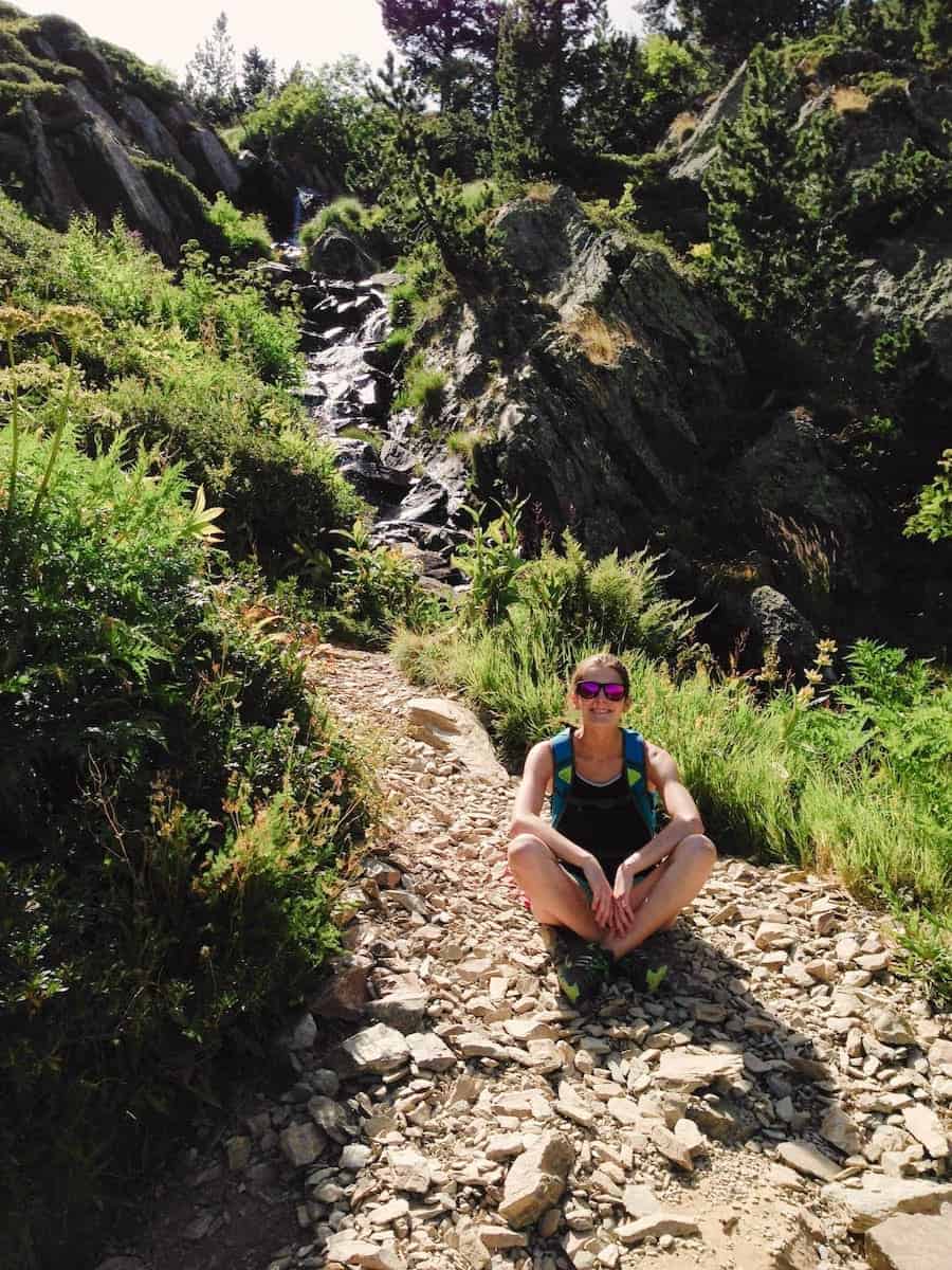
After 10 minutes or so, you’ll enter a beautiful red pine and fir forest, cross a small wooden bridge, and continue your way up through a black pine forest, always with the sound of the Pollós and Comapedrosa rivers in the background. Keep an eye out for tasty raspberries and blueberries, which will make your climb more delicious (and enjoyable)!
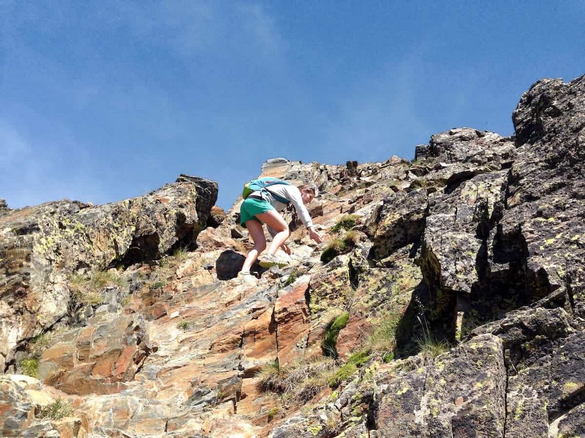
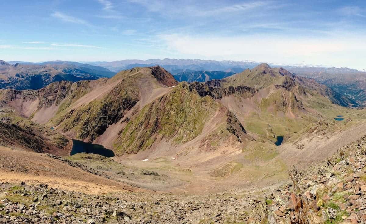
The path becomes rockier and steeper for a while, but keep going! Soon, you’ll reach the Comapedrosa mountain pass. Keep pushing, and once you get to the top, the landscape suddenly widens before you. You’ll be rewarded with beautiful views of a large plain (named Pleta del Comapedrosa). If you switch your attention to the mountains in front of you, you’ll also be able to spot the mountain’s U-shape glacial valleys.
The steep ascend gives you a break as you move through the comfortable, flat terrain of the plain.
Livestock farming was the main economic activity not long ago in these valleys, with the herds gathering in the plains. Can you spot the little cabin used by the shepherd as shelter?
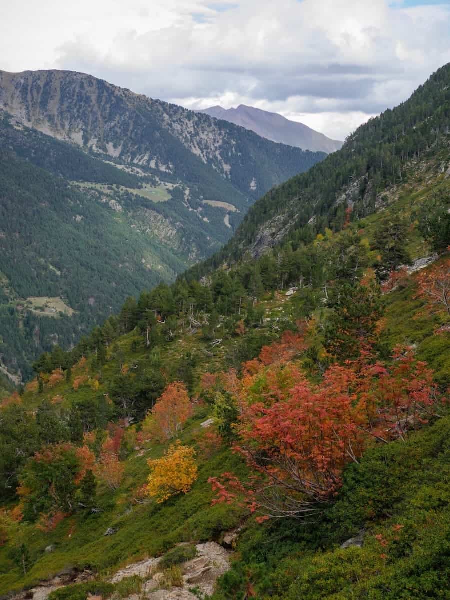
🍁 Our tip
Visiting Andorra in autumn and looking for autumn colours? The hike from the Prat Sobirans to Pleta del Comapedrosa will be a feast for your eyes!
Time to go up again! As you get further and further from the plain and start gaining altitude, the vegetation disappears, giving way to rocky screeds.
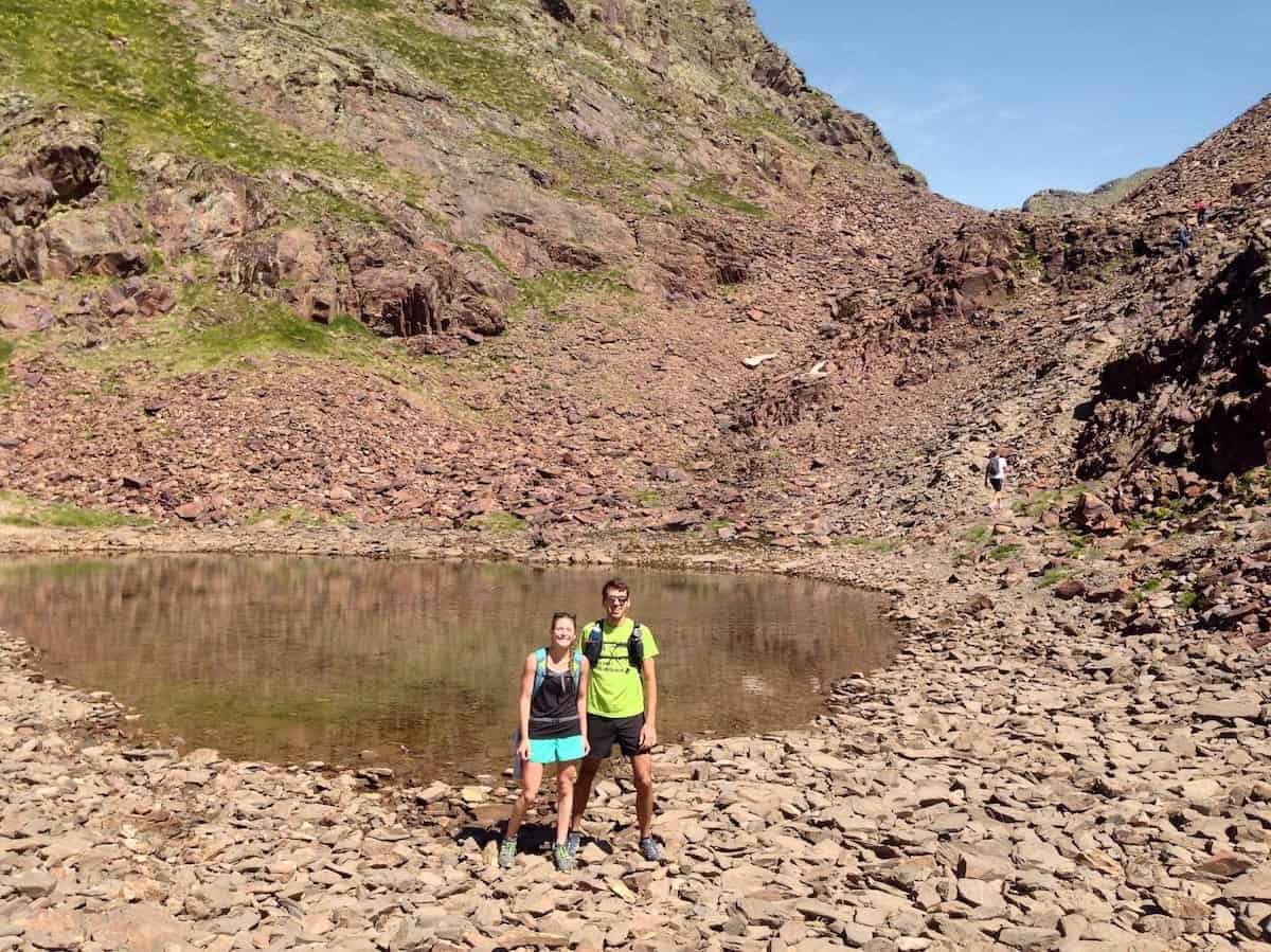
You’ll soon reach the Estany del Comapedrosa, a small body of water that contrasts with the stony landscape surrounding it.
Keep following the white and red marks until you stumble across a sign indicating “Alt de Comapedrosa” to the right and “Estany Negre” to the left. Both ways will get you up to the summit of the Comapedrosa.
However, the first one follows the mountain’s ridge and is an aerial section. If you are comfortable with this, go ahead! Follow the yellow dots and see how the Estany Negre gets smaller and smaller with each step. The views are mindblowing, and the climb is super fun.
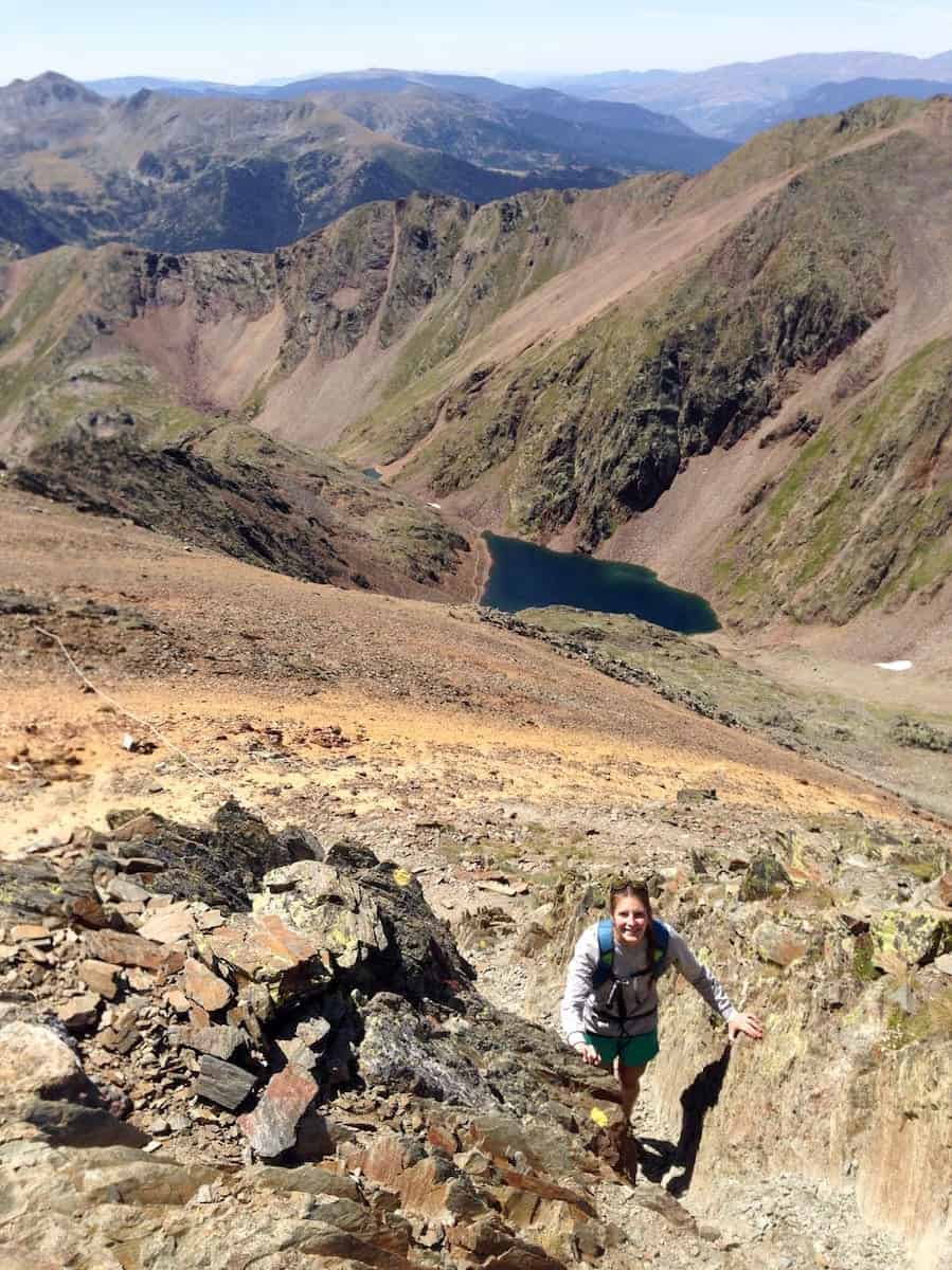
Instead, if you aren’t comfortable with heights or aerial sections, we recommend following the path to Estany Negre. In this case, keep following the white and red marks until you find a sign indicating the Comapedrosa Peak. You’ll then reach the summit through a path that is not exposed.
And volià! You’ve reached the summit. You can now say you’ve been to Andorra’s highest point!
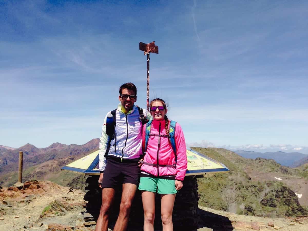
Take time to recover, eat a snack/lunch, and admire the views. From the top, the panoramic is impressive. You can admire the Pica d’Estats, the highest mountain in Catalonia, if you look northwest. In all other directions, you’ll have beautiful views of the mountain peaks of Andorra, Catalonia, and France. You’ll also be able to spot several lakes and the mountain village from where you started the hike: Arinsal.
Time to go down! One option is to descend following the same path you ascended through the mountain’s ridge. But we prefer the descent to Estany Negre. This allows you to do a semi-circular route and see a part you haven’t seen before.
Next to the summit, you’ll see a sign indicating “Portella de Baiau.” Follow that direction.
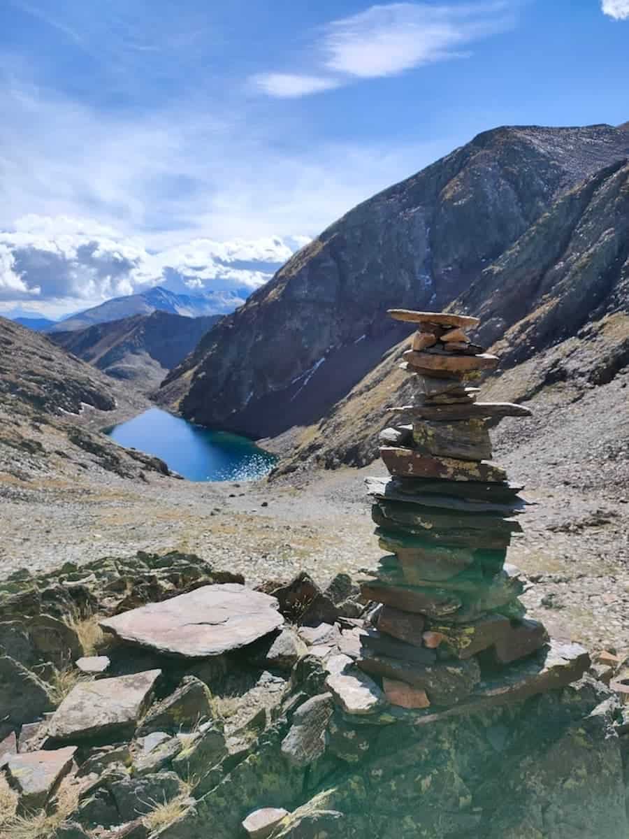
Just before reaching the mountain pass, you’ll find the white and red marks again and stumble upon another sign indicating the “Estany Negre”. That’s where you want to go.
In the distance, you can already see the lake Estany Negre, a glacial lake with intense blue waters. On sunny days, the water reflects the sunlight, creating bright spots that seem to be dancing as you move. It’s magical.
After skirting the lake, the trail keeps descending to the plain, following the same path you used to go up.
Once at the plain, you can detour and visit the Comapedrosa hut and the nearby Truites Lake. The hut is guarded from June to September, so you can enjoy a refreshing drink or a snack in an unbeatable setting.
From here, you follow the trail to the Comapedrosa mountain pass and descend through the same path you’ve taken to go up.
When you’re on the dirt road, 500 m before the end of the route, you’ll see a sign indicating “Circuit Interpretatiu del Comapedrosa”, pointing at a trail that goes through the forest. Instead of doing this last part through the dirt road, we recommend taking the forest detour. More beautiful and relaxing! Also, there’s an impressive waterfall. You’ll end up on the paved road you followed to meet the trailhead.
And that’s the end of the route. Well done! Now it’s time to chill, get a much-deserved shower and enjoy a delicious meal. If you’re looking for a place to eat, you can check our “Where to eat in Andorra: A guide to the best food finds” guide.
Things to take into account when hiking Comapedrosa
🌦 Never ever ignore the weather forecast! Looking through the window and seeing a clear sky doesn’t mean the weather will be good. What if it’s also super cold? Or the weather forecast predicts a big thunderstorm in two hours? Remember that the weather can change quickly in the mountains, and be prepared for that.
🧴 Grab plenty of water, sunscreen (reef-friendly!), and a cap or hat.
🌡 If hiking on a scorching day, starting very early in the morning is your best bet to avoid sweating like a pig!
🌬Even though you hike in summer, it’s never a bad idea to take a windproof jacket cause it can be windy on top. Also, an extra layer might come in handy as the weather in the mountains can change quickly.
💆🏼♀️ The trail gets quite busy in summer. If you’re looking for a more relaxing experience, we recommend going there at the end of spring or beginning of autumn.
👉🏼 Read next
To learn how to enjoy an outdoor experience responsibly while cracking a laugh, check out our fun guide, “Stepping outdoors 101: How to enjoy nature responsibly and be safe out there.”
We hope this guide helps you plan your Comapedrosa adventure and inspires you to climb the peak and enjoy its mindblowing views!
For more ideas on what to do in Andorra and how to plan your trip, check out our entire Andorra collection.

0 Comments