

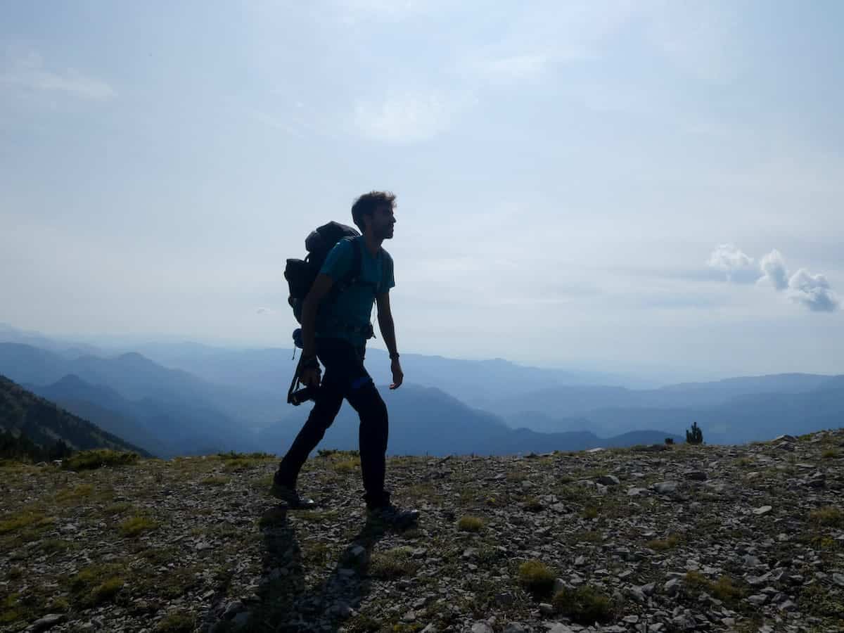
Mediterranean forests, endless meadows, rocky mountains, picturesque huts, and delicious food make the Cavalls del Vent one of Catalonia’s most popular thru-hiking trails, and it’s no wonder why!
The circular route links eight mountain huts in the Cadí-Moixeró Natural Park, a two-hour drive from Barcelona. Walkers can start at several points along the route and take the direction they prefer.
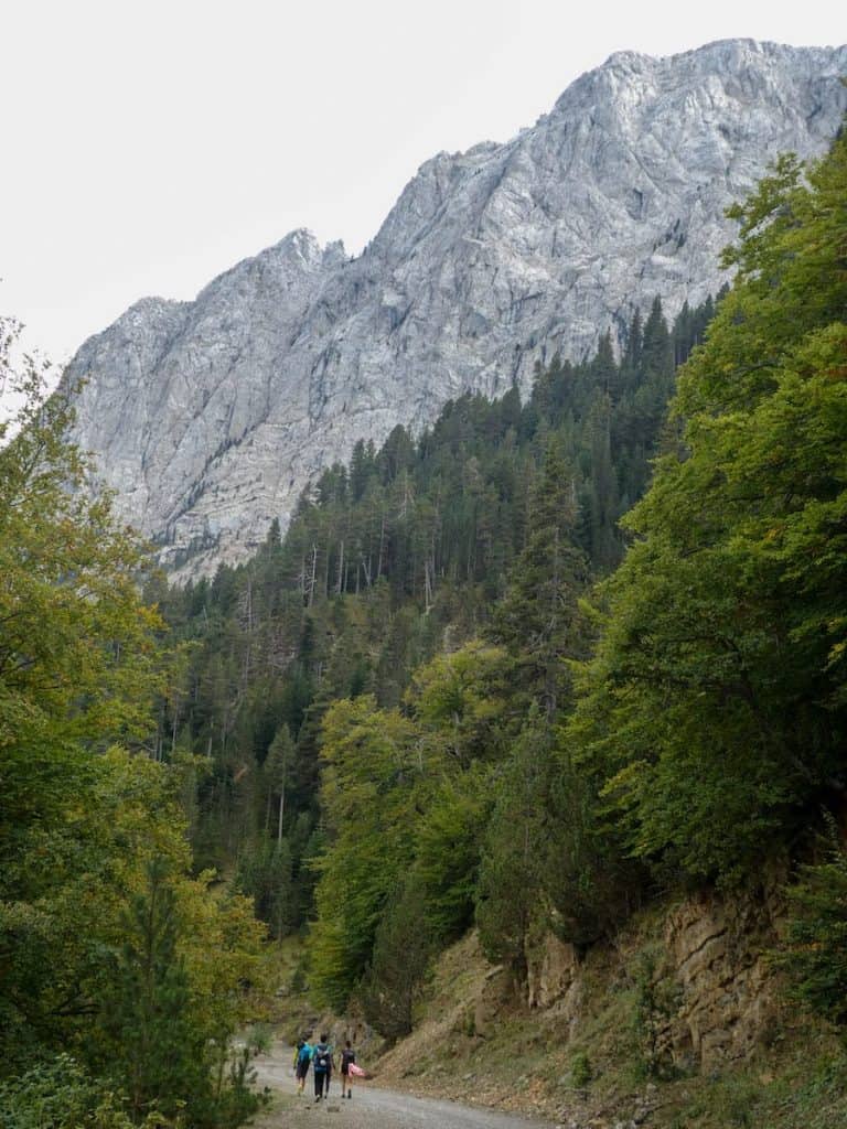
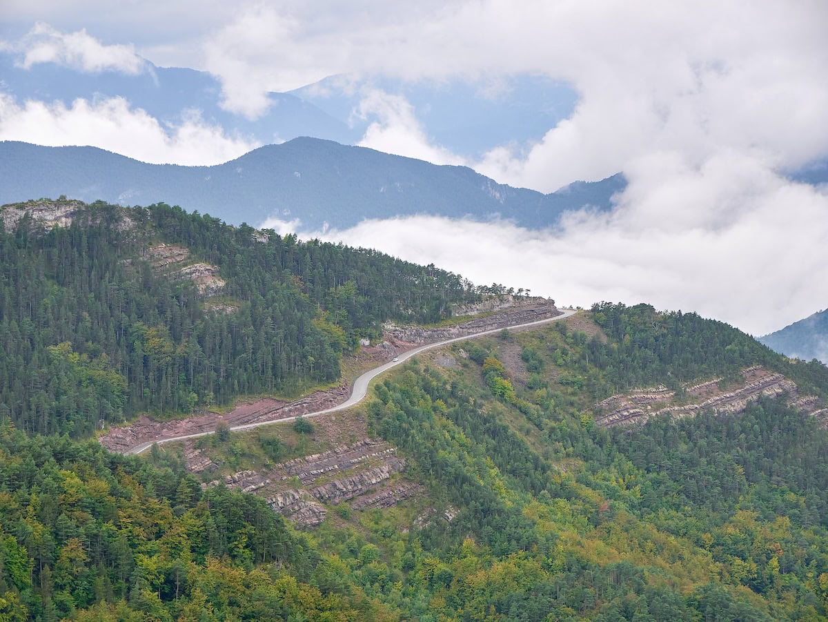
Covering over 80 km of track and running between the 902 m high Bastareny River Valley and the 2.513 m high Niu de l’Àliga shelter, the landscapes are as varied as spectacular.
Cavalls del Vent (which means Horses of the Wind) can be completed in 4 to 7 days. Each day, you hike to a mountain hut with basic facilities, including a bed, shower, and sometimes Wi-Fi. That feels great after walking all day! But the best is the mountain food: delicious soups, typical rice dishes, high-quality meat, you name it!
We hiked Cavalls del Vent with some family members in September 2020. We did it in four days, starting and finishing in the hut Cortals de l’Ingla.
Here are our review, tips, and photos to help you plan your Cavalls del Vent adventure!
* Post written for the first time in January 2022 and updated in February 2025.
Things to know before hiking Cavalls del Vent
Technical details
🥾 Total distance: 84.2 km
🟠 Difficulty: Moderate
⬆️ Cumulative elevation gain: 5.600 m
⏰ Duration: Between 4 and 7 days
🗓 Recommended season: Cavalls del Vent is a high-mountain route, so the best time to enjoy it is from June to September
The route is graded “moderate“, which we think is accurate. We regularly hike, and although it rained and was foggy, we found the track challenging but not technically difficult.
One thing that we would probably change is not to rush and to add an extra day. We did it in four days, and five would have been ideal. But this depends on everyone’s fitness level and how they like to face a hut-to-hut hike.
👌🏼 Our tip
September is an excellent month to do this hike as it isn’t as crowded as the summertime.
Where does the route start?
You can start the route from any of the huts in the park:
- Lluis Estasen hut: Access it from the Gresolet lookout (15-minute walk). You can’t reach this hut by car.
- Gresolet hut: Access it from Saldes or Gisclareny (a 1:30-hour walk) or by car (following a dirt road).
- Sant Jordi hut: Access it from Aparcament dels Empedrats (a 2-hour walk). You can’t reach this hut by car.
- Rebost hut: Access it from Bagà (a 3:30-hour walk) or by car by following the road Coll de Pal (BV-4024) and parking in this spot. Then, it’s a 1 km walk.
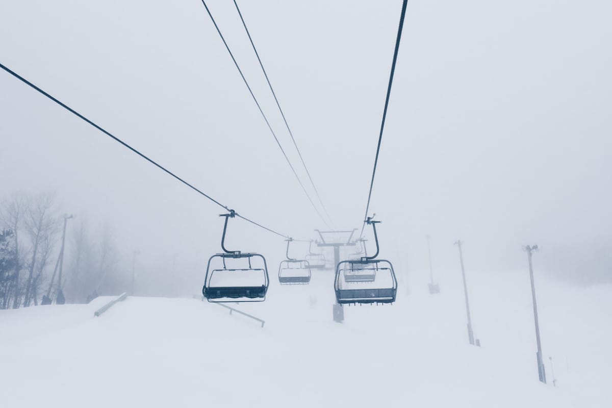
- Niu de l’Àliga hut: Access it from the ski station La Molina (a 2:30-hour walk) or by taking the chairlift “La Tosa” (the last one is at 4 pm). You can’t get to this hut by car.
- Serrat de les Esposes hut: Access it from Riu de Cerdanya (a 1:10-hour walk) or by car (following a dirt road).
- Cortals de l’Ingla hut: Access it from Bellver de Cerdanya (a 2:30-hour walk) or by car from Riu de Cerdanya (following a dirt road) or Bellver de Cerdanya (also a dirt road).
- Prat d’Aguiló hut: Access it from Montellà (a 3-hour walk) or with a 4WD by following a dirt road that starts in Montellà.
👌🏼 Our tip
If you are coming from Barcelona, your best options are to start from the Gresolet hut or Rebost hut. They’re both located approximately two hours’ drive from Barcelona. In this way, you don’t need to pay the toll Túnel del Cadí to enter the region of La Cerdanya, which costs 14.6€.
We chose to start from Cortals de l’Ingla because the number of km in each stage was quite balanced. Also, we could spend a night at Niu de l’Àliga hut, the highest guarded shelter of the Pyrenees. Sunset and sunrise were promising!
Reaching Cavalls del Vent by public transport
From Barcelona, you can reach Bagà by bus and then walk to the Rebost hut (7 km) or the Sant Jordi hut (10 km).
You can also reach La Molina by train. Select the train station from where you want to depart and choose La Molina as a destination. Once at the ski resort, you can get to the Niu de l’Àliga hut by chairlift.
For those who prefer not to walk long distances, the Cavalls del Vent organisation offers a flexible taxi service. This service can take you closer or pick you up anywhere accessible by motor vehicle. You can easily hire this service by calling the Booking Centre (+34 938 215 111).
Which direction is best to follow?
Regarding the direction of the route, we did it counterclockwise. You can do it clockwise and counterclockwise as it’s a circular track.
However, we recommend counterclockwise because it’s a bit easier, although the differences are minimal.
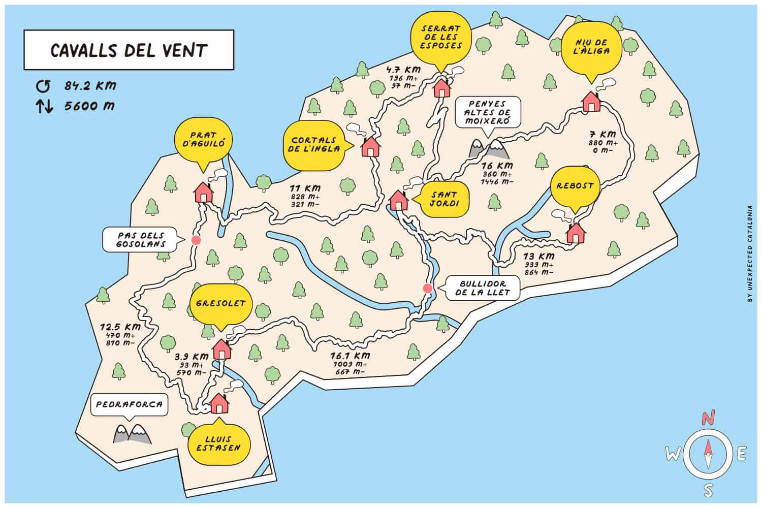
Here’s a map with the various mountain huts, their altitude, elevation gain, and distance between them to help you better plan your approach to this route:
Is the route marked?
The route is well-signposted with orange marks.
However, it’s wise to pack a map of the area. You can buy the map online, in some bookstores, or through the Cavalls del Vent organisation.
🧭 Wikilock track
If you want to download the track, here’s the official Wikilock route track.
Weather and gear recommendations
It’s not all sunshine and heat in the Catalan mountains! The weather can change rapidly; even though you’re hiking in summer, you can get rain and fog.
We recommend packing some warm clothes, even though you hike in summer. For example, a pair of gloves and a lightweight down jacket. You’ll also need waterproof gear (jacket, pants, and backpack cover), a head torch, and safety equipment, such as an emergency blanket and a first aid kit.
Pack sunglasses, a hat (or a cap), and sunscreen (reef-friendly!). There are several sections of the route where there isn’t a single shade.
Another thing you’ll be grateful for is earplugs. We bet you’ll appreciate them if your neighbour starts snoring! And a set of clothes only for the huts. There is nothing like reaching the hut all sweaty, taking a shower, and putting on some clean, warm, and cosy clothes!
You don’t need to bring slippers or flip-flops as all the huts give you Crocs.
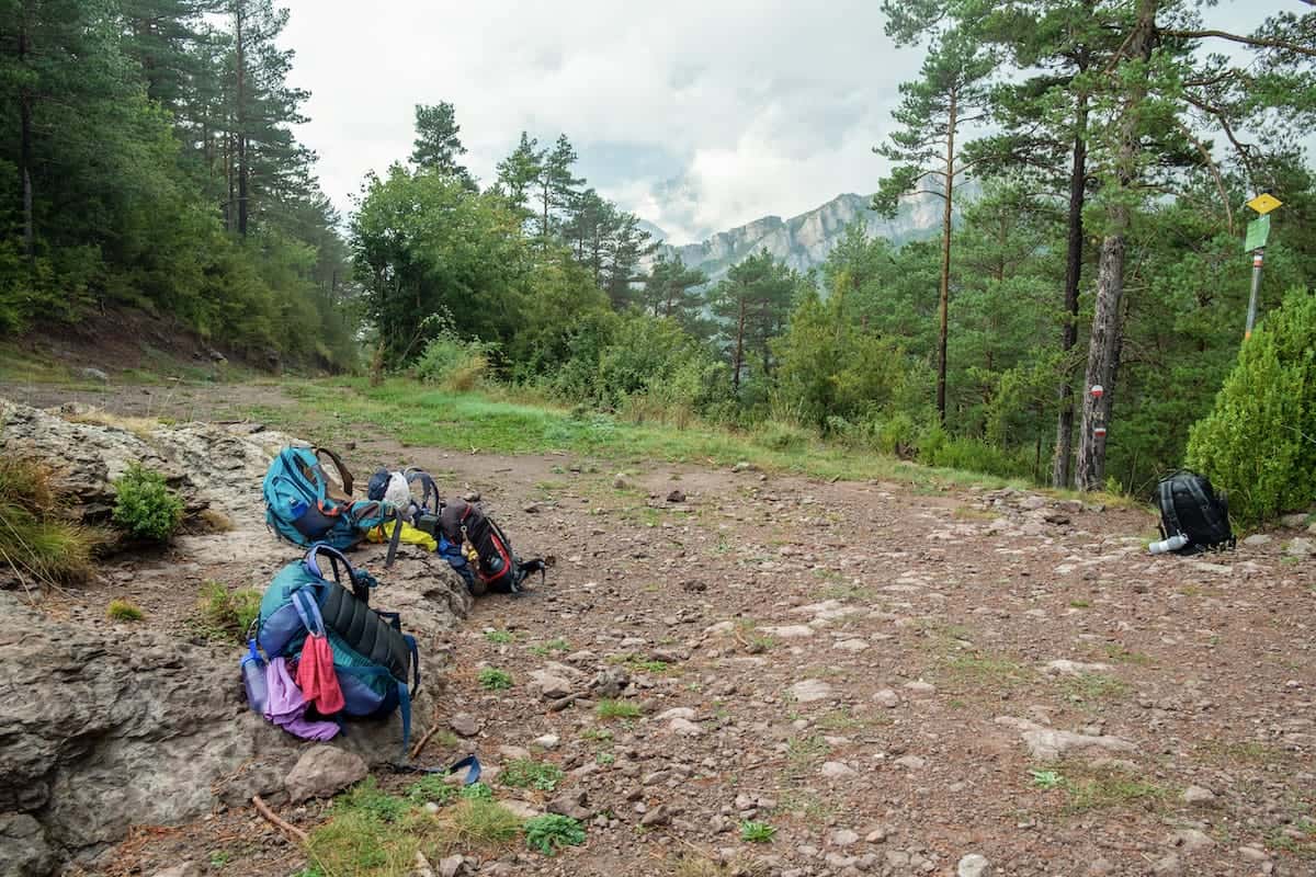
As you’ll spend many hours hiking, it’s wise to pack light but sensibly. You’ll need to carry your water, clothes, sleeping bag/sheets, personal items, camera, food (depending on the meals you select when booking), etc. You won’t need to pack a sleeping pad or more than one day’s worth of water at a time.
It’s also essential to take a bag with you to put all the trash there. You can throw it at some huts or once you end the route. Please take care of the environment and leave no trace.
For more info in-depth info on what to pack, read our guide “10 things we never forget to pack when hut-to-hut hiking in the Pyrenees.”
🌦️ Where to check the weather
You check the weather forecast for the days you’re hiking on the local Meteo website or the local mountain Meteo website.
Phone service
The phone service varies depending on the operator, but we had phone service during most of the route.
Let family members or friends know you’re doing this hike so they don’t freak out if you don’t answer them in some hours.
In case of an emergency, call 112. This emergency number has good coverage throughout the hike.
The huts on the Cavalls del Vent route
The eight huts in the area are located in beautiful natural settings. Remember that the huts are not mountain hotels, and their schedules and rules must be respected.
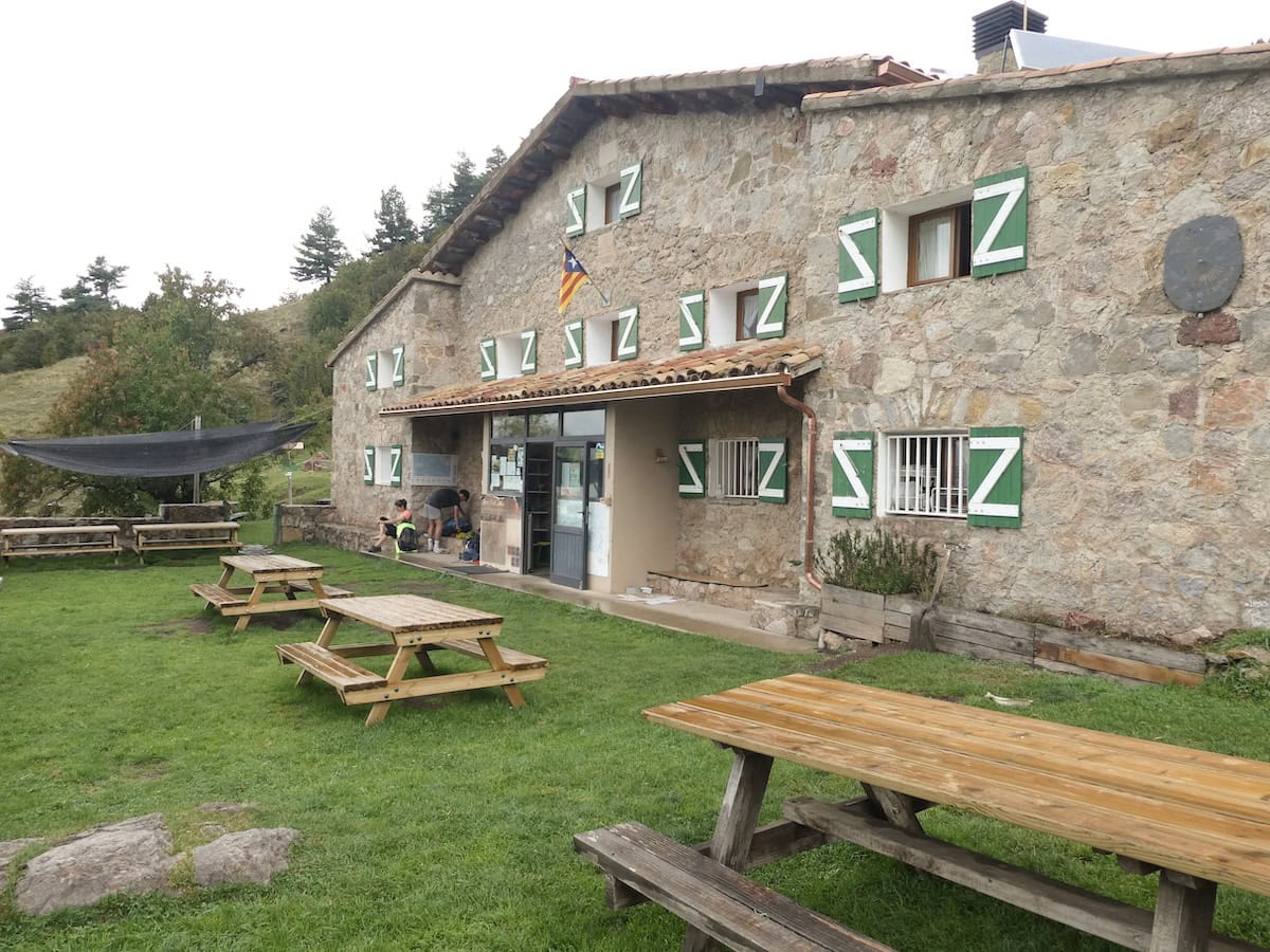
They all have the essential things to spend the night there: a place at the entrance to leave your backpack and boots, heating, accommodation, food and showers (sometimes at an extra cost).
You sleep in a bunk bed in shared dormitories, which are bigger or smaller depending on the hut. The mattresses are pretty close to your neighbour, so try not to move a lot!
All the huts have blankets, but you must bring your sleeping bag or sheets.
We wouldn’t say we’d had the best night’s sleep in a hut, as in a 40-bed room, the chances of someone snoring or moving are pretty high. Remembering this is good, so you’re not frustrated or disappointed after sleeping for a few hours!
You’ll find charging stations at each hut, so charging phones, cameras, e-book readers, etc., is a breeze.
Food
🍽 Breakfast and dinner
Breakfast and dinner are served in the huts, and we’re sure that this will become one of your favourite parts of the hike! This is actually one of the hut-to-hut hikes in the Pyrenees where we’ve eaten the best food.
Breakfast usually consists of bread with cured meats, cheese, jam, coffee, biscuits, and tea.
The guards often cook three dishes for dinner, including soup, salad, a meat dish, and a dessert. The menu can vary from hut to hut and also changes daily.
⚠️ Important!
If you have a food allergy or dietary requirements (vegetarian, vegan, gluten-free, etc.), please let the guards know when booking the huts. They will accommodate your requests and make the necessary changes.
However, remember that sometimes the hut’s resources are limited, and the special meals can be less varied. For example, vegetarians may only be able to choose between cheese or jam for breakfast, whereas non-vegetarians have more options, such as various cured meat.
🥪 Lunch
You can either bring lunch from home or buy a picnic at the huts where you sleep. We got food for the four days from home. We took tuna cans, cheese, tortilla wraps, and apples. If you want the picnic, you must request it when booking.
🥜 Snacks
We also recommend you bring some extra snacks, like nuts or energy bars. Think about foods that don’t spoil quickly and take up little space.
Water
Water is a must-have on any hike. We strongly advise you to carry two reusable water bottles, each with a capacity of 1 L . This will ensure you stay hydrated throughout your journey. Remember, you can always refill your water bottles at the mountain huts.
There aren’t any lakes and few water sources during this lake, so we recommend ensuring you have enough water before leaving the huts (both for drinking and refreshing yourself when it’s really hot).
⚠️ Important!
Swimming in the rivers is strictly forbidden in the Cadí-Maixeró Natural Park.
Cost of hiking Cavalls del Vent
You can book the hike through the Cavalls del Vent organisation. When booking, you’ll receive a passport, which will be stamped in each hut. It costs 27 € (or 43€ if you want a shirt) and includes a map of the itinerary, a Buff, a box of teas, a passport, and 24-hour phone support.
👌🏼 Our tip
It’s always necessary to book the huts in advance. Also, if you choose to do the hike during the high season (July and August) or long weekends, you’d better book long in advance.
The cost of the hike varies depending on the huts you sleep in, the modality you choose and the meals you select.
⚠️ Important!
Remember to bring cash! They don’t accept card payments in most huts, so having some money with you is always better. Prat d’Aguiló, Lluís Estasen and Niu de l’Àliga huts are the only ones accepting card payments.
Cavalls del Vent route
Day 1 – Idyllic huts and the emblematic Pedraforca mountain
Cortals de l’Ingla to Prat d’Aguiló, 11 km hike, 828 m+, 321 m-
The journey kicked off at first light when it was still cool. We reached the Cortals de l’Ingla hut by car and parked next to it (following the warden’s instructions).
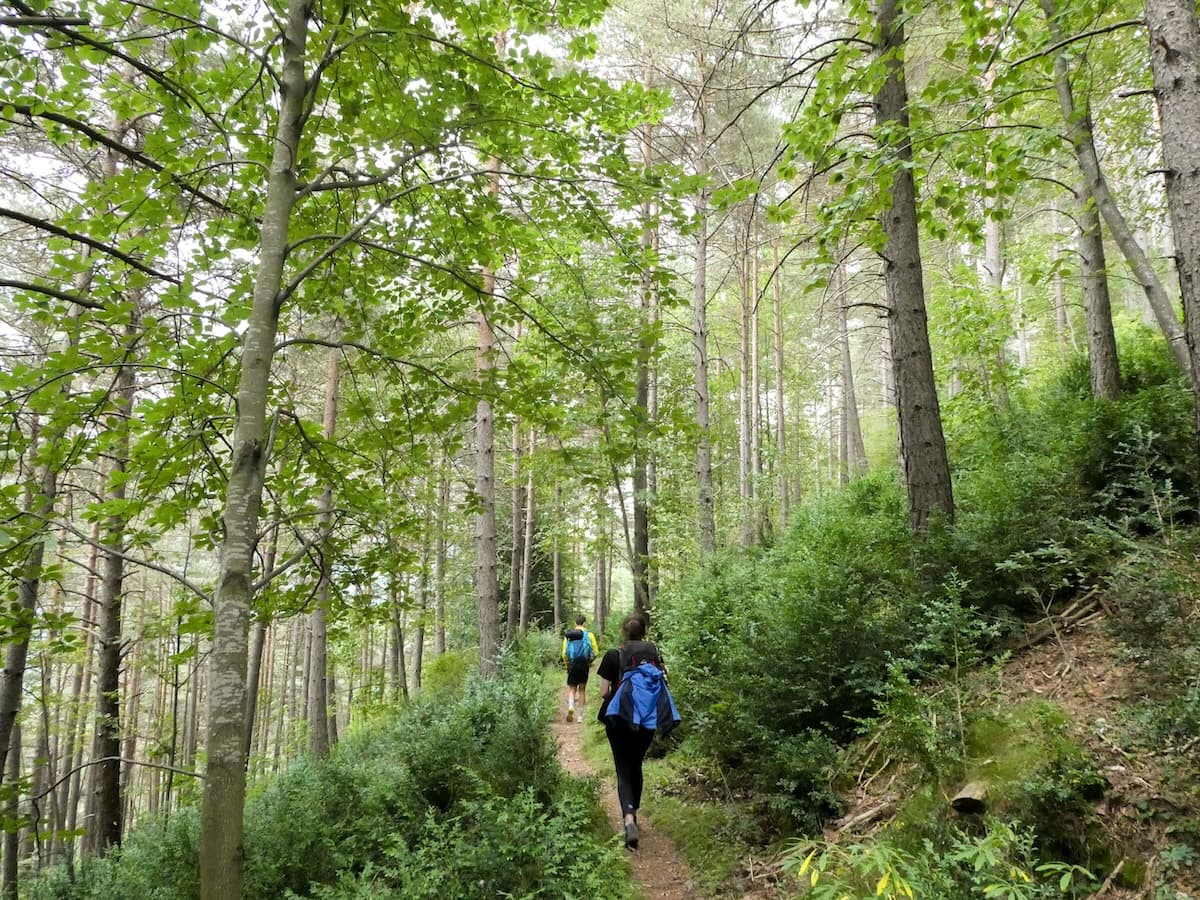
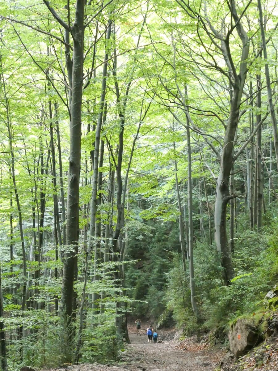
Time to start the 11 km hike until the next hut. The trail unwinded between green forests and rocky mountains, gaining altitude with each step we made.
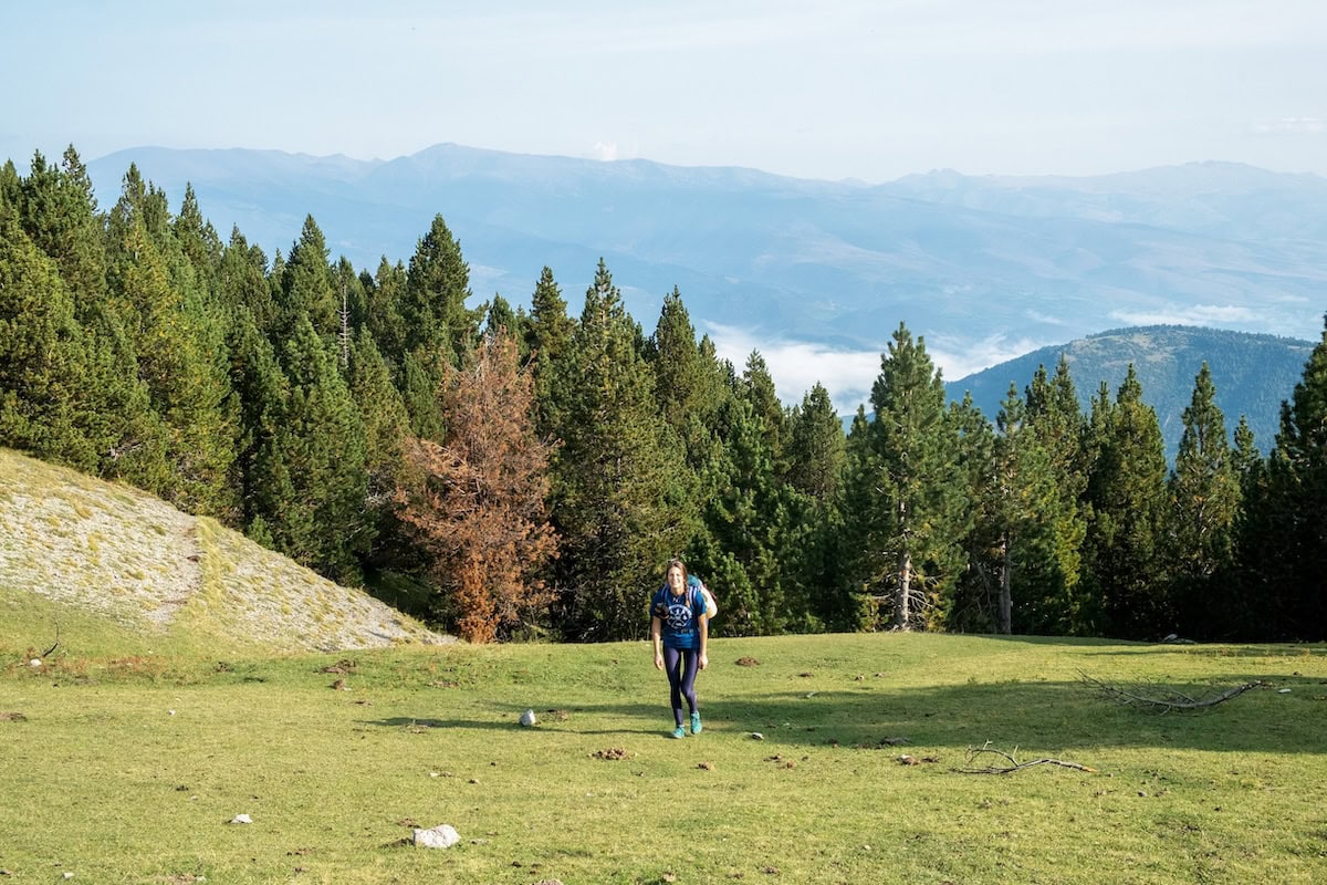
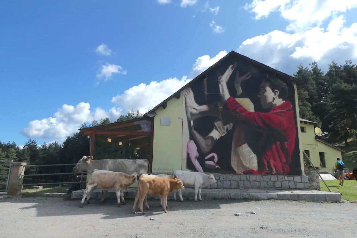
After 10 km, we encountered a meadow. Horses and cows, who made that field their home, welcomed us.
Paying attention to the distance, we saw the Prat d’Aguiló hut. It’s an idyllic mountain house of stone and cement surrounded by grassland and mountains.
It was almost lunchtime, so we stopped there for a quick bite. We had brought a picnic from home, but you can also buy a sandwich or a warm dish in the hut.
👌🏼 Our tip
We advise you not to eat a lot as the ascent that continues the hike is quite strenuous!
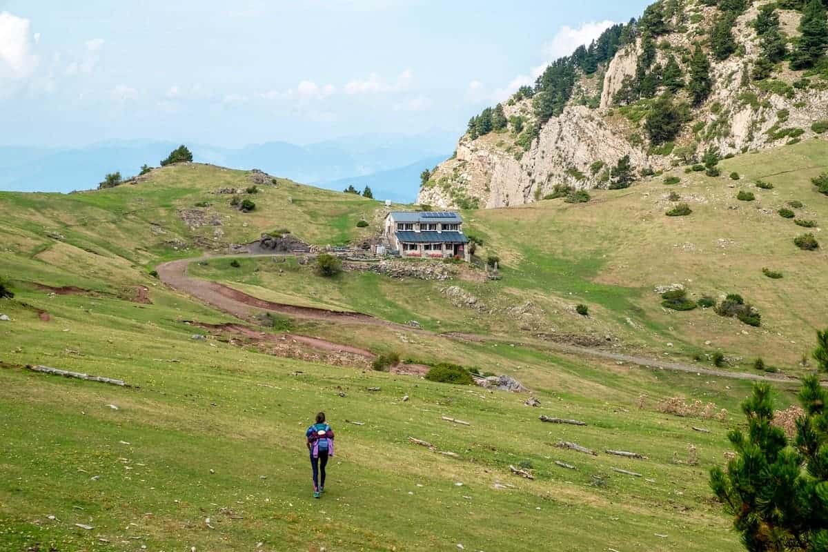
Prat d’Aguiló to Lluís Estasen, 12.5 km hike, 470 m+, 810 m-
This section started with a long hour of sturdy climbing. The views over the Prat d’Aguiló hut were impressive: the hut looked so small in the middle of the meadow and surrounded by high mountains.
After an hour of ascending, which felt like an eternity, we arrived at an iron sign indicating the Pas dels Gosolans. This plateau reminded us of the Mongolian steppe.
After the plateau, the trail descended until reaching the Lluís Estasen hut.
However, you aren’t close yet. There are a few good km until you get there!
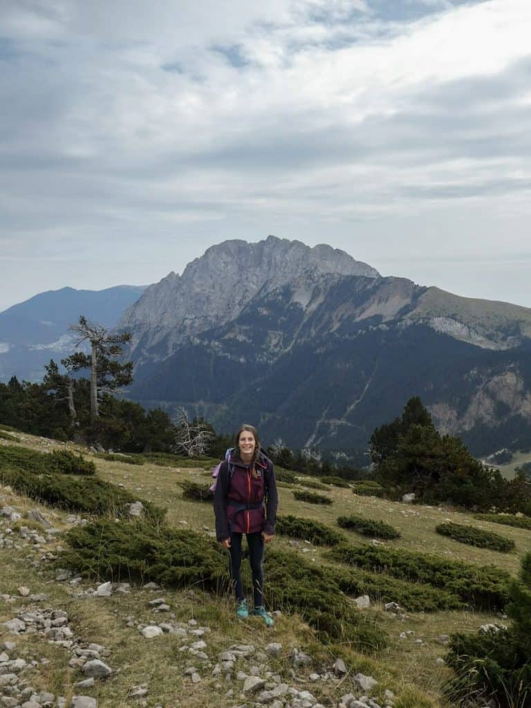
The good part was that there were beautiful views of the Pedraforca during the whole stretch. The Pedraforca is one of the most emblematic mountains of Catalonia. It’s easy to identify because of its rare form and the fact that it is not visibly connected to any other adjacent mountains.
The views were striking enough to get us through the next hour along a dirt path that would eventually lead us to the day’s destination.
 With the Pedraforca mountain as background
- Hiking under the Pedraforca mountain
Lluís Estasen hut had everything we could have asked for: hot showers, a friendly warden, and delicious food.
Punki, the hut’s warden, cooked us one of his speciality dishes: mountain rice. And he even added some edible mushrooms we found along the way!
With our belly satisfied, it was time to rest and prepare for the next day’s hike.
Day 2 – Pedraforca views, waterfalls and cheesecake
Lluís Estasen to Gresolet, 3.9 km hike, 93 m+, 570 m-
After a delicious dinner and a good night’s sleep, we had an excellent breakfast.
Once finished, we started the track and in less than 1 hour, we reached the next hut (Gresolet). This hut had a beautiful lawn and views of the Pedraforca, so it seemed a good spot to stop for a break.
Gresolet to Sant Jordi, 16.1 km hike, 1.009 m+, 330 m-
This was the longest hike section, with the most positive elevation gain. After leaving Gresolet hut, the route descended pleasantly through a lush green forest with tall trees.
We chose a nice spot to eat our sandwiches, and only moments after finishing did it begin raining, as the weather forecast had predicted. The water was pouring down, and although we had the necessary rain gear, we were soaking wet.
It was a steep and long climb to the hut, but the landscape distracted us from it and the rain.
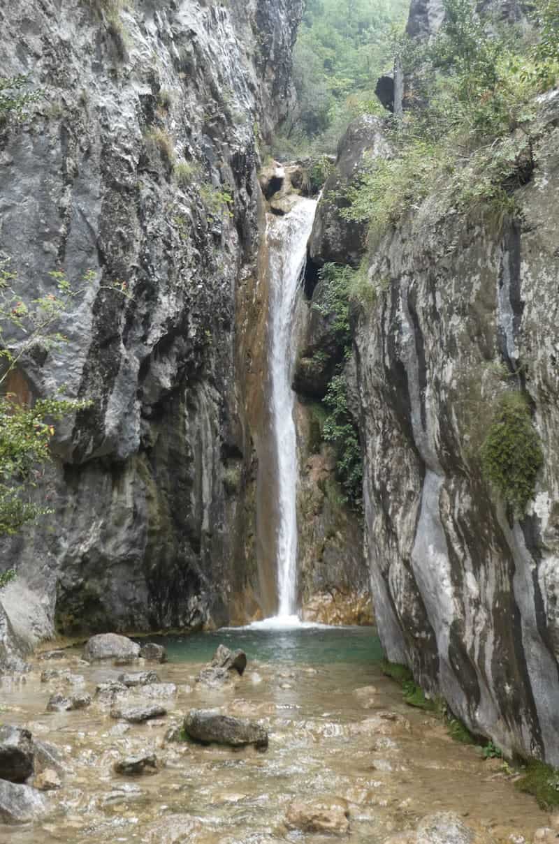
The trail entered a gorge, and we encountered many lovely little waterfalls along the way.
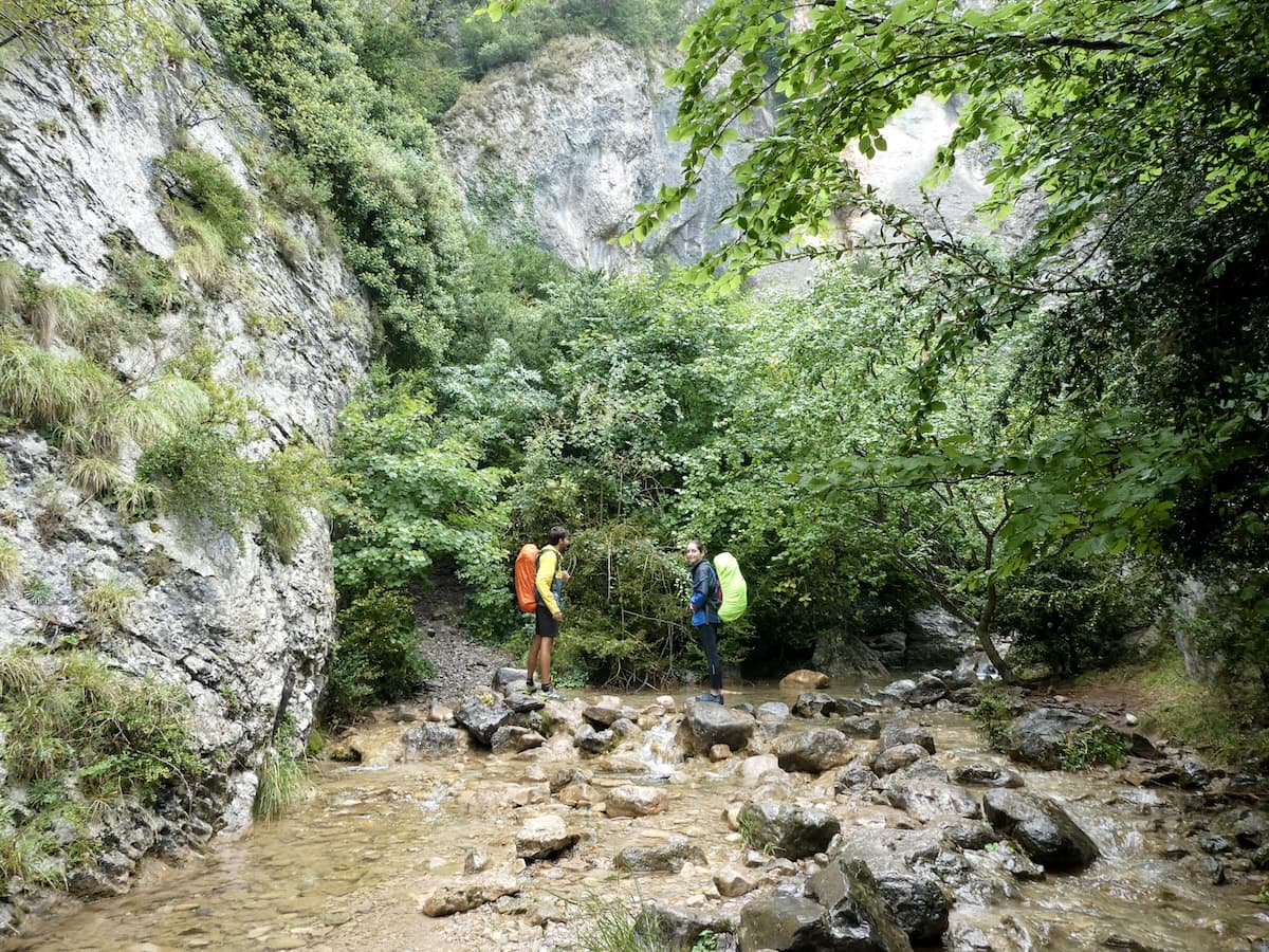
El Bullidor de la Llet (The Milk’s Boiler) is the most spectacular. The name comes from when the waterfall’s water flows with all its force and acquires a whitish colour, resembling milk.
After an eight-hour adventure, we arrived at Sant Jordi hut. We were so grateful for the fireplace!
Besides the cosy interior and the hot shower, the friendly wardens were what we loved the most. And the food! We were treated to superb burgers and cheesecake for dessert.
At 10 pm, the hut closed its lights, and everything became silent. Time to sleep!
Sant Jordi to Rebost, 13 km hike, 939 m+, 864 m-
This day was the toughest one for us. The first part of the trail was easygoing, descending almost always in a non-abrupt way through a spectacular green forest.
After 6 km, things changed. We crossed two roads, and the trail started gaining altitude. We thought we would seethe Rebost hut every time there was a turn, but we found another steep hill to climb.
So, don’t despair! It’s a long climb. Enjoy the landscape, and the hut will finally appear!
Once there, we were rewarded with impressive views of the Pedraforca and nearby mountains.
If it’s sunny, the outdoor area of the hut is an excellent place for a break. It was pretty cold in our case, and the warden was very kind to let us eat our snacks inside. He even lighted the fireplace!
Rebost to Niu de l’Àliga, 7 km hike, 880 m+, 0 m-
From here on, the trail only ascended. Non-stop.
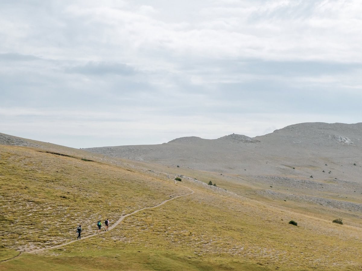
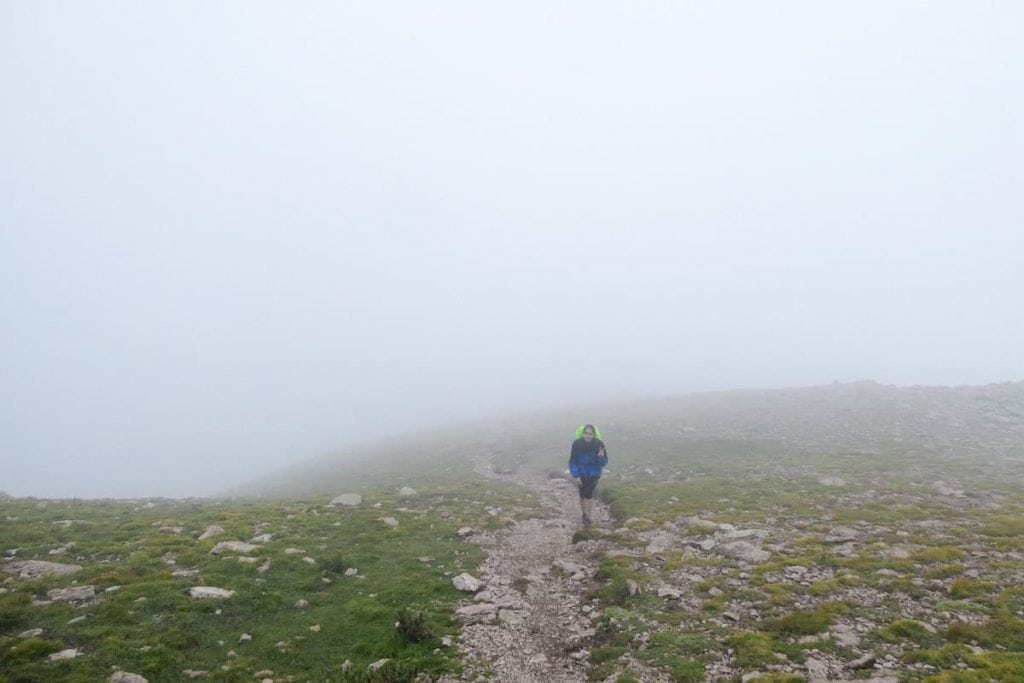
The first section unwinded between meadows and forest, and, apparently, the views are impressive, but we couldn’t see them because of the fog. We could barely see ten steps in front of us.

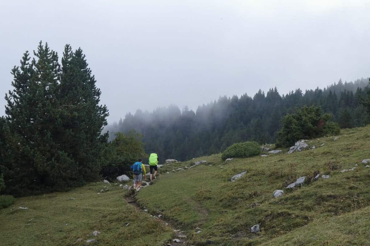
The landscape changed as we passed the 2.000 m, becoming rockier, and the vegetation disappeared.
The fog became our companion, covering everything around us and giving the landscape a mystical atmosphere.
We had to pay close attention to the orange signs to avoid getting lost. In fact, when we reached the top of the mountain, we were only twenty meters away from the next hut, but we couldn’t see it!

Niu de l’Àliga hut, which means Eagle’s Nest, is located in the highest area of La Molina ski resort (at the top of the mountain Tosa d’Alp). It can be accessed with a chairlift, and when we arrived, many people were having lunch there.
We liked the hut the least, mainly because you can feel it’s run by the ski resort and not by a warden. We had to wait until everyone finished lunch to shower and go to the rooms.
Also, the food and the attention received were far from what we had experienced in the other huts.
Day 4 – Goodbye Cavalls del Vent
Niu de l’Àliga to Serrat de les Esposes, 16 km hike, 360 m+, 1446 m-
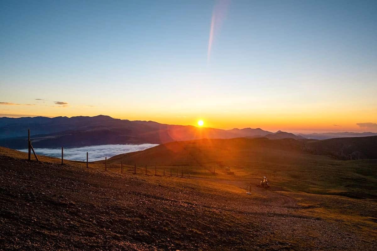
The last day couldn’t have started better. We set our alarm just in time to get dressed and step outside to enjoy the sunrise (highly recommended!). Seeing the mountains wake up was magical, painting colours we couldn’t easily forget.
And if you’re lucky enough, you might see a cloud inversion!
If the last day’s section mainly was climbing up to the Tosa d’Alp, this section was mostly downhill.
The first part descended 400 m in a short distance. The panoramic views were breathtaking. If the day is clear, you could spot Montserrat in the distance.
After this, the trail unwinded again through meadows and forest, alternating uphills and downhills.
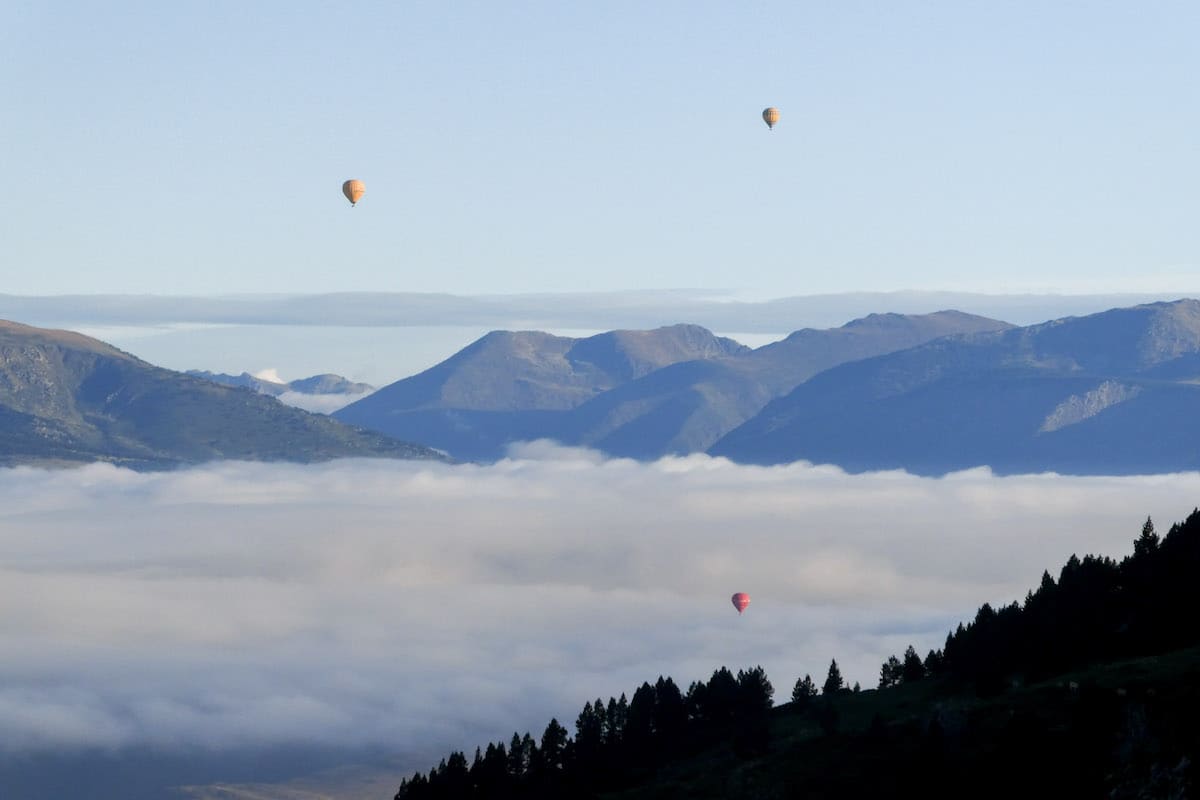
We were lucky to enjoy the presence of some hot air balloons that were riding early in the morning. It felt like we were still dreaming; it was such a picturesque scene!
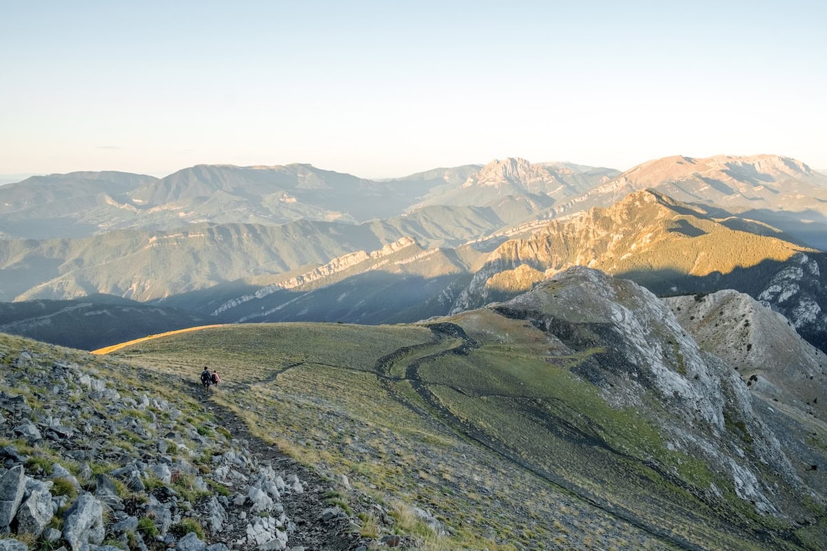
Just some km after leaving the hut, the trail started going up abruptly to reach the Penyes Altes de Moixeró Peak (2.279 m).
👌🏼 Our tip
The Cavalls del Vent official trail passes close to the Penyes Altes de Moixeró Peak but doesn’t reach it. We recommend leaving the track and making a slight detour (walking a hundred meters) to reach the summit. It’s totally worth it; the views are jaw-dropping!
After swallowing a snack, we returned to the track and continued down. After a few meters, there was a small section with rocks. But it was fine as hikers had a rope to use. That’s the only “difficulty” of this section.
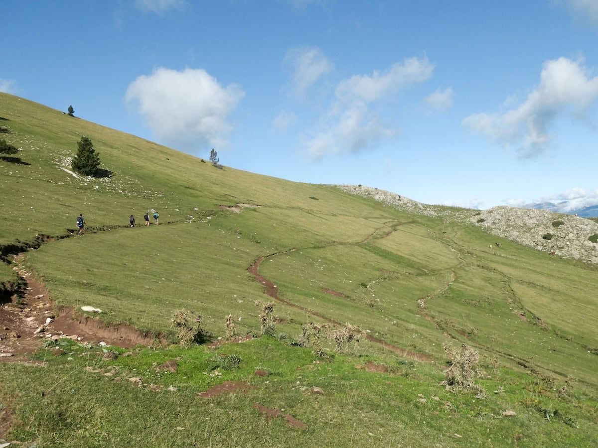
After this, the landscape turned into endless meadows again. You could see green and cows and other livestock grazing everywhere you looked. The grass seemed to invite us to munch on it, and we couldn’t help but lay there for a while and let the sun warm our faces while we enjoyed the silence.
Then, we crossed the last mountain pass of the hike: Collet del Moixeró. It was a steep descent through a forest from there until the next hut.
Be patient because the descent is long, and the terrain is rocky. But you’ll be in Serrat de les Esposes hut sooner than expected.
We loved this hut. Its decoration is beautiful and it has a huge outdoor area featuring chairs and tables. We didn’t eat there, but we must say that the food looked delicious!
Serrat de les Esposes to Cortals de l’Ingla, 4.7 km hike, 196 m+, 97 m-
Only 4.7 km separated us from completing Cavalls del Vent. This last part of the route alternated between a dirt road connecting the huts Serrat de les Esposes and Cortals de l’Ingla and a trail through a forest of fir trees.
Finally, we arrived at the Cortals de l’Ingla hut, the starting point of this adventure four days ago. We made it!
Next thing we did? Hurry to a restaurant to celebrate it with a well-deserved lunch!
Would we recommend Cavalls del Vent?
For sure! The Cadí-Moixeró Natural Park is a beautiful area with a great variety of landscapes. One moment, you think you’ve been teleported to the Alps, only to find yourself crossing a typical Mediterranean wood minutes later. And when you reach the huts, you might feel you’re suddenly in a Switzerland refugio (only that it’s much warmer here!).
Cavalls del Vent is perfect for anyone who wants to experience a multi-day hike but would like the comforts of staying in a hut, carrying less weight and eating delicious and abundant food!
Remember to follow Leave No Trace practices. Be kind to fellow hikers. Be respectful to hut wardens and the local communities. And hike on!
More hut-to-hut hiking routes in the Pyrenees
Check our “Hut-to-hut hiking in the Pyrenees: Six stunning routes + Essential info” guide to discover more thru-hikes in the Pyrenees. We hope you enjoy them!

Heya!
I am planning on doing the Cavalls del Vent this june, on a 5 days trek.
My question to you would concern my rucksack. It is a 72l. one. I have it since always and find it comfortable, though do you reckon it would be suitable for that trip?
Hey!
72L seems a bit too much, especially if you sleep and eat in the huts. We did it with a 30L one, carrying all lunches ourselves, and it was enough.
Are these trails suitable for trail runners rather than hiking boots?
Hi Mark, yes! We actually wore trail-running shoes when we did this hike.