

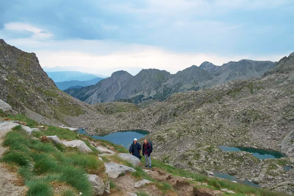
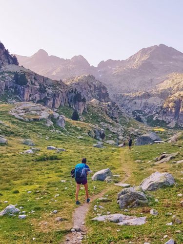
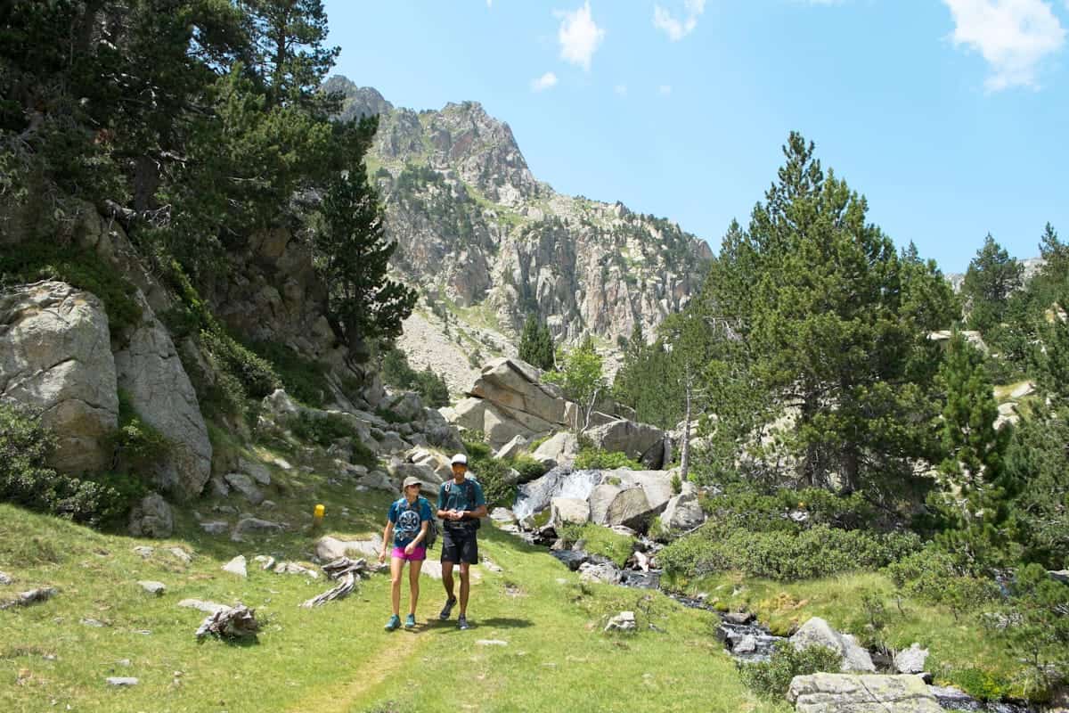
Crystal-clear lakes, mountain peaks, lush forests, wildlife and great food—that’s what awaits you at Carros de Foc!
Located in Aigüestortes i Estany de Sant Maurici National Park, the hike follows a circular itinerary connecting nine mountain huts in the Catalan Pyrenees. Walkers can start at several points along the route and take the direction they prefer.
The route is 55 km long and can take between 4 and 9 days to complete. Each day, you hike to a mountain hut with basic facilities, including a bed, shower, and, sometimes, Wi-Fi. One of the things we remember the most was the food. After hiking all day, you’re treated to delicious soups, typical meat dishes, pasta, river trout…you name it!
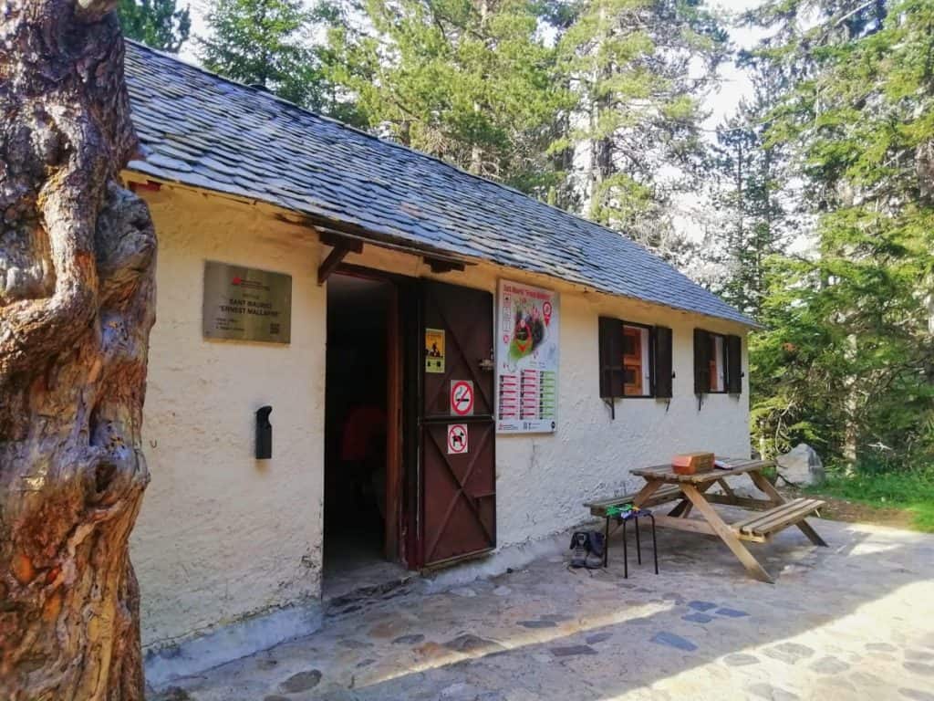
We hiked Carros de Foc in July 2019 with some family members, and we did it in 5 days and a half, starting and finishing in the hut Ernest Mallafré.
We hope you enjoy our review, tips, and photos!
* Post written for the first time in June 2021 and updated in February 2025.
Things to know before hiking Carros de Foc
Technical details
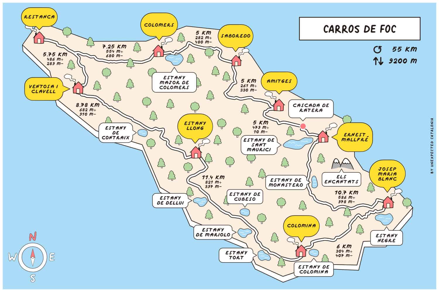
🥾 Total distance: 55 km
🟠 Difficulty: Moderate-difficult (depending on how many huts you stop at)
⬆️ Cumulative elevation gain: 9.200 m
⏱ Duration: Between 4 and 9 days (depending on how many huts you stop at)
🗓 Recommended season: Carros de Foc is a high-mountain route. Therefore, it’s best enjoyed from mid-June to end of September
The route is graded “moderate-difficult,” which we think is accurate. We regularly hike, and the weather was pretty nice most of the time, so we found the track to be challenging but not especially difficult.
The cumulative elevation gain is 9.200 m, and day 4 was the most challenging for us, so don’t underestimate it!
Where does the route start?
You can start the route from any hut, but none of the huts can be reached by car. However, all of them have access walking from their closest towns:
- Ernest Mallafré hut: You can access it from Espot (1 h walk)
- Amitges hut: You can access it from Espot (2 h 45 min walk)
- Saboredo hut: You can access it from El Port de la Bonaigua (2 h 30 min walk)
- Colomèrs hut: You can access it from Salardú (2 h walk)
- Restanca hut: You can access it from Artiés (2 h walk)
- Ventosa i Calvell hut: You can access it from Caldes de Boí (2-2:30 h walk)
- Estany Llong hut: You can access it from Boí (3 h walk)
- Colomina hut: You can access it from Sallente (2 h walk)
- Josep Maria Blanc hut: You can access it from Espot (3 h 30 min walk)
We chose to start from the Prat de Pierró parking lot, close to the village of Espot. From there, the walk to the Ernest Mallafré hut is only 4 km (50 min). This is the fastest approach to any hut in the park.
If you want to skip this part of the walk, you can take a 4-wheel drive taxi in Espot to the San Maurici Lake, near the Ernest Mallafré hut. The taxi can also take you to the Amitges and Josep Maria Blanc hut. Check Taxi Espot to see the taxi schedule, the price and make the bookings.
Getting to Aigüestortes National Park by car takes approximately 4 hours from Barcelona, the same as from Girona. From Tarragona, it takes 3.5 hours and only 1 hour and 45 mins from Lleida.
Getting to Carros de Foc by public transport
From Barcelona or Lleida, take the bus to Esterri d’Àneu and stop at Escaló or La Guingueta villages. Because there is no regular public transport service to the national park entrance, you’ll need a taxi. Make sure to arrange it beforehand.
The best place for the taxi to drop you off is the parking lot Prat de Pierró. From there, it’s a 4 km hike to the first hut (see Day 1 below for an explanation of this hike).
In summer, you can go by bus from the village of Escaló or La Gingueta to Espot because there is a service called Bus del Parc that covers the area surrounding the national park. Once in Espot, it’s an hour’s walk to the Ernest Mallafré hut.
Which direction is best to follow?
As it’s a circular track, you can do it clockwise or counterclockwise.
However, we recommend doing it counterclockwise. The shortest and easiest stages are at the beginning, allowing the body to adapt and gain confidence in the terrain.
If you do the route clockwise, there is an elevation gain of 1.000 m from Estany Llong to Ventosa i Calvell, which is pretty tough.
Also, the highest mountain pass of the route (Contraix) is considerably slippery on the side of Ventosa i Calvell, so it’s safer to ascend it than descend it.
Here’s a map with the various mountain huts and the distances between them to help you better plan your approach to this route.
Is the route marked?
There are panels located along the route, as well as cairns indicating part of the track. However, the vast majority of the itinerary is not signposted.
Therefore, one crucial thing that you mustn’t forget is to take a map with you.
The route has no special marking, and getting lost in some places is easy. It happened to us, adding 2 extra hours of walking on the longest day. It wasn’t fun at all!
That’s why it’s wise to pack a map of the area. You can buy the map online, in some bookstores, through the Carros de Foc organisation, or at the Roya Hotel in Espot.
🧭 Wikilock track
We also suggest you download the hike’s track on your phone. Here’s our Wikilock track of the route.
Weather and gear recommendations
Although we’re in sunny and hot Catalonia, the weather can change rapidly in the mountains.
We recommend packing some warm clothes, even though you hike in summer. For example, a pair of gloves and a lightweight down jacket. You’ll also need waterproof gear (jacket, pants, and backpack cover), a head torch, and safety equipment, such as an emergency blanket and a first aid kit.
Pack sunglasses, a hat (or a cap), and sunscreen (reef-friendly!). There are several sections of the route where there isn’t a single shade.
Another thing you’ll be grateful for is earplugs. We bet you’ll appreciate them if your neighbour starts snoring! And a set of clothes only for the huts. There is nothing like reaching the hut all sweaty, taking a shower, and putting on some clean, warm, and cosy clothes!
You don’t need to bring slippers or flip-flops as all the huts give you Crocs.
As you’ll spend many hours hiking, it’s wise to pack light but sensibly. You’ll need to carry your own water, clothes, sleeping bag/sheets, personal items, camera, food (depending on the meals you select when booking), etc. However, you won’t need to pack a sleeping pad or more than one day’s worth of water at a time.
It’s also essential to take a bag with you to put all the trash there. You can throw it at some huts or once you end the route. Please take care of the environment and leave no trace.
For more info in-depth info on what to pack, read our guide “10 things we never forget to pack when hut-to-hut hiking in the Pyrenees.”
🌦️ Where to check the weather
You check the weather forecast for the days you’re hiking on the local Meteo website or the local mountain Meteo website.
Phone service
There isn’t any phone service in about 60–70% of the route.
It’s good to let family members or friends know so they don’t freak out if you don’t answer them in some hours or days!
In case of an emergency, call 112. This emergency number has good coverage throughout the hike.
The huts on the Carros de Foc route
The 9 huts in the area are located in truly spectacular settings and are very different from each other. Remember that the huts are not mountain hotels; you must respect their schedules and rules.
All the huts have the essentials to spend the night there: a place at the entrance to leave your backpack and boots, heating, accommodation, food and showers.
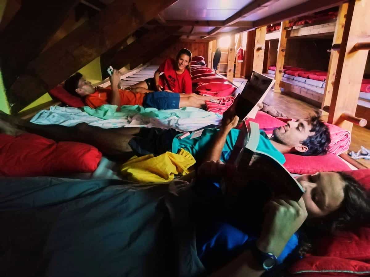
You sleep in a bunk bed in shared dormitories, bigger or smaller depending on the hut. The mattresses are close to each other, so try not to move much!
All the huts have blankets, so you just need to bring your own sleeping bag or sheets.
We wouldn’t say we’d had the best night’s sleep in a hut, as in a 40-bed room, the chances of someone snoring or moving are pretty high. Keeping this in mind is good, so you’re not frustrated or disappointed after sleeping for a few hours!
Not all huts have hot water, and the ones that do can charge extra for it (usually 1 or 2€). Consider it an opportunity to start a cold therapy routine!
There are usually charging stations at the huts, so charging phones, cameras, e-book readers, etc., is a breeze.
Food
🍽 Breakfast and dinner
Breakfasts and dinners are served in the huts.
Breakfast usually consists of bread with cured meats, cheese, and/or jam, coffee, biscuits, pastries, and tea.
The guards often cook three dishes for dinner, including soup, salad, a meat dish, and a dessert. The menu can vary from hut to hut and also changes daily.
⚠️ Important!
If you have a food allergy or dietary requirements (vegetarian, vegan, gluten-free, etc.), please let the guards know when booking the huts. They will do their best to accommodate your requests and make the necessary changes.
However, remember that sometimes the hut’s resources are limited, and the special meals can be less varied. For example, vegetarians may only be able to choose between cheese or jam for breakfast, whereas non-vegetarians have more options, such as various cured meat.
🥪 Lunch
You can bring it from home or buy a picnic at the huts you sleep in. If you want the picnic, you must request it when booking.
We brought food from home for the five days’ lunches. We took tuna cans, cheese, wrap bread, and apples.
🥜 Snacks
We recommend you bring some extra snacks, like nuts or energy bars. Think about foods that don’t spoil quickly and don’t take up much space.
Water
Regarding the water, we recommend you take two reusable water bottles of 1 L with you. You can refill the water bottles in all mountain huts.
If you carry a water filter, there are plenty of streams, lakes, and rivers where you can fill your water bottle.
We recommend ensuring you have enough water before leaving the huts (both for drinking and refreshing yourself when it’s really hot).
⚠️ Important!
Swimming in the mountain lakes and rivers is strictly forbidden in the Aigüestortes i Estany de Sant Maurici National Park.
Cost of hiking Carros de Foc
You can book the hike through the Carros de Foc organisation. You’ll receive a forfeit at registration, which you stamp on each of the huts and makes for a nice souvenir.
The cost of the hike varies depending on the huts you sleep in, the modality you choose, and the meals you select. You can check the prices to get an idea of what it will cost you.
⚠️ Important!
Remember to bring cash! Most huts don’t accept card payments, so having some money with you is always better.
Carros de Foc route
Day 1 (half day) – Getting ready
Prat de Pierró parking to Ernest Mallafré, 4 km hike, 262 m+, 7 m-
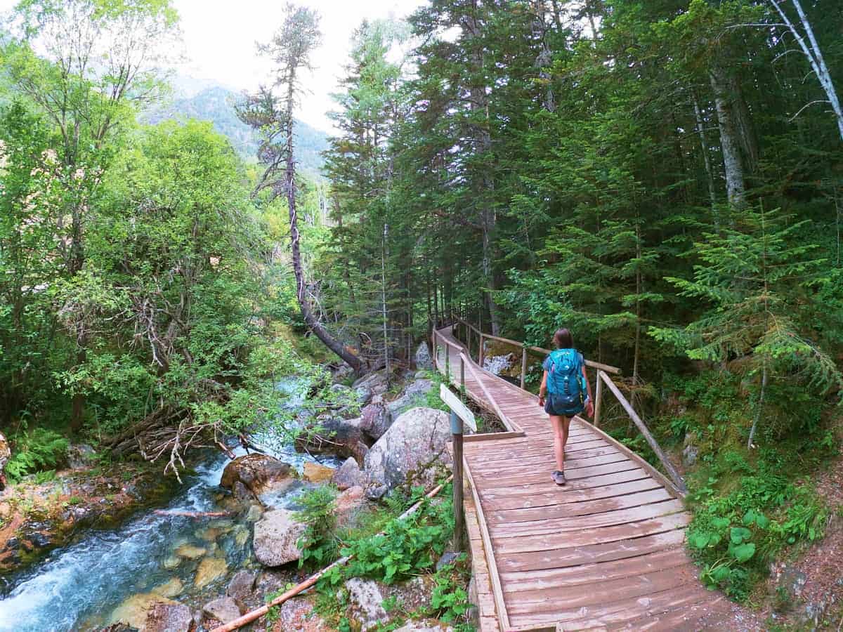
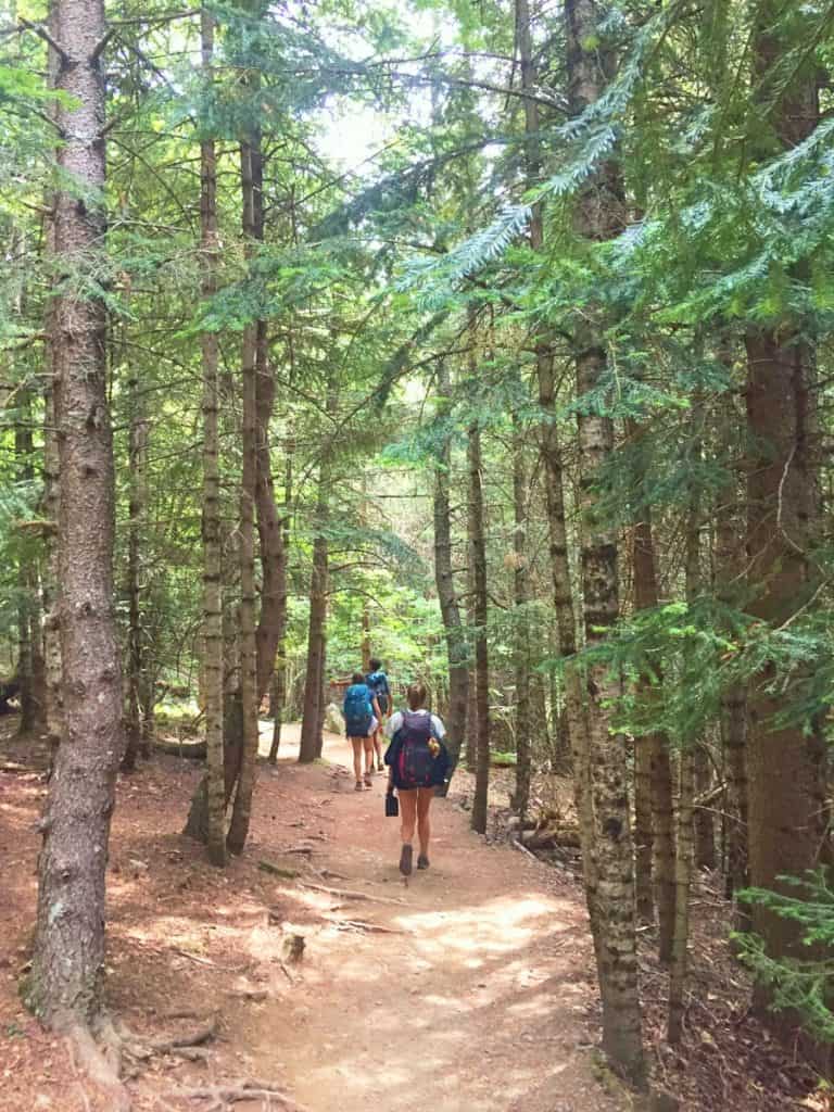
We reached the national park by car. We left it in the Prat de Pierró parking lot for free and started the 4 km hike. The first part was on a boardwalk and unwinded between green forests. Then, the trail started gaining altitude until reaching the hut.
Day 1 was definitely the shortest and easiest day of hiking, and we arrived at the hut Ernest Mallafré in one hour.
We planned it this way as we thought it would be too much to drive and hike an entire stage in one day.
Also, it gave us time to enjoy dinner outside, play board games and catch up.
We brought our own dinner from home, but if you’re considering having it there, remember that they serve it between 7 pm and 8:30 pm.
Day 2 – Iconic spots
Ernest Mallafré to Amitges, 5 km hike, 479 m+, 10 m-
Breakfast was from 7 to 8:30 am and consisted of coffee, toast with jam, muffins and fruit.
Once finished, we started the track, and in less than 15 minutes, we found the first highlight of the day: Sant Maurici Lake and Els Encantats. This is the national park’s most emblematic spot.
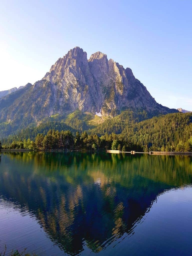
Instead of taking the track, we continued following the trail that unwinds beside the lake. At the next bifurcation, we went right, and we were soon in front of an impressive waterfall: the Cascada de Ratera.
From there, we followed the taxis’ track until taking another detour to the Mirador de l’Estany. The views from this lookout were a perfect postcard of the Sant Maurici Lake and the Encantats mountains.
We backed off until we found a trail on our left hand, which took us to the Amitges hut, passing by a beautiful lake named Obagues de Ratera. This was a much better option than the official track! There was no noise from taxis, and the landscape was more beautiful.
Once in the Amitges hut, we took some time to rest and explore the lakes around.
👌🏼 Our tip
We recommend you look at the landscape from the hut’s terrace; the views are amazing!
Amitges to Saboredo, 5 km hike, 261 m+, 330 m-
The track continued ascending to the next mountain pass, Port de Ratera. Save some energy during the climb, as the last final stretch to the top of the mountain pass can be tough!
Once on top, you can breathe! From there to the charming Saboredo hut, it’s all descent.
From the beginning of the route, it took us around 3 and a half hours to reach Saboredo hut. Once there, we made a quick stop to eat lunch and refilled the water bottles before continuing.
Saboredo to Colomèrs, 5 km hike, 282 m+, 450 m-
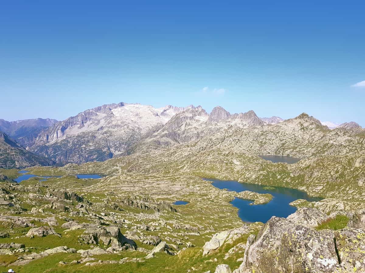
There was one more ascent, and after that came a long descent. Although the legs were getting tired, the views grabbed all our attention, making us forget about the pain. No matter the direction you looked, you could see a lake.
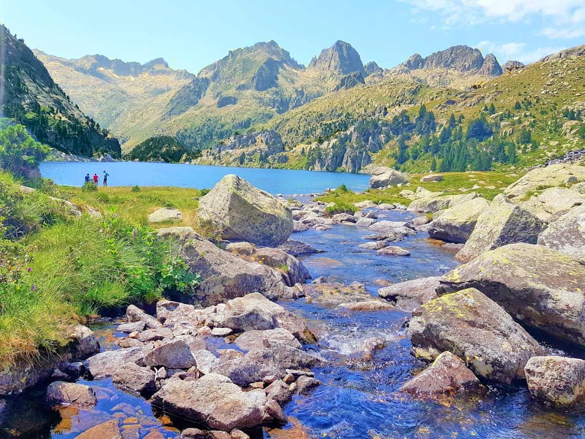
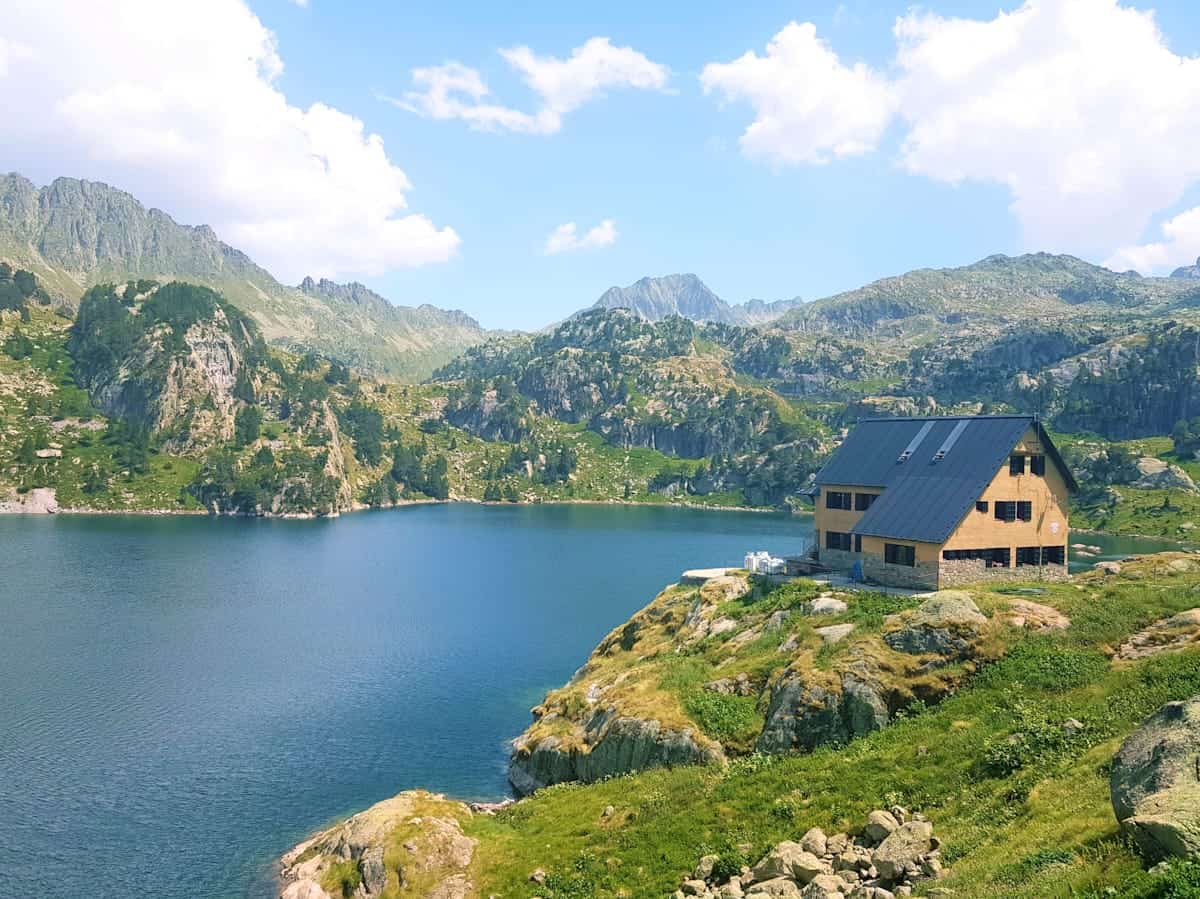
The final part of the track ran next to the Estany Major de Colomèrs lake, from where we could already see a hut.
Don’t be fooled, though! This is the old Colomèrs hut, and we had to keep walking along the lake until getting to the new Colomèrs hut, located at 2.135 m of altitude.
We spent the afternoon dipping our feet in cold water, reading and sunbathing. Not having anything to do is something we rarely experience nowadays, and the feeling is incredible!
The best part was yet to come, though: dinner time. Dinner was at 7 pm and, when we were there, it was a delicious soup, followed by river trout with salad and chocolate pudding as a dessert.
At 10 pm, the hut closed its lights and was silent. The truth is we were so tired that by 9.30 pm, we were already in bed.
Day 3 – Walking twice the same track
Colomèrs to Restanca, 7.25 km hike, 554 m+, 680 m-
Although the distance was less than the day before, we found this stage harder.
We woke up early as breakfast was served from 7:30 am to 8 am. We packed everything, laced our boots and started the hike. After walking a couple of kilometres, we marvelled at the views of the hut. What an energy boost to start the day!
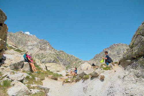
The first part of the track was the ascent to the Port de Caldes. Some big rocks were in the middle of the way, so we had to use our hands more than once.
The landscape was similar to the day before: high peaks covered in snow contrasted with green grass and blue lakes.
At some point, a sign indicated that the Restanca hut was in the right direction and the Ventosa hut was on the left. Here, you have two options:
- To complete the official Carros the Foc route, follow the directions to the Restanca hut
- If you want to shorten this stage, you can skip the Restanca hut and go directly to Ventosa i Calvell
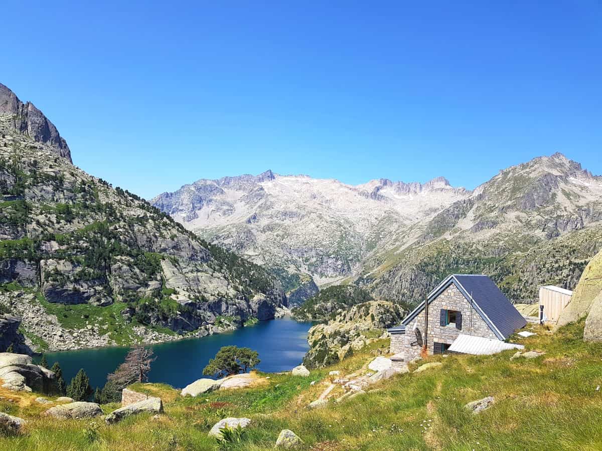
Restanca to Ventosa i Calvell, 5.75 km hike, 486 m+, 289 m-
Once in the Restanca hut, we returned to the sign indicating the Ventosa hut the same way we came. From there, it was a nice descent, and we passed by several beautiful lakes until our next destination.
Ventosa i Calvell was the hut we loved the most. It was renovated in 2017, adding hot showers and more services to improve users’ comfort. It has a lake nearby, ideal for chilling during the afternoon if you get to the hut early.
The dinner was also superb; we got a massive portion of bolognese pasta, sausages with salad and fries, and fruit as dessert.
Day 4 – The hardest one
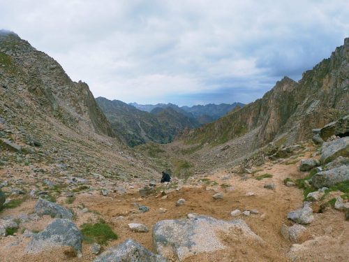
Ventosa i Calvell to Estany Llong, 8.78 km hike, 682 m+, 910 m-
This day was the toughest as the trail crossed the route’s highest point. But it was also stunning due to the variety of landscapes.
We started with a pleasant hike through a gorgeous closed valley with small lakes and a waterfall.
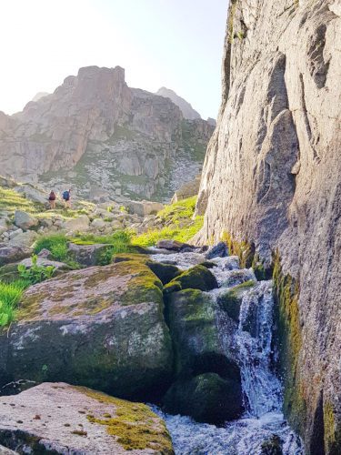
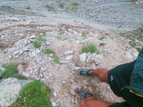
After a while, big rock blocks appeared, which slowed us down.
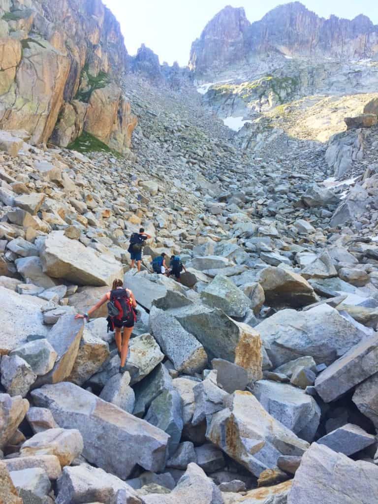
We could see the Contraix mountain pass from the rocks, and it looked impressive! It was a very vertical scree that required using the hands on several occasions. For some of us, this climb was super fun. For others, it was a nightmare. If you’re an experienced mountaineer, you won’t find any difficulties. If you’re not, just be careful not to slip.
⚠️ Important!
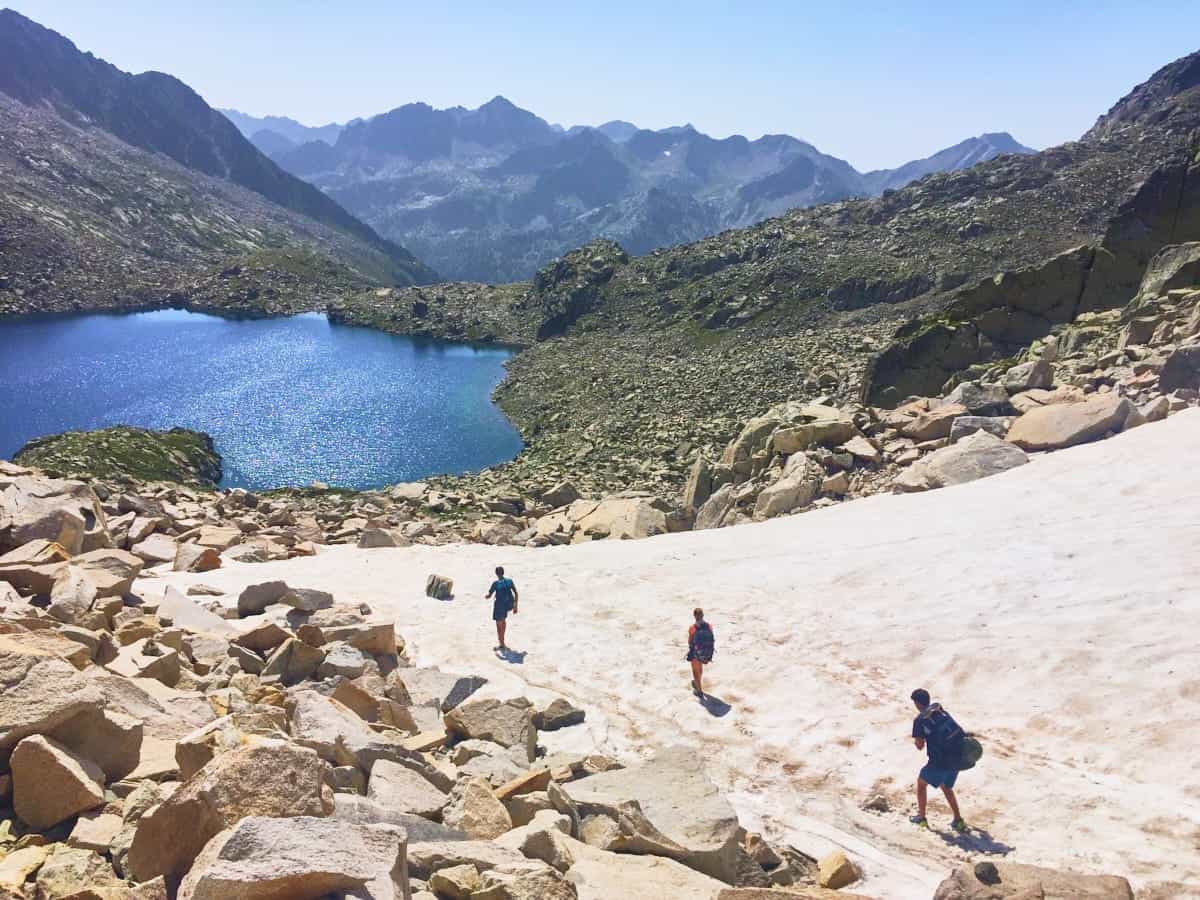
We found some snow on the top of the mountain pass, even though it was the end of July. If you’re going in June, email or call the Carros de Foc organisation or the Ventosa i Calvell hut to check the amount of snow. You might need crampons to cross the mountain pass.
The descent was easier and finding snow added some fun to it. The contrast between the snow’s white and Contraix Lake’s blue was jaw-dropping.
The trail gradually took us into a green valley. After passing the first wooden bridge, we had to pay attention and look for the correct signs; otherwise, it’s easy to get lost and walk away from the hut.
The Estany Llong hut was surrounded by trees and had a river nearby. We recommend you walk to Llong Lake (only 700 m from the hut), as it’s beautiful and a great spot to chill and take a nap!
Day 5 – From lake to lake
Estany Llong to Colomina, 11.4 km hike, 821 m+, 397 m-
Breakfast was served between 7 and 8 am. As it was the longest day, we decided to wake up early, eat breakfast fast and get ready to leave by 8 am.
Carrying a map is helpful as getting lost around this area is easy. In our case, we left the hut in the wrong direction and lost one hour trying to find the right track—an excellent way to start the longest day.
Once back on track, the trail had no complications except for the distance.
It started with an ascent through the forest, and as the terrain gained altitude, it became stonier.
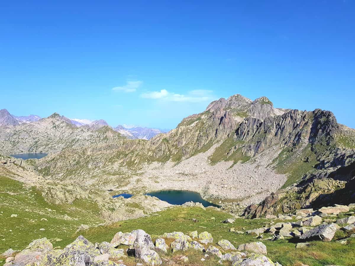
The trail kept ascending and passing through lakes, finally reaching the Dellui mountain pass. It wasn’t a challenging mountain pass, but we could feel the fatigue in our legs after so many km accumulated.
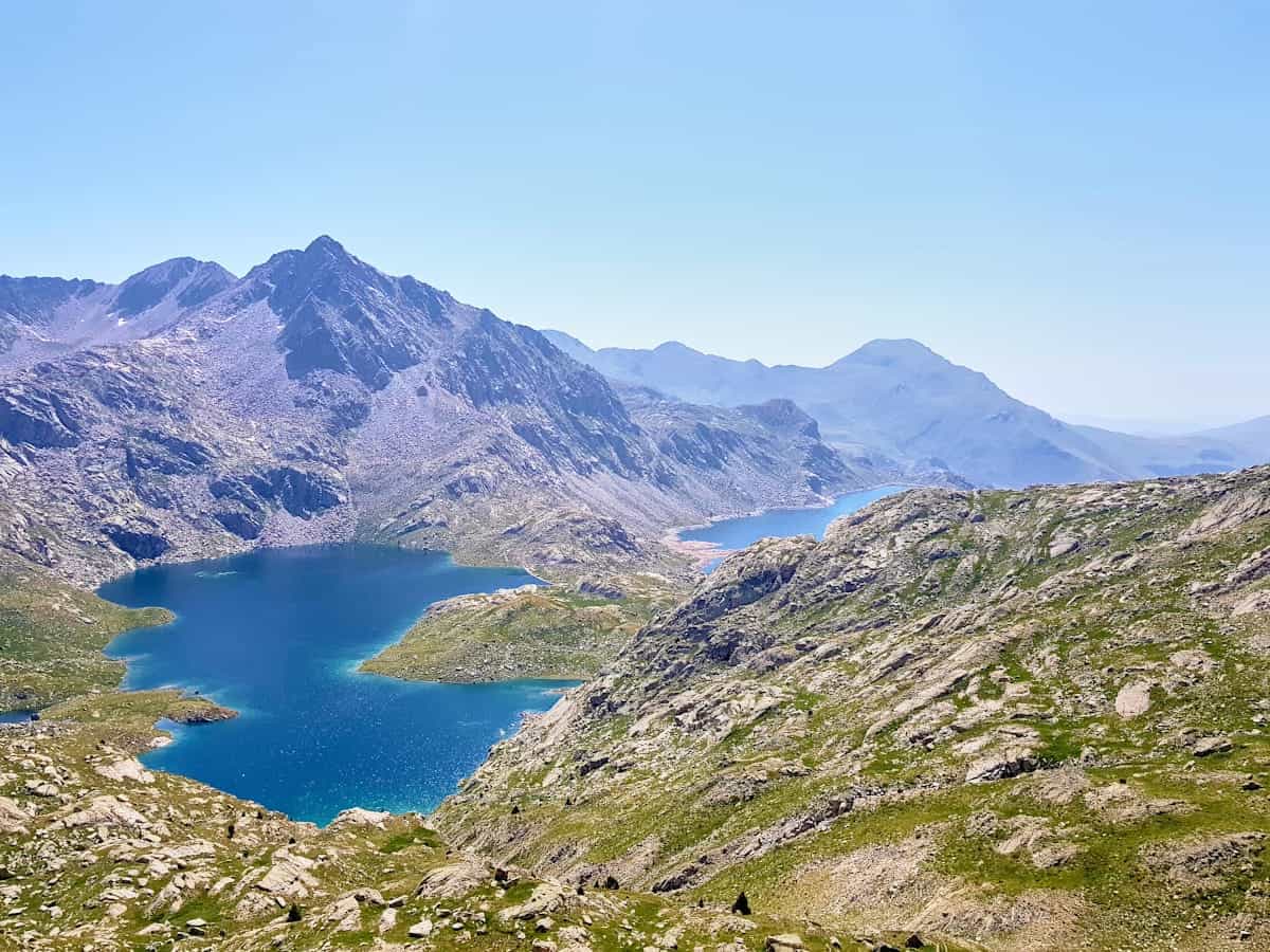
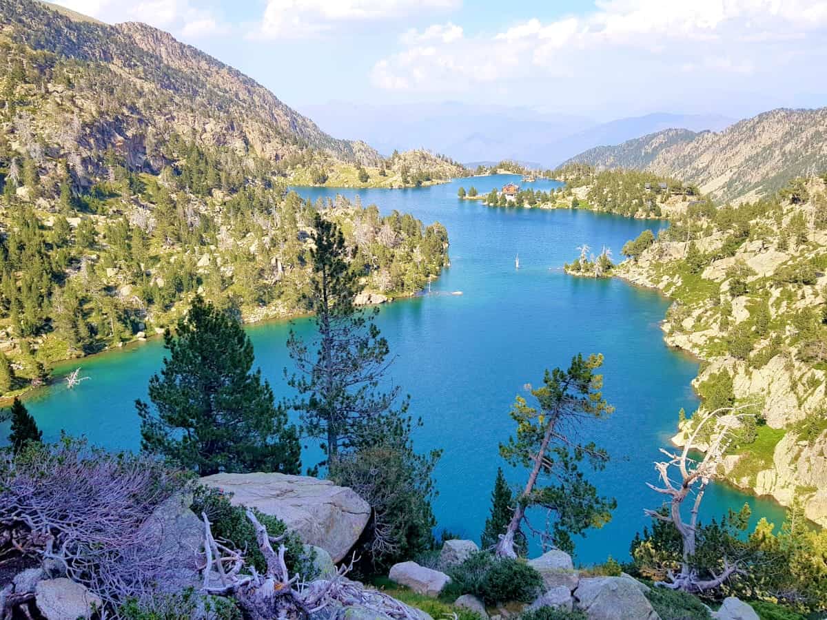
The views from the mountain pass were fantastic, and the emerald colour of the lake’s water was beautiful. After the Dellui mountain pass, the trail crossed an area with little vegetation and large lakes.
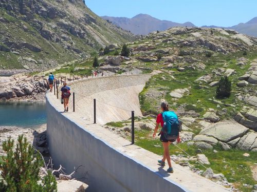
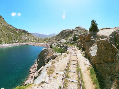
Before reaching the Colomia hut, the trail crossed two dams and then followed the old wagon train path used to transport materials when the dam was built.
We stopped at the Colomina hut to have lunch and enjoy the lake views next to the hut.
Colomina to JM Blanc, 6.7 km hike, 304 m+, 407 m-
The next part of the trail crossed more than seven lakes until reaching the Josep M Blanc hut.
The only challenging part of this stage was the mountain pass El pas de l’Ós, because of all the tiredness and km accumulated. But keep pushing; the reward is worth it!
When descending to the hut, pay attention to the signs as it’s easy to get confused and end up in Ernest Mallafré.
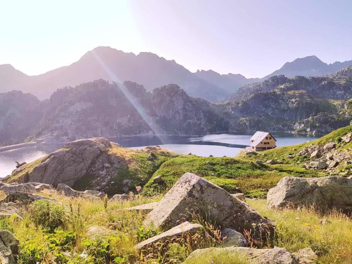
The location of the Josep M Blanc hut was idyllic. Lakes of intense blue colour surrounded the place, and the landscape was jaw-dropping.
We grabbed a beer, sat on the terrace and soaked up the views during sunset. We couldn’t have asked for a better way to end the longest day!
Day 6 – Goodbye Carros de Foc
JM Blanc to Prat Pierró parking, 13 km hike, 432 m+, 1.109 m-
We woke early to see the sunrise from the lake beside the hut. It was such a peaceful and beautiful moment.
Although it was the last stage of the route, we still needed some energy as it involved overcoming the second-highest point of the journey, the Monestero mountain pass.
After leaving the hut, we followed the signs to collada de Monastero. The trail to the mountain pass crossed some beautiful lakes, and it wasn’t difficult except for the last part, where we encountered some big rock blocks.
We didn’t have the opportunity to take many pictures because, due to the rain, we were walking as fast as possible.
Once at the top of the mountain pass, the clouds went away, and the sun started to shine.
We were lucky because we needed all our attention in the descent to make it to the next hut! The descent was super steep, and the rocks were very decomposed at the beginning, making it easy to slip and fall.
From that point on, it only got better. The trail continued descending and descending. Have patience because the descent is loooong.
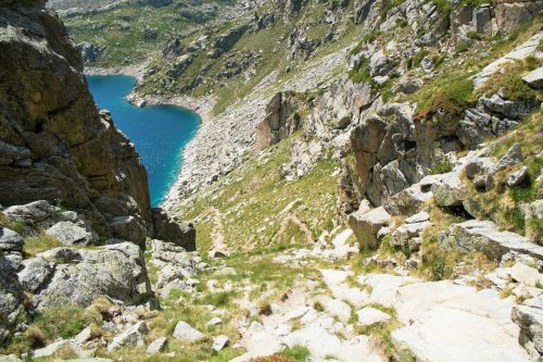
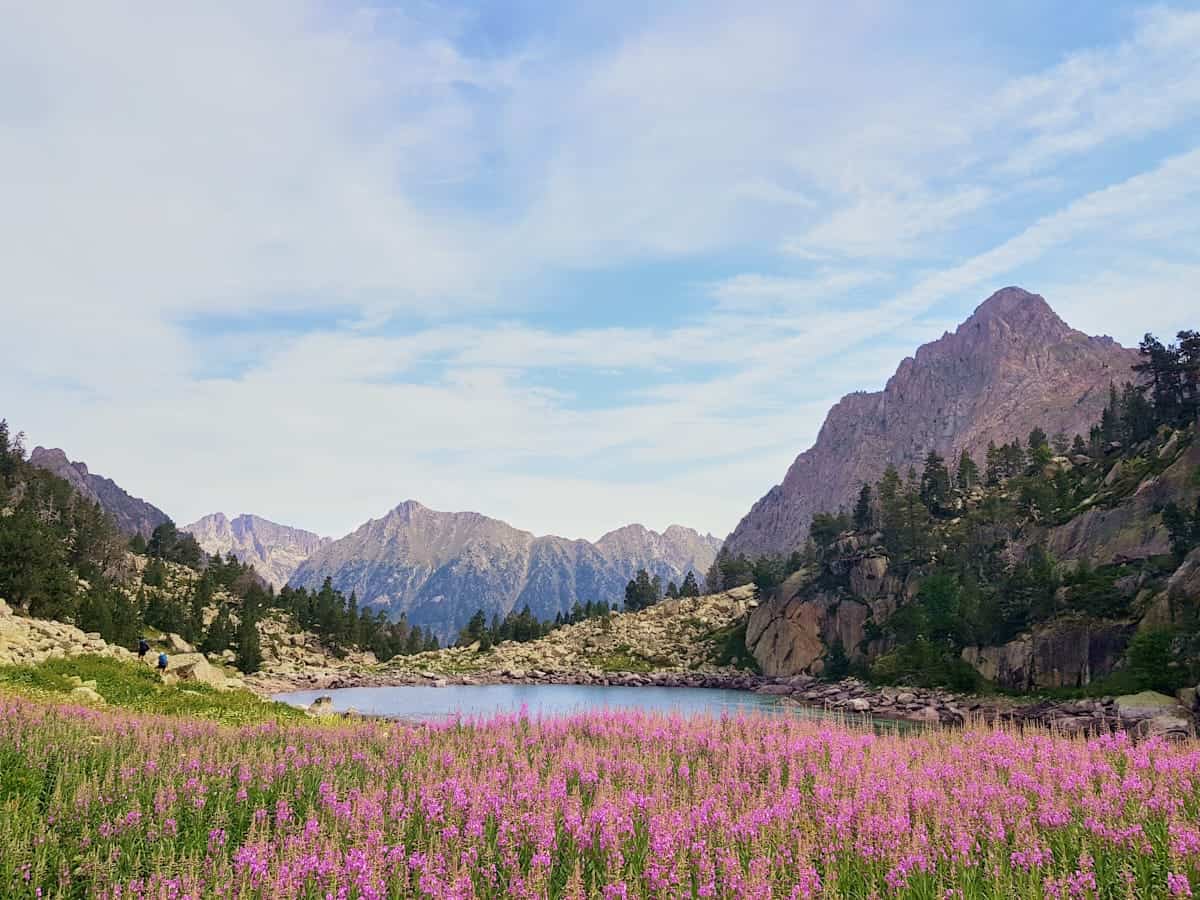
Finally, we arrived at Monastero Lake, which had a spectacular turquoise colour and was one of the route’s most beautiful lakes. It was surrounded by pink flowers, looking like the landscape of a painting.
As we approached the park’s main entrance, the vegetation changed, and more people started to appear. The path widened, and it even had some wooden walkways.
We finally arrived at the Ernest Mallafré hut, where we started this adventure 5 days ago.
From there, we only had to follow the path that left us again in the Prat Pierró car park, where we concluded this incredible journey.
Would we recommend Carros de Foc?
We can’t recommend it enough! The Aigüestortes i Estany de Sant Maurici National Park is the only national park in Catalonia, and it’s worth spending some days exploring such a beautiful spot.
Carros de Foc is a great way to discover the park and traverse its wide variety of landscapes. This hike is perfect for anyone who wants to experience the Pyrenees but would like the comforts of staying in a hut, carrying less weight and eating yummy food!
Remember to take care of the environment. Be kind to fellow hikers and respectful to hut wardens and the local communities. And hike on!
More hut-to-hut hiking routes in the Pyrenees
Check our “Hut-to-hut hiking in the Pyrenees: Seven stunning routes + Essential info” guide to discover more thru-hikes in the Pyrenees. We hope you enjoy them!

Absolutely love all of your guides and I am using them to begin the planning of our yearly hiking trip this summer.
I did have two questions after working my way through this guide.
1. The maps you reference. Are they available to get in advance as I like to pre plan routes and make notes about what we will be coming across each day.
2. I know the first question I will get from my group is. “Can we enjoy a beer or 2 at the end of each day?” So with that in mind. Do the huts sell beer?
Thanks so much again for putting this together!
Thanks Will 🙂 Glad our guides are helpful to plan your summer hiking trip.
The maps we reference are all from Editorial Alpina. You’ll find them on their website, and they ship them to many countries, so you can get them in advance to plan the route.
Tell your group they don’t need to worry about beer! All huts sell it, so you’ll be able to enjoy a much-deserved beer after a day of hiking!
Hi there, thanks so much for this fab guide! It’s really helping me in my planning for this years hiking trip 🙂
I’m wondering if you’d know- I am trying to book a stay at Colomers in July but its saying its closed (no dates are showing at all on the main booking page). I’m not sure if this hut is closed completely? If so, is Soboredo to Restanca doable in a day?it looks around 12.5km, but I’m not sure yet about the terrain (waiting for my map to arrive!).
Any help would be fab! thank you 🙂
Hi Leanne,
Thanks for your nice comment 🙂
I’ve just taken a look at the booking page (https://refusonline.com/ca/mapa-reserves-online) and, indeed, it appears like the hut is closed in July, which is very strange… 🤨 I would give them a call (+34 973 641 681) or send an email to the booking platform (info@refusonline.com). It might just be that they haven’t started receiving bookings but it’s worth trying to contact them.
If it is indeed closed, you can definitely hike from Saboredo to Restanca, which would be 12.5km and 836m of elevation gain.
Hope this helps!
Hello, I am currently booking huts for June and have found availability on them through the site but when I try to check out it asks what Forfait I want but I am unable to select a Forfait. Do you know how to bypass this issue?
Hey Yana! You have to write the number of forfaits you want next to the forfait type you want to select. Then, you should be able to select the dates and book the huts. If it doesn’t work, you can contact the Carros de Foc organisation (https://www.carrosdefoc.com/contacto/) and they can do the booking for you. Hope this helps!
Hi there! This is kind of a random question, but I’m so intrigued because these views look fantastic. I’ll be in Girona for the month of July, and I love the idea of doing a weekend hike in Aiguestortes. I’d need to start from Girona on Saturday morning and return on Sunday evening – is there any hike-in-spend-one-night-hike-back-out kind of itinerary? Thanks so much in advance!
Hi Hannah!
Carros de Foc is indeed fantastic! One thing you could do is hike from the parking lot Prat de Pierró to the hut JM Blanc, sleep there, and come back the next day following a different path. You can check the entire route here.
Keep in mind that you’ll probably need a car to go from Girona to Aigüestortes and the drive is around 4 hours.
Hope this helps 🙂
Hi there!
I am planning to do this route in June and am wondering how you would recommend getting back from Prat de Pierro parking lot to Espot on the last day? I won’t have a car and am not sure I’ll be able to book a taxi in advance, as I don’t have a sense of how long the last 13km will take me. Do you know if there are any shuttles/buses/taxis waiting at the parking lot for hikers? Thanks in advance 🙂
Hi Jo,
The Bus del Parc, the shuttle in the park, doesn’t go from Prat de Pierro to Espot, so this is not an option. The best option is to walk from Prat de Pierro to Espot (3.7 km, mostly flat), which will make your hike a bit longer but you won’t need to rely on a taxi. You could also call the taxi company (973 624 105) once you get to Prat de Pierro and see if they are available to pick you up.
Hope this helps!🙂
Hello!
We are considering doing this route this upcoming June and we were curious if you had any tips or information on what to do with extra luggage. We’ve read a few things that say most hotels offer storage or some people have left luggage in their rental car.
Wanted to see if you had any additional tips or info!
Thanks!
Hi David!
Your best bet is definitely to ask your hotel. Most of them are happy to store luggage for you, and it’s the safest and easiest option. If for some reason the hotel can’t store your luggage (though it’s rare), leaving it in your rental car could work too, but I’d avoid leaving anything valuable there just to be on the safe side.
Hope that helps! 🙂
Hi thank you for the response!
Do you happen to recall how long the last day took from JM Blanc to Espot area?
Thanks!
Hi David,
I think it took us between 4 and 5 hours.
Hi – is it possible to bivouac overnight in a small tent away from the trail?
Hi Chris,
Overnight stays outside the huts, as well as camping and bivouacs, are prohibited throughout the park and some of its surroundings.
Hallo UC,
I’m planning walking the Carros de Foc in July with my family og 5 adults. When I want to book refugies, I have to chose between: Forfait open 35E, forfait open nord 35 E, forfait open sud 35E and forfait open plus – byt I have no idea what that means? and what to choose. I hope you can help me – please.
Hey Inger,
The forfait open is the one you should choose if you want to do the normal route that passes by the 9 huts, the open plus adds two more huts to the route (Gerdar and Pla de la Font), the open nord is only if you want to do the northern part of the National Park, and the open sud is only for the southern part.
Hope this helps! 🙂
Hello!
Thank you for creating such a well informed guide, it’s been very helpful!
I would like to do this hike in 6 days. However my buddy and I wanted to spend an extra day simply in the mountains there. Is there any hike you’d recommend to do slightly off course just to simply spend more time there? Please let me know, thank you!
Thank you Yana 🙂
One option is the hike to the lake Estany de Gerber. It starts in Port de la Bonaigua mountain pass and it’s 3 km one way (you can check the Wikiloc route).
Another option is Estany de Besiberri, which starts in the Conangles hut (Wikiloc route).
And a last option is to do a route around the Vall de Boí, which is really beautiful. You could hike to Estany de Llebreta or Estany de Cavallers.
Hello, I wanted to thank you for responding earlier and having such an informative website. I haven’t found any other that was as helpful as this one. I do have a question about the Forfeit. When asked where I would like to pick it up I’m given the options of colomers, colomina, estany llong, saboredo or Ventosa. However, the hike we planned starts at Espot and we want to go to the Amitges or Ernest Mallafre first. Is it ok to pick up the Forfeit later along the way or must it be picked up from the first hut you go to?
Hey Yana, I’ve just checked the website and it says you can pick the forfeit in the village of Espot, at the Tu Rai store, next to the taxi stand (opening hours: 9 a.m. to 8 p.m.).
What’s going to be your recommendation between Carros De Foc & Coronallacs?
Both are beautiful. Carros de Foc is best if you want to take things easy, as there are more huts and you can split the sections. We only recommend Coronallacs if you’re a seasoned hiker, as the stages are long and with a lot of elevation gain/loss. Coronallacs is also easy to reach from Barcelona, as there is direct bus to the start of the route. So it depends on your fitness level and number of days you have. Besides that, both routes are incredible, with alpine lakes, varied terrain, and great huts 🙂
Hi UC, thanks for the detailed information.
I was researching about the Carros de Foc but saw so many other recommendations on your site.
I only have time for one trail, which would you recommend:
Carros de Foc
La Porta del Cel
Estanys Amagats
Cavalls del Vent
Hi Deko!
Carros de Foc is the most famous one. The landscapes are amazing but I wouldn’t choose it if you’re looking to escape the crowds, especially in the huts. La Porta del Cel is the toughest one, so I only recommend it if you’re an experienced hiker and have done some hut-to-hut hikes before. Estanys Amagats is great to escape the crowds but the landscapes of the first and last day aren0t as impressive. And Cavalls del Vent is also beautiful but the landscape is less alpine (there aren’t any lakes along the route).
Hope this helps! 🙂