

La Travessa dels 3 Refugis is one of Catalonia’s lesser-known thru-hiking trails but one of the most beautiful to us.
The circular route links three mountain huts in the Capçaleres del Ter i del Freser National Park, bounded by the French border to the north. Part of the route passes through France, and the other passes through Catalan territory. So, you’ll be hiking in two countries! Isn’t that cool?
La Travessa dels 3 Refugis (literally meaning The Crossing of the 3 Mountain Huts) covers over 50 km and can be completed in 3 to 6 days. Walkers start at the charming village of Queralbs and take the direction they prefer.
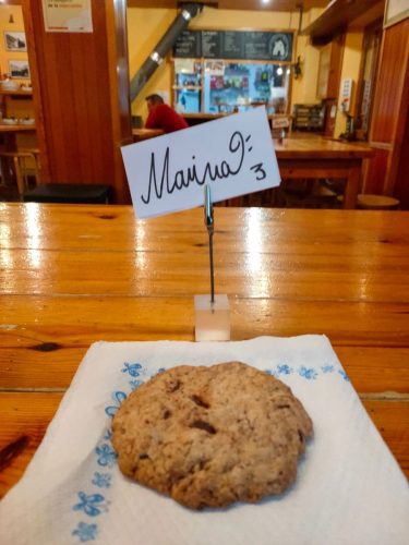
Each day, you hike to a mountain hut with basic facilities, including a bed, shower and, sometimes, WiFi. But the real treat is the mountain food! After a day of walking, you’ll be treated to delicious soups, high-quality meat, and even some sweet treats.
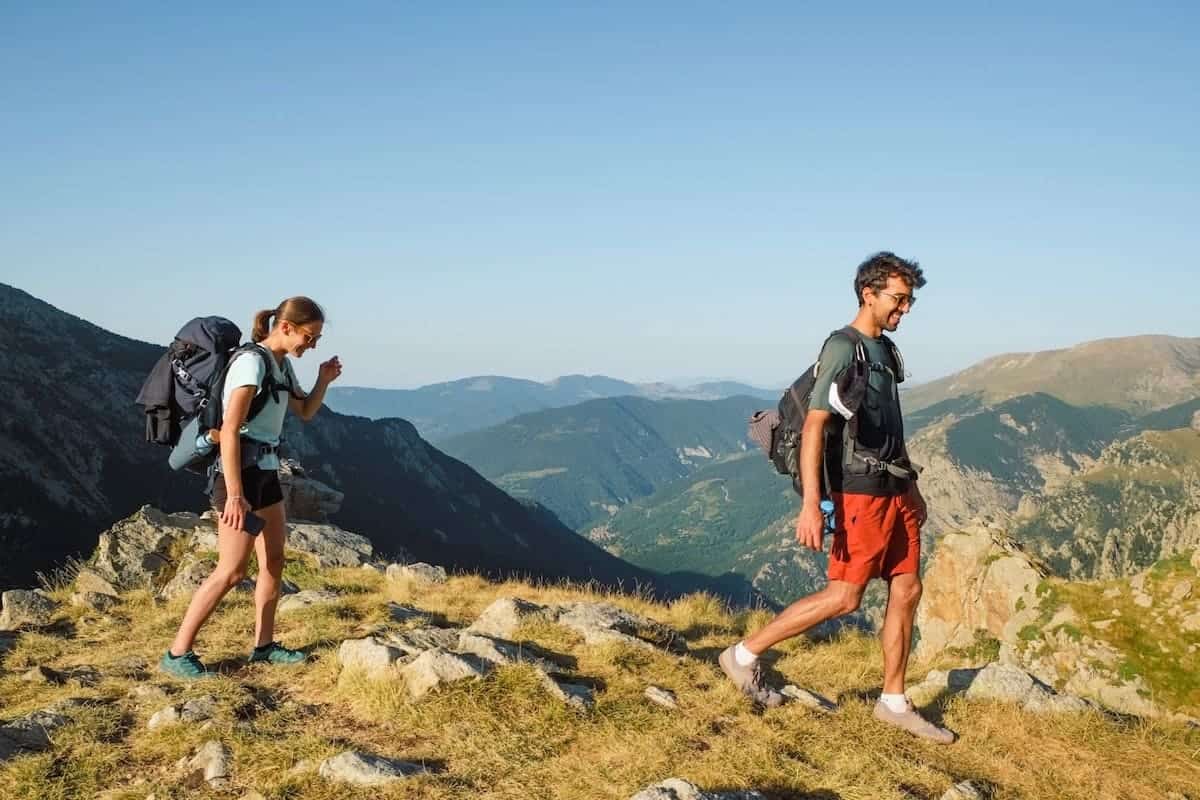
We hiked La Travessa dels 3 Refugis in August 2021 with some family members, and we loved it. We even added a night climb to a peak along the route to see the sunrise.
Here, we share our personal experience, valuable tips, and stunning photos to inspire and guide you in planning your own Travessa dels 3 Refugis adventure!
* Post written for the first time in May 2022 and updated in February 2025.
Things to know before hiking La Travessa dels 3 Refugis
Technical details
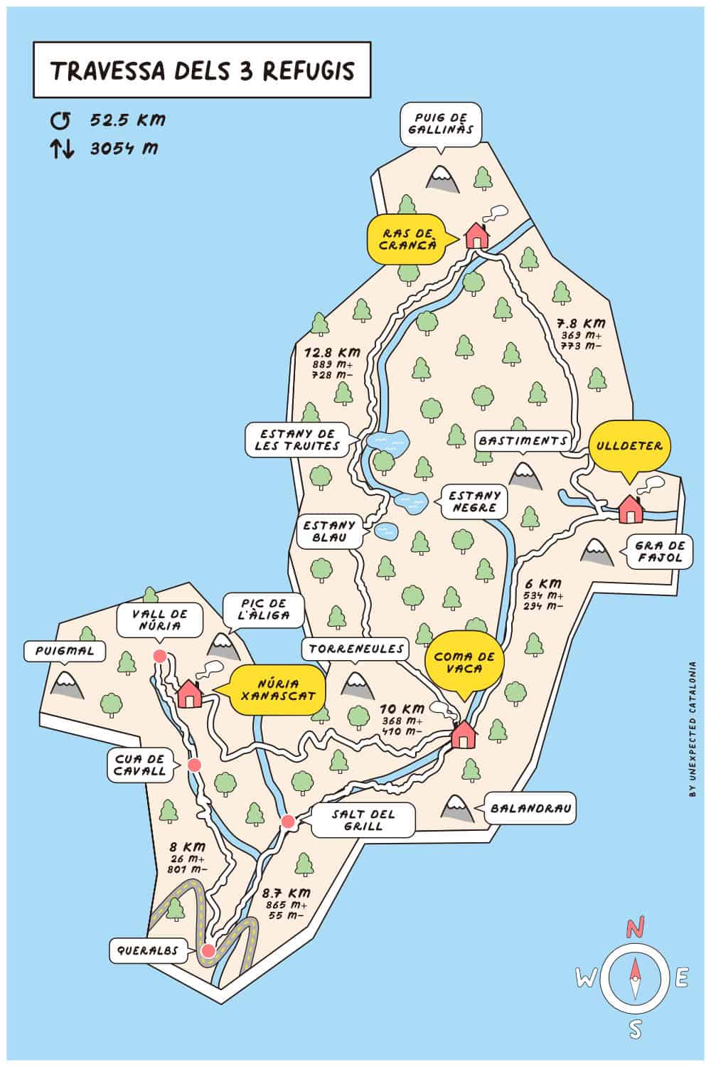
🥾 Total distance: 52.5 km
🟠 Difficulty: Moderate
⬆️ Cumulative elevation gain: 3.054 m
⏱ Duration: Between 3 and 6 days
🗓 Recommended season: Travessa dels 3 Refugis is a high-mountain route, so the best time to enjoy it is from the beginning of June to mid-September
The route is graded “easy-moderate“, which we think is accurate. We regularly hike and found the track challenging the first two days because of the distance, but it wasn’t technically difficult. If done at a leisurely pace, we believe that this route is affordable for most hikers.
👌🏼 Our tip
September is an excellent month for this hike as it isn’t as crowded as summertime.
Where does the route start?
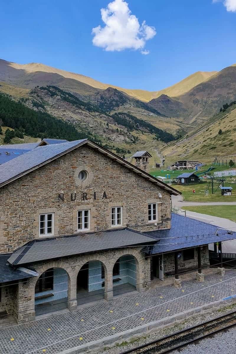
The route starts and finishes in the village of Queralbs, located in the eastern Pyrenees.
It takes approximately 2 h to drive from Barcelona to Queralbs, 2 h 40 min from Lleida, and 1 h 30 min from Girona.
Reaching La Travessa dels 3 Refugis by public transport
From Barcelona, you can easily reach Queralbs by public transport.
For the first leg of your journey, you’ll board a train from Barcelona (Sants, Plaça Catalunya, Arc de Triomf, or La Sagrera) to Ribes de Freser. The ride takes 2 h 25 min, with several trains running daily.
The second part of the journey is a rack railway train or a bus from Ribes de Freser to Queralbs. The bus is cheaper but only operates twice daily, whereas the railway train runs six times daily.
Which direction is best to follow?
Regarding the route’s direction, we did it counterclockwise. Travessa dels 3 Refugis is a circular track, so you can hike it clockwise or counterclockwise.
However, we recommend counterclockwise because the trail from Queralbs to Núria can be pretty tedious, so we think it’s better to descend it than ascend it.
Here’s a map with the various mountain huts, their altitude, elevation gain, and distance between them to help you better plan your approach to this route:
How many days do you recommend to hike La Travessa dels 3 Refugis?
This depends on your fitness level and how you like to tackle a thru-hike. The route can be done in 3 days if you’re used to hiking, in good shape, and don’t mind hiking 15-20 km each day with 1.000-1.500 m of elevation gain.
If you like to face multi-day hikes in a slow traveller’s way, we recommend 4 or 5 days. This way, you’ll have time not to rush, chill at the huts, take more breaks, and even add hikes to nearby peaks.
One of the cool things about this hike is that you can climb many emblematic peaks along the route, like Bastiments or Puigmal. For example, we added a night climb to the Pic de l’Àliga to see the sunrise. We’ll mention all the mountain ascents you can add to the route below.
If you do so, consider the time it’ll take you and plan the number of days accordingly.
You can also shorten the route if you’re short on days to spend in the area. For example, you can skip the last part from Coma de Vaca hut to Vall de Núria and go straight from Coma de Vaca to Queralbs again.
Recommended plan for the 3-day route
If we did this route in 3 days, we would break the sections as follows:
- 1st day: Queralbs – Coma de Vaca hut – Ulldeter hut
- 2nd day: Ulldeter hut – Ras de Crançà hut – Coma de Vaca hut
- 3rd day: Coma de Vaca hut – Vall de Núria – Queralbs
Recommended plan for the 4-day route
If we did this route in 4 days, we would break the sections as follows:
- 1st day: Queralbs – Coma de Vaca hut – Ulldeter hut
- 2nd day: Ulldeter hut to Ras de Crançà hut
- 3rd day: Ras de Crançà hut to Coma de Vaca hut
- 4th day: Coma de Vaca hut – Vall de Núria – Queralbs
* As you’ll see later when we explain our experience and the different stages, we didn’t follow what we recommended for the four-day hike. This was because two of us were joining the hike later, and we needed to arrange to meet. If we did it again in four days, we would follow the abovementioned plan.
Recommended plan for the 5-day route
This is the plan we would follow for the 5-day route:
- 1st day: Queralbs – Coma de Vaca hut – Ulldeter hut
- 2nd day: Ulldeter hut to Ras de Crançà hut
- 3rd day: Ras de Crançà hut to Coma de Vaca hut
- 4th day: Coma de Vaca hut to Vall de Núria
- 5th day: Vall de Núria to Queralbs
Recommended plan for the 6-day route
And finally, if you want to do it in 6 days, you can split the first stage in two. So, day 1 would be Queralbs to Coma de Vaca hut, and day 2 would be Coma de Vaca hut to Ulldeter hut. In this case, you will sleep twice in the Coma de Vaca hut during the route.
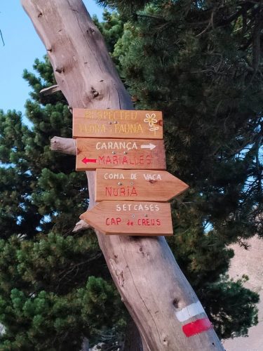
Is the route marked?
The route is signposted with different types of marks:
- Yellow lines or red points from Queralbs to Coma de Vaca hut.
- Red and white lines from Coma de Vaca hut to Ulldeter hut, Coma de Vaca hut to Vall de Núria, and Vall de Núria to Queralbs.
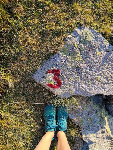
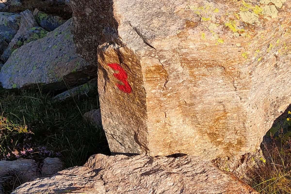
- The route from Ulldeter hut to Ras de Crançà hut is marked with red and white lines until the restaurant Les Marmotes (closed in summer) in Vallter 2000. Beyond this point, the number 3 and cairns indicate the route.
- From Ras de Crançà hut to Coma de Vaca hut, you’ll find cairns until the mountain pass Coll de Crançà. Then, follow the red dots.
Following the track at some points can be tricky, like at the mountain pass Coll de La Geganta or when leaving the Ras de Crançà hut. So, it’s wise to pack a map of the area. We suggest buying it online, but you can also find it in some bookstores in Barcelona or around the region.
🧭 Wikilock track
We also suggest you download the hike’s track on your phone. Here’s our Wikilock track of the route.
Weather and gear recommendations
It’s not all sunshine and heat in the Catalan mountains! The weather can change rapidly, as it did to us. It was sunny in the morning, but as soon as we got to the Ulldeter hut, the weather changed abruptly, and it started snowing!
Expect any weather and get equipped accordingly.
We recommend packing some warm clothes, even though you hike in summer. For example, a pair of gloves and a lightweight down jacket. You’ll also need waterproof gear (jacket, pants, and backpack cover), a head torch, and safety equipment, such as an emergency blanket and a first aid kit.
Pack sunglasses, a hat (or a cap), and sunscreen (reef-friendly!). There are several sections of the route where there isn’t a single shade.
Another thing you’ll be grateful for is earplugs. We bet you’ll appreciate them if your neighbour starts snoring! And a set of clothes only for the huts. There is nothing like reaching the hut all sweaty, taking a shower, and putting on some clean, warm, and cosy clothes!
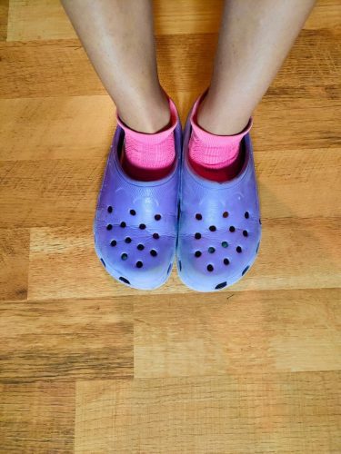
You don’t need to bring slippers or flip-flops as all the huts give you Crocs.
As you’ll spend many hours hiking, it’s wise to pack light but sensibly. You’ll need to carry your own water, clothes, sleeping bag/sheets, personal items, camera, food (depending on the meals you select when booking), etc. You won’t need to pack a sleeping pad or more than one day’s worth of water at a time.
It’s also essential to take a bag with you to put all the trash there. You can throw it at some huts or the village where you finish the route. Please take care of the environment and leave no trace.
For more info in-depth info on what to pack, read our guide “10 things we never forget to pack when hut-to-hut hiking in the Pyrenees.”
🌦️ Where to check the weather
You check the weather forecast for the days you’re hiking on the local Meteo website or the local mountain Meteo website.
Phone service
The phone service varies depending on the operator, but we had phone service during most of the route.
⚠️ Important!
Be aware that a portion of the route passes through France, which could impact your phone coverage costs. If you have a SIM card from an EU country, it’s essential to check if roaming is included in your plan. If not, consider turning off your mobile data to avoid unexpected expenses that could make your trip more costly than anticipated!
We recommend turning off the mobile data when leaving the Ulldeter hut and turning it on again when entering the Coma de Vaca hut.
It’s good to let family members or friends know you’re doing this hike so they won’t freak out if you don’t answer in some hours.
In case of an emergency, call 112. This emergency number has good coverage throughout the hike.
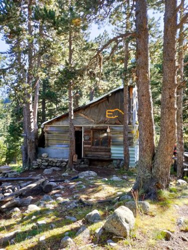
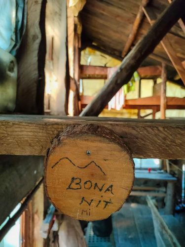
The huts on La Travessa dels 3 Refugis hike
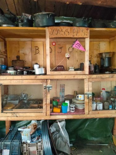
The three huts in the area (Coma de Vaca, Ulldeter, and Ras de Crançà) are located in beautiful natural settings. The huts are not mountain hotels, and their schedules and rules must be respected.
They all have the essential things to spend the night there: a place at the entrance to leave your backpack and boots, heating, accommodation, food and showers (sometimes at an extra cost).
You sleep in a bunk bed in shared dormitories, which are bigger or smaller depending on the hut. The mattresses are close to your neighbour, so try not to move much!
All the huts have blankets, but you must bring your sleeping bag or sheets.
We wouldn’t say we’d had the best night’s sleep in a hut, as in a 40-bed room, the chances of someone snoring or moving are pretty high. Remembering this is good, so you’re not frustrated or disappointed after sleeping for a few hours!
Each hut has charging stations, so charging phones, cameras, e-book readers, etc., is a breeze.
Accommodation options in Vall de Núria
Besides the three huts, there are two other accommodation options if you spend a night in the emblematic Vall de Núria.
This is a tourist spot, and there are no mountain huts there. Instead, you can choose between sleeping in a hotel or a hostel.
For the ones who fancy more comfort and luxury, your best option is the Hotel Vall de Núria. It’s a 3-star hotel in an emblematic building at the valley’s heart. You can rent a room or an apartment, and the building has a restaurant and a bar.
The budget-friendly option we went for is the Alberg Núria Xanascat (aka Alberg Pic de l’Àliga). It’s a mountain hostel located 15 min walking from the heart of the Vall de Núria. The vibe differed from a mountain hut; it was not as familiar but still nice. And the views were top!
There are rooms with 3, 4, 5, 6 and 8 beds with a bathroom, which feels more intimate than the big rooms usually found at the mountain huts. However, the food was less delicious than in the other places we slept; it felt more like a school meal.
Food and water
🍽 Breakfast and dinner
Breakfast and dinner are served in the huts, and we’re sure that this will become one of your favourite parts of the hike!
Breakfast usually consists of bread with cured meats, cheese, and/or jam, coffee, biscuits, and tea.
The guards often cook three dishes for dinner, including soup, salad, a meat dish, and a dessert. The menu can vary from hut to hut and also changes daily.
⚠️ Important!
If you have a food allergy or dietary requirements (vegetarian, vegan, gluten-free, etc.), please let the guards know when booking the huts. They will accommodate your requests and make the necessary changes.
However, remember that sometimes the hut’s resources are limited, and the special meals can be less varied. For example, vegetarians may only be able to choose between cheese or jam for breakfast, whereas non-vegetarians have more options, such as various cured meat.
🥪 Lunch
You can buy lunch at a supermarket before starting the route or buy a picnic at the huts where you sleep. If you want the picnic, you must request it when booking. In our case, we brought the food for the first three days from home. We had tuna cans, cheese, tortilla wraps, and apples.
On the last day, because the route finishes at the village of Queralbs, we booked lunch at the restaurant El Racó de Cal Litus, and we could enjoy a well-deserved lunch there! We highly recommend doing the same if you plan to finish the hike before 2-3 pm.
🥜 Snacks
We also recommend you bring some extra snacks for the route, like nuts or energy bars. Think about foods that don’t spoil quickly and take up little space.
💧 Water
When it comes to water, we recommend you take two reusable water bottles of 0.75-1 L with you. You can refill the water bottles in all mountain huts.
If you carry a water filter, there are plenty of streams, lakes, and rivers where you can fill your water bottle.
We recommend making sure you have enough water before leaving the huts (both for drinking and refreshing yourself when it’s really hot).
Cost of hiking La Travessa dels 3 Refugis and how to book it
This route doesn’t have a centralised booking service, so you have to book each hut on its specific webpage and buy the map yourself. However, you can find more info on the Travessa dels 3 Refugis website.
You can book the huts at the following websites: Coma de Vaca, Ulldeter, and Ras de Crançà (don’t email them as their mailbox is full. Better call them at +33 9 88 66 73 81).
👌🏼 Our tip
It’s always necessary to book the huts in advance. Also, if you choose to do the hike during the high season (July and August) or long weekends, you’d better book long in advance.
The cost of the hike varies depending on the huts you sleep in and the meals you select.
⚠️ Important!
Remember to bring cash! Most huts don’t accept card payments, so having some money with you is always better.
La Travessa dels 3 Refugis route
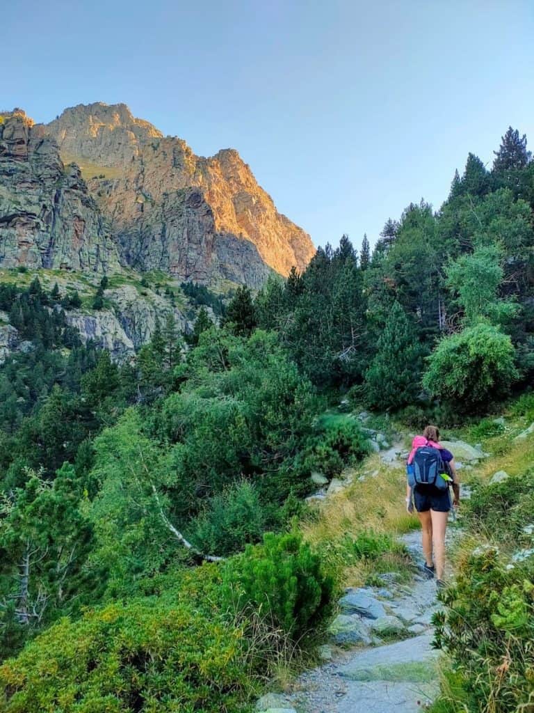
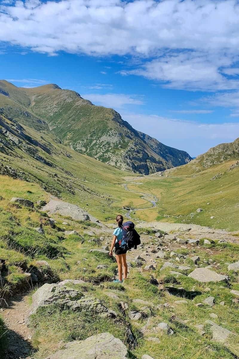
Day 1 – Green meadows and cool mountain huts
Queralbs to Coma de Vaca, 8.7 km hike, 865 m+, 55 m-
It was 5 am when our alarm clock rang. We hopped in the car and drove to Queralbs, arriving there in time to see the first rays of the sun.
We parked the car in this parking lot and started walking down the road.
At this point, it’s easy to miss the track. Pay attention when you see a sharp curve on the left; that’s where the detour is.
The track continued towards the Daió de Baix power station, the first hydroelectric plant in Catalonia to transport electricity over long distances. It was built in 1907, and although the original building was demolished in 1999, adjacent buildings and infrastructures remain on site.
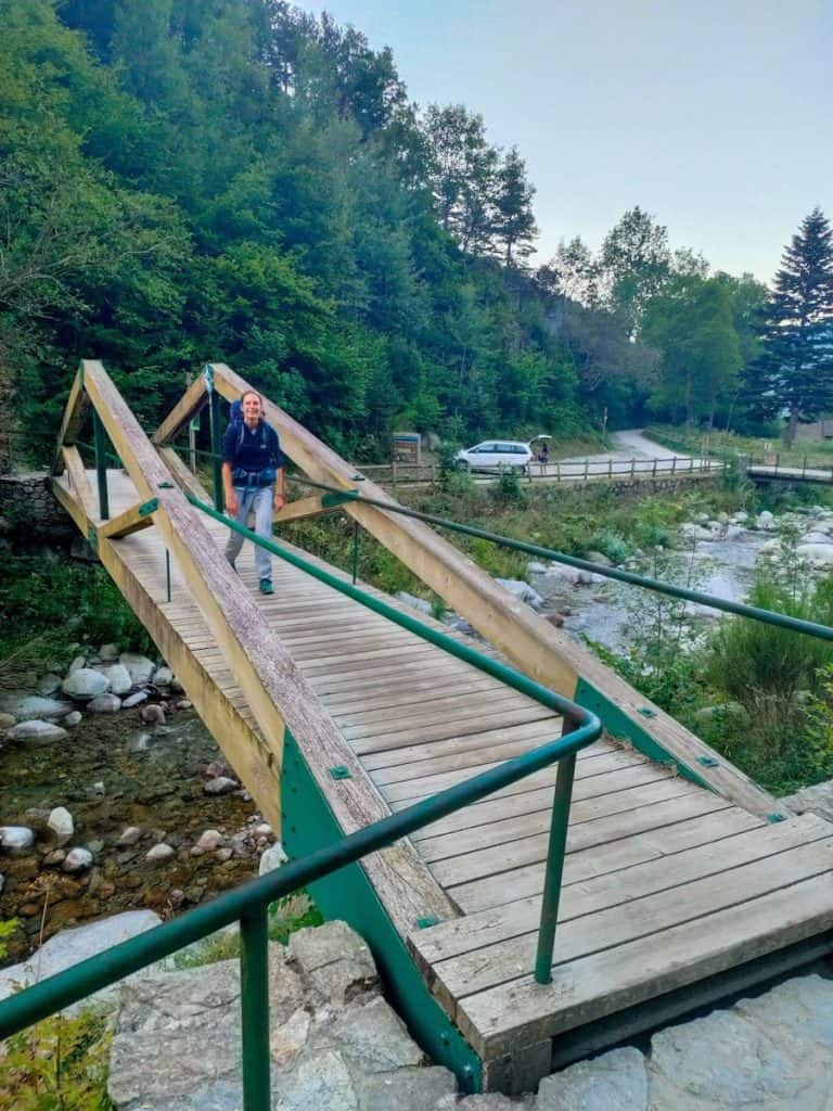
We crossed the wooden bridge and started the climb following the Freser River.
After a while, we found a sign indicating the Salt del Grill. It’s a beautiful waterfall and an excellent place to stop for a snack and a sip of water.
The track continued going up, with the Freser River on our right side, until we reached a meadow.
Time to cross the river. For that, there is a metallic bridge that will do the work.
And then began the most challenging part of the climb.
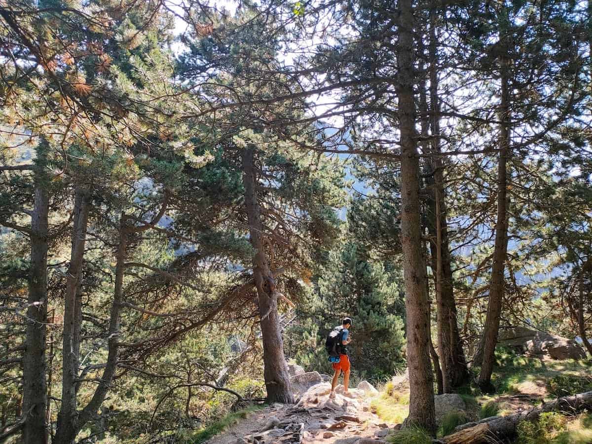
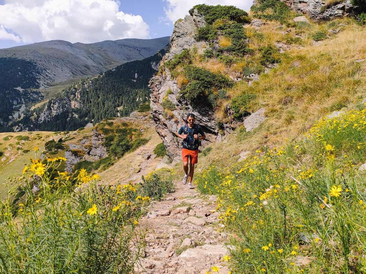
First, we climbed through the middle of the forest and then through a rockier landscape with less vegetation. As we gained altitude, the views of the Freser Valley just got better and better!
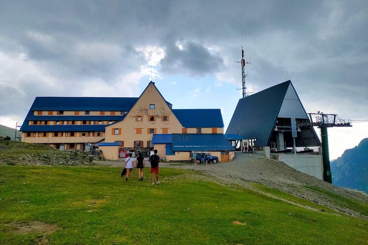
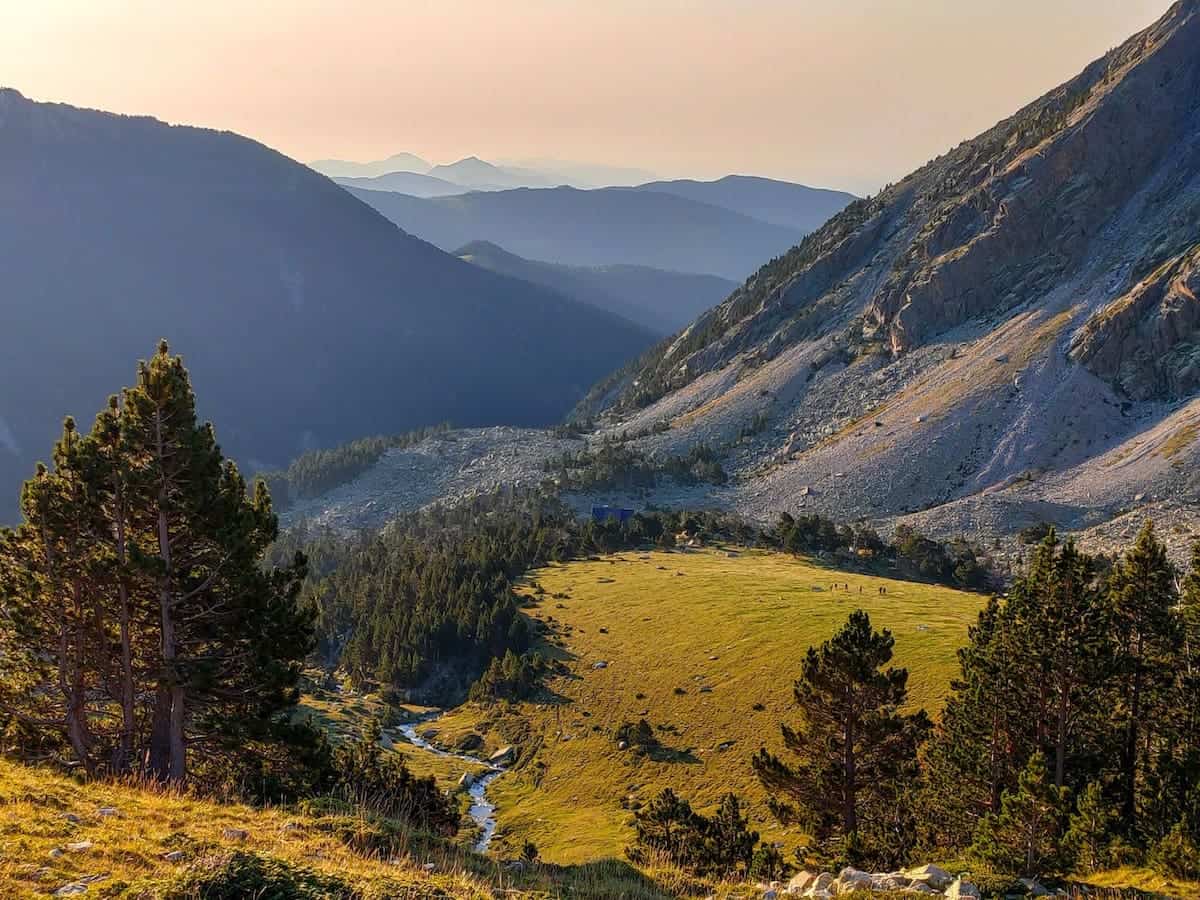
Once we reached an altitude of 2.100 m, the trail became flatter, and suddenly, the breathtaking Pla de les Eugues appeared before us. This is where the rivers Freser and Coma de Vaca meet each other. And it’s also where the first mountain hut of the route is located!
We stopped at the Coma de Vaca hut to rest and eat some nuts and apples before continuing the hike to the Ulldeter hut.
🏔 Additional peaks to add to this section
You can climb Balandrau Peak (2.584 m) when hiking this section. If you do so, add 2 h 30 min to the total section time.
🍿 Our tip
Looking for something to watch on the plane/train heading on this hiking trip? You can watch the documentary Balandrau, frozen hell. It tells the story of different mountaineer groups skiing and climbing in the area in December 2000. All of a sudden, a violent blizzard came and claimed the lives of ten of them.
This documentary is the first-person account of those who survived. It’s a harsh and touching reminder that nature can be unpredictable and that we must be as prepared as possible for unexpected events.
Coma de Vaca to Ulldeter, 6 km hike, 534 m+, 294 m-
Once recovered and refreshed, we continued the hike to the final destination for the day.
We didn’t rest much because the weather forecast predicted a storm shortly after midday. And we didn’t want it to catch us in the middle of the mountain!
Following the red and white stripe marks, we crossed the Pla de les Eugues, with the river always on our left side and the cows observing us.
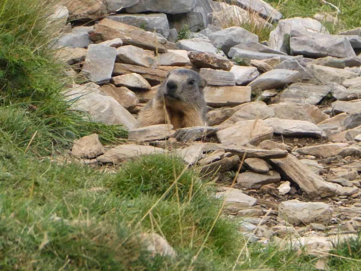
There are often horses, cows, and groundhogs in this area. The first ones are easy to spot, but if you pay attention, you might hear a groundhog or even glimpse it!
👌🏼 Our tip
Remember to turn around every now and then; the views of the Pla de les Eugues with the Coma de Vaca hut are SO beautiful!
After an hour of walking, we saw a rain gauge on our left. That’s the moment to turn right 90 degrees and start climbing the Marrana mountain pass. We let our intuition guide us because the path is not well-signed.
We climbed for 30 min to reach the top of the mountain pass. On our left, we could see the Bastiments Peak, the Gra de Fajol Peak on our right, and the Ulldeter Cirque in front of us. Pretty impressive views!
We could already see the path descending on the mountain pass’s other side. A few more km and, we would get to the final destination for the day, the Ulldeter hut.
🏔 Additional peaks to add to this section
When hiking this section, you can climb the Bastiments Peak (2.883 m) and the Gra de Fajol Peak (2.708 m). If you do so, add 2 h (for each summit) to the total time of the section.
Six hours after our early start in Queralbs, we reached the Ulldeter hut just in time for the snowstorm. The weather forecast was correct!
The weather changed quickly and abruptly. It was sunny all morning, and in seconds, the sky turned grey, and it started snowing.
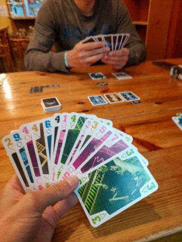
Time to get cosy inside the hut, eat some homemade cookies and play board games!
We loved the Ulldeter hut. It’s a cosy mountain hut, and the guards do a great job decorating it. For example, the rooms have the names of the peaks and mountain passes around the area.
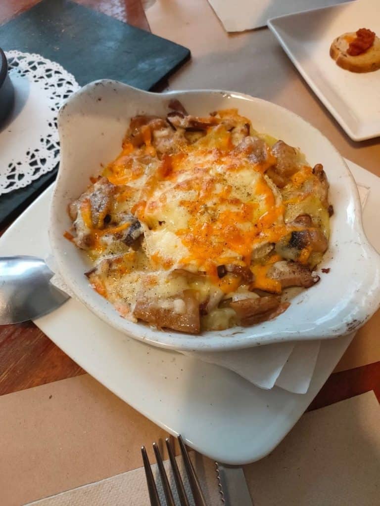
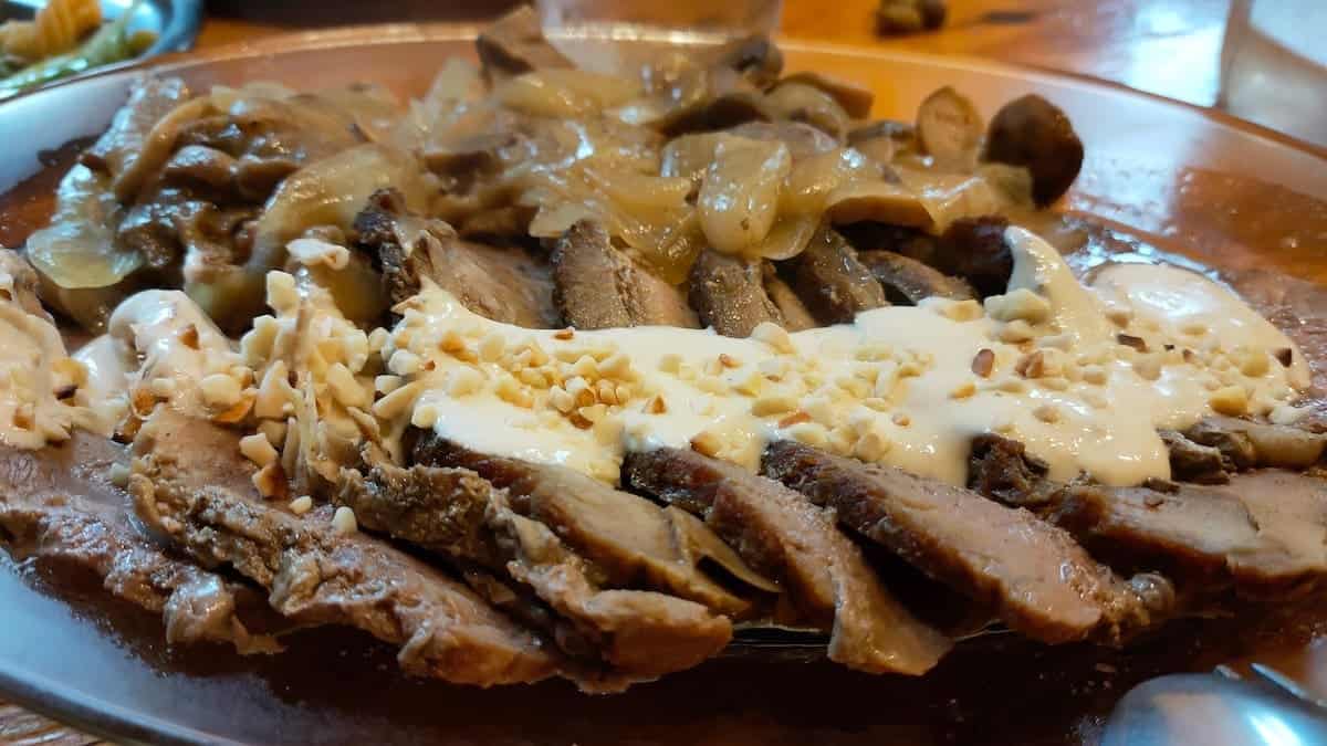
We also loved the food! We had soup, a salad with pasta, meat with caramelised onion, and an almond sauce for dinner. Excellent!
Day 2 – Lakes, lakes, and… more lakes!
This was the longest day for us and by far the most challenging one.
We suggest breaking this day into two or rearranging the sections you hike on each day (see the “How many days do you recommend?” section above for a detailed plan).
Ulldeter to Ras de Crançà, 7.8 km hike, 369 m+, 773 m-
Breakfast was served early in the morning and consisted of yoghurt, cereals, coffee, toast with cured meats, muffins, and fruit.
Once finished, we started the track. We had to follow the path from where we came the day before until we found a sign that indicated “Coll de la Marrana” and “Naixement del Ter”. We followed the sign, walking along the Ter River and gaining altitude with each step.
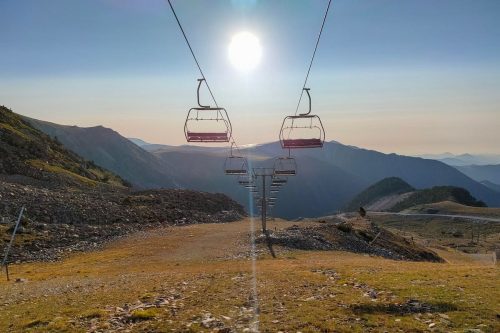
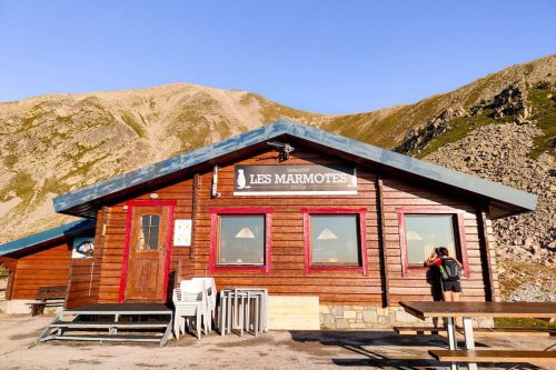
After a while, we reached the wide ski slopes of the Vallter 2000 ski resort and started climbing them. Use the cafeteria Les Marmotes, located on top of the slopes, to avoid getting lost.
 Vallter 2000 ski resort
- Cafeteria Les Marmotes
On the right, we saw the remains of the old Ulldeter hut. This was the second mountain hut built in Catalonia, inaugurated in 1909.
When the Civil War started, the mountain hut was abandoned, to be later bombarded by the Francoists.
Now, only some remains are left, along with a commemorative plaque explaining the place’s story.
The new Ulldeter hut, currently functioning, was opened in 1959 and is located at a lower altitude, closer to the road.
When we reached the cafeteria Les Marmotes, the fun started.
Here, you must forget about red and white marks and look for some number 3 painted on rocks. It felt like an escape room 😂 The Ulldeter hut guard did the paintings to make the climb to the Geganta mountain pass easier.
The first part of the climb was between rocks. Then, it got smoother, and we were on top of the mountain pass in the blink of an eye.
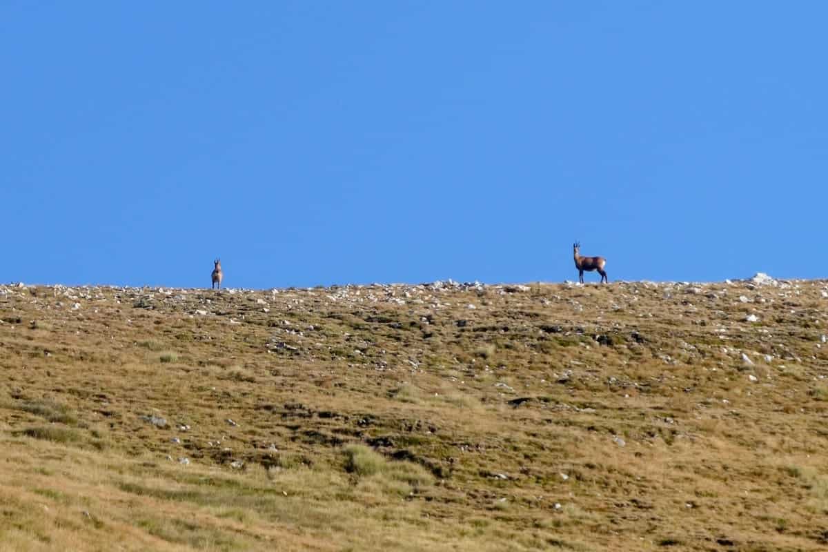
What a surprise awaited us there! A dozen deers were happily grazing, and as soon as they saw us, they quickly disappeared across the mountains. It was magical.
And the views from the top of the mountain pass were also magical! We stopped for a while and rested before descending to the other side.
The path to descend can be tricky to find, so stay alert! Once on top of the mountain pass, walk for about 5 min west, without losing altitude, until you see a small path descending to the bottom of the valley. And voilà! You’re now in France!
Once in the valley, there were no signs or marks, so we let our intuition and a few cairns guide us. The light was spectacular, and the landscape was beautiful.
We crossed the river several times until the openness disappeared, and we entered a forest.
Then, we found a plastic and wood cabin. It’s said that a family built it not long ago to spend the winter there. Now, it’s an open hut, and you can spend the night there, always leaving everything as found.
Shortly after, the path became wider, and we soon crossed a wooden bridge, which left us a few meters from our destination, the Ras de Carançà hut.
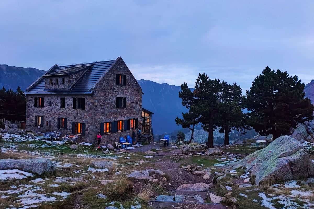
This hut is in a spectacular setting, surrounded by green mountains and forests.
When we were there, the hut was closed due to COVID-19, but we could use the outdoor area to sit and enjoy breakfast under the sun.

🏔 Additional peaks to add to this section
When hiking this section, you can climb the Gallinàs Peak (2.624 m). If you do so, add 2 h to the total time of the section.
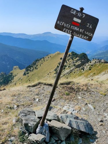
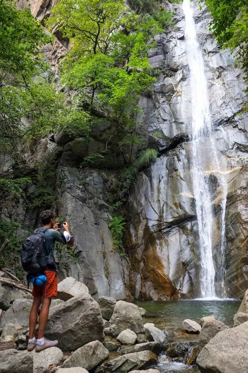
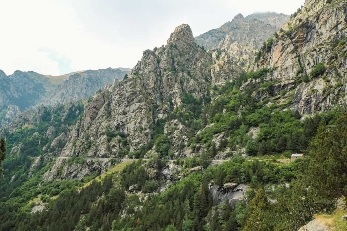
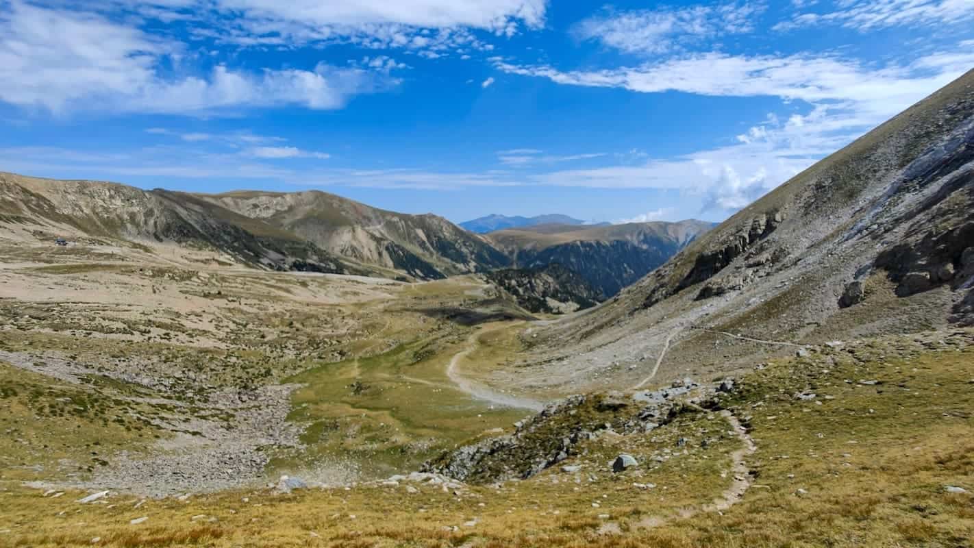
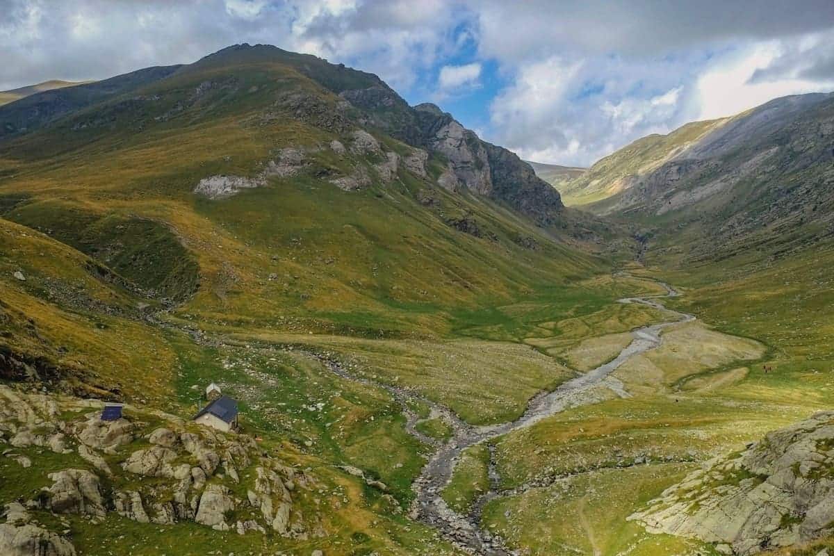
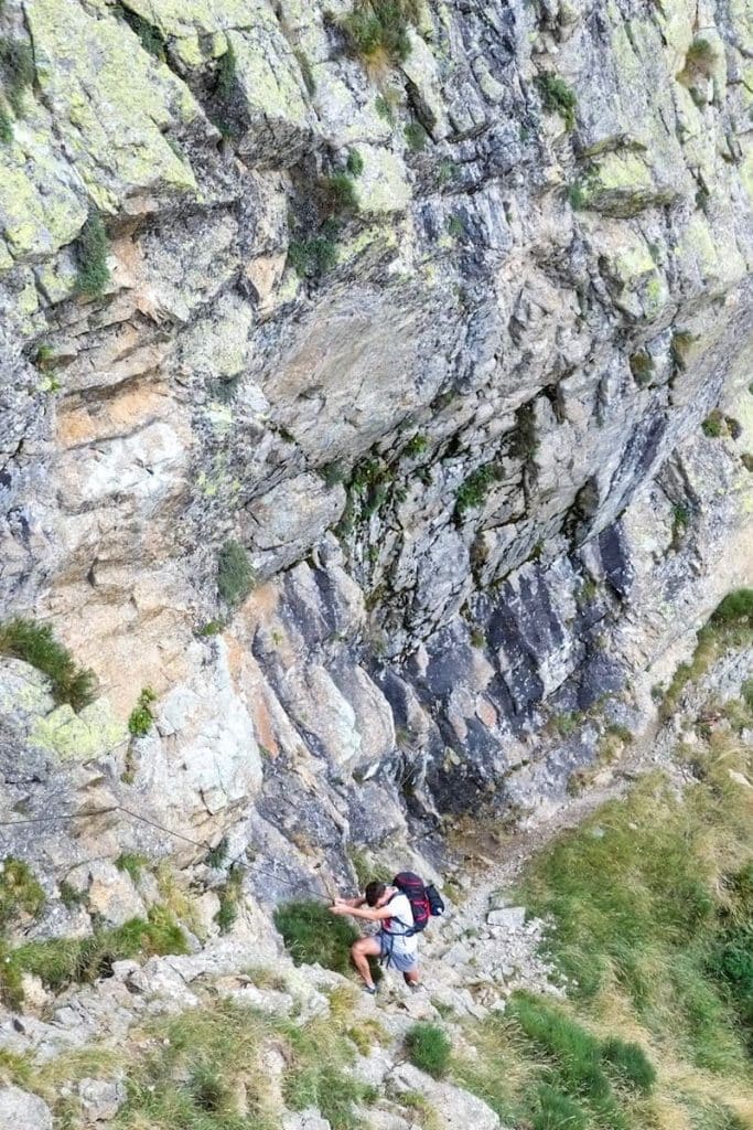
Ras de Crançà to Coma de Vaca, 12.8 km hike, 892 m+, 728 m-
This was the most challenging section by far. Luckily, there were many cool spots along the way!
We left the Ras de Crançà hut and started hiking through meadows, always with the Crançà River on our left side. From then on, it was an 800 m uphill journey, ascending non-stop.
Soon, the meadows turned into forest, and it was time to climb a steep slope. We stopped at several points along the river to admire little waterfalls and catch our breath!
When we left the forest, the landscape changed dramatically. In front of us were extensive green wetlands—such a pristine landscape! Countless cows were chilling under the sun and sipping water from the river.
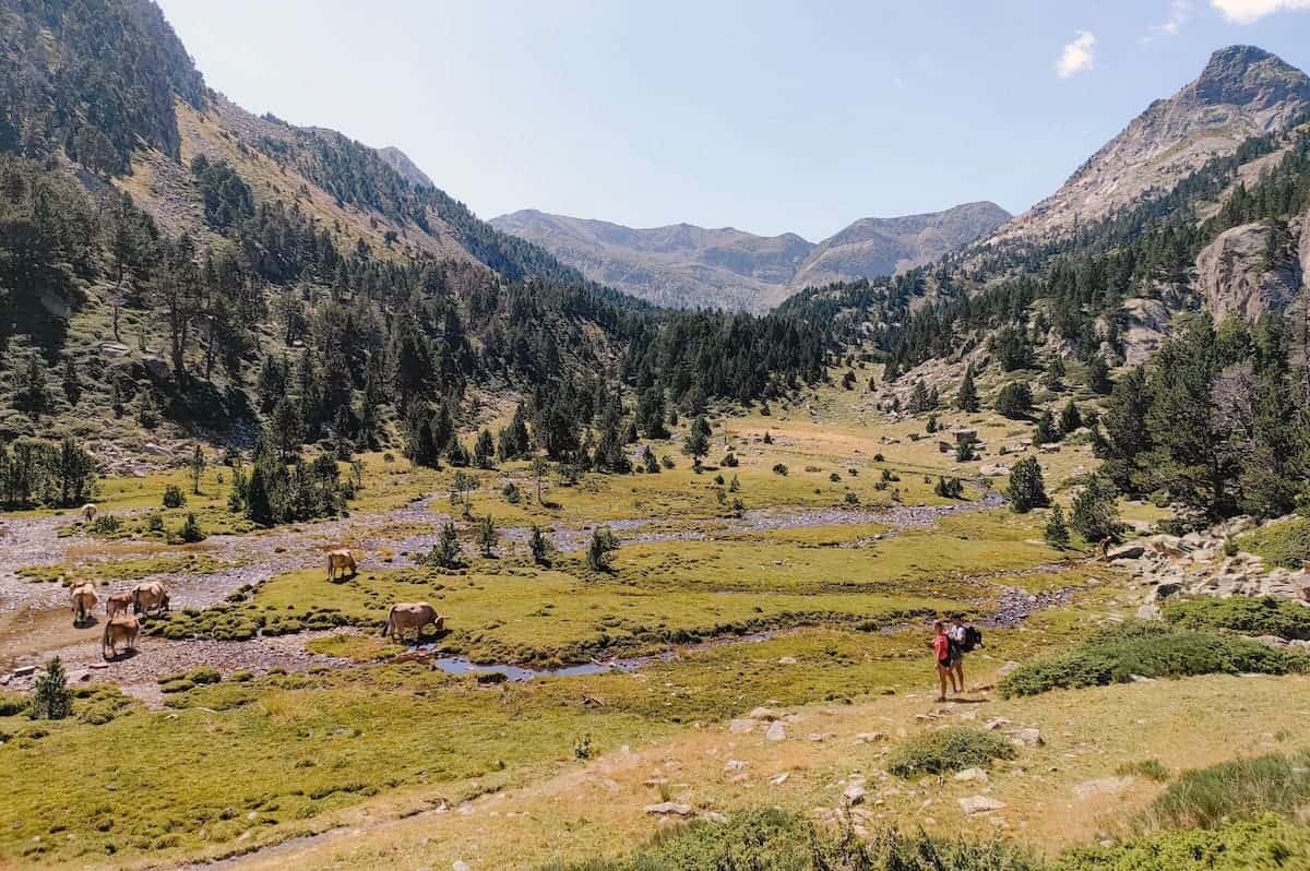
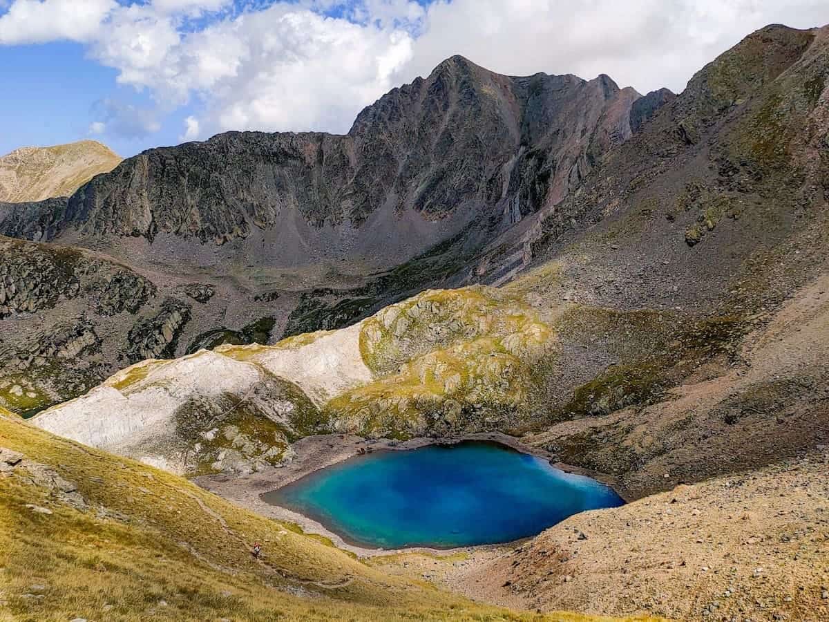
From here to the highest point of this section, it was finding one lake after another. In total, there were three.
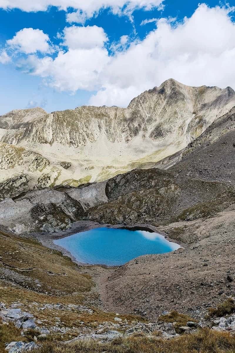
The first was Estany Gran de Carançà, also known as Estany de les Truites (Trout Lake). We had to go around this beautiful blue mountain lake to ascend to the next one.

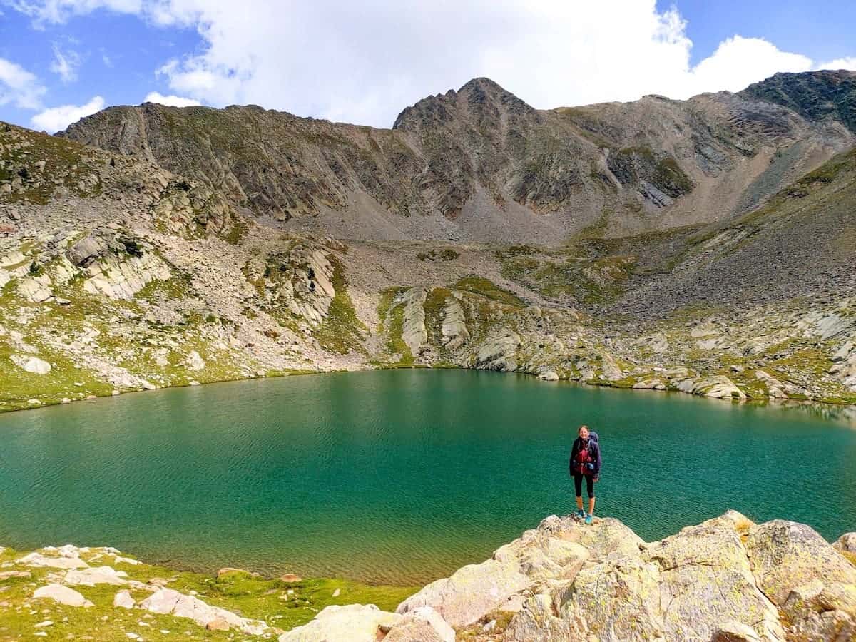
We followed the river up and crossed it several times. After a steep slope, we reached the next lake: Estany Negre (Black Lake).
This emerald lake was our lunch spot. We devoured our picnic and quickly napped before it got colder, and the first clouds appeared.
By then, we were pretty tired, but we still had some km until getting to this night’s bed!
From here, the path didn’t get any flatter. We kept walking with the lake on our left side and climbed the steep slopes until the Estany Blau (Blue Lake).
This one was our favourite. The place had a unique energy. Its shape, the mountains behind it… Don’t you think it looks breathtaking?
After taking pictures and admiring this last lake, we did the final stretch of ascending left for the day.
The views were SO impressive during the whole climb! The Estany Blau was getting smaller and smaller with each step we took, and it finally looked like a small blue drop between all the big rocky mountains.
The path was less rocky here, and it was easier to hike.
After a km, we reached the Crançà mountain pass, the day’s highest point. What a relief! From here on, everything we had to do was downhill.
⚠️ Important!
Attention is needed when you’re in the mountain pass! If you follow the path towards the west, you’ll end up in Vall de Núria. If you follow it towards the east, you’ll return to the Ulldeter hut. What do you do then?🤔
You just look in front of you, and you’ll see a scree. The steep one? Yes, that’s the one you have to descend! Tip: Follow the red point marks for a much easier descent.
We know you’ll be focused on trying not to fall during the descent, but please take your eyes off your shoes and look in front! The landscape is otherwordly. It felt like we were suddenly in a remote part of Iceland.
We kept descending through the valley without an obvious path but following the red points and cairns. We were surrounded by raw nature, and we couldn’t stop but notice that we were so small compared with the vastness of the surroundings.
The Coma de Vaca Valley was a great area to glimpse some groundhogs. We heard lots of them, and we saw a couple.
We could also catch sight of a deer.
Finally, we spotted the Coma de Vaca hut in the distance. It looked so tiny, surrounded by mountains!
After some more km, we arrived at our destination. There, two friendly mountain guards were already preparing dinner.
Meanwhile, we lay on the perfect grass in front of the hut, stretched, and enjoyed a cold beer!
Afterwards, we could shower and enjoy soup, exquisite rice, and tasty meat. We couldn’t have asked for anything else!
🏔 Additional peaks to add to this section
When hiking this section, you can climb Torreneules Peak (2.711 m). If you do so, add 2 h to the total time of the section.
Day 3 – An old chapel turned into a ski resort and lots of groundhogs
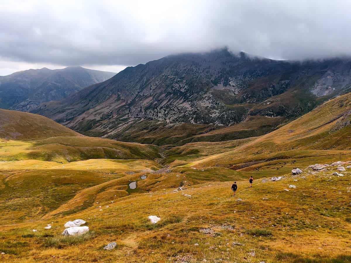
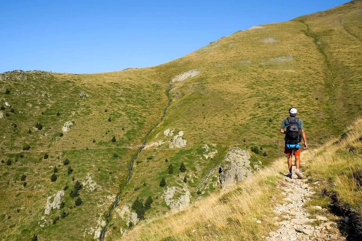
Coma de Vaca to Vall de Núria, 10 km hike, 368 m+, 410 m-
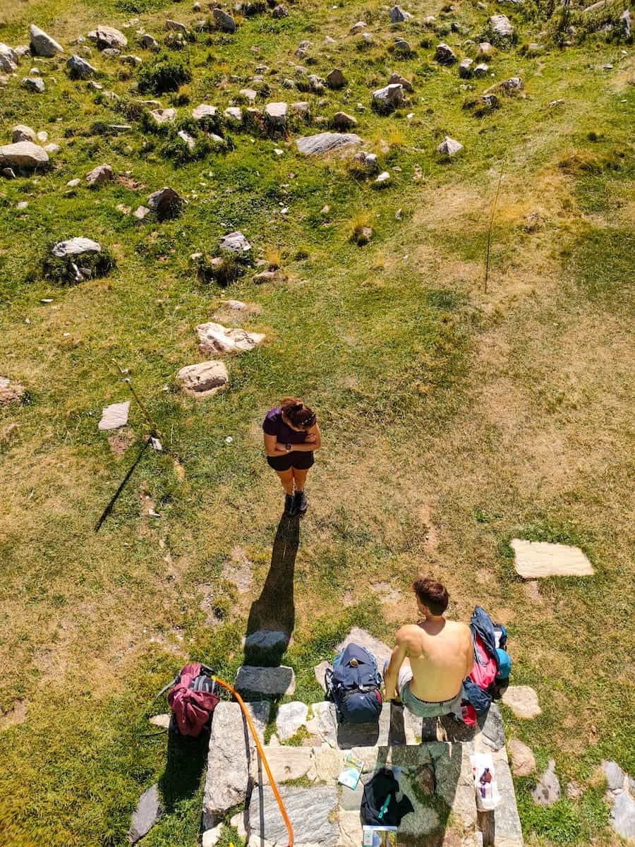
We had a delicious breakfast after a tasty dinner and a good night’s sleep. Since we had an easy day ahead, we decided to take things slow and start the hike a bit later than usual.
⚠️ Important!
The day’s hike wasn’t difficult. Still, it’s good to know that the whole track takes place at an altitude of 2.000 m. This means breathtaking views, but it can be intimidating for those apprehensive about heights. Nevertheless, if you’re careful and don’t walk on the edge, the hike is suitable for everyone.

The path we had to follow started behind the Coma de Vaca hut. Its name is Camí dels Enginyers (Engineer Path). The engineers built this path to carry everything necessary to construct an artificial dam and a power plant in the area. Luckily, this never happened.
With the Freser River on our left side, we kept climbing the path until reaching the Coll dels Homes mountain pass. This is a spectacular viewpoint! We were rewarded with endless views of mountains, forests, and paths. See if you can spot the village of Queralbs!
After soaking up the views, we followed the aerial path, which constantly unwinded up and down.
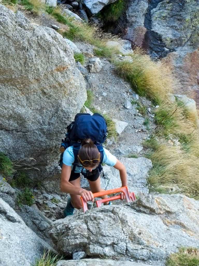
One hour later, we reached a more rocky area. The most challenging parts were equipped with metal rungs and chains, making the hike suitable for everyone.
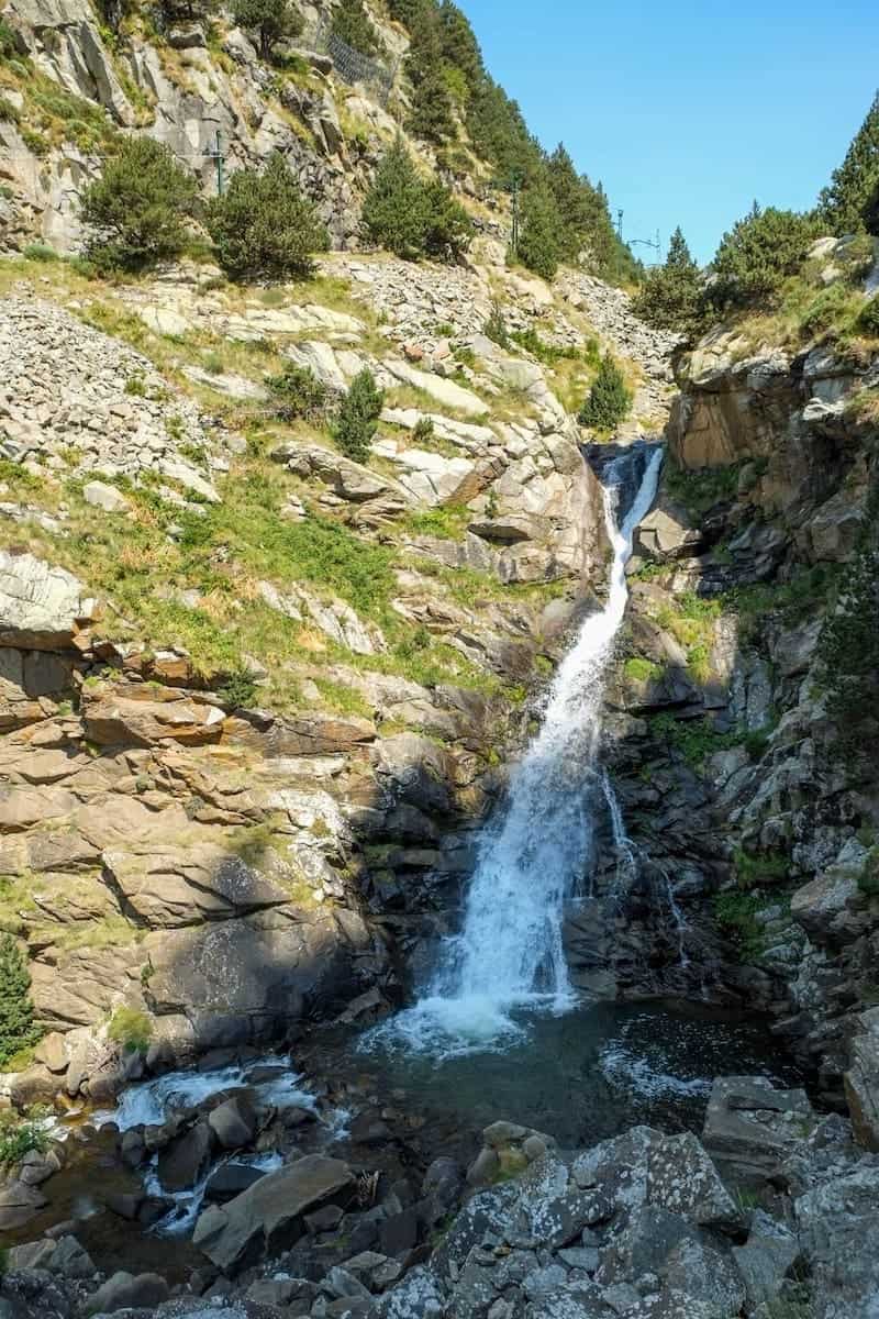
And when we less expected it, a sky-high waterfall appeared before us. It was spectacular, wild, and highly photogenic!
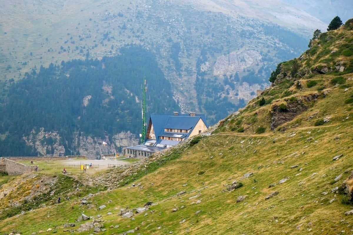
The last part of the hike crossed the waterfall and unfolded through a greener landscape until we finally spotted the Núria Xanascat hostel, our choice for that night.
This place has an interesting story… It was built in 1934 as a hotel, and in 1940, a cable car was installed to get people there.
However, ten years later, there was a fire, and the hotel had to close. In 1950, a second fire damaged the cable car, making it useless.
Finally, the Catalan government took the building. It became a hostel and a hiking base for exploring the surroundings.
🏔 Additional peaks to add to this section
When hiking this section, you can climb the Puigmal Peak (2.910 m). If you do so, add 3 h 30 min to the total hike.
We checked in and left all the bags in the room. We had a whole room for ourselves and our own bathroom. It was a simple room with only eight bunk beds and a wardrobe.
We rested for a while and decided to explore Vall de Núria, a 15-minute walk from the hostel.
This is a valley in the eastern part of the Catalan Pyrenees, famous as a hiking destination in summer and skiing in wintertime.
A long time ago, there was only a chapel there. Nowadays, there’s a ski resort with a hotel, restaurants, an artificial lake, and a sanctuary. There are no roads to access the valley; the only way to get there is by foot or a rack railway train.
Vall de Núria is also a symbolic place for Catalans because the document that would be the basis for writing the Statute of Autonomy of Catalonia was drafted in room number 202 of the hotel in 1931.
Seeing so many people after two days of isolation in the mountains was shocking! We enjoyed a picnic in the grass, overviewing the lake.
As soon as the clouds came, we returned to the hostel following the Bosc de la Verge path, a 2.2 km hike unwinding through the forest.
🍿 Our tip
Here comes another movie recommendation! This time it’s a fiction movie, filmed in Vall de Núria. We’re talking about the Spanish movie Contratiempo (The Invisible Guest). If you haven’t watched it, add it to your bucket list!
We spent the whole evening observing and following groundhogs. There were MANY of them in the meadow next to the hostel.
Check out our “Stepping outdoors 101: How to enjoy nature responsibly and be safe out there” guide for some tips on how to have a great time watching wildlife without bothering them.
Day 4 – Sunrise, waterfalls and a well-deserved meal
Sunrise hike to the Pic de l’Àliga, 3.58 km, 305 m+, 305 m- (optional)
As the last day looked easy and relaxed, we added a little adventure: climbing a peak to see the sunrise.
We researched what was around and decided to go for the Pic de l’Àliga (2.428 m), an easy hike that would last no more than 40 min.
We woke up at 5 am, dressed in warm clothes, and grabbed the headlamp. Once equipped, we ventured outside.
It was pitch dark around us. Only the light of the full moon illuminated the peaks surrounding the hostel.
We started the climb, which wasn’t difficult. It was a steady climb, and it took us around 30 min to reach the peak. The only challenge was not to freak out whenever we saw a cow’s eyes glowing in the dark!
Once on the top, we waited until the sky turned from black to orange, then pink, purple, and light blue. It was so peaceful up there!


The first rays of the sun appeared, and the light slowly bathed the highest parts of the surrounding mountains. Watch out for deer and other fauna; spotting them at sunrise is easy.
After enjoying the show, it was time to return to the hostel for breakfast.
🧭 Wikiloc track
If you decide to climb the Pic de l’Àliga and would like to follow a track, check the one we uploaded to Wikiloc.
Vall de Núria to Queralbs, 8 km hike, 26 m+, 801 m-
After recharging our batteries with breakfast, we descended from the hostel to Vall de Núria, following the path known as Via Crucis.
The route links various religious monuments and symbols around the area. Its construction started in 1914 during a Franciscan congress held in Vall de Núria and lasted until 1963.

As it wasn’t late, we decided to visit the sanctuary. The current sanctuary was inaugurated in 1911, and it is a place of pilgrimage and cult to the virgin, known as Mare de Déu de Núria.
As a curiosity, when the Civil War started in Spain (1936), the parish’s rector fled to France, taking the virgin with him. He wanted to protect it from the indiscriminate burning of religious objects taking place at the time. The virgin was hidden in Switzerland until 1941 when it was returned to Vall de Núria.
It’s not unusual for couples to visit the Mare de Déu de Núria to thank the virgin for their newborn. Throughout history, there has been the belief that the Mare de Déu de Núria symbolises fertility.

After visiting the sanctuary, we continued the route to Queralbs.
The path was well-arranged, although not too comfortable. The descent was well signposted, and it wasn’t difficult at all.
As we walked, we saw the blue railway train going and returning from Núria several times. We also saw several waterfalls along the way, the most famous being the Cua de Cavall.
To get to Queralbs, we followed the direction “Queralbs pel Pont del Cremal“. After leaving the waterfalls behind, you’ll see it marked on a signpost.
This entire area that follows the river is excellent for swimming. We found a spot near Pont del Cremal’s stone bridge and went for a dip. The water was cold, but it felt great!
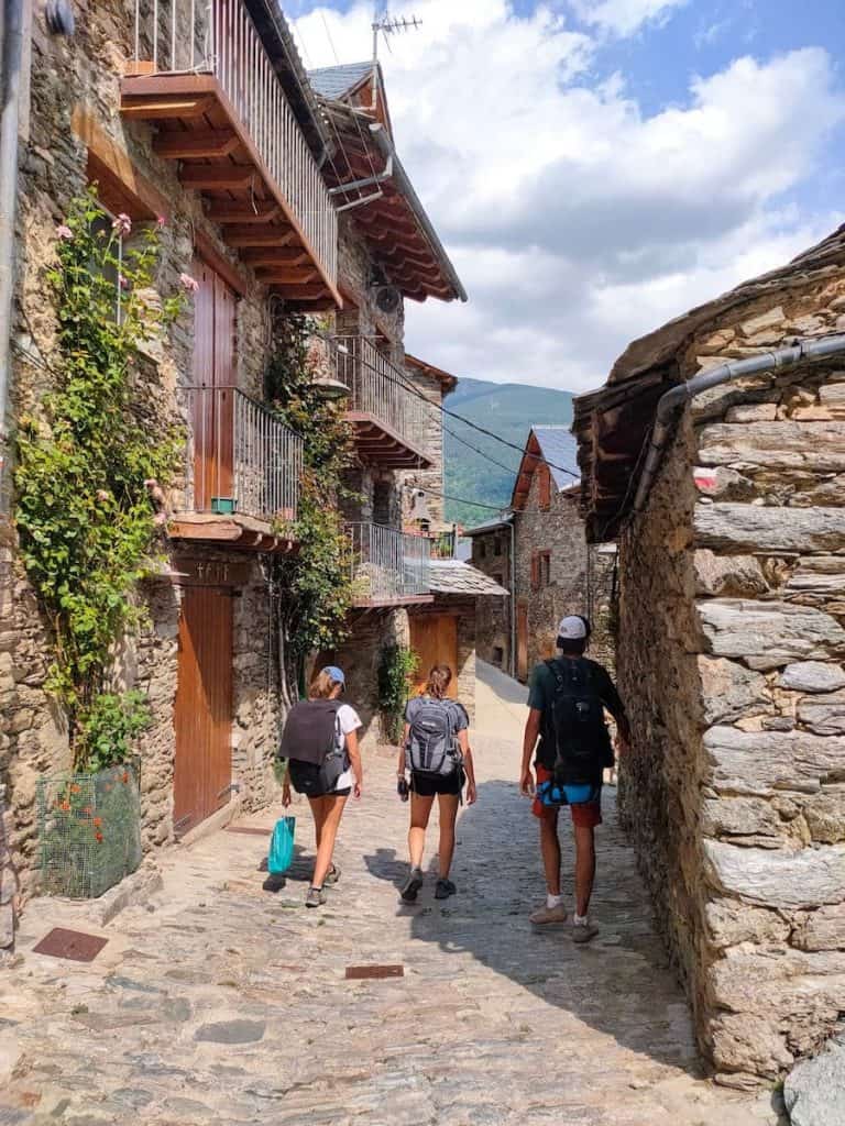
The last stretch until the picturesque village of Queralbs unwinded through the forest. We must admit that the path got a bit monotonous at some point, and we couldn’t wait to get to Queralbs, sit on a terrace, and enjoy a cold drink.
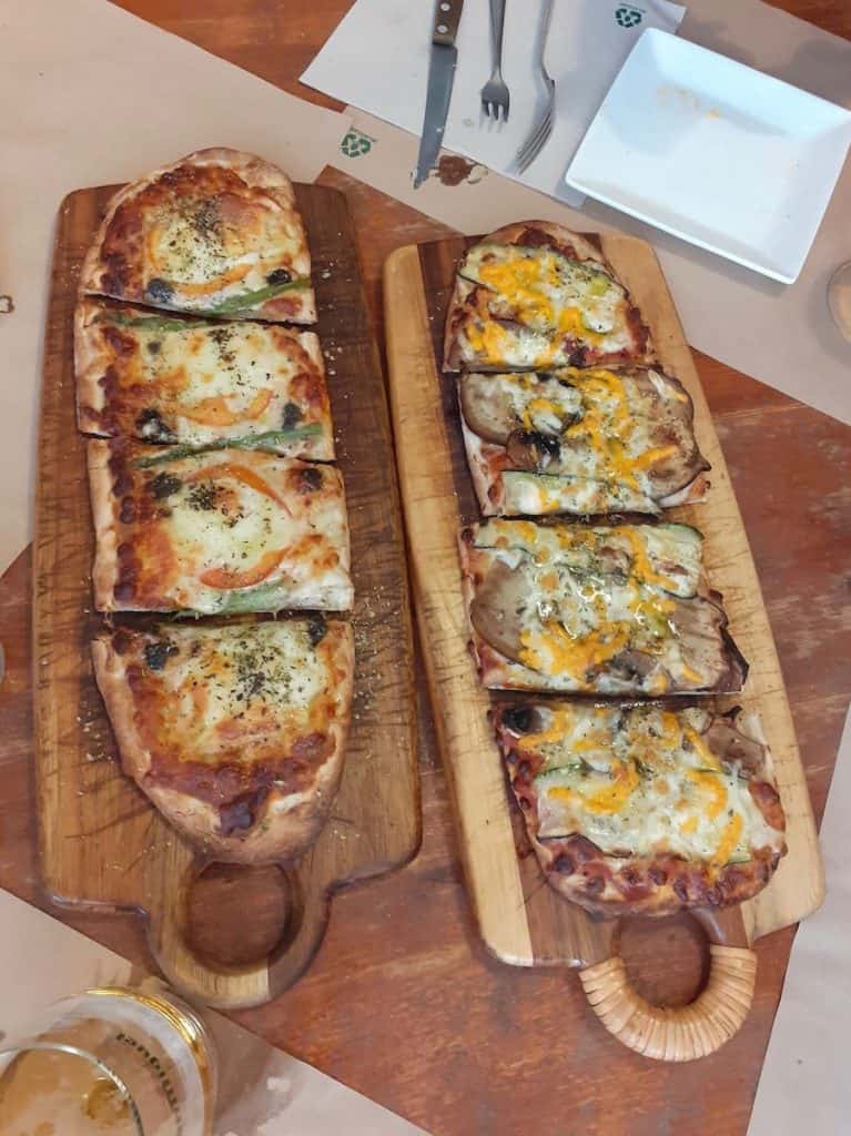
And that’s precisely what we did! When we got there, we visited a market in the village’s main square, drank lemonade, and enjoyed a tasty and casual lunch at El Racó de Cal Litus.
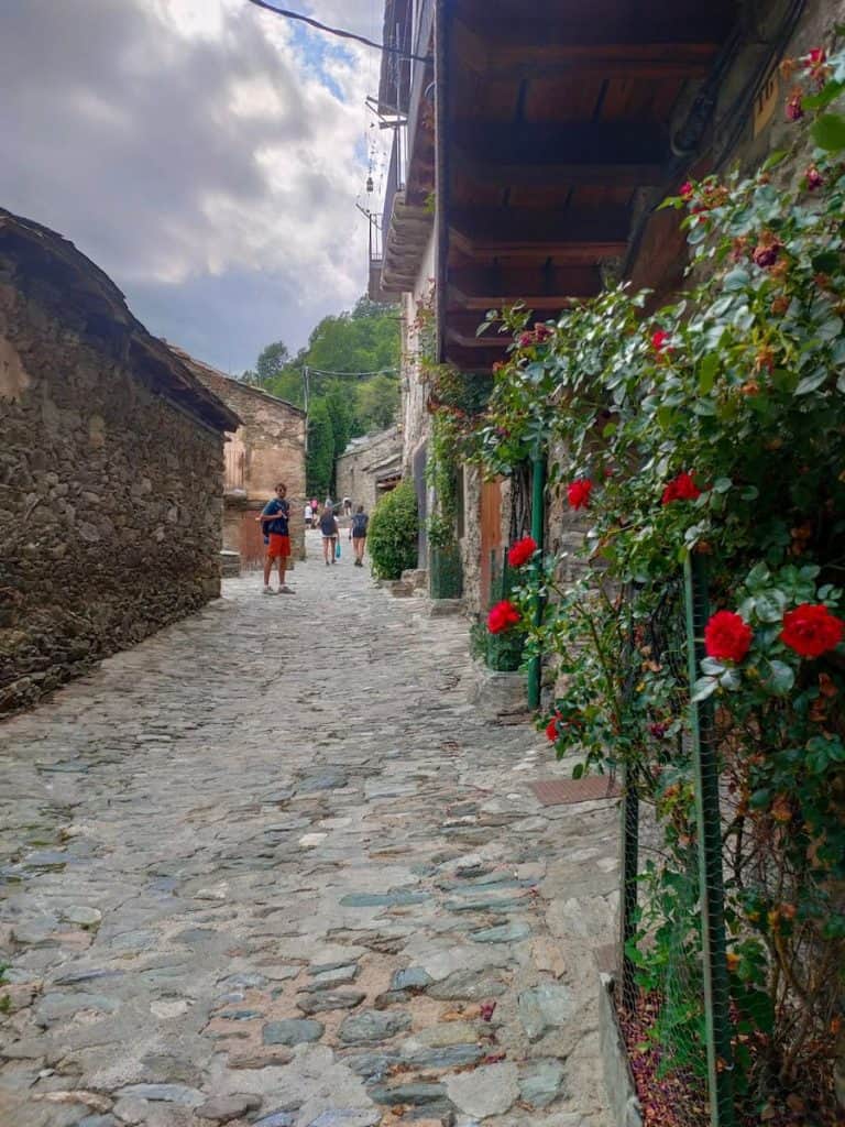
After eating, we wandered the village, discovering its narrow streets and hidden corners. Long ago, Queralbs was a shepherd’s village with a mining tradition. Due to the abundant water in the surrounding area, Queralbs is currently home to 5 hydroelectric power plants and more than 60 springs.
To get back to the starting point where we parked the car, we just had to follow the road to Ribes de Freser. And here ended our adventure!
Would we recommend La Travessa dels 3 Refugis?
Absolutely! We didn’t have high expectations for this multi-day hike, as we had never heard about it before, and it’s not as well-known as Carros de Foc or Cavalls del Vent. And the truth is that we loved it!
This part of the Pyrenees is breathtaking, and the hike’s varied landscapes make the journey entertaining.
We were also surprised by the wildlife we encountered: groundhogs, deer, mouflons, and birds.
La Travessa dels 3 Refugis is perfect for anyone who wants to experience a multi-day hike but would like the comforts of staying in a hut, carrying less weight and eating delicious and abundant food!
Also, it’s a hike we recommend to people getting started with thru-hiking.
Remember to follow Leave No Trace practices. Be kind to fellow hikers, hut wardens and the local communities. And hike on!
More hut-to-hut hiking routes in the Pyrenees
Check our “Hut-to-hut hiking in the Pyrenees: Seven stunning routes + Essential info” guide to discover more thru-hikes in the Pyrenees. We hope you enjoy them!

Amazing article ! Thank you for the beautiful pictures and tips!
Do you recommend to do it as such:
Day 1 : Queralbs to Como de vaca hut and then day 2 : Como de vaca hut to carranca hut, day 3: carranca hut to Vall de Nuria ?
Thanks
Hi Iseult. I’m glad you found it helpful 🙂
If we did this route in 3 days, we would break the sections as follows:
1st day: Queralbs to Ulldeter hut (passing by Coma de Vaca hut)
2nd day: Ulldeter hut to Coma de Vaca hut (passing by Ras de Crançà hut)
3rd day: Coma de Vaca hut to Queralbs (passing by Vall de Núria)
Great article! Is this route doable in mid to late October without snow gear? Would it be alright for hikers in average athletic shape?
Hi Lia, thanks for your comment!
In terms of weather, it’s doable to do the route in mid or late October. The only problem are the huts. Carança hut is closed in mid-September, although there’s a part of it that remains open, but it’s non-guarded. You’d have to bring your own sleeping bag, mattress, and food. Coma de Vaca hut is opened all Saturdays, and you should ask about the rest of the days. Same with Ulldeter, the calendar on its website doesn’t work so you should contact them for more info.
If Coma de Vaca and Ulldeter are opened, you could also shorten the route and skip Carança hut.
The hike is okey for hikers in average athletic shape if you do it in 4 or 5 days (check the How many days do you recommend? section).
Hope this is useful! 🙂
Thanks for your article and amazing pictures!
My partner and I are planning to do this hike in December, and have worked everything out with the refuges.
However, we are finding it very confusing trying to book buses from Barcelona – Queralbs and back, do you have any advice about booking buses in this area? Or any numbers / email addresses to contact about this?
Many thanks,
Sam
Hi Sam, thanks for your comment. I’m sure you’ll love the hike!
Booking the trains and buses can be quite confusing indeed… The easiest way to get to Queralbs is this one:
Take the bus from Barcelona (Av. Meridiana – Sagrera) to Vic and then the train from Vic to Ribes de Freser. The total time of the journey is 2 h 30 min. You can take a look at the schedule here: https://www.rome2rio.com/es/map/Estaci%C3%B3n-de-Barcelona-La-Sagrera/Estaci%C3%B3n-de-tren-Ribes-De-Freser#r/Bus-train
Once in Ribes de Freser, you can take a short bus to Queralbs (it only takes 15 min). There are only 2 buses a day: 11:40 am and 5:45 pm (Monday to Friday) / 10:40 am and 4:40 pm (Saturday)
You can check the schedule here: https://www.autocarsmir.com/linies/
RIPOLL>VALL DE RIBES goes from Ribes de Freser to Queralbs while VALL DE RIBES>RIPOLL is the other way around
Hope it’s clearer now. Let me know if you have any further doubts! 🙂
the email listed for Ras de Cranca is not in service – it says the mailbox is full.
They do however have a website: https://www.refugelacaranca.com/en
Thank you for the info you provided, we have booked and will be doing this hike this summer 2024!
Hi Shannon, thanks for pointing this out! I’ve just updated the post accordingly. It’s true that their mailbox is full, so the best option is to give them a call.
Hope you enjoy this hike this summer 😃
hi, quick question, do u know if this route has backpacker movers? meaning help that carry’s the bags from one hut to the other, with out us carrying such heavy weight on our backs?
Hi Carla. I’m afraid this route doesn’t have backpacker movers. If you’re looking for a route that does, you can check Carros de Foc (check the comfort option). Hope this helps!
Hello, my name is orr and me and my friends want to do the trek but our mothers are very worried and the want more information and explanation.
We would like to do a zoom video or something like that(we will pay). That you will help us to explain to our mothers.
We want to do it on 25 july so if you can answer me soon it will be great.
Hi, do you have the GPX available as well?
Hi Raoul,
You can download it from our Wikiloc route (just click the tab File and you’ll be able to download the GPX file).
Hello, thanks for your great article! Do you know if it’s possible to wild camp on this route? Thanks
Hey Diogo, I’m glad you found it helpful!
Yes, wild camping is allowed on this route, but you can only camp (bivouac or with a tent) between 8:00 PM and 8:00 AM, and no tents can be set up outside these hours. Lighting fires is strictly prohibited. You can camp near the mountains huts, and in Vall de Núria, there’s a campsite with some facilities (cold showers, WC).
Hope this helps! 🙂
Hello! Thank you for this amazing and super detailed itinerary of your adventures! me and 3 friends just booked a 5 night hike based on your recommendation in late August! Ras de Crançà hut now mention on their site that ”The blankets being limited, it is advisable to come with your own sleeping bag.”, and it seems a shame to pack/carry a sleeping bag for 5 nights when only using it for one, any thoughts on lighter alternatives?
Hi Mel, glad our guide was useful 🙂 I’d send an email to the hut explaining the situation and asking if they could save some of the blankets for you so you don’t need to carry a sleeping bag just for one night.
Hello! Thank you so much for this guide. My sister and I did this hike in 4 days/3 nights and followed your guide very closely. I also used AllTrails which was helpful for GPS navigation. We loved all of the huts and the different landscapes we saw every day. Such a special hike and we would absolutely do it again!
I’m really really glad you liked it Sophie! Thank you for letting us know 🙂
Shorter three day option? With limited time, and no time to adjust to altitude, I’d like to do a three day trip; two options would be: Queralbs – Coma de Vaca hut; Coma de Vaca to Vall de NNúria; then Vall de NNúria back to Queralbs; or we could do Queralbs – Coma de Vaca hut; then Coma de Vaca to Ulldeter (staying either at Ulldeter or going back to Coma de Vaca); then third day back to Queralbs.
Any thoughts?
Hey! It depends on what you’d like. If you don’t like crowds and are looking for more solitude, then I’d do: Queralbs – Coma de Vaca hut; then Coma de Vaca to Ulldeter; then third day Ulldeter back to Queralbs. I’d follow this route on day 2 (https://www.wikiloc.com/hiking-trails/refugi-coma-de-vaca-coll-de-caranca-coll-de-tirapits-coll-de-la-marrana-refugi-dulldeter-253171021), so then you go from Coma de Vaca to Ulldeter following one path and from Ulldeter to Coma de Vaca on day 3 following another.
If you don’t mind finding more crowds and staying in a less “authentic” mountain setting (though still beautiful) then you can do Queralbs – Coma de Vaca hut; Coma de Vaca to Vall de Núria; then Vall de NNúria back to Queralbs.
Hi there.
I have 2 questions. Is there anywhere in Queralbs you would recommend to stay the evening before so we can access the hike the next morning?
Second, do you know of any public transport to/from Girona to the hike?
Hi Georgia,
There isn’t a lot of accommodation in Queralbs, so I recommend booking in advance. Two nice places are Hotel Rural L’Ortiga Blanca and Apartaments Fontalba (those are apartments, not a hotel).
There is a direct bus from Girona to Ribes de Freser, then you should either hire a taxi to get to Queralbs from Ribes de Freser or take another bus (take a look at the lines that say VALL DE RIBES).
Hope this helps! 🙂
Thank you!
Do you know if taxis are easily accessible in Ribes de Freser?
I did a quick search and found this company: Taxi de la Vall de Ribes de Freser (phone number +34637215255).
Thanks so much for your help! we are doing the hike next week and are very excited. Would you say there are many spots to swim near the huts?
Nice! Hope you have a great time and enjoy the landscapes 🙂 The only lake next to a hut it’s in Vall de Núria but it’s forbidden to swim in that lake. The other huts don’t have any lakes nearby.
Hi! Quick question, do any of the huts have wifi? how is the cell service on the hike? which provider did you use?
Hi Bob,
There is wifi in Coma de Vaca and Alberg Xanascat Núria. The cell service on the hike varies depending on the area. There isn’t any in the Carança area while there’s good mobile coverage around Vall de Núria. I use Vodafone as a provider.
Thank you for the fantastic article! My wife and I wanted to ask whether getting from Ras de Crançà hut to Alberg Nuria Xanascat in one day is reasonable? I think I saw a route that bypasses Coma de Vaca hut entirely, traversing Pic de Noucreus instead. Do you know how difficult that might be in August, considering we’re both in good shape but don’t have much mountain hiking experience? We’d really appreciate any tips 🙂
Hey Elisha,
If you want to go from Ras de Carança to Alberg Núria, I’d follow this route. I’ve done it and, although it’s long (15km), it’s not technical and the elevation gain is 1000 m. The only thing is that most of the trail isn’t in the shade, so you’ll need to bring plenty of water and sun protection if the temperatures are high.
Hope this helps 🙂
That helps a lot, many thanks! We appreciate you taking the time to reply 🙏