

The beaches in the region of Girona, also known as Costa Brava, attract many visitors during the peak months, from June to August. This means one thing: lots of people! The most popular beaches become crowded quite early, making it difficult to find a spot to leave your towel while going for a refreshing swim.
But we have some good news: there are enough beaches and coves in Girona for everyone! You don’t need to be packed like sardines in a can.
In this post, we’ll share the coves and beaches in Girona (Costa Brava) that are usually quite empty.
Why are they uncrowded? Is it because they aren’t stunning?
Not at all! It’s just because you have to walk to get to them. For some more, and for some less, but none of them is reachable by car. And what for some might be a pain in the ass, for others, is just awesome. You’ll get to do some hiking along the coast surrounded by pine forests, and the swim will feel even more refreshing!
Ready to discover the spots we are talking about? Here we go!
* Post written for the first time in July 2021 and updated in April 2024.
Seven quiet beaches in Girona
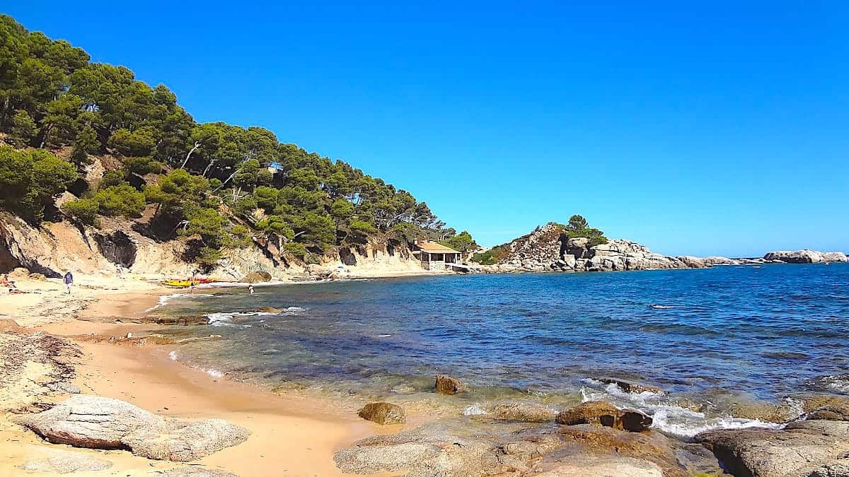
Cala Cap de Planes
You’ll find this beautiful sandy cove in the Camí de Ronda between Palamós and Calella de Palafrugell. The views from the cove are outstanding, as you can see the archipelago named Illes Formigues on the left side. If you plan on going there, it’s an 800-meter swim.
You won’t find any service on Cala Cap de Planes—only wilderness and quietness. But you’ll find great snorkelling opportunities because the sea bed is very rocky.
On one side of the cove, there’s a little fishing hut with a porch, which hikers often use to stop and enjoy some shade. The shed also has a boat launch ramp, which is private property.
Cala Cap de Planes is a nudist beach.
You can’t get to this cove by car; the only way to access it is to hike from Palamós or Calella de Palafrugell. Follow the Camí de Ronda (GR-92), a coastal path that links both cities, and you’ll get there! From Palamós, it’s more or less a 6.7 km hike, and from Calella de Palafrugell, it’s a 4.8 km hike.
🧭 Wikiloc track
This is the track starting from Palamós, and this is the track from Calella de Palafrugell.
Cala Ferriol
If you don’t like snorkelling, you’ll still love this place. Cala Ferriol is a secluded cove tucked between rock formations and pine forests between L’Escala and L’Estartit. It’s the last rocky and virgin cove in l’Estartit. The type of sand on this cove is pebbled, and just in front of the cove, the are two islets known as Illots de Cala Ferriol.
Like the one before, this cove has no services—just nature. You’ll have to bring your own water and snacks.
Snorkel enthusiasts! This cove is a haven for your favourite activity. Its proximity to a nature park makes it a spot rich in wildlife, mirroring the ecosystem of the renowned Medes Islands, a marine fauna and flora reserve in the western Mediterranean. So, get ready to spot a diverse array of underwater creatures.
We recommend going there early, as you can find some kayaks, divers, and boats later in the day.
Cala Ferriol is only accessible on foot or by boat. To get there from L’Estartit, you have to follow the Camí de Ronda (GR-92), which takes around 1 h 30 min (8 km). You can also get to this cove from L’Escala, which is a 6-km hike.
🧭 Wikiloc track
This is the Wikiloc track of the hike from L’Estartit, and this is the hike from L’Escala.
Cala Fornells
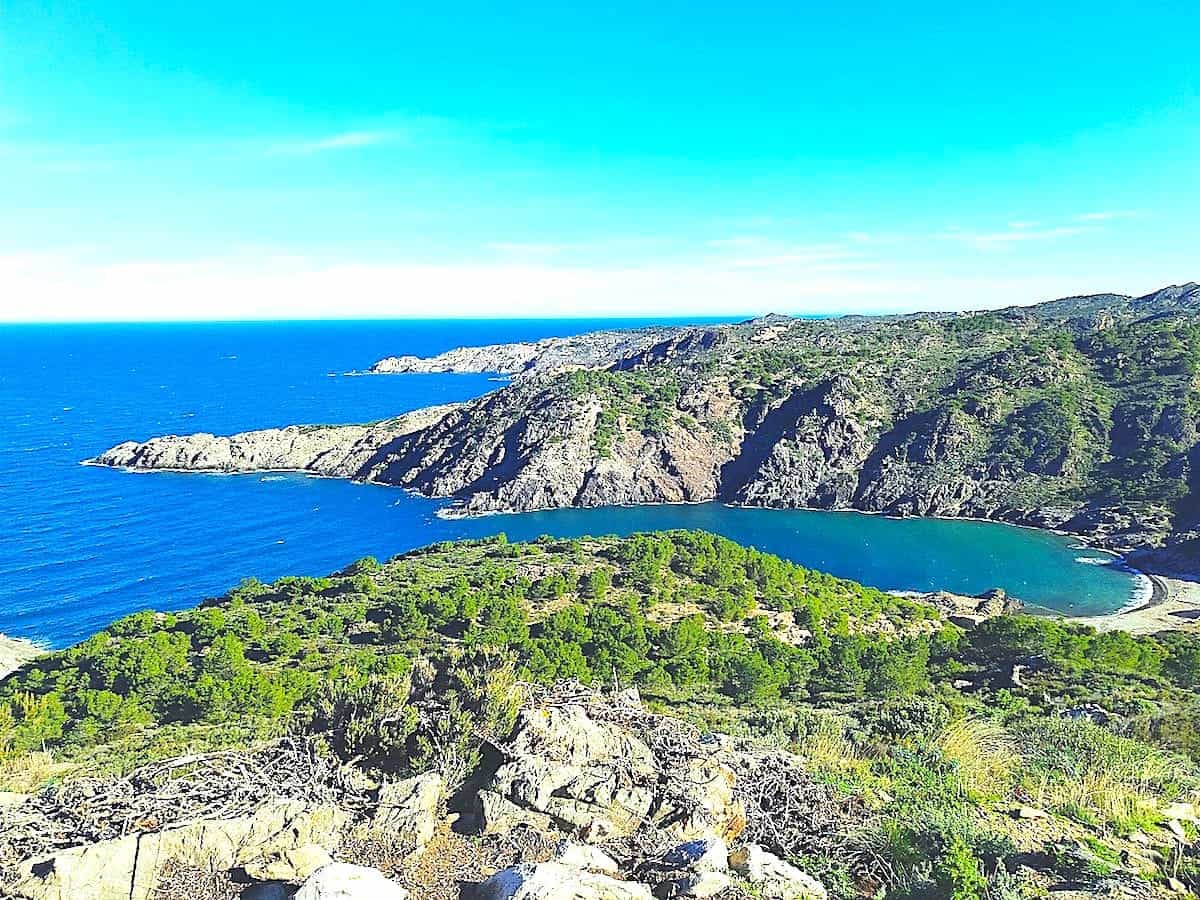
If you’re looking for a wild beach inside a natural park, this is it! Cala Fornells is a rocky beach in the Cap de Creus Natural Park.
It’s one of the best beaches in Girona for hikers, as there are many hiking trails around, both following the coast and on the mountains inside the natural park.
If you go during the summer months, remember that there is not much shadow on the cove during midday, so it’s good to take a hat and sunscreen.
The route to this cove starts in the beautiful village of Port de la Selva. If you’re going by car, there’s a car park next to Cala Tamariua, where the Camí de Ronda path starts.
Remember that the car park is super small and probably full during summer. We recommend you park in the village and walk from there to the beginning of the path. It’s a 4.5-km hike from the village to Cala Fornells.
🧭 Wikiloc track
This is the track to hike to Cala Fornells.
Cala Murtra
This unspoiled beach is surrounded by lush and beautiful vegetation, making it an excellent choice for those who are looking for nature, quiet, and solitude. It’s located in the municipality of Roses, inside the Cap de Creus Natural Park.
Cala Murtra’s waters are turquoise and almost transparent, and we’re not the only ones saying that! Since 2009, this cove has had the European EMAS environmental certificate and the international ISO 14.001 environmental management certificate, so the quality of its waters and surroundings is assured. The seabed combines sand, pebbles, and rock, and it’s full of marine life, so it’s an ideal spot for snorkelling.
The cliffs and pine forests surrounding the cove are stunning, but because the cove is oriented slightly to the north, they don’t offer much shelter during strong Tramontane winds. It’s good to check in advance, as Tramontane happens quite often in this region.
Also, take into account that nudism is often practised at Cala Murtra.
The hike from Roses to Cala Murtra is 7 km.
If you’re up for a thrilling adventure, consider driving from Roses to Cala Montjoi. At the 7th km, a sign will guide you to the descent towards Cala Murtra. Be alert, or you might miss it! Park your car in the unpaved space on the road’s edge. The descent to the cove may not be well-conditioned, and there are no marks, but you can use the cove as a visual guide. The trail, with its gentle slopes, poses no danger, and in just 15-20 minutes, you’ll find yourself in the cove, ready for a refreshing swim.
🧭 Wikiloc track
Here is the track from Roses to Cala Murtra.
Cala Sa Sabolla
Located south of the famous village Cadaqués, this little wild cove is worth a visit if you’re in the area.
It’s not sandy; it has pebbles, gravel and slate rocks. But believe us, it won’t matter. The clean and refreshing waters and the beautiful underwater seabed will be much more attractive than lying in the sun!
The seabed is covered with Posidonia, a seagrass species native to the Mediterranean Sea.
Nudism is a common practice in this cove, and, like the other coves in the area, you won’t find any services.
You can only access this cove on foot, by boat, kayak, or SUP. From Cadaqués, it’s a 3.7-km walk, which offers excellent panoramic views of Cadaqués’ Bay. It starts with the heavy hill on d’es Quers’ houses, and then it follows the direction of Cala Nans lighthouse (far in Catalan) and the Sa Conca beach. The only tough stretch is at the beginning, and then the path becomes flat. To get to the cove from the main track.
Along the walk, you’ll see the lighthouse Cala Nans, the only lighthouse in Catalonia without road access. The uninhabited lighthouse still works and is active for boaters.
🧭 Wikiloc track
Here is the track to get to Cala Sa Sabolla. If you want to visit Cala Nans lighthouse, follow this track.
Cala Taballera
Cala Taballera is one of the most secluded beaches in Girona, located in the Cap de Creus Natural Park.
Its waters are shallow, making it perfect for swimming. Also, the seabed is home to a wide range of marine creatures.
Many small boats anchor there in peak season, but otherwise, it’s infrequent to find anybody else.
If you want to sleep at the shelter in the cove, call the local council to see if it’s available and in proper condition. Be sure to set the alarm and wake up to witness the sunrise from the sea!
Keep in mind that some people practise nudism in this cove.
The only way to reach this remote cove is a 2-hour hike from Port de La Selva or Cadaqués. From Port de la Selva, the trail unwinds inside the natural park. An excellent excursion is to do the loop, reaching the cove by following the coast and returning to Port de La Selva by following the natural park path.
From Cadaqués, it’s an 8-km hike to get to this cove. Consider that there are no fountains along the route, so bring plenty of water. Also, grab a hat and sunscreen if you plan on hiking this track during the summer months. There aren’t almost any trees along the route.
Some blogs and guides insist that 4WD can reach the cove, but that’s false. The safest way is either walking or by boat.
🧭 Wikiloc track
Here is the track to get to this cove from Cadaqués and from Port de la Selva.
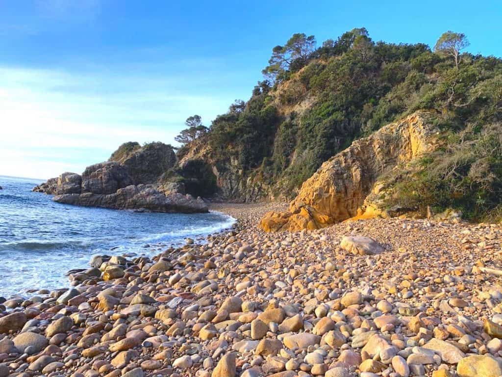
Cala de Vallpresona
You’ll find this beach between Sant Feliu de Guíxols and Tossa de Mar. It’s away from any urban centre, so it’s a great place if you’re looking to be alone and enjoy the incredible underwater life.
Nudism is a common practice there.
The beach has stones on both the land and the seabed. We recommend you wear booties, as the rocks are covered with algae, and it’s easy to slip on.
To get to this cove, follow the road GIV-682, which links Tossa de Mar and Sant Feliu de Guíxols. Stop at the 34th km, where you’ll see a sign indicating “Platja de Vallpersona”. You can park the car at the same spot where the sign is. Once there, you’ll have to descend through a lush forest for 15 min until getting to the cove.
🧭 Wikiloc track
Things to know when hiking to these beaches in Girona
🥾 Remember always that the routes to the following beaches are proper hikes. We recommend you wear hiking shoes as some downhills can be slippery, and you can find rocks along the way.
🗑️ Most of those beaches are so virgin that they don’t even have bins, so please take your waste with you 🙃
We’re sure some other coves and beaches in Girona are also quite empty during the peak months, especially in Cap de Creus. Also, most of the coves we’ve mentioned have similar ones nearby, which you can access following the Camí de Ronda. Do you know any other deserted beaches in Girona?
More things to do in Costa Brava
We’ve written several posts with adventures to do in the area. Here are some suggestions:
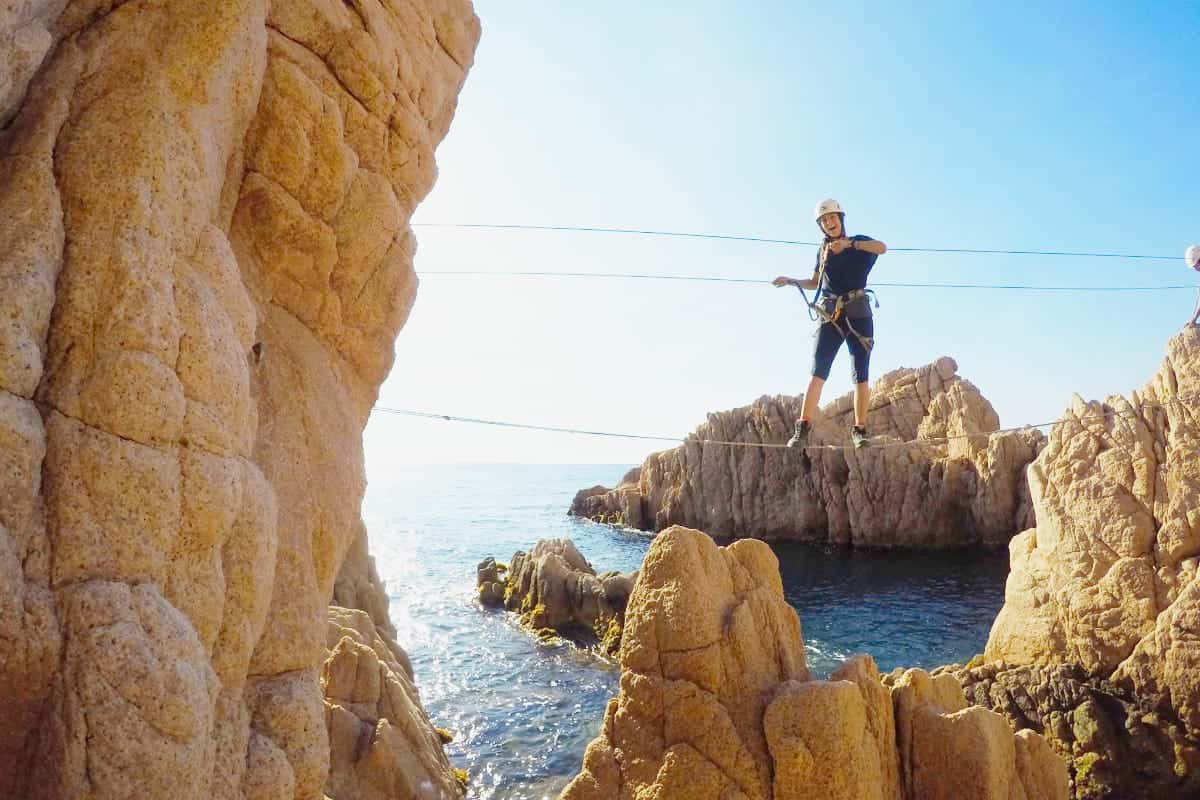
- Via ferrata Cala del Molí: Get ready to climb the only via ferrata on Europe’s coast. Impressive panoramic views over the Mediterranean Sea are guaranteed!
- Herbocaiac, a foraging and kayaking adventure in the Costa Brava: A kayaking, snorkelling, and foraging experience in Palamós. You’ll learn about the region’s plants and algae and get immersed in a beautiful landscape while doing some exercise.
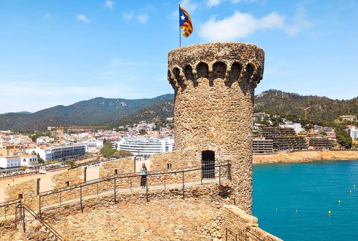
- Discovering Tossa de Mar, a historic medieval town in the Costa Brava: Tossa de Mar is a historic city of the Costa Brava, famous for its sandy coves, lighthouse, and fortified medieval village.

0 Comments