

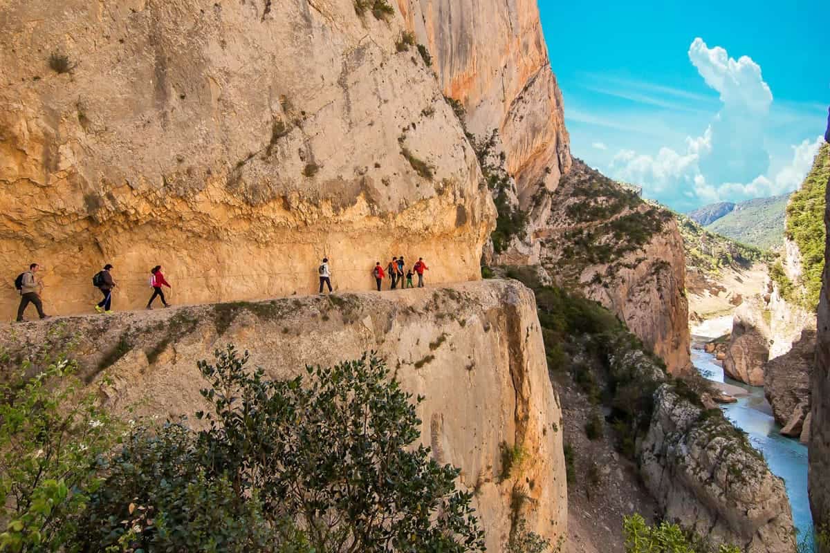
Estanys Amagats is a beautiful thru-hiking trail in the Catalan Pyrenees where you’ll find charming mountain villages, over 40 lakes, valleys declared World Heritage Sites and green meadows. The route doesn’t take place only at high altitudes, making it an exciting combination to discover the region’s architecture and magnificent landscapes.
The circular journey links four mountain huts in the Catalan and Andorran Pyrenees. Part of the route passes through the tiny country of Andorra, so you’ll be hiking in two countries!
If you’re a fan of mountain lakes, you’ll love this hike! The route’s name, Estanys Amagats, actually translates as “Hidden Lakes”, and believe us when we say they gave it this name for a reason… 40 lakes await you along the 73 km journey!
The hike can be completed in 4 to 5 days and starts at the tiny village of Talltendre, just 2 hours from Barcelona. Each day, you hike to a mountain hut with basic facilities, including a bed, shower and, sometimes, WiFi. But what you’ll remember is the mountain food! After a day of walking, you’ll be treated to delicious soups, high-quality meat, and sweet treats.
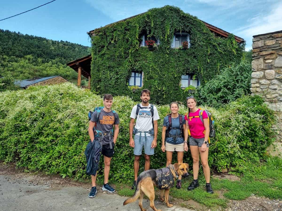
We hiked Estanys Amagats in August 2022 with some family members, and we did it in 4 days, skipping a night at Cap del Rec hut.
Here are our review, tips, and photos to help you plan your Estanys Amagats adventure!
* Post written for the first time in April 2023 and updated in February 2025.
Things to know before hiking Estanys Amagats
Technical details
🥾 Total distance: 73 km
🟠 Difficulty: Moderate
⬆️ Cumulative elevation gain: 3.599 m
⏱ Duration: Between 4 and 5 days
🗓 Recommended season: Estanys Amagats is a high-mountain route, so the best time to enjoy it is from mid-June to the end of September
The route is graded “moderate“, which we think is accurate. We regularly hike and found the track challenging because of the distance and elevation gain, but not technically difficult. If done at a leisurely pace, we believe that this route is affordable for most hikers.
👌🏼 Our tip
September is an excellent month to do the Estanys Amagats hike if you can because it isn’t as crowded as in summertime.
Where does the route start?
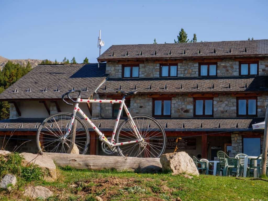
The route starts and finishes in Cal Pere Sidro. It’s an old hut that is no longer used, located in the village of Talltendre in the Catalan Pyrenees.
It takes more or less 2 h to drive from Barcelona to Talltendre, 2 h 10 min from Lleida, and 2 h 15 min from Girona.
Reaching Estanys Amagats by public transport
There’s no direct way to reach the start of the Estanys Amagats route by public transport, but you still can get there if you combine a bus journey plus some walking.
First, you need to take a bus from Barcelona (Estació del Nord) to Bellver de Cerdanya. The ride takes 2 h 20 min, and there are two to three buses daily. Here you can check the schedule (write Bellver Cerdan as the destination).
The second part of the journey is a walk from Bellver de Cerdanya to Talltendre, following a secondary road. It’s a 2-hour walk with 592 m of elevation gain.
Which direction is best to follow?
Regarding the direction of the route, we did it counterclockwise. As it’s a circular track, it can be done clockwise and counterclockwise.
However, we recommend counterclockwise because the section from the Cap del Rec hut to Cal Pere Sidro is pretty tedious, so we think it’s better to leave it for the end. Also, if you do it this way, you’ll hike the most demanding section on the second day when you’re still fresh.
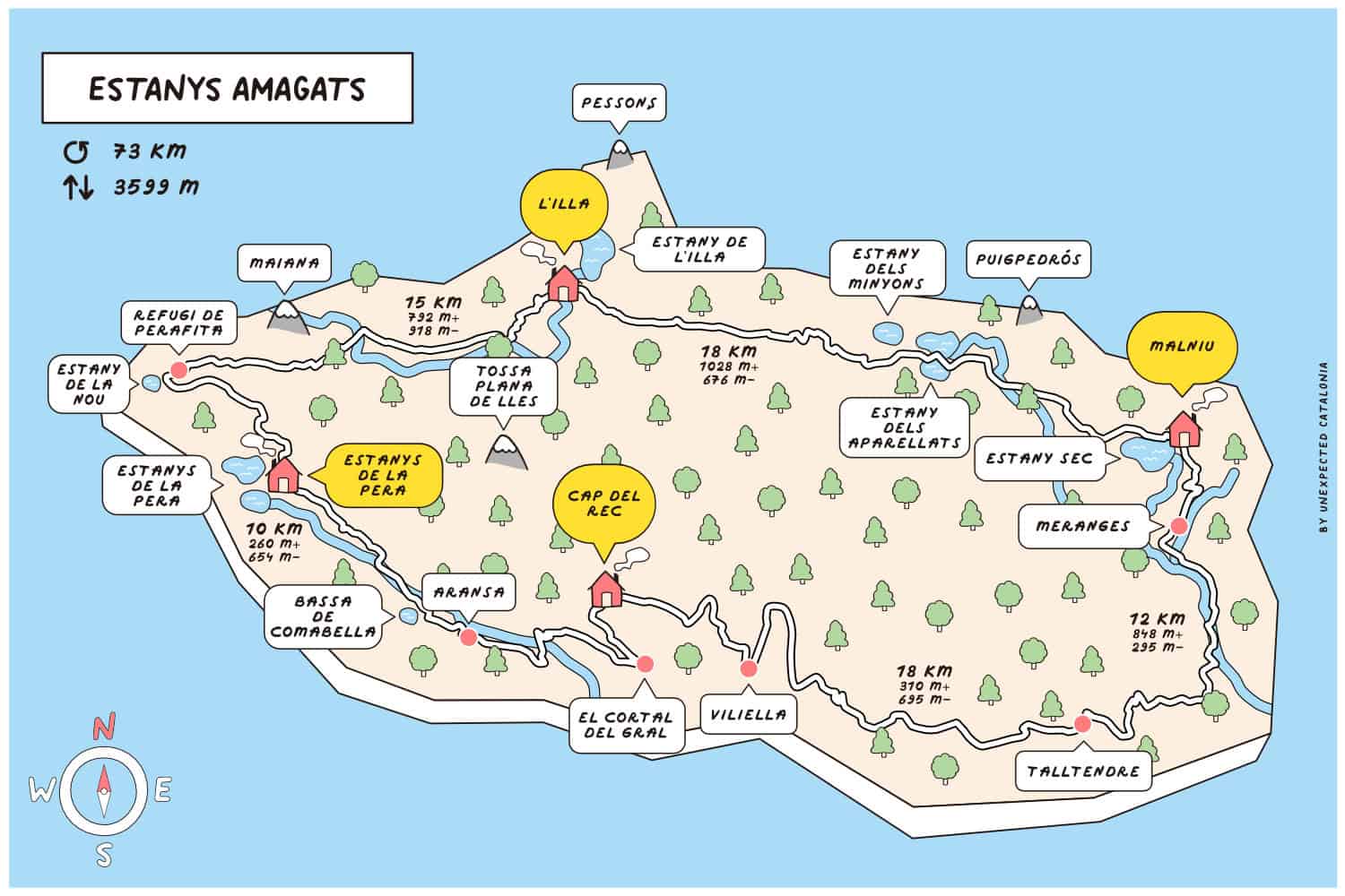
To better plan your approach to this route, here you can see a map of the Estanys Amagats route, with the various mountain huts, their altitude, the elevation gain, and the distance between them.
How many days do you recommend?
This depends on your fitness level and how you like to face a thru-hike. The route can be done in 4 days if you’re used to hiking, in good shape and don’t mind hiking 15-30 km each day with 600-1.000 m of elevation gain.
If you like to face multi-day hikes in a slow traveller’s way, we recommend 5 days. This way, you’ll have time to not rush, chill at the huts, take more breaks, and even add additional hikes to nearby lakes and peaks.
Is the route marked?
Most of the route is signposted with red and white lines, except for a part of the third stage (in Andorra) that is signposted with yellow and red marks.
It’s wise to pack a map of the area and/or have the GPS track in your phone. You can buy the map online, in some bookstores in Barcelona or around the region, or through the Estanys Amagats organisation.
🧭 Wikilock track
If you want to download the track, here’s the Wikilock track of the route.
Weather and gear recommendations
It’s not all sunshine and heat in the Catalan mountains! The weather can change rapidly, as it happened to us. On the first three days, it was sunny in the morning, and as soon as we got to the hut, the clouds came, and it started raining and even hailing! So, expect any weather and get equipped accordingly.
We recommend packing some warm clothes, even though you hike in summer. For example, a pair of gloves and a lightweight down jacket. You’ll also need waterproof gear (jacket, pants, and backpack cover), a head torch, and safety equipment, such as an emergency blanket and a first aid kit.
Pack sunglasses, a hat (or a cap), and sunscreen (reef-friendly!). There are several sections of the route where there isn’t a single shade.
Another thing you’ll be grateful for is earplugs. We bet you’ll appreciate them if your neighbour starts snoring! And a set of clothes only for the huts. There is nothing like reaching the hut all sweaty, taking a shower, and putting on some clean, warm, and cosy clothes!
You don’t need to bring slippers or flip-flops as all the huts give you Crocs.
As you’ll spend many hours hiking, it’s wise to pack light but sensibly. You’ll need to carry your own water, clothes, sleeping bag/sheets, personal items, camera, food (depending on the meals you select when booking), etc. You won’t need to pack a sleeping pad or more than one days worth of water at a time.
It’s also essential to take a bag with you to put all the trash there. You can throw it at some of the huts or the village where you finish the route. Please take care of the environment and leave no trace.
For more info in-depth info on what to pack, read our guide “10 things we never forget to pack when hut-to-hut hiking in the Pyrenees.”
🌦️ Where to check the weather
You check the weather forecast for the days you’re hiking on the local Meteo website or this website specialising in the Pyrenees.
Phone service
The phone service varies depending on the operator, but we had phone service during most of the route.
⚠️ Important!
Remember that part of the route takes place in Andorra, which might affect your phone coverage costs. Andorra is not part of the EU, so the roaming doesn’t work there. Turn off the mobile data, or your trip will become more expensive than expected!
We recommend you turn off the mobile data when leaving the Malniu hut and turn it on again in the Estanys de la Pere hut.
It’s good to let family members or friends know you’re doing this hike so they don’t freak out if you don’t answer them in some hours.
In case of any emergency, call 112. For this emergency number, there’s good coverage throughout the hike.
The huts on the Estanys Amagats route
The four huts in the area (Malniu, L’Illa, Estanys de la Pera, and Cap del Rec) are located in beautiful natural settings. Most of them have lakes nearby.
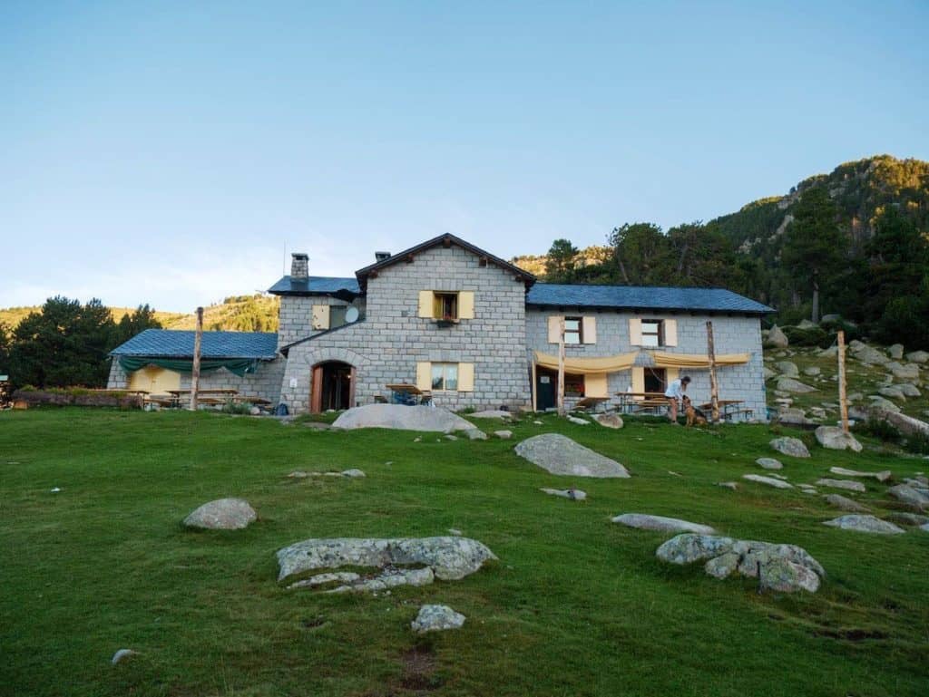
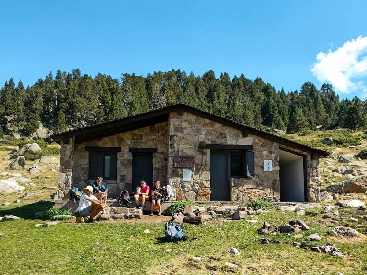
 Refugi de Malniu
- Refugi de l’Illa
 Refugi Estanys de la Pera
- Refugi Cap del Rec
The huts are not mountain hotels, and their schedules and rules must be respected.
They all have the basic things needed to spend the night there: a place at the entrance to leave your backpack and boots, heating, accommodation, food and showers (sometimes at an extra cost).
You sleep in a bunk bed in shared dormitories, bigger or smaller depending on the hut. The mattresses are pretty close to the neighbour, so try not to move a lot! All the huts have blankets, so you just need to bring your own sleeping bag or sheets.
We wouldn’t say we’d had the best night’s sleep in a hut, as in a 40-bed room, the chances of someone snoring or moving are pretty high. Keeping this in mind is good, so you’re not frustrated or disappointed after sleeping for a few hours!
Each hut has charging stations, so keeping phones, cameras, e-book readers, etc., charged is a breeze.
Food
🍽 Breakfast and dinner
Breakfast and dinner are served in the huts, and we’re sure this will become a great part of the hike!
Breakfast usually consists of bread with cured meats, cheese, and/or jam, coffee, biscuits, and tea.
The guards often cook three dishes for dinner, including soup, salad, a meat dish, and a dessert. This can vary from hut to hut, and the food also changes daily.
⚠️ Important!
If you have a food allergy or dietary requirements (vegetarian, vegan, gluten-free, etc.), please say so when booking the huts. The guards will accommodate your requests and make the changes needed.
However, remember that sometimes the hut’s resources are limited, and the special meals can be less varied. For example, vegetarians may only be able to choose between cheese or jam for breakfast, whereas non-vegetarians have more options, such as various cured meat.
🥪 Lunch
For lunch, you can either buy it at a supermarket before starting the route or buy a picnic at the huts you sleep. If you want the picnic, it’s essential to request it at the time of booking. You can also get a sandwich or a warm dish when you arrive at the hut. In our case, we brought the food for the first three days from home.
We took lots of dried fruit, jerky, and energy bars and bought an omelette sandwich at the Estany the la Pera hut (it tasted SO delicious after two days of eating dried fruit!).
On the last day, we got to Talltendre around 3 pm, so we quickly got into the car and looked for a place to eat nearby. We ended up eating at Pizzeria Sant Roc, a pizza place in Bellver de Cerdanya.
🥜 Snacks
Also, we recommend you bring some extra snacks for the route, like nuts. Think about foods that don’t spoil quickly and take up much space.
Water
When it comes to water, we recommend you take two reusable water bottles of 1 L each with you. You can refill the water bottles in all mountain huts and a couple of fountains along the route.
If you carry a water filter, there are plenty of streams, lakes, and rivers where you can fill your water bottle.
We recommend making sure you have enough water before leaving the huts (both for drinking and refreshing yourself when it’s really hot).
⚠️ Important!
Swimming in the mountain lakes and rivers is forbidden in Catalonia and Andorra.
Cost of hiking Estanys Amagats and how to book it
You can book the hike through the Estanys Amagats organisation. You’ll receive a forfeit at registration, which will be stamped in each of the huts and makes for a nice souvenir. It costs 30 € and, besides the forfeit, it also includes a map of the itinerary and an aluminium bottle.
The cost of the hike varies depending on the huts you sleep in and the meals you select (check the prices).
👌🏼 Our tip
It’s always necessary to book the huts in advance. Also, if you choose to do the hike during the high season (July and August) or long weekends, you’d better book long in advance.
⚠️ Important!
Remember to bring cash! They don’t accept card payments in most huts, so having some money with you is always handy.
Estanys Amagats route
Day 1 – Charming mountain villages
Cal Pere Sidro to Malniu, 12 km hike, 848 m+, 295 m-
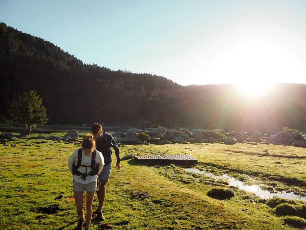
We awoke with the first rays of the sun, grabbed our backpacks, and hopped in the car. The drive to Talltendre was pleasant, and we got there early morning. The village was tiny, and no one was around. It was still chilly, perfect for hiking without breaking a sweat in two minutes.
We laced our hiking shoes, searched for the route signs, and started the hike.
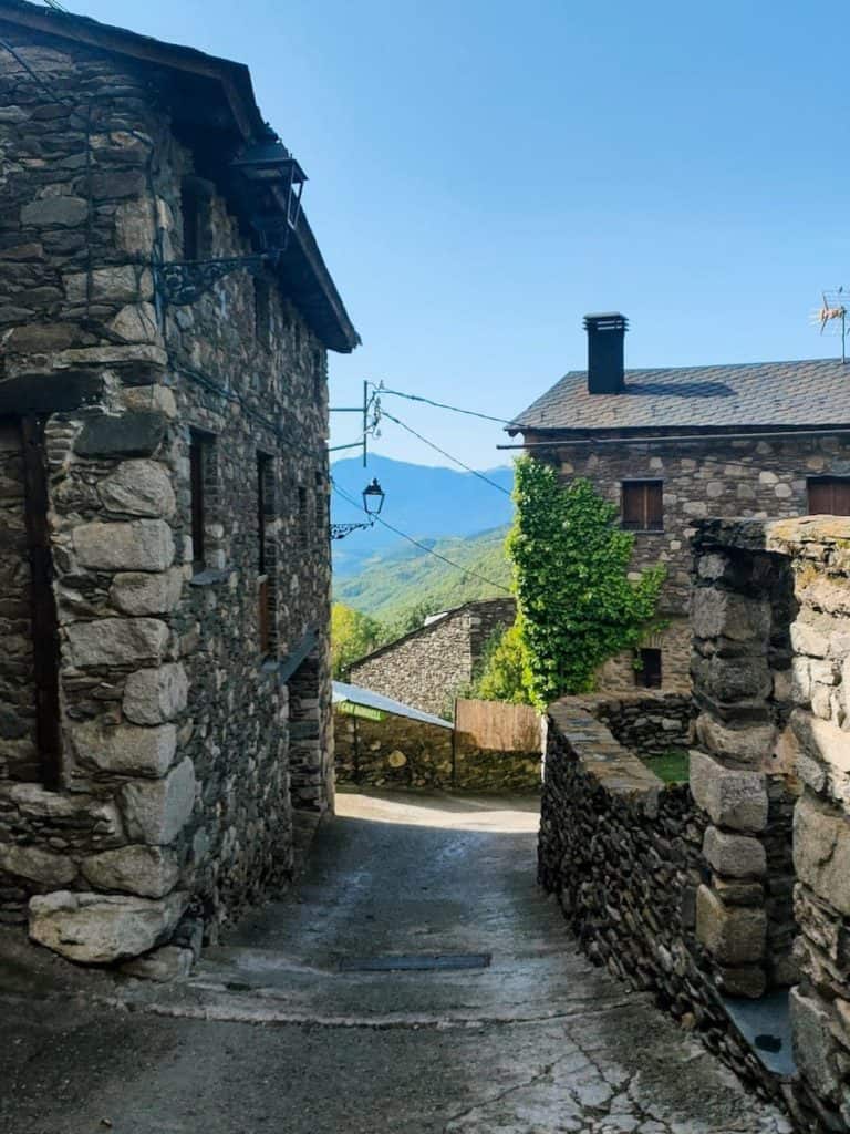
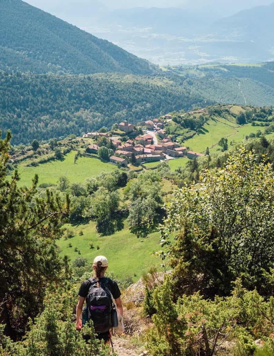
After 1 km, we reached Ordèn, another tiny village with stone houses surrounded by a green landscape.
We followed a wide path for about 4 km until we arrived at the next village in this section: Èller. Another typical mountain village of the area, with stone houses. One, in particular, stood up cause it was all covered by plants.
Until here, the track was relatively flat. But from this point on, it was all ascending.
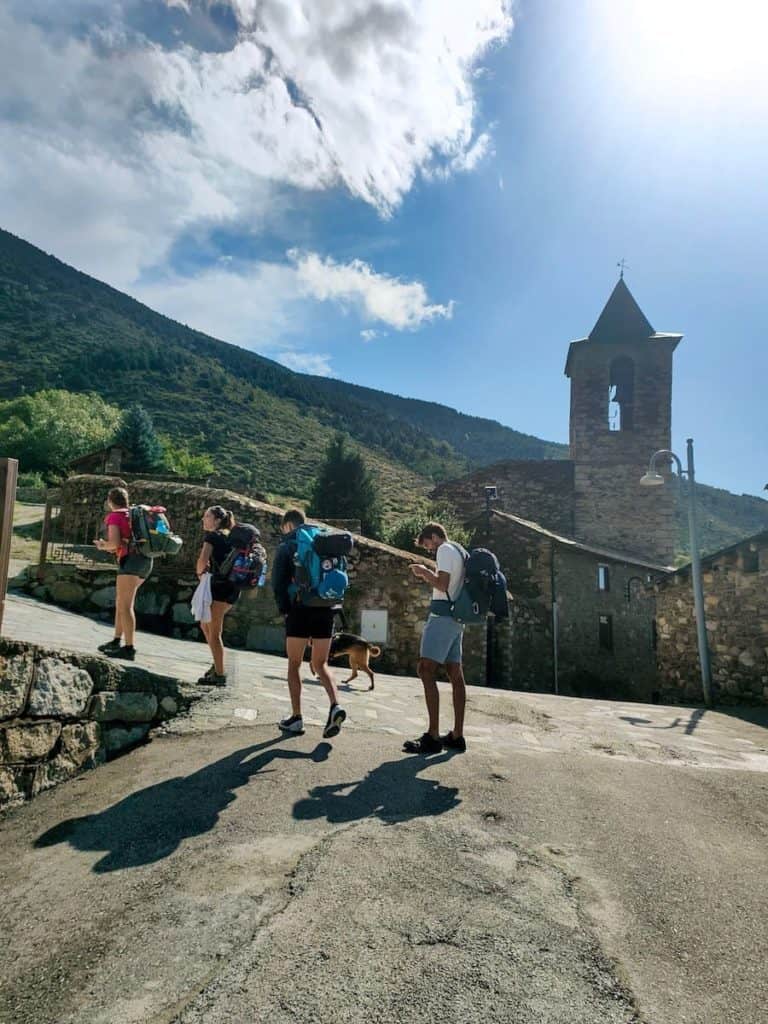
First, it was a mild ascent to Meranges, a bigger village where we stopped for breakfast. We devoured our sandwiches, strolled around the charming streets, passed by the church, and got ready for the 600 m+ of ascent separating Meranges and the Malniu hut.
After the arduous ascent, we found a sign indicating the way to the hut. So, we abandoned the main path we were following and entered a beautiful forest.
As we got closer to the hut, we started encountering more and more people. This hut is accessible by car, and many hikers park there as a starting point for hiking around the area.
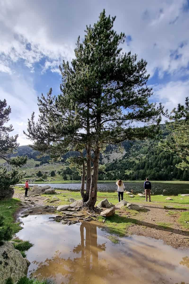
Malniu is a big hut made of stone, surrounded by green meadows and a lake nearby. We ate lunch on the terrace, and as the sun was shining, we laid down on the grass and took a much-deserved nap.
Not long after, the weather changed dramatically, and it started raining. The siesta was over!
It was nice to spend the afternoon inside the hut, chilling and reading while watching the storm through the window.
Only at sunset, just before dinner, the clouds cleared, and we could walk to the nearby lakes and enjoy the views. The Malniu Lake is a 15-minute hike from the hut, and the beautiful Estany Sec is right next to the hut.
Afterwards, we could shower (showers are located outside the hut, in a different building) and enjoy a tasty dinner. We couldn’t have asked for anything else!
Day 2 – Lakes, lakes, and… more lakes!
Malniu to L’Illa, 18 km hike, 1.028 m+, 676 m-
After a good night’s sleep and a delicious breakfast, we started the second section of this journey. The day was sunny and clear; we hiked under a crystal blue sky for the first hours.
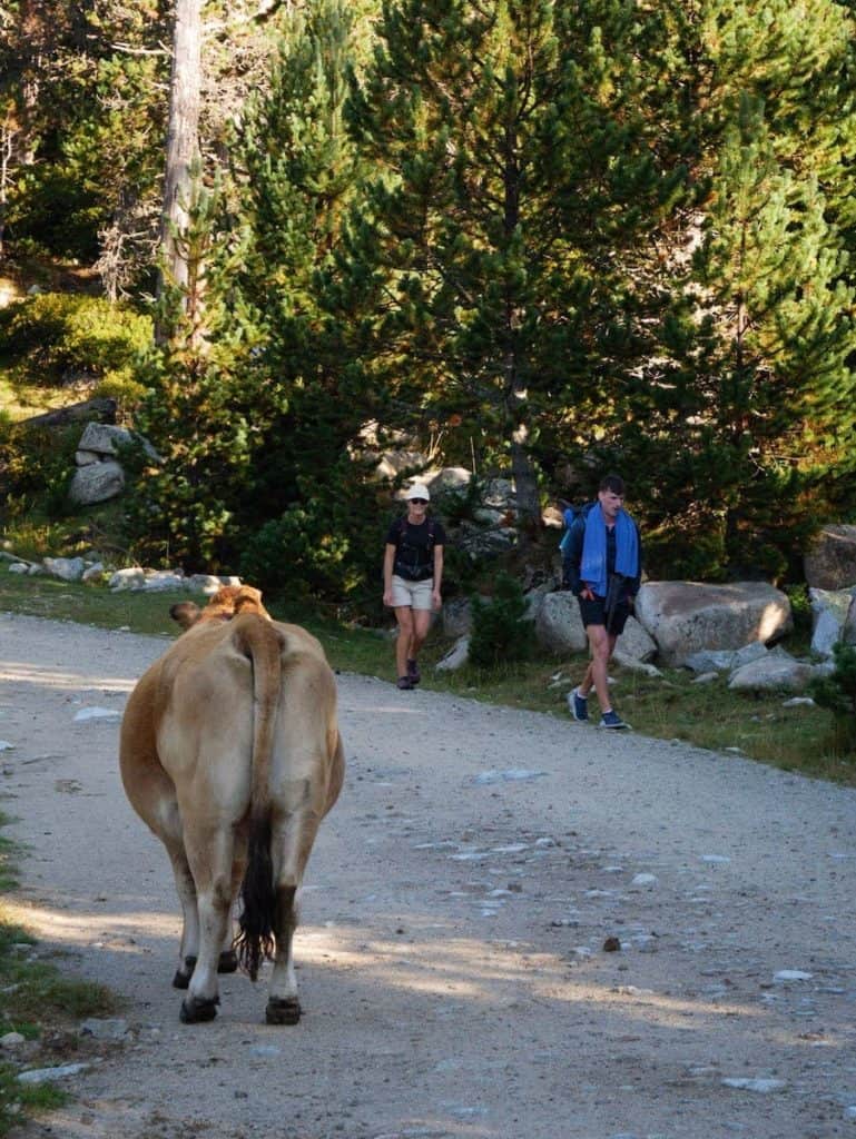
We circled the beautiful Estany Sec and followed the GR-11 marks (red and white) through green meadows that looked magical, bathed by the early morning light. Cows were grazing around, paying more attention to the grass they ate than us.
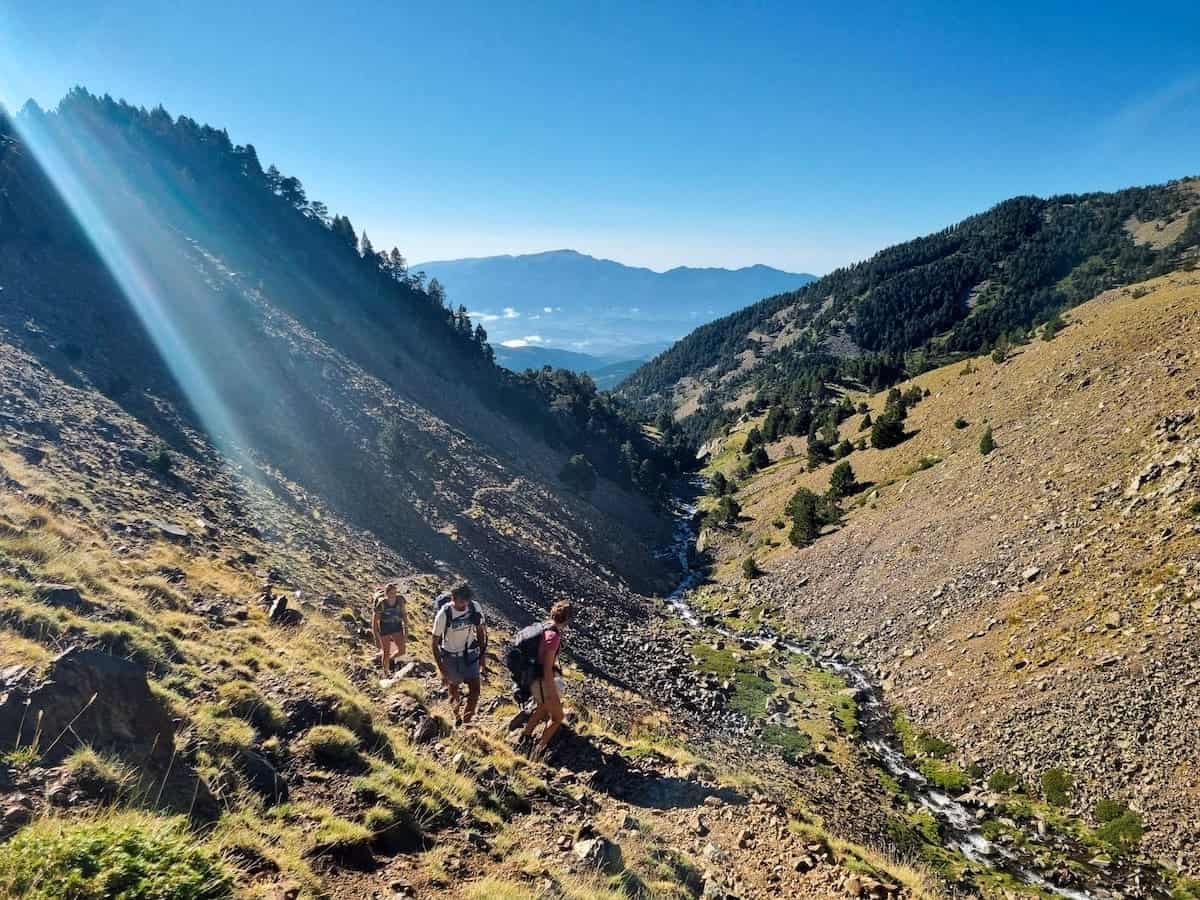
As we ascended, we got closer to the Duran River. With it on our left side all the time, we kept pushing our way up, crossing the river and admiring beautiful waterfalls until the non-guarded J. Folch i Girona hut. We took some time to rest, admire the views, and eat a snack.
And up we went again! Only 1 km separated the hut from the next highlight of the section: the Engorgs cirque.
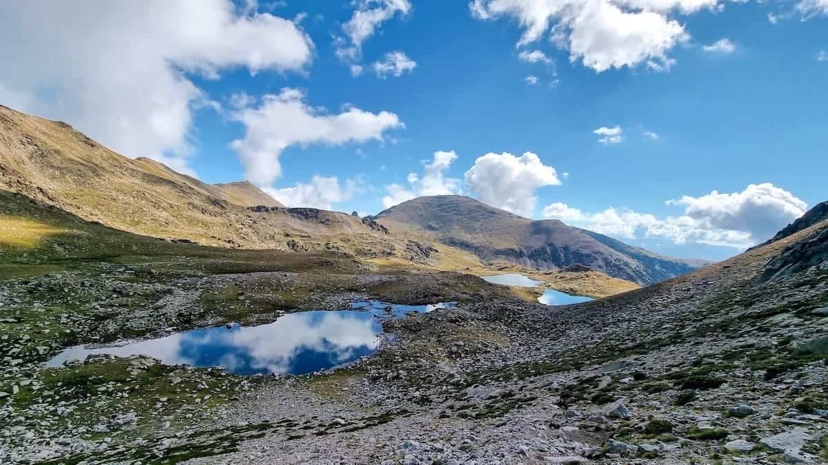
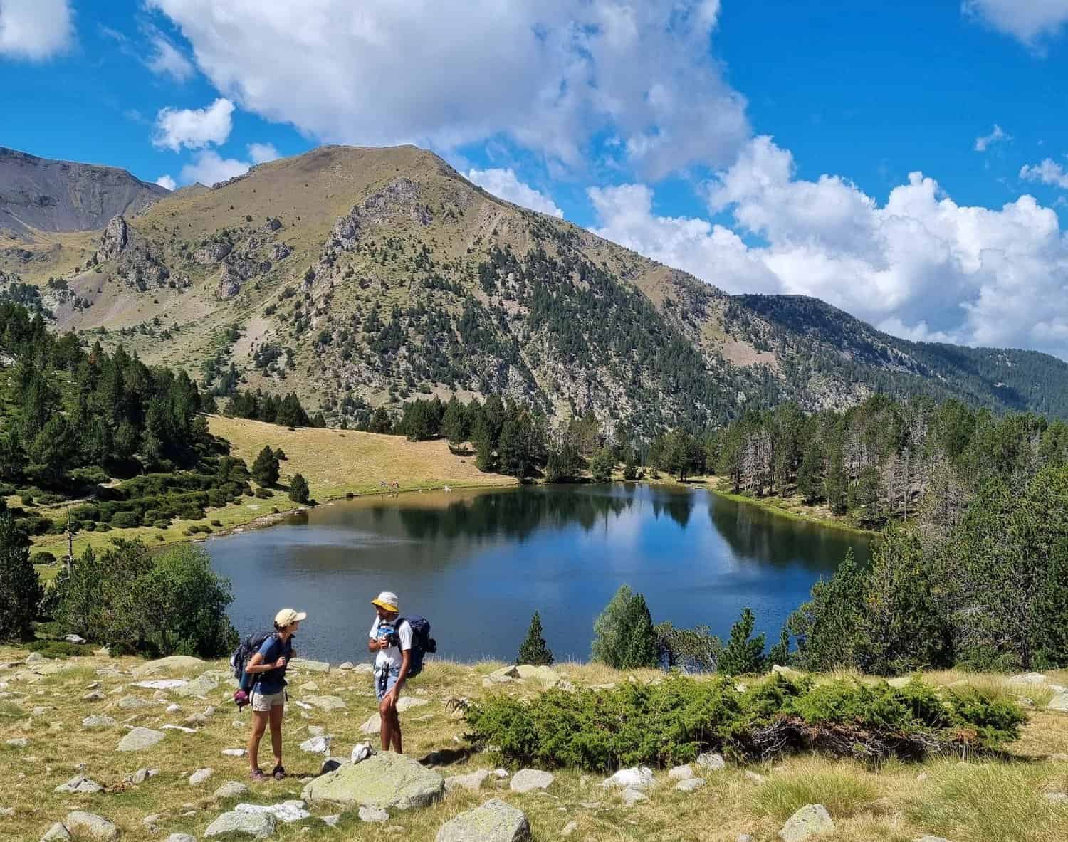
It’s a breathtaking cirque of glacial origin, sheltered by peaks almost 3.000 meters high and with more than 10 transparent water ponds and lakes. As a curiosity, those ponds are the only ones without fish in the Eastern Pyrenees!
We left the lakes behind and kept following the track, which continued ascending. The panoramic from this altitude was breathtaking. The lakes became smaller and smaller, and they were so clear they were like a mirror, reflecting the clouds that had gathered in the sky in the last hours.
Sooner, we were on top of the mountain pass known as Portella d’Engorgs, and we could already spot the mountains from the next country we would soon be setting foot in: Andorra.
From this point, we could see what we had left to go down, but above all, what we had left to climb: the mountains in front that separated us from our goal for the day.
The first part of the descent was easy and pleasant, and we soon entered a forest where the track lost height more abruptly.
After descending 600 m of elevation, we finally found ourselves in a valley called Vall de la Llosa. We crossed the river and spotted the Esparvers shed, used a long time ago by smugglers as a shelter.
And now, it was time to go up again!
⚠️ Important!
If you haven’t turned off the mobile data yet, this is the time to do so! You’ll soon be entering Andorra, and as this country is not part of the EU, mobile data is quite expensive. Turn off the mobile data, or your trip will become more expensive than expected!
With the Vallcivera River on our left side, we kept climbing the path, zigzagging the mountain until reaching the Port de Vallcivera mountain pass. This natural border separates Spain and Andorra, and it’s a spectacular viewpoint! We were rewarded with endless views of mountains and lakes. See if you can spot the hut of L’Illa from here!
Less than 500 m separated us from this section’s final destination. As we descended to get there, we passed by the Estany de l’Illa, a big lake and one of the most isolated ones in Andorra. From here, the views of the hut and its surroundings are spectacular.
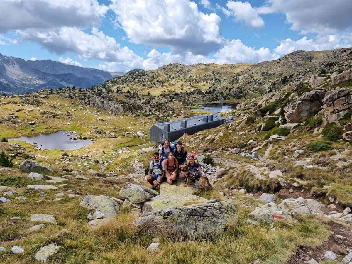
We finally got to the Refugi de l’Illa, where we would spend the night, and the first thing we did was sit on the spacious terrace and eat a much-needed lunch while enjoying the views!
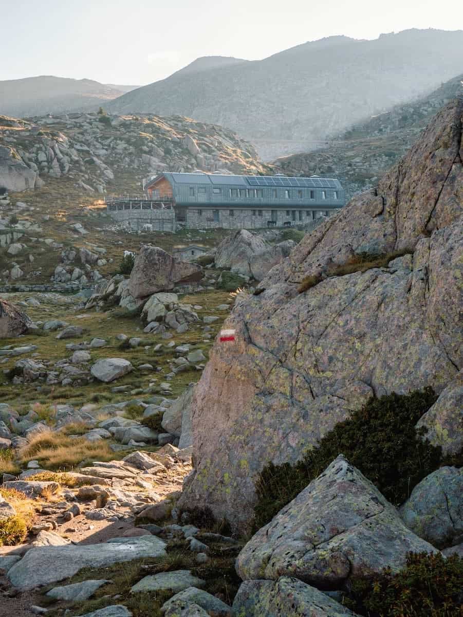
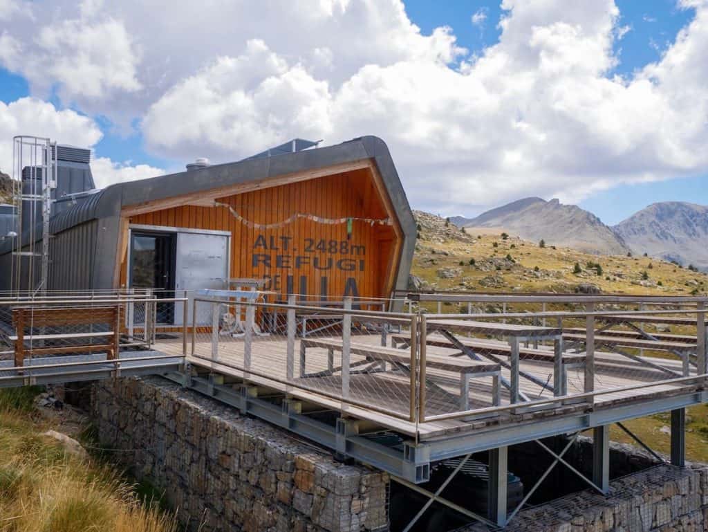
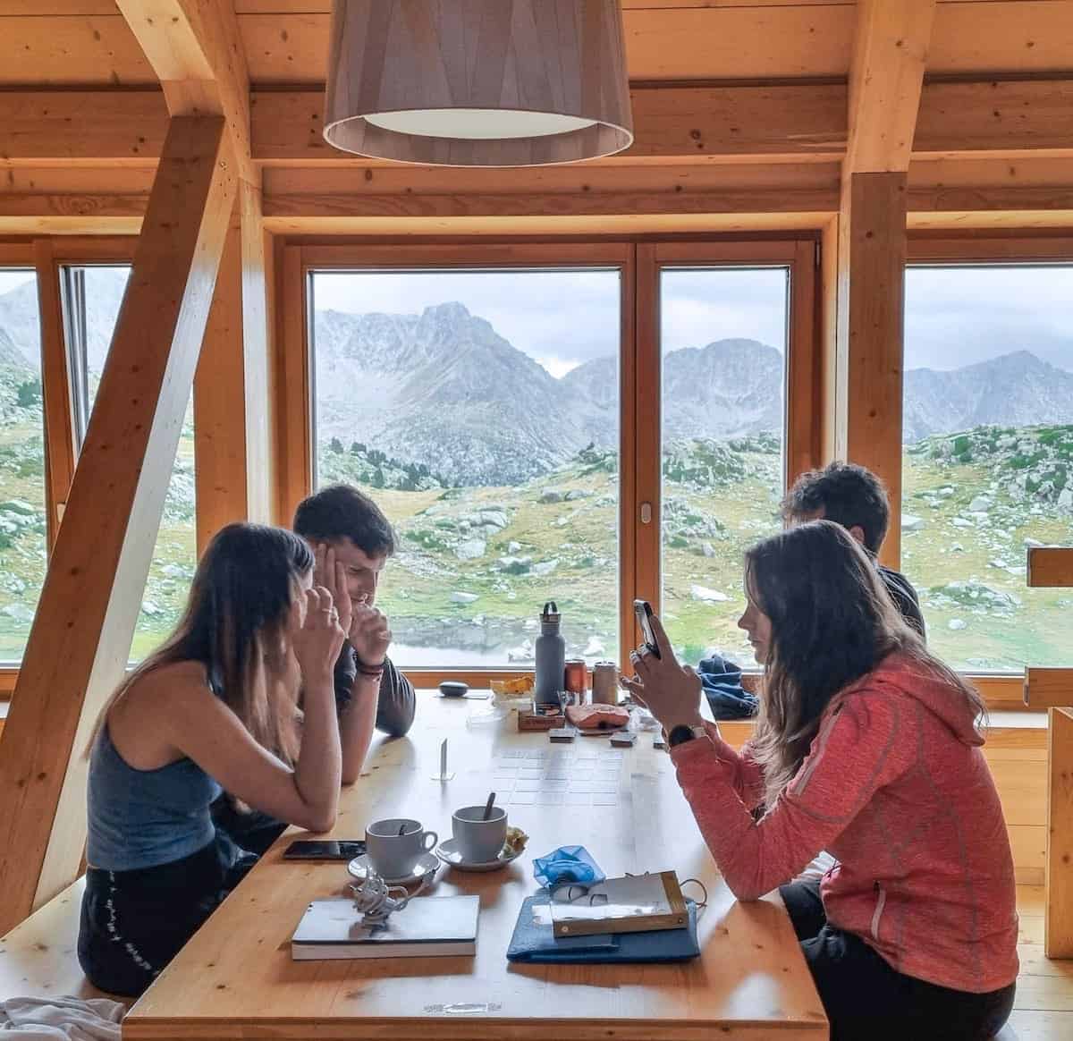
Refugi de l’Illa was our favourite hut in terms of facilities. It’s a modern hut, built in 2016 on top of the old non-guarded hut that existed there before. The facilities are top-notch: a bright and cosy living room made of wood, warm showers (max. 1 min), nice rooms, and a magnificent terrace with views of the lake and the mountains surrounding it. Oh, and the views from the bedrooms and the living room are amazing!
It rained the whole afternoon, so we took a shower, got cosy, and played board games.
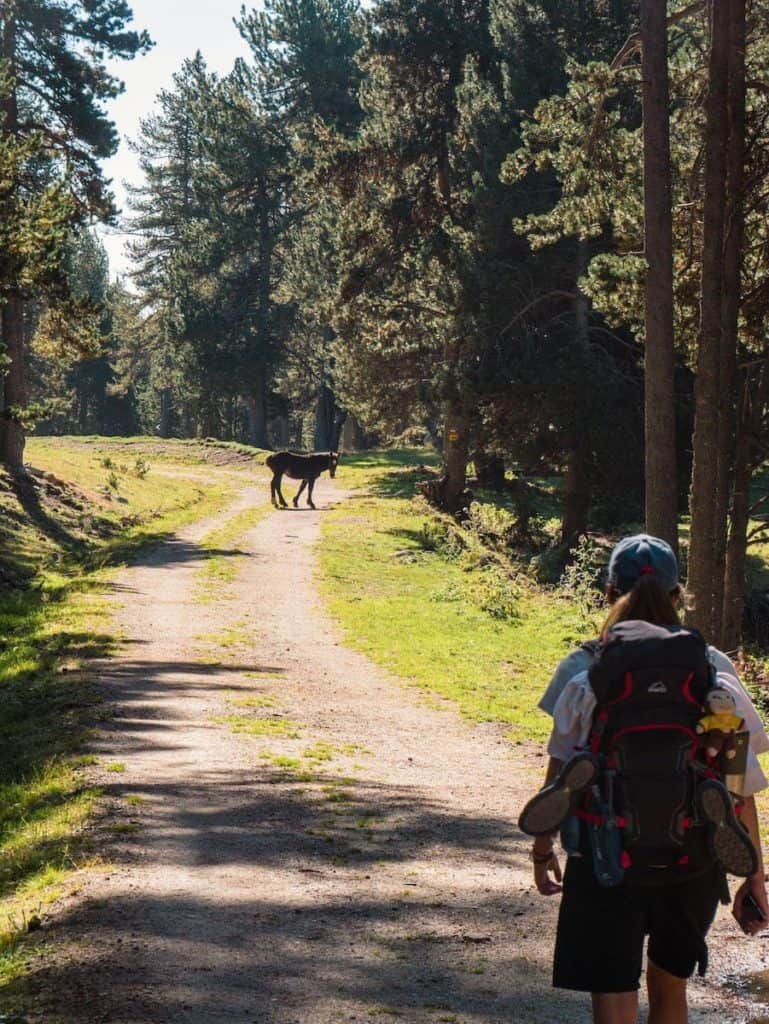
As happened the day before, the sky cleared at sunset, allowing us to go for a walk and enjoy the display of colours. We played with a donkey the wardens were training to help them carry food to the hut because the Refugi de l’Illa is the most isolated guarded hut in Andorra. It’s only reachable by a 4-hour hike or helicopter, so you can imagine how hard/pricy it must be to get the food and drinks there…
Dinner consisted of soup, a great rice and meat dish, and dessert.
And so the second day ended, and it was time to rest. We had a room for ourselves, giving us a break from hearing people snoring, which was much appreciated!
Day 3 – Forest vibes and rocky peaks
L’Illa to Estanys de la Pera, 15 km hike, 792 m+, 918 m-
After a good night’s sleep, we enjoyed breakfast overlooking the beautiful lakes surrounding the hut. The light was magical in the early morning, creating postcards like this one.
This day’s section took part entirely in the Vall de Madriu, a remote and beautiful national park in Andorra declared a World Heritage Site by Unesco in 2004 due to its landscape value.
The first part of the journey was a descent through the Madriu valley following the GR-11. We passed by the small lake known as Estany de la Bova, where many cows and horses were happily grazing.
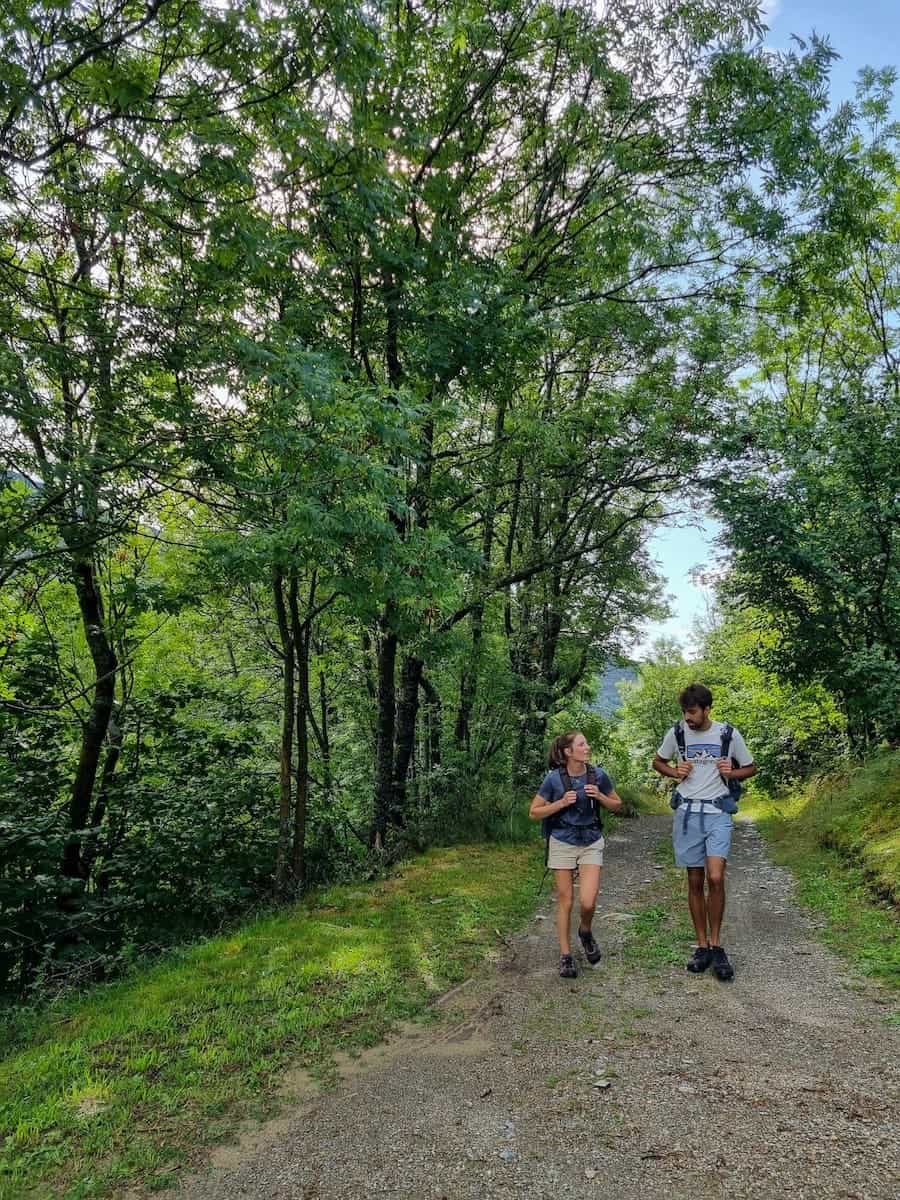
Then, we entered a beautiful forest. The sun’s rays filtered through the tree branches, giving the place a mystical light. After leaving the forest behind, we encountered the non-guarded little hut named Riu del Orris.
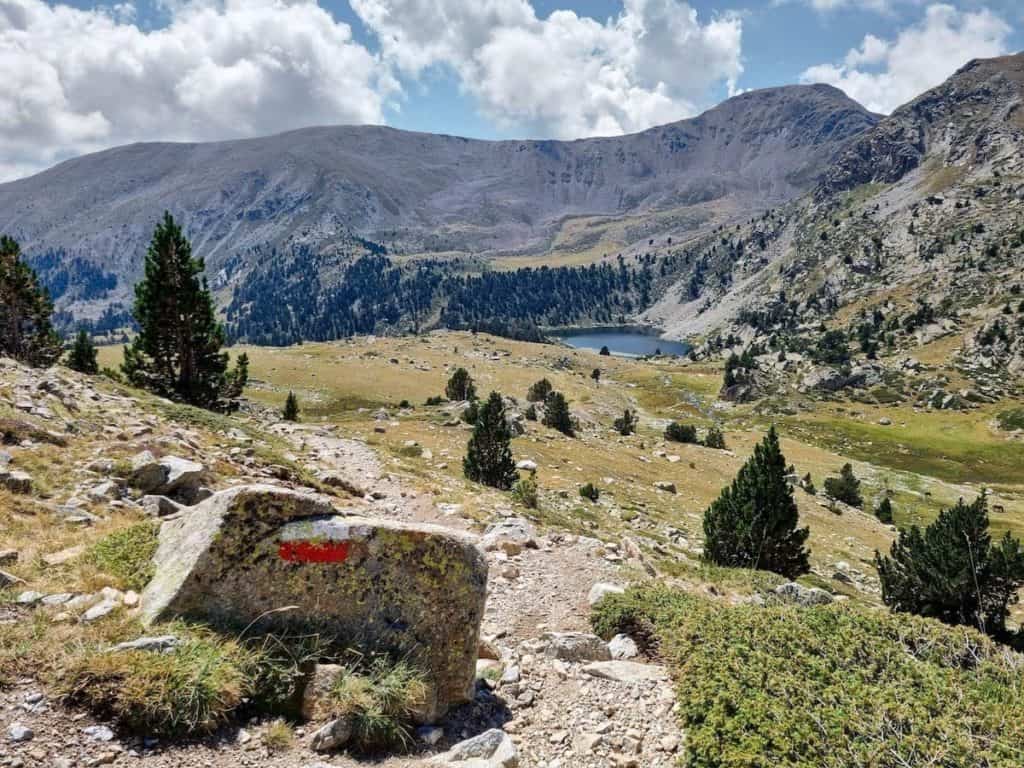
We continued descending through this magnificent granite valley that combines pastures with the black pine forest until it was time to leave the GR-11 and take the detour to the Maiana mountain pass. Here, we stopped following the red and white marks and started following the red and yellow ones.
Our eyes marvelled at the greenery of the landscape. We were in front of a vast meadow, with the Madriu river crossing it, surrounded by forest and with rocky peaks on the horizon.
We crossed the river and started to climb through the path at the bottom of the valley. The trail wasn’t technically difficult but, believe us, we were glad when we reached the top of the mountain pass! We dropped our bags, laid on the grass, closed our eyes for a few seconds, and enjoyed the silence to recharge our batteries.
After 2 km of descent, we found the Refugi de Perafita, another idyllic non-guarded hut. As it was mid-morning, we stopped there and enjoyed a snack.
The official map indicated going straight from the hut to the Perafita Lake, but we decided to make a slight detour to see the beautiful Estany de la Nou. This only added about a km to the route, but it was much worth it!
Estany de la Nou is a high-altitude lake with crystal-clear waters surrounded by trees. We found a shadow under a tree, sat for a while, and enjoyed a snack while admiring the views. It was all we needed to be fresh again for the ascend ahead!
Time to go up again, watching the Estany de la Nou become smaller and smaller.
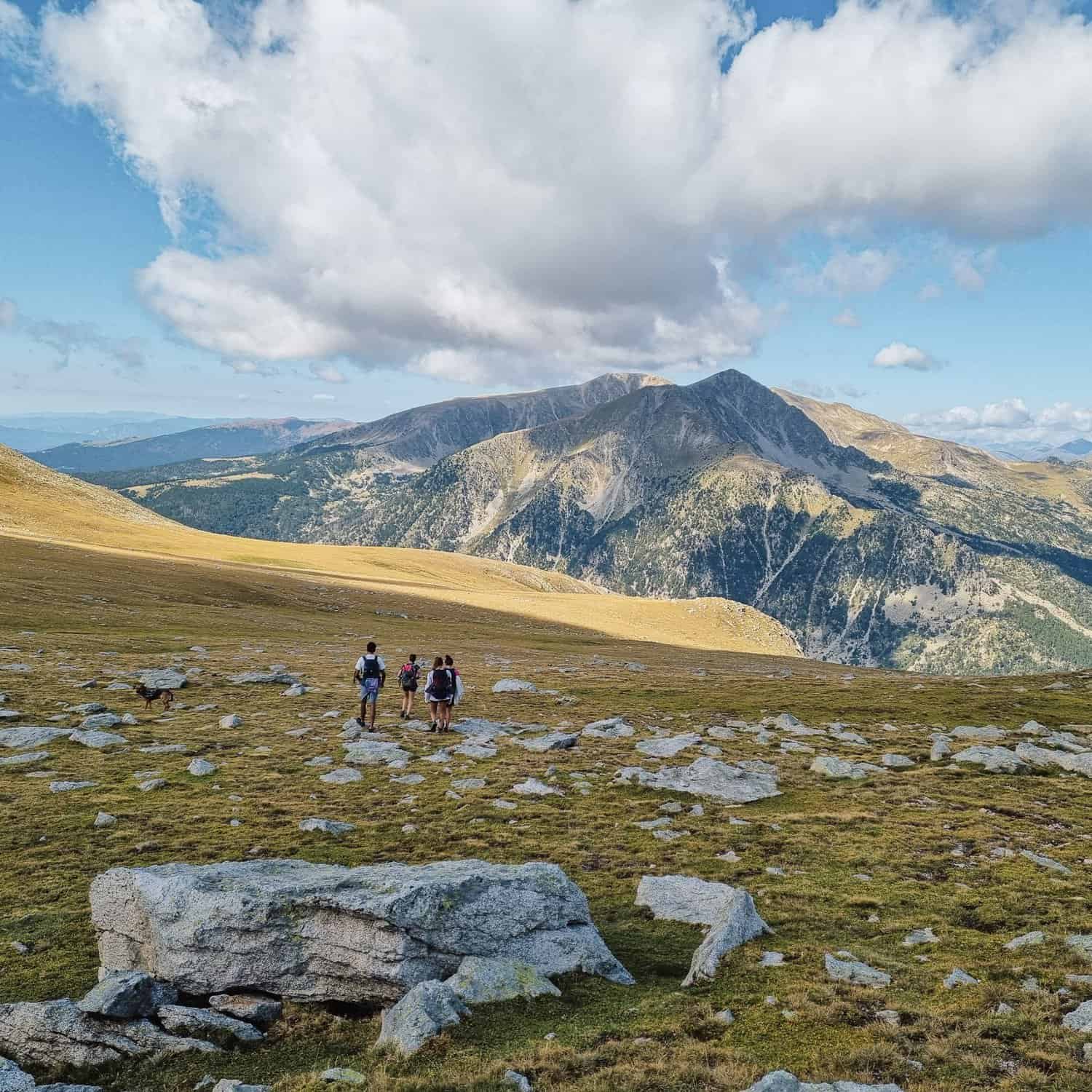
In the middle of the ascend was another pond, the Estany de Perafita. We didn’t spare much time there and continued our way up to the Port de Perafita. This mountain pass delimits the border between Andorra and Spain. Time to cross, and we were in Spanish territory again!
After the arduous climb, we spent some time on top of the mountain pass, enjoying the views of the valley ahead and the mountains in all directions.
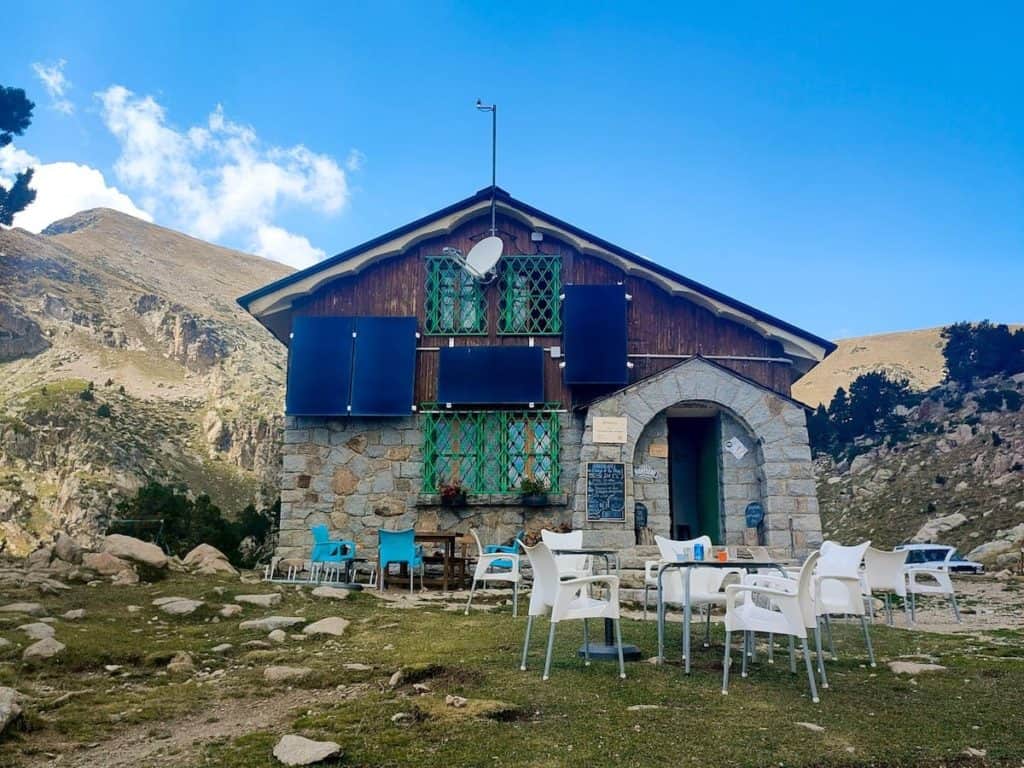
Only a descent separated us from the Refugi d’Estanys de la Pera, our destination for the day. The track was well-marked, and we could soon spot one of the lakes that give the name to the hut, Estanys de la Pera.
We reached the hut in less than 2 km. Omg, how much we enjoyed the sandwiches the hut warden prepared for lunch! We sat on the terrace, devoured the food, and grabbed a cold beer to celebrate the end of the third section.
As usual, it rained in the afternoon but cleared out afterwards, so we explored the two nearby lakes known as Estanys de la Pera.
We enjoyed a delicious three-course dinner and rested on our last night in these mountains.
Day 4 – Forest, more mountain villages, and exhaustion
Estanys de la Pera to Cap del Rec, 10 km hike, 792 m+, 918 m-
After a wonderful breakfast, we packed everything and got ready for the last hiking day of this journey. Although the elevation gain until Talltendre wasn’t much, the hike seemed tough due to the distance. We had joined the last two sections in one, and we were going to find out if that had been a mistake or not.
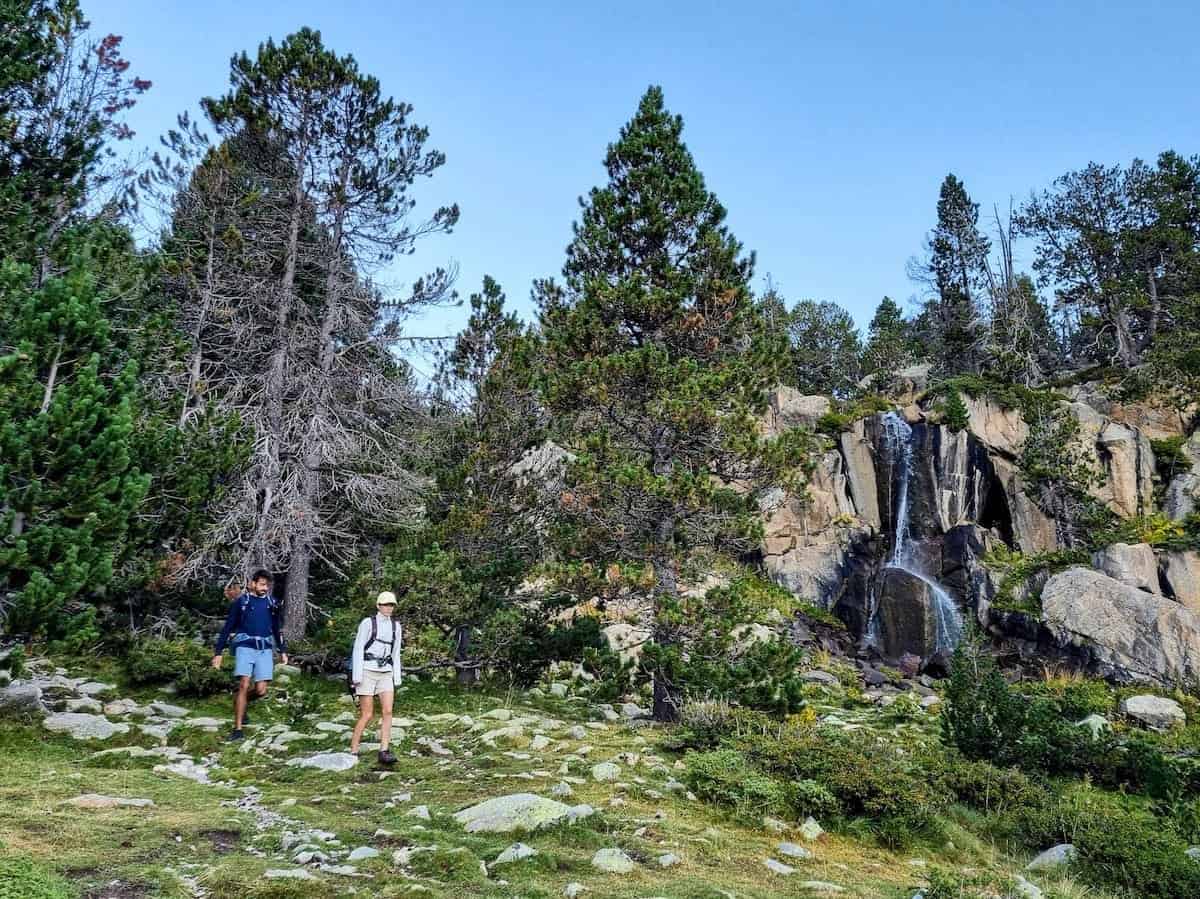
Less than one km after we left the hut, we found the first highlight of the day: the Planell waterfall. It’s a beautiful waterfall on a rocky wall in the forest.
We kept descending through the forest, losing altitude with each step. Just before reaching the Refugi de les Pollineres, we decided to shorten the route.
We had two options: getting to the Cap del Rec hut following the official route or taking a shortcut following the “Pista de Lles de Cerdanya a les Pollineres” and passing by the Refugi del Pradell (hut). As we had to do two sections of the route in one day and still had a long stretch until our final destination, we decided to go for the second option.
If your final destination for the day is the Cap del Rec hut, we recommend taking the official route. You’d pass by the Refugi de les Pollineres, an abandoned hut and a picnic area perfect for a snack, the pond Bassa de Comabella, the nordic ski resort Aransa, and the campsite Camping El Cortal del Gral, until finally reaching the Cap del Rec hut.
In our case, we descended following the “Pista de Lles de Cerdanya a les Pollineres”, which unwinded through the forest, crossing several water streams, until a green meadow where the non-guarded hut Refugi del Pradell was located. The views from there were breathtaking!
We were now halfway to Cap del Rec. We abandoned the track we were following and continued through the GR11.10 for several km until reaching the Cap del Rec hut.
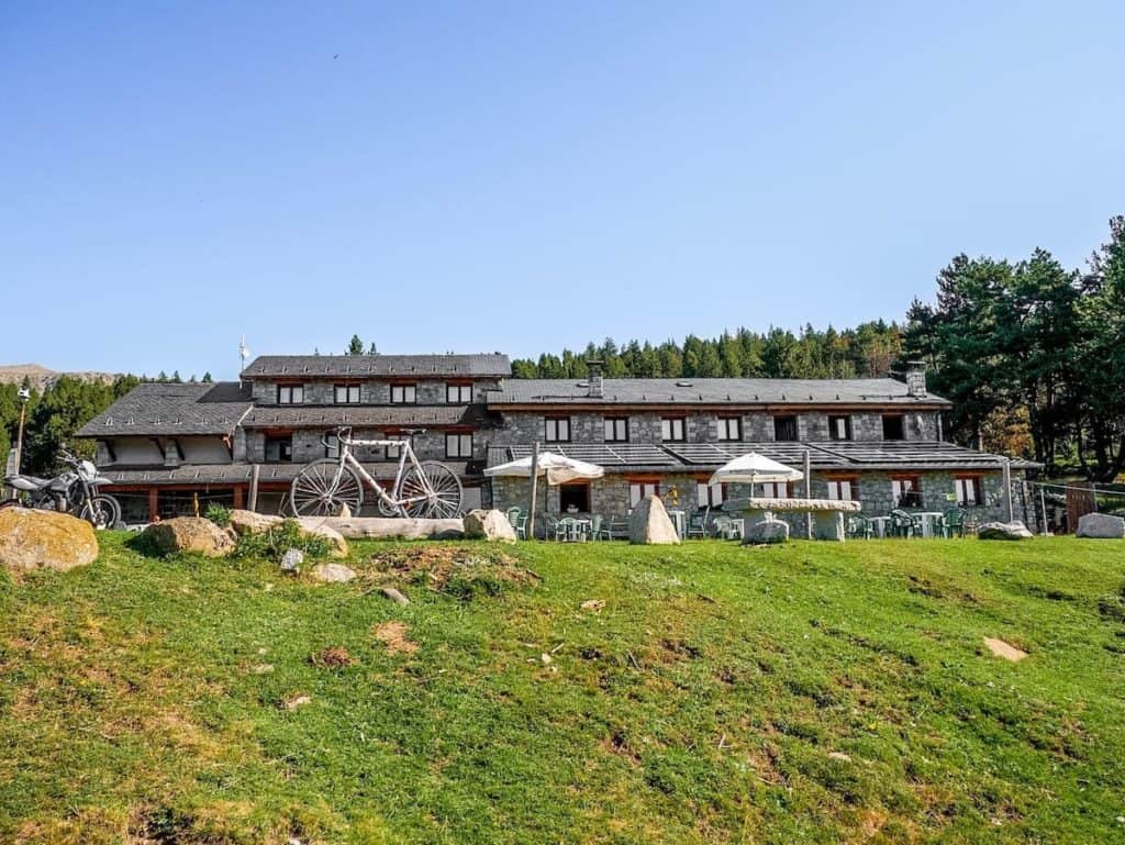
Cap del Rec is the biggest hut on this route, with a beautiful outdoor terrace and several buildings of the Lles cross-country ski resort nearby. Years ago, Killian Journet’s father was the hut warden of Cap del Rec. The great sky-running athlete grew in this hut and the surrounding area, falling ni love with the mountains.
Cap del Rec to Cal Pere Sidro, 18 km hike, 310 m+,695 m-
After a much-deserved break, we continued our journey to the point where we started the route 3 days ago.
We started walking along the track that began in front of the refugee and entered the forest, maintaining the height. It had rained the night before, and the pine fragrance was intense and pleasant. We crossed many cows and horses along the track, some nicer than others.
After a while, the track followed a water stream, Torrent de Viliella, and we could already spot the mountain village we were heading to.
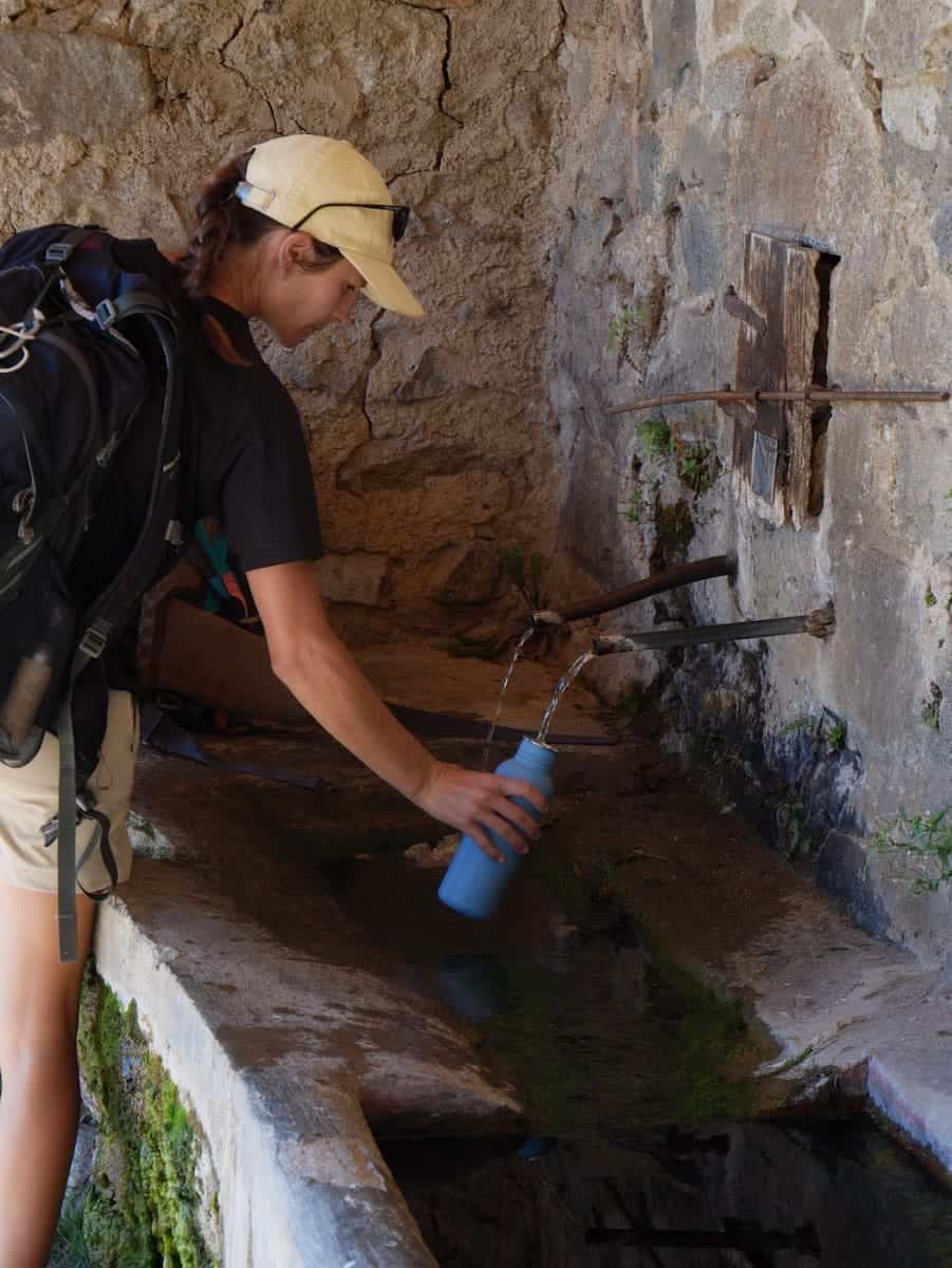
Viliella is a small village with a handful of houses, with the Romanesque church standing out. There’s also a fountain, perfect for refilling the bottle with fresh water.
From here on, it was our less favourite section. Except for some punctual moments, the track is quite monotonous. Hence, the lack of pictures.
We were pretty tired from all the km accumulated, and this last part was mentally challenging.
From the village, we continued along the track until crossing the Llosa river through a small wooden bridge. The path widened and descended to Coborriu de la Llosa, another tiny village with literally four houses.
Here, the track stopped descending to ascend again. This part was tough. At the end of the climb, the forest disappeared, giving place to an arid and stony wasteland with junipers and little else.
The descent to Talltendre seemed to never end. Those last 5 km were the longest 5 km ever. It was hot, there were no shades, and we were exhausted.
But you can imagine our faces when we finally spotted the first stone house of Talltendre. We made it! We had completed the 4 days of hike and were again where we parked the car. It felt like we had been in the mountains for a week!
As it wasn’t late, we called a restaurant to see if they could still offer us food. Bingo! We jumped in the car and enjoyed a much-deserved pizza to celebrate the end of this beautiful journey.

Would we recommend Estanys Amagats?
Sure! We were like “wow” more than once during the hike!
We were impressed by the extreme beauty of this hike, from the crystal-clear lakes to the lovely villages that seemed to have stopped in time and the green meadows that invited you to lie down and appreciate the nature around you.
We didn’t have high expectations for this multi-day hike, as we had never heard about it before, and it’s not as well-known as Carros de Foc. But the truth is that we loved it!
We have explored Andorra in depth through the years, but this route took us to places from the Vall del Madriu that are difficult to reach if you only do one-day hikes. This part of the Pyrenees is breathtaking, and the landscapes that the hike covers are varied, making the journey entertaining.
Estanys Amagats is perfect for anyone who wants to experience a multi-day hike but would like the comforts of staying in a hut, carrying less weight and eating delicious and abundant food!
Remember to follow Leave No Trace practices. Be kind to fellow hikers, hut wardens and the local communities. And hike on!
More hut-to-hut hiking routes in the Pyrenees
Check our “Hut-to-hut hiking in the Pyrenees: Seven stunning routes + Essential info” guide to discover more thru-hikes in the Pyrenees. We hope you enjoy them!

Hi, thanks for sharing your experience, it was super helpful! Do you know if it’s allowed to do bivouac (overnight tent only from sunset to sunrise) along the Estanys Amagats route, or is it restricted to huts?
Hi Neta! Bivouac is not allowed (but there is an exception: between 8 pm and 8 am and only above 2.000 m and one night in the same place). We’ve seen people setting the tent next to the L’Illa hut in Andorra.
Great write up!! Is there a place to park your vehicle in Talltendre?
Thanks John! Yes, we parked the car right at the entrance of the village.