

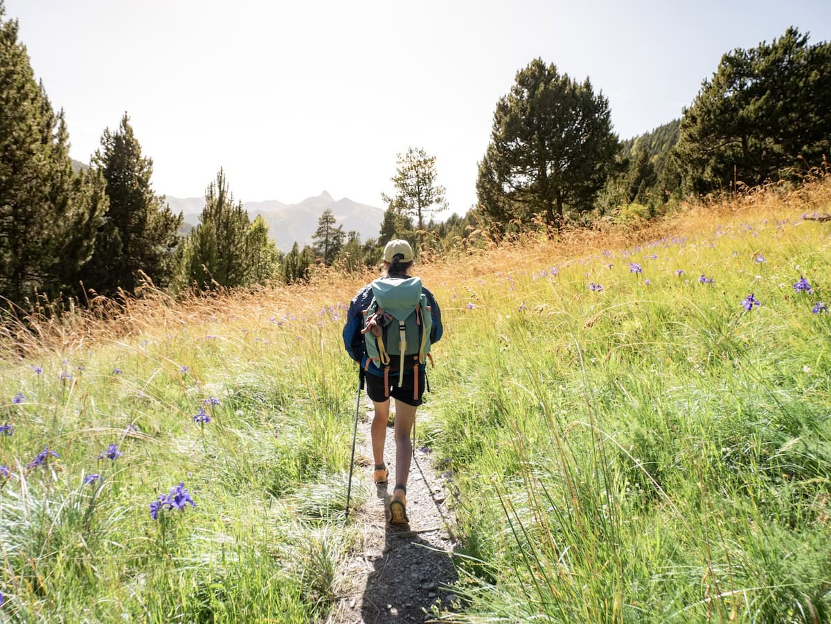
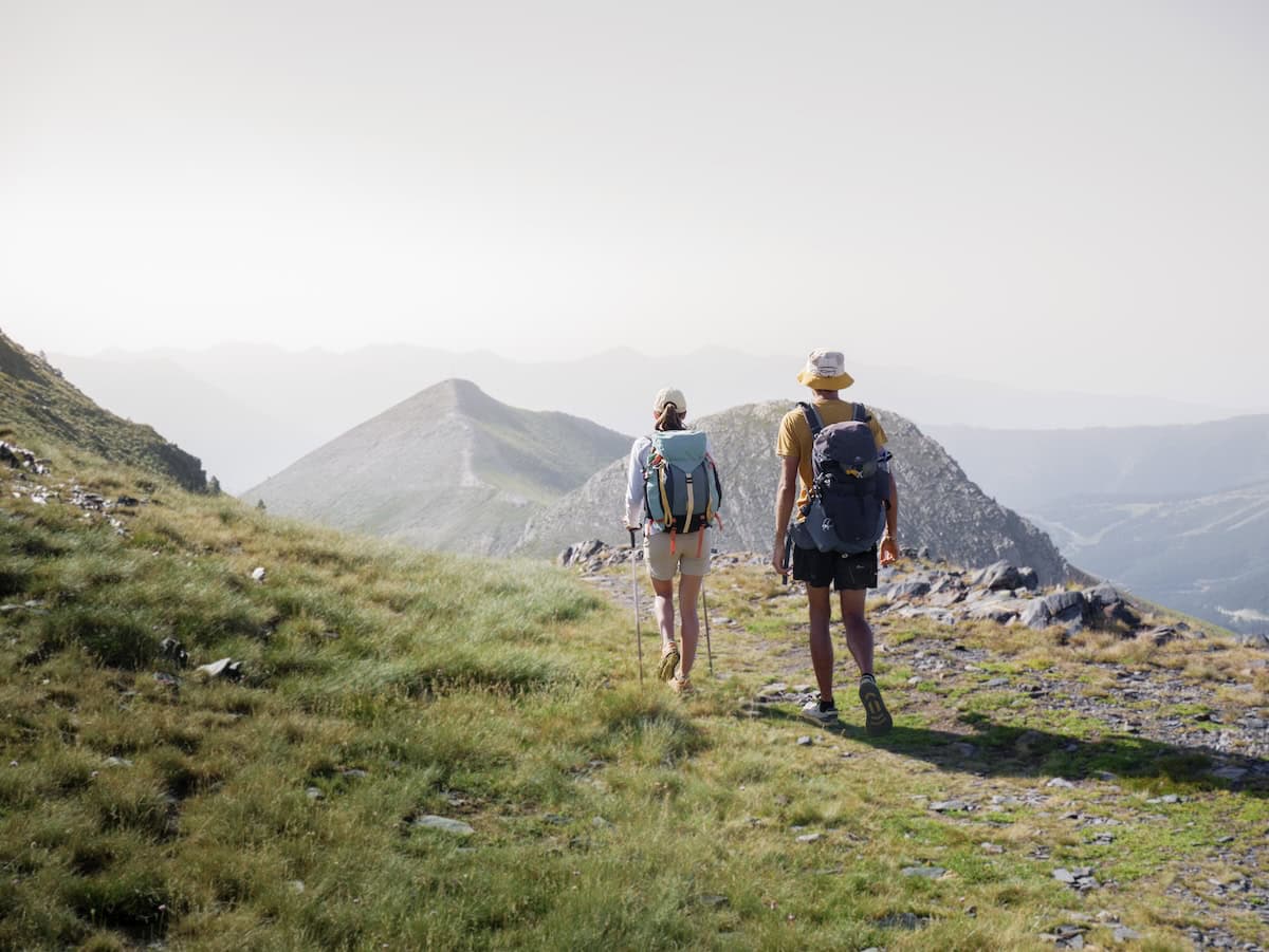
Coronallacs is an incredible hut-to-hut hike for those up for a challenge. This 92 km circular route links Andorra’s four guarded mountain huts, and it’s an excellent way to discover Andorra’s most remote and scenic spots.
Plus, the Coronallacs route starts and ends in the capital, making it one of the most accessible multi-day hikes in the Pyrenees.
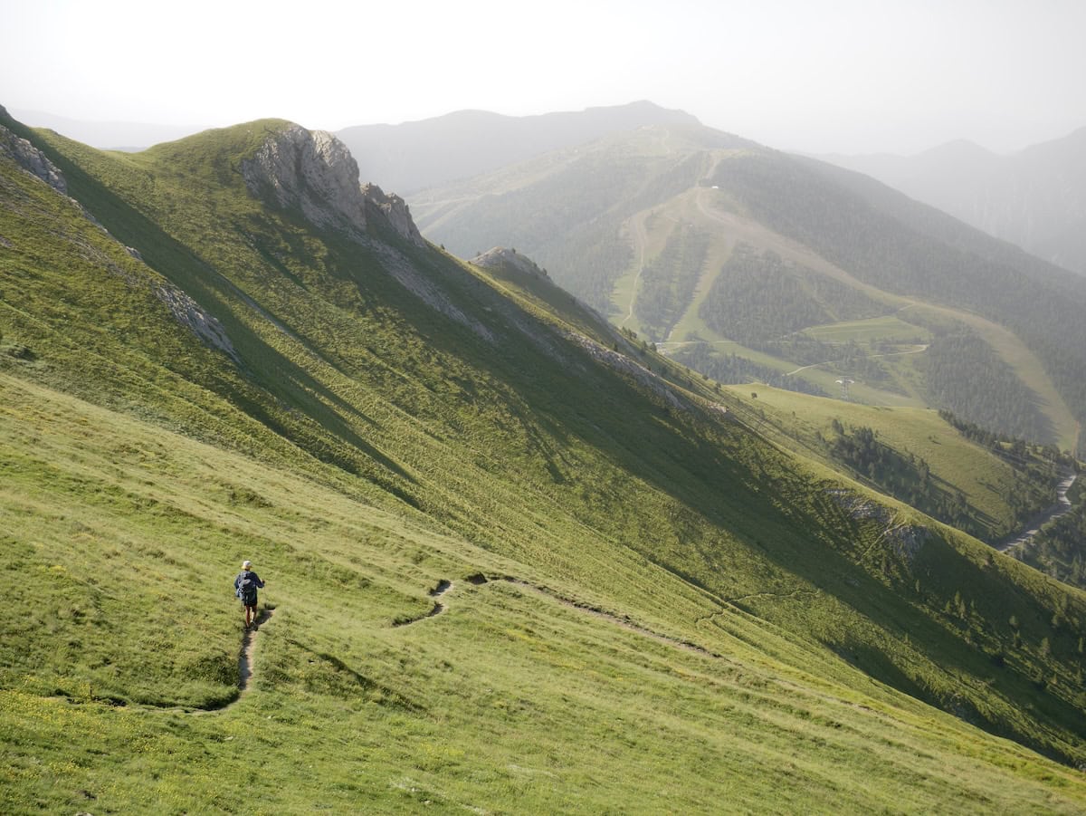
Expect rugged peaks, high-altitude lakes, breathtaking valleys, and meadows full of colourful wildflowers. But keep in mind that the route is a tough one. With a total elevation gain of 6.449 m, expect long days on the trail, with steep climbs and high mountain passes. That said, if the full route sounds a bit too intense, you can shorten some stages by bus, making it more flexible.
We hiked Coronallacs in July 2024, and it was hands down one of the toughest yet most rewarding hut-to-hut hikes we’ve ever done.
Here’s our full review, tips, and photos to help you plan your Coronallacs adventure!
* Post written for the first time in February 2025 and updated in March 2026.
Things to know before hiking Coronallacs
Technical details
🥾 Total distance: 92 km
⚫ Difficulty: Very difficult
⬆️ Cumulative elevation gain: 6.449 m
⏱ Duration: 5 days
🗓 Recommended season: Coronallacs is a high-mountain route, so the best time to enjoy it is from the end of June to the beginning of October.
We graded this route very difficult, not because of the terrain, which isn’t technically difficult, but because of the elevation gain and distance. The average daily distance is 18.4 km, with an average elevation gain of more than 1300 m. This means long days (8-10 h) and a lot of going up and down!
We recommend Coronallacs to experienced hikers in great shape who don’t mind hiking 15-25 km each day with 1.200-1.900 m of elevation gain.
If you don’t have experience with long hikes, we think it’s better to do some easier hut-to-hut hikes, like Travessa dels Tres Refugis, Cavalls del Vent, or Gran Paseo, before embarking on this adventure.
Also, most stages of Coronallacs occur in high-mountain terrain, and some sections are pretty isolated, so having the proper knowledge and material is essential.
🚌 Want to shorten the stages?
Most stages of this route can be shortened by taking a bus, reducing both distance and elevation. So, if the full route feels too challenging, using the bus is a great option. You can adjust the route based on how many km you want to walk each day. We’ll cover some ways to do this in the “Coronallacs route” section below, but if you’d like a personalized itinerary, you can also book a call with us!
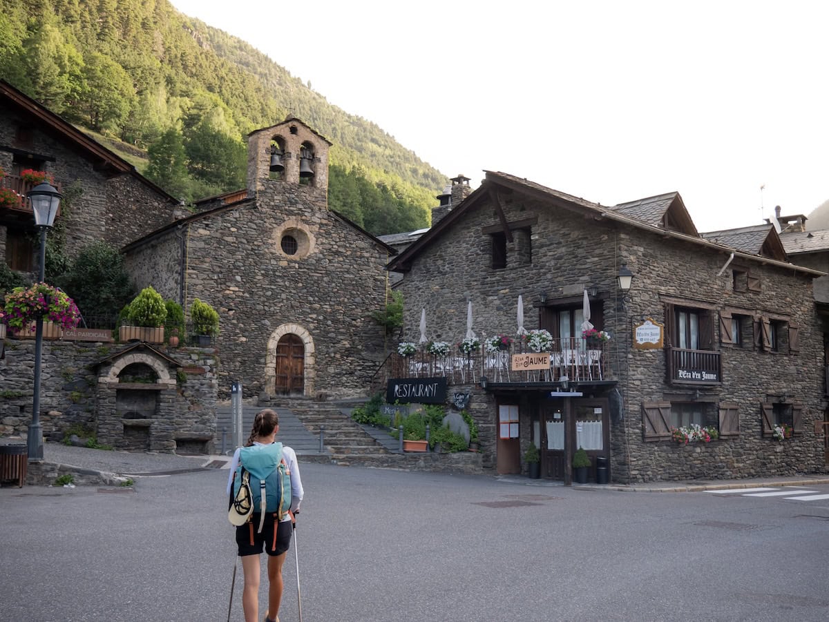
Where does the Coronallacs route start?
The route starts from Escaldes-Engordany, a town connected to Andorra’s capital (Andorra La Vella).
It takes about 3 h to drive from Barcelona or Girona to Escaldes-Engordany. If you do come by car, keep in mind that free parking in Escaldes-Engordany is almost impossible. To save time (and sanity!), we recommend leaving the car in a parking lot.
If you book the route through the Coronallacs organisation, you’ll enjoy a discount in various parking lots from Escaldes during the five days you’re hiking.
Reaching Coronallacs by public transport
One of the best things about the Coronallacs route is that it’s really easy to reach by public transport from Barcelona (unlike many other hut-to-hut routes in the Pyrenees).
Two bus companies cover the journey between Barcelona and Andorra: Andbus and Directbus. Both companies cost almost the same, and the travel time is also the same, so just choose the one that fits your schedule better. We’ve travelled with the two of them and liked both.
The bus journey starts at the airport, making it really convenient if you’re landing in Barcelona and want to go straight to Andorra. They also do one more stop in Barcelona’s city: Diagonal Avenue (Andbus) and at Sants train station (Directbus). And then, they go straight to Andorra.
Which direction is best to follow?
As it’s a circular track, Coronallacs could be done clockwise and counterclockwise.
However, we recommend counterclockwise. The section from the Pal ski resort to Escaldes is very long, and doing it uphill would be pretty tedious (1.049 m of elevation).
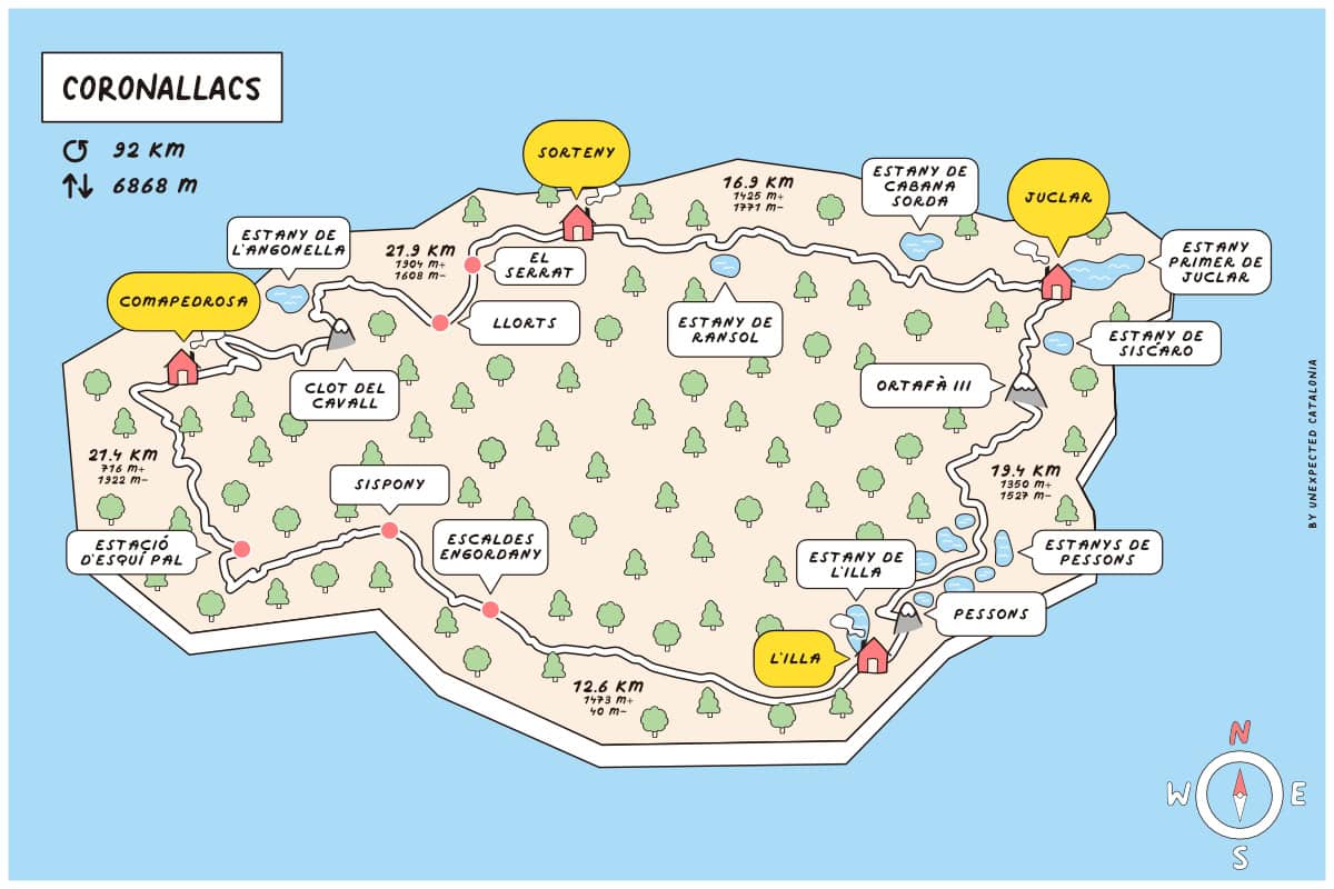
To better plan your approach to this route, here is a map showing the various mountain huts, their altitudes, elevation gains, and distances between them.
Is the Coronallacs route marked?
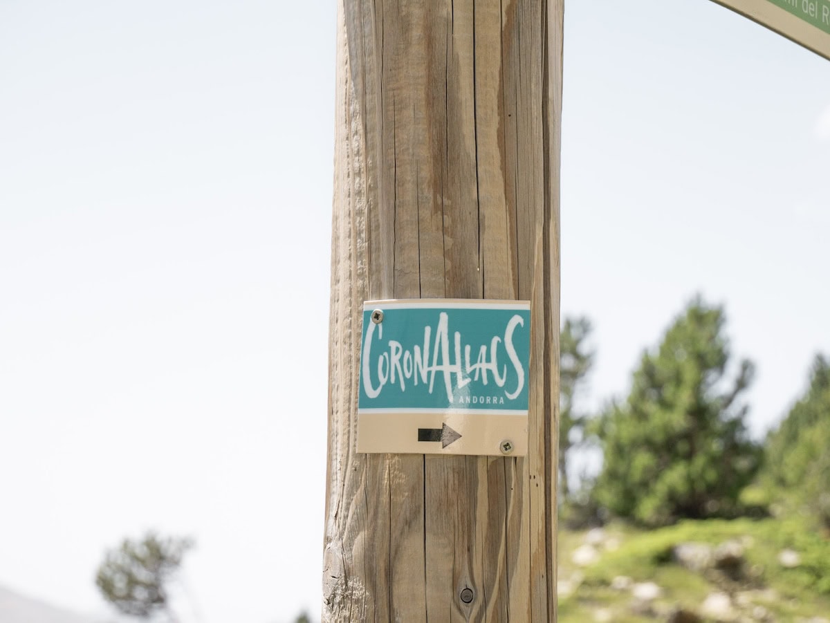
Almost the entire itinerary is marked with the GRP (Great Country Route) signs, which are yellow and red lines. Some sections are also marked with GR signs (white and red). Plus, along the route, you’ll find sky-blue signs with the Coronallacs logo.
🧭 Wikilock track
Here are the tracks divided by days. If you use another outdoor navigation app that isn’t Wikiloc, you can download the .gpx files from Wikiloc and upload them to the app you use.
The huts on the Coronallacs route
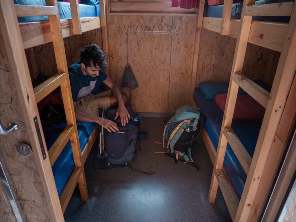
The four guarded huts in Andorra (Refugi de l’Illa, Refugi de Juclar, Refugi de Sorteny, and Refugi del Comapedrosa) are located in incredible natural settings. Keep in mind that they are not mountain hotels, and their schedules and rules must be respected. For example, dinners usually start around 7:30-8 pm, so huts recommend arriving before 7 pm.
All the huts have the essentials for spending the night: a place at the entrance to leave your boots, heating, accommodation, drinks, food, and showers. Also, all of them have hot water, though most of them charge extra for it (usually 1€ or 2€).
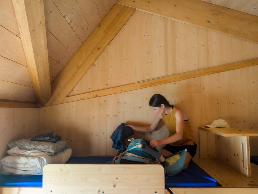
One thing we loved is that all the huts here let you take your backpack to the room! Which is actually really handy. And all of them also have pillows and blankets, so all you need to bring is bed linen. No need for a sleeping bag.
You sleep in a bunk bed in shared dormitories, bigger or smaller depending on the hut. The smallest sleeps six people, and the biggest sleeps around 12. We wouldn’t say we’d had the best night’s sleep in a hut, as in a 10-bed room, the chances of someone snoring or moving are pretty high. Keeping this in mind is good, so you’re not frustrated or disappointed after sleeping for a few hours!
There are charging stations at the huts, so charging phones, cameras, e-book readers, etc., is a breeze. But we still recommend packing a portable charger.
 L’Illa hut
- Comapedrosa hut
 Juclar hut
- Sorteny hut
Accommodation options in Escaldes-Engordany
The stages of the Coronallacs route are quite long, so hiking and travelling on the same day isn’t really feasible. You’ll likely need to stay in Andorra the night before you start and again after you finish the hike.
Here are some hotels near the starting point we recommend:
- Hotel Metropolis: Its location is excellent, just a 4-min walk to the start of the route. The rooms are clean and modern, and the hotel offers private parking, which isn’t easy to find here in Andorra!
- Yomo Mola Park: Marc’s grandparents always stay there when they visit us, and they love it! The location is great (8-min walk to the start of the route), the rooms are spacious, and the staff is super friendly.
Cost of hiking Coronallacs and how to book it
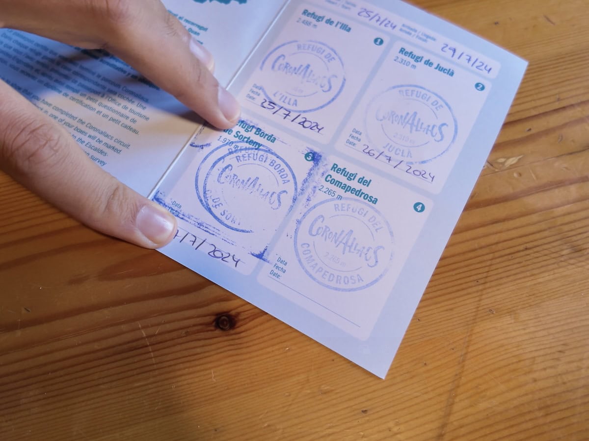
Use the Coronallacs organisation website to book the hike. Once in Andorra, you’ll need to go to the tourism office in Escaldes to grab a map of the route and a forfeit. You can stamp the forfeit at each of the huts, and it’s a nice souvenir to bring back home! Once you finish the route, you can pass by the tourism office again, and they’ll give you a gift.
We passed by the tourism office the same day we started the hike. They are open from 9 a.m. to 1 p.m. and 3 p.m. to 7 p.m. (weekdays and Saturdays) and from 9 a.m. to 1 p.m. on Sundays. We also went to get our gift the same day we finished the hike.
If you’re coming by car, you need to purchase your car parking discount at the time of the booking. Once in Andorra, you can get your parking pass at the Caldea-covered car park ticket office.
👌🏼 Our tip
It’s always necessary to book the Coronallacs hike in advance. Also, if you choose to do it during the high season (July and August) or long weekends, you’d better book in advance.
The approximate cost for the half board in the four huts is 224€. That includes breakfast and dinner in the four guarded huts. If you also want a picnic for lunch, let the Coronallacs organisation know at the time of the booking.
⚠️ Important!
Remember to bring cash. Some of the huts don’t accept card payments, so having some money with you is essential if you want to enjoy a cold drink after a long day of hiking!
Weather and gear recommendations
The weather in the mountains can change rapidly, especially in high altitudes. Expect any weather and get equipped accordingly.
We recommend packing some warm clothes, even though you hike in summer. For example, a pair of gloves and a lightweight down jacket. You’ll also need waterproof gear (jacket, pants, and backpack cover), a head torch, and safety equipment, such as an emergency blanket and a first aid kit.
Pack sunglasses, a hat (or a cap), and sunscreen (reef-friendly!). The summer sun in Andorra is really strong, and there are several sections, like mountain passes, where there isn’t a single shade. We learnt it the hard way as we got sunburnt on the third day. We had to hike with the windbreaker and long sleeves for the rest of the route 😔
Another thing you’ll be grateful for is earplugs. We bet you’ll appreciate them if your neighbour starts snoring! And a set of clothes only for the huts. There is nothing like reaching the hut all sweaty, taking a shower, and putting on some clean, warm, and cosy clothes!
And finally, we believe that hiking poles are essential for this route. Flat terrain is almost non-existent; it’s all uphill and downhill, and the poles come in really handy.
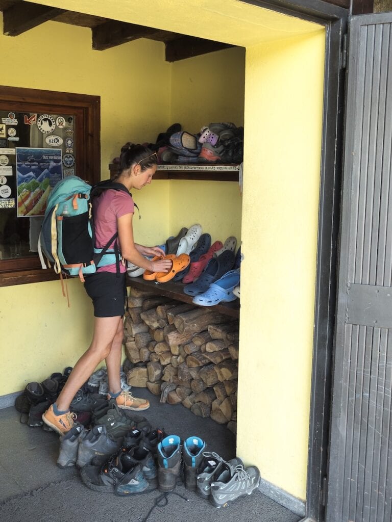
You don’t need to bring slippers or flip-flops as all the huts give you Crocs.
As you’ll spend many hours hiking, it’s wise to pack light but sensibly. You’ll need to carry your own water, clothes, bed linen, personal items, camera, food (depending on the meals you select when booking), etc. You won’t need to pack a sleeping pad or more than one day’s worth of water at a time.
It’s also essential to bring a bag to put all the trash in. You can throw it at some huts or in the villages you’ll find along the route. Please take care of the environment and leave no trace.
For more info in-depth info on what to pack, read our guide “10 things we never forget to pack when hut-to-hut hiking in the Pyrenees.”
🌦️ Where to check the weather
You check the weather forecast for the days you’re hiking on the local Meteo website.
 Grabbing some Crocs at Juclar hut
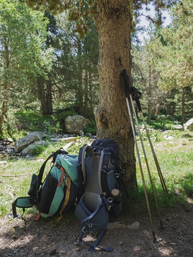
 Backpacks we used for hiking Coronallacs (30 L)
Phone service
There is phone service on most of the route.
⚠️ Important!
Unless you have an Andorran SIM card, we don’t recommend turning on your mobile data. Internet rates are crazily high here in Andorra, and we don’t want you to end up with a bill of 60€ just for receiving a couple of WhatsApp messages!
So, it’s good to let family members or friends know you’re doing this hike so they don’t freak out if you don’t answer them!
In case of an emergency, call 112. This emergency number has good coverage throughout the hike. You can also call 118, the firefighters (they have a special mountain rescue team).
Food
🍽 Breakfast and dinner
The huts serve breakfast and dinner, and dinner is one of the best moments after hiking the whole day! The guards often cook three dishes, including a soup or salad, a consistent dish, and a dessert. Breakfast usually consists of bread with cheese, cured meats (sometimes), jam, coffee, biscuits, juice, and tea.
⚠️ Important!
If you have a food allergy or dietary requirements (e.g., vegetarian, vegan, gluten-free), let the hut guards know when you make the booking. They will accommodate your requests and make the necessary changes. Take into account that the hut’s resources are limited, and the special meals can be less varied.
🥪 Lunch
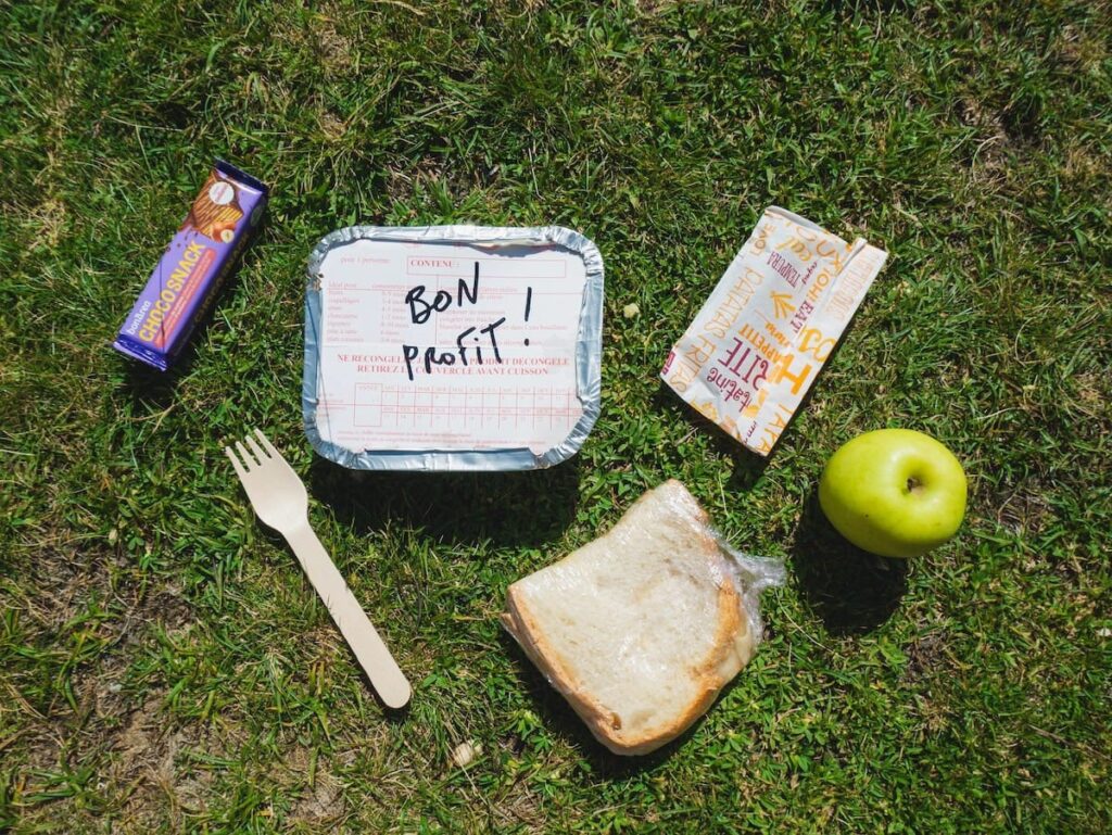
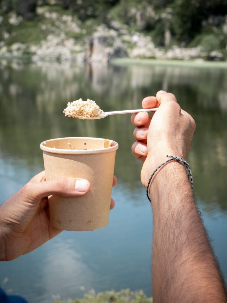
For lunch, you can buy it at a supermarket before starting the route or buy a picnic at the huts where you sleep. If you want the picnic, you must request it when booking. We highly recommend this option so you don’t have to carry 5-days worth of food.
We bought the picnics at the huts during this route, and the truth is they were very complete. Most picnics consisted of a salad (with pasta or couscous), a sandwich, a piece of fruit, nuts, and a snack bar.
🥜 Snacks
We also recommend you bring some extra snacks for the route, like nuts, chocolate, or energy bars. Think about foods that don’t spoil quickly and take up little space.
- Picnic from Juclar hut
 Breakfast at Juclar hut
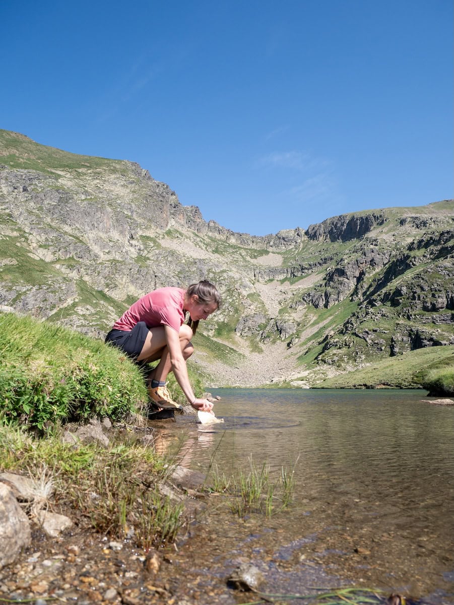
Water
When it comes to water, we recommend taking at least 2 reusable 1 L water bottles with you. You can refill the water bottles in all mountain huts. You’ll also find some fountains along the way (mainly in the non-guarded mountain huts) to refill water.
If you carry a water filter, there are plenty of streams, lakes, and rivers where you can fill your water bottle.
If you’re hiking in late July or August, expect hot days. We highly recommend stopping at the fountains to refresh. When we hiked in the summer heat, we used lakes and rivers to soak our hats and caps. It felt SO good!
⚠️ Important!
Swimming in the mountain lakes and rivers is forbidden here in Andorra.
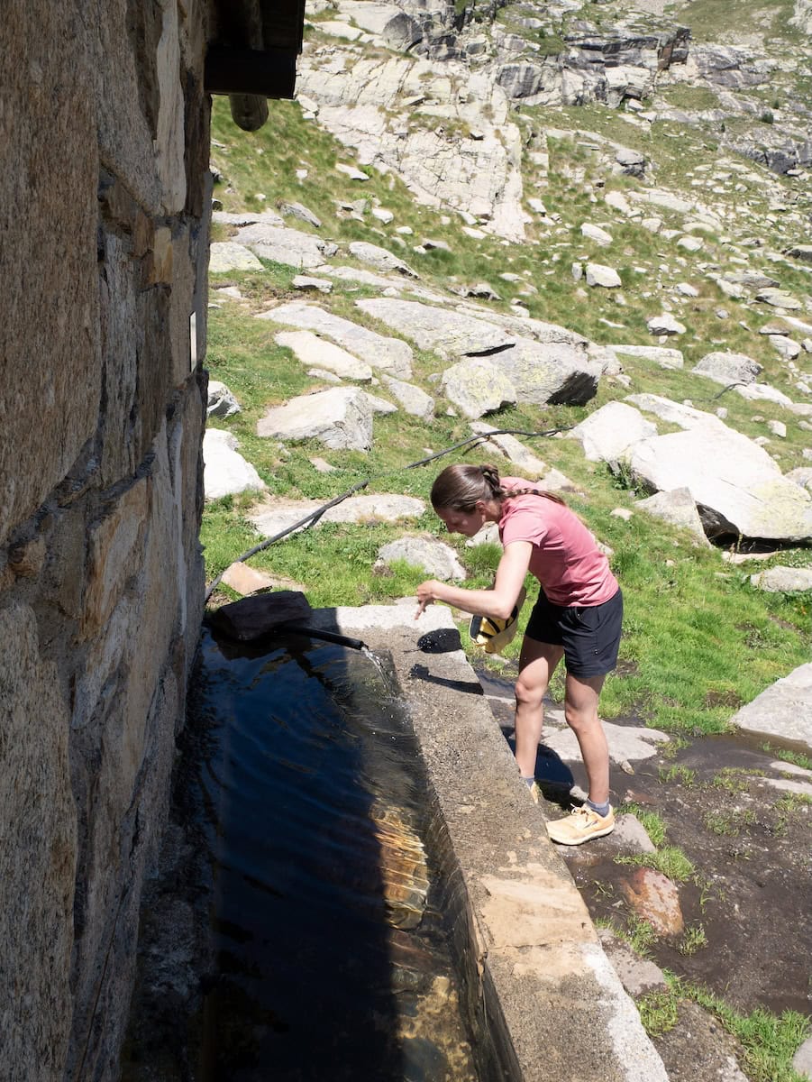
 Soaking the cap in Cabana Sorda Lake
- Fountain in Coms de Jan hut
Coronallacs route
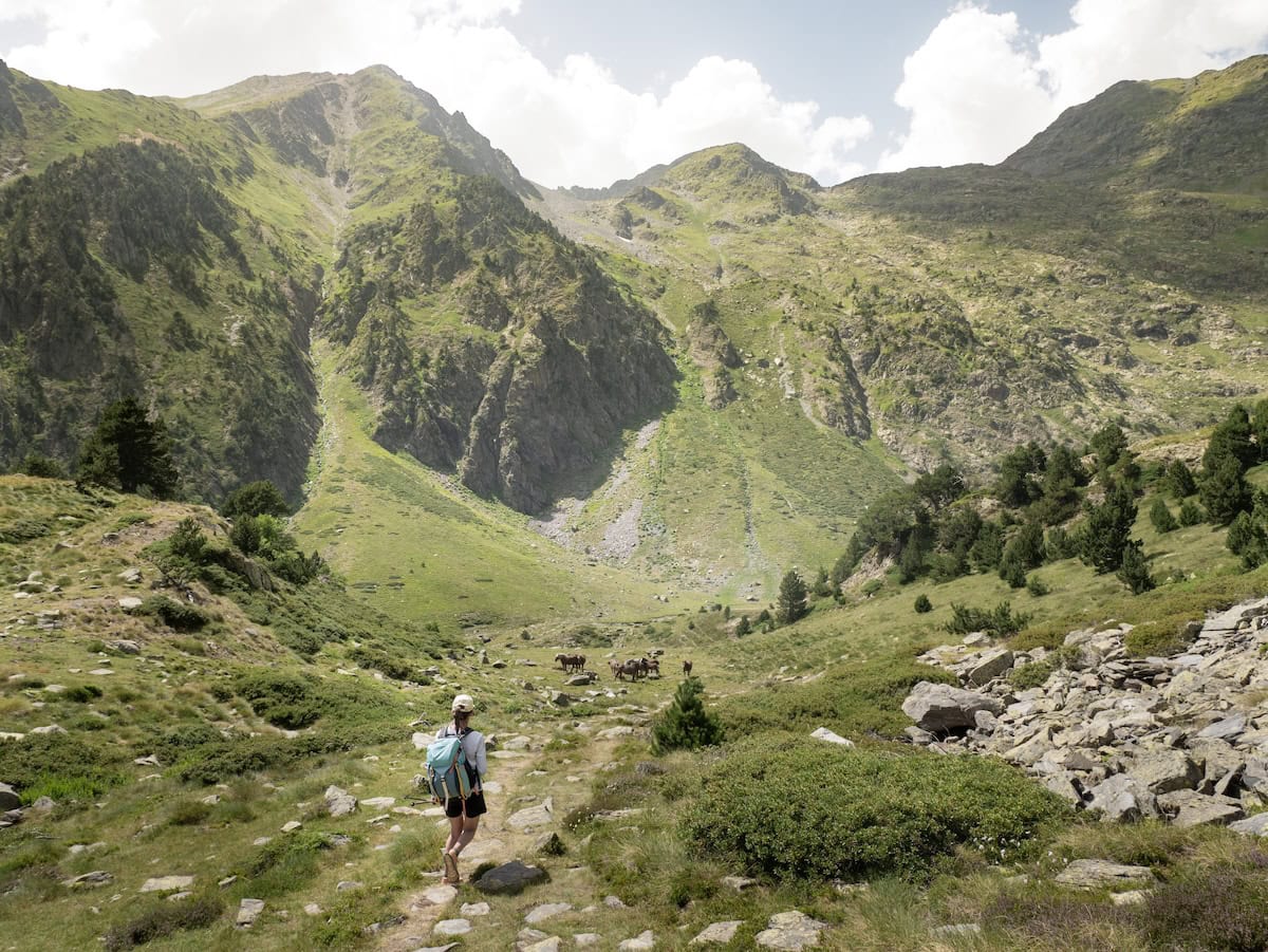
Day 1 – Hiking in a UNESCO World Heritage Site
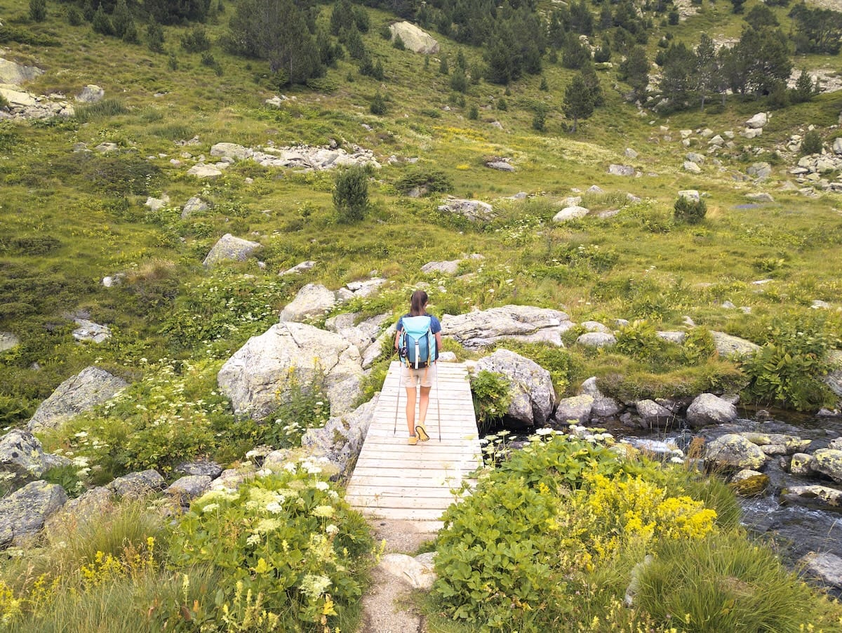
Escaldes Engordany to L’Illa hut, 12.6 km hike, 1473 m+, 40 m-
We woke up early and caught the bus all the way to Escaldes, where we stopped near the tourism office. We grabbed our forfeit and the map and started hiking to the mountains.
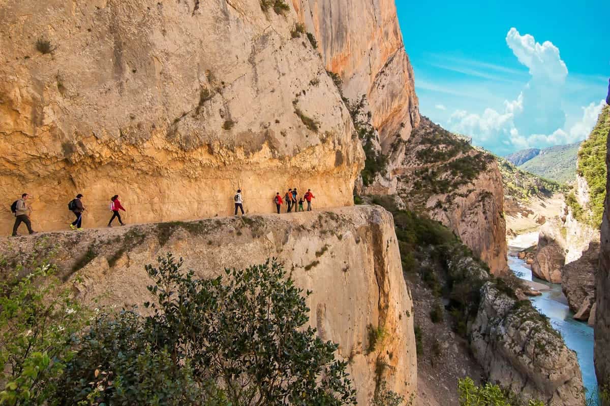
After around 15 minutes, we left civilisation behind and found ourselves at the entrance of the Madriu-Perfita-Claror Valley. This valley was declared a UNESCO World Heritage Site in 2004, and it’s absolutely gorgeous.
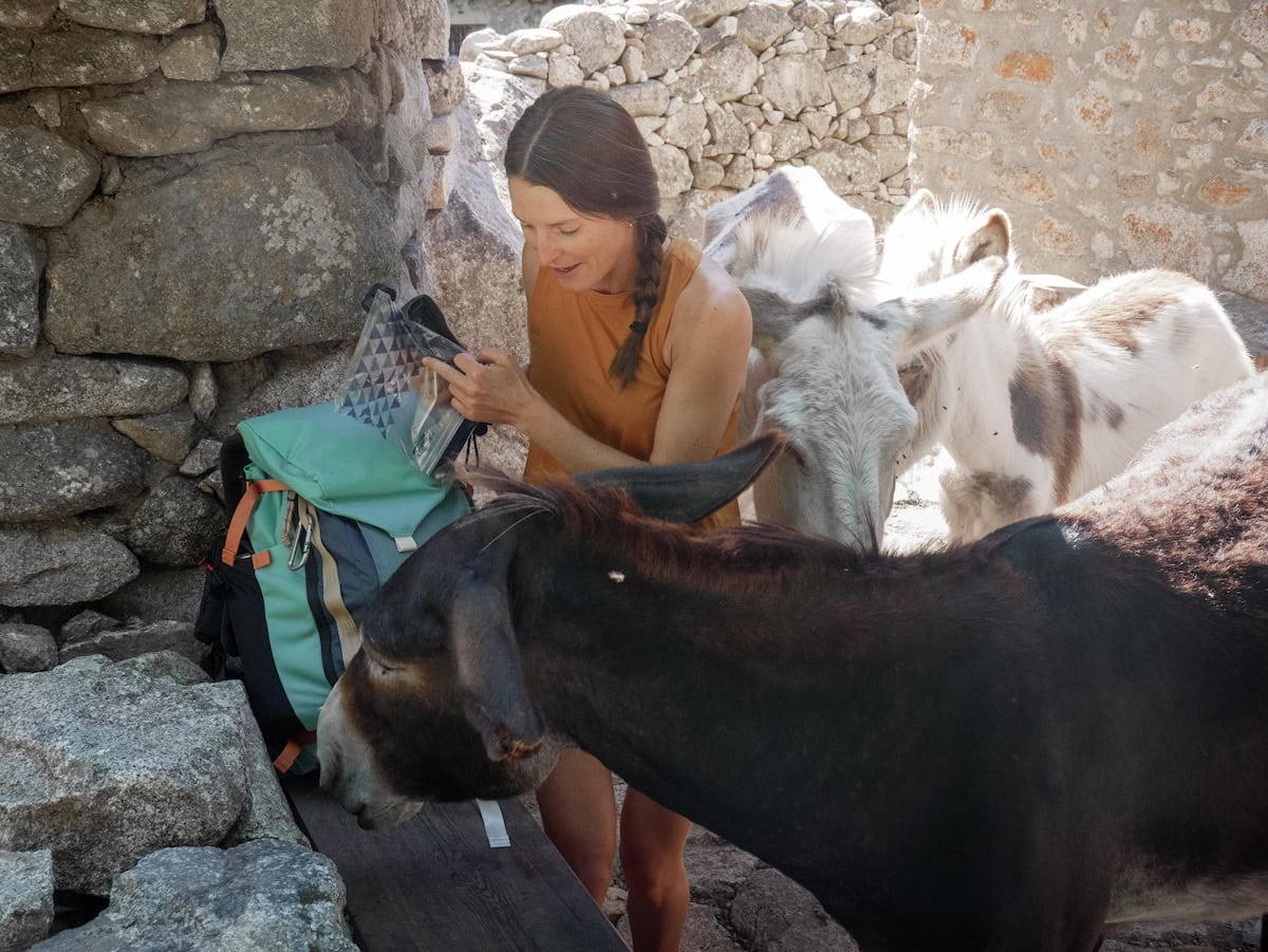
The path was slowly gaining altitude, following the Madriu River, but it was really comfortable. We soon reached Ràmio, a set of traditional houses now used to keep donkeys and carry out educational activities. We stopped there for breakfast, and just when we were taking our sandwich out of the backpack, a group of donkeys arrived. They came closer and closer, and before we knew it, they were trying to steal our food 😂 Luckily, we were faster!
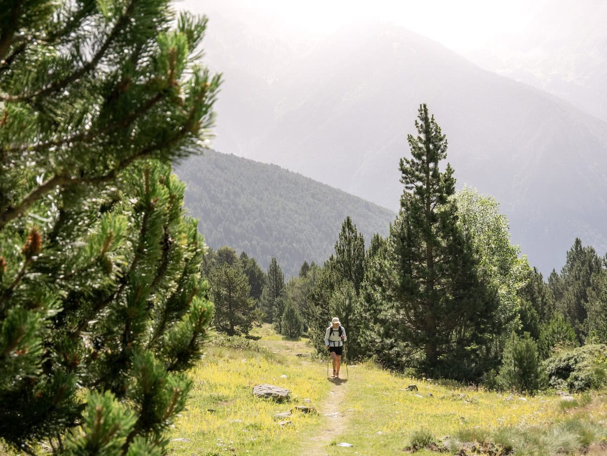
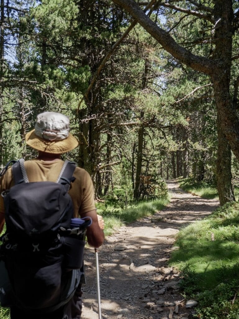
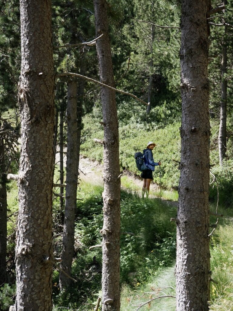
With our bellies full, we continued the hike through the green meadows and forests. The path was easy and pleasant, and after a while, we reached the Fontverd hut, a non-guarded hut in an idyllic setting. We stopped there to drink and refresh in the fountain, and after a little break, we kept going.
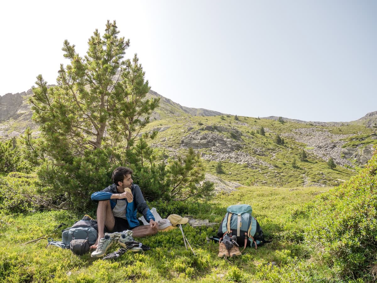
The forests we passed through were beautiful, and they were a blessing because it was starting to get hot. Then, the forest disappeared, giving way to a huge green meadow with the river crossing it. We stopped there for lunch. We got rid of the shoes, sat in the shade, and enjoyed a couple of sandwiches and some snacks. Oh, that was life!
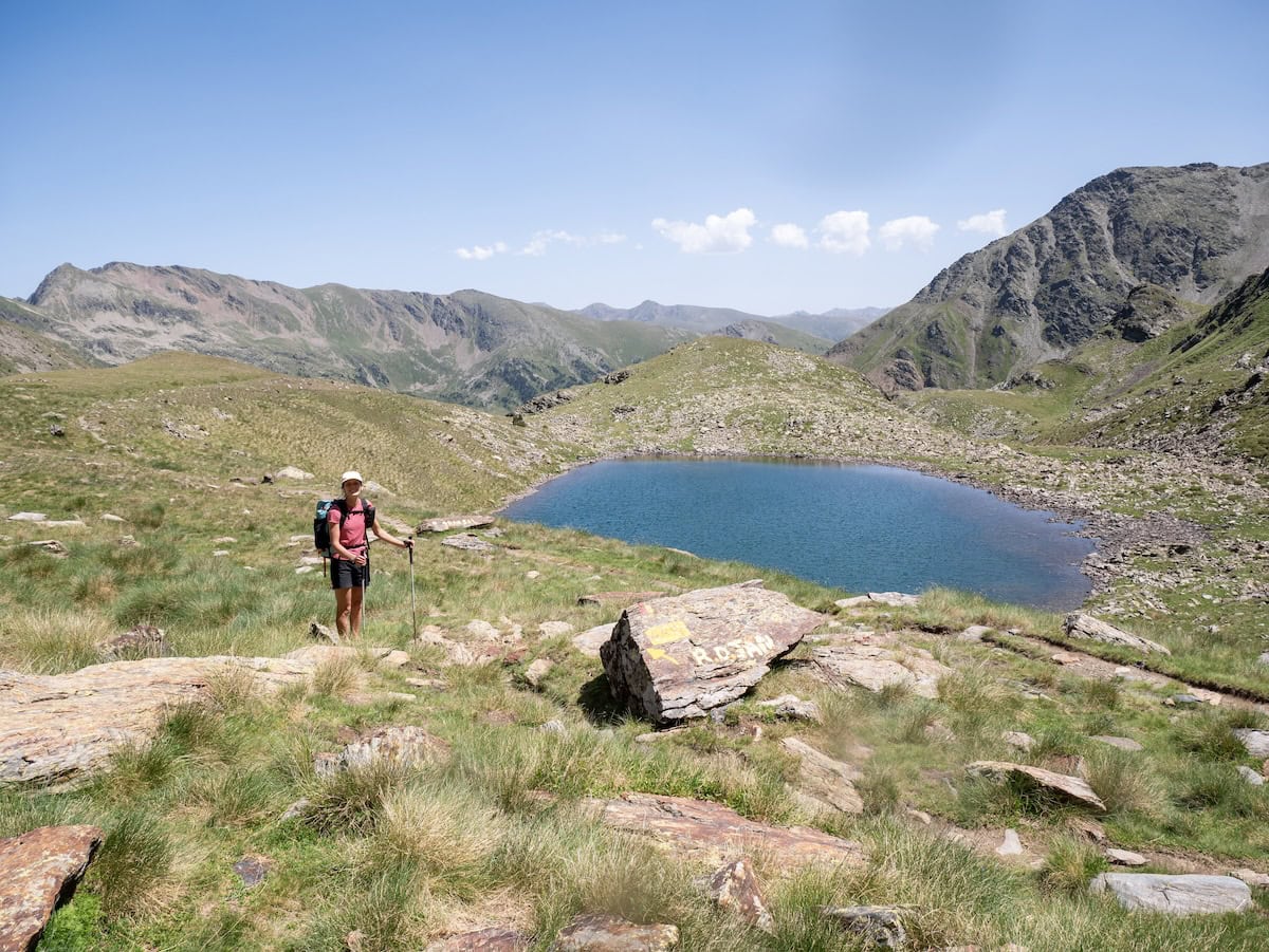
But it was time to continue. We still had 5 km to reach the day’s destination. We crossed the huge green meadow, passed by Riu dels Orris hut (a non-guarded hut), and had incredible views of the surrounding mountain peaks. Then we reached Estany de la Bova, a breathtaking turquoise alpine lake.
- Passing by the beautiful Estany de la Bova
 Taking a break on our way to L’Illa hut
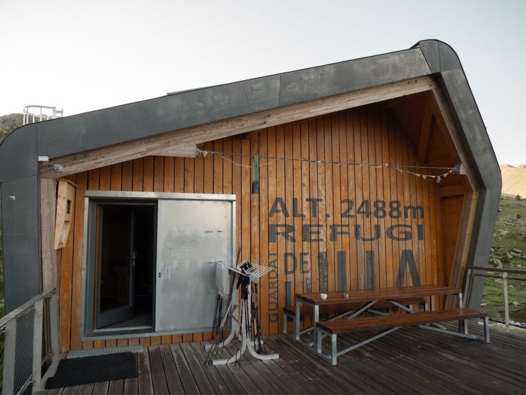
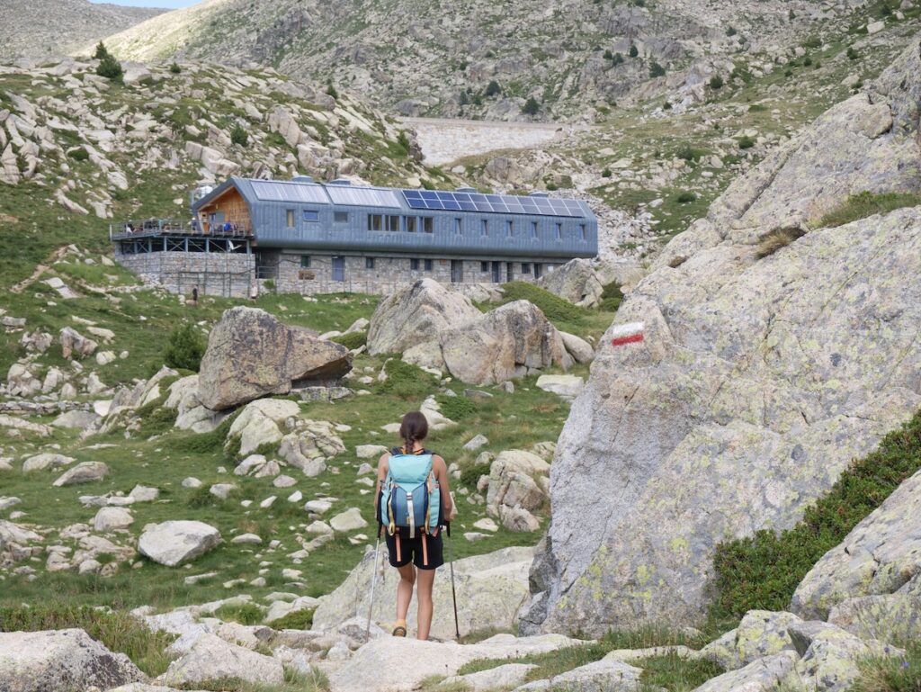
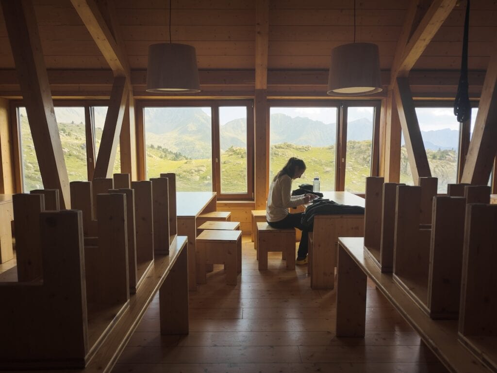
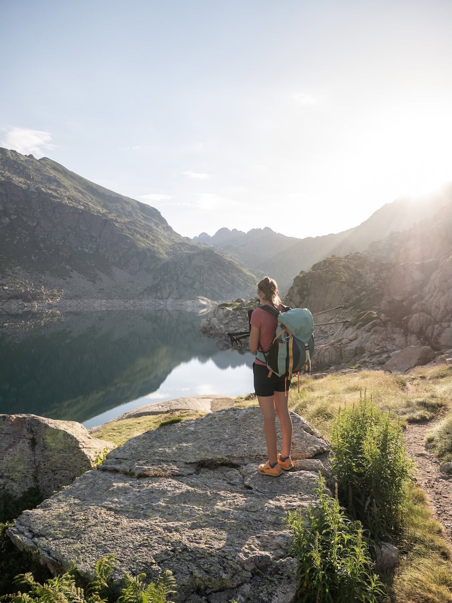
We hiked the last km, and we finally reached L’Illa hut! This is the highest guarded hut in Andorra and the newest one (they built it in 2016).
The truth is, the place is beautiful. The interior is entirely made of wood, and the views from the dining room and the bedrooms are incredible. When we were there, they had a problem with the water. We could shower (luckily!), but from 9 p.m. onward, we had to use bottled water to go to the toilet and brush our teeth because there was no running water.
The first thing we did was sit on the spacious terrace and enjoy a much-deserved drink while enjoying the views! Then, the weather changed abruptly, and it started raining, so we went inside and played board games.
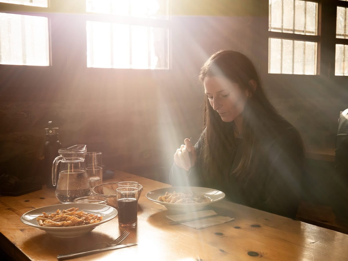
We finished the day with a nice soup, a dish of macaroni bolognese, and a piece of fruit.
- Dining room at L’Illa hut
Enjoying a drink at L’Illa hut
Bedrooms at L’Illa hut
Day 2 – Nine alpine lakes and a 2.584 m high peak
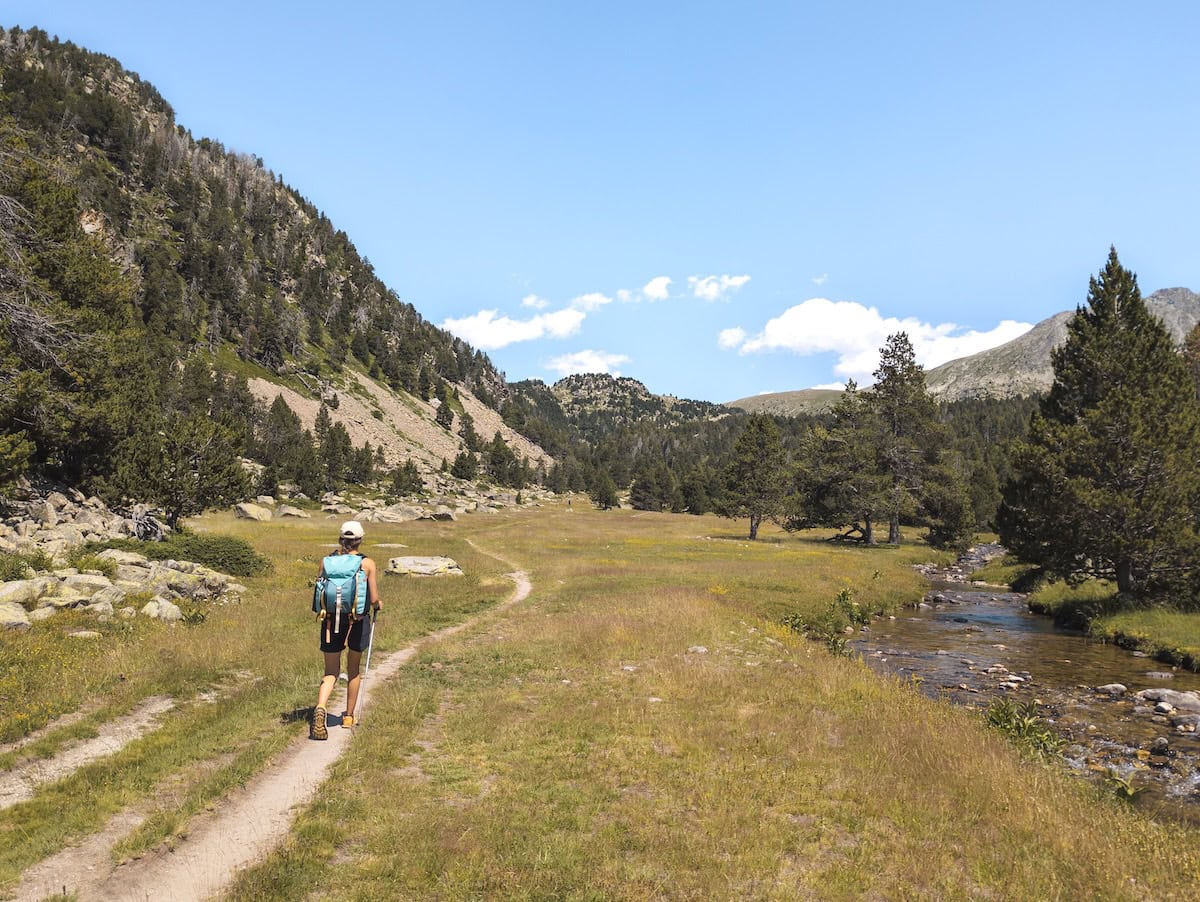
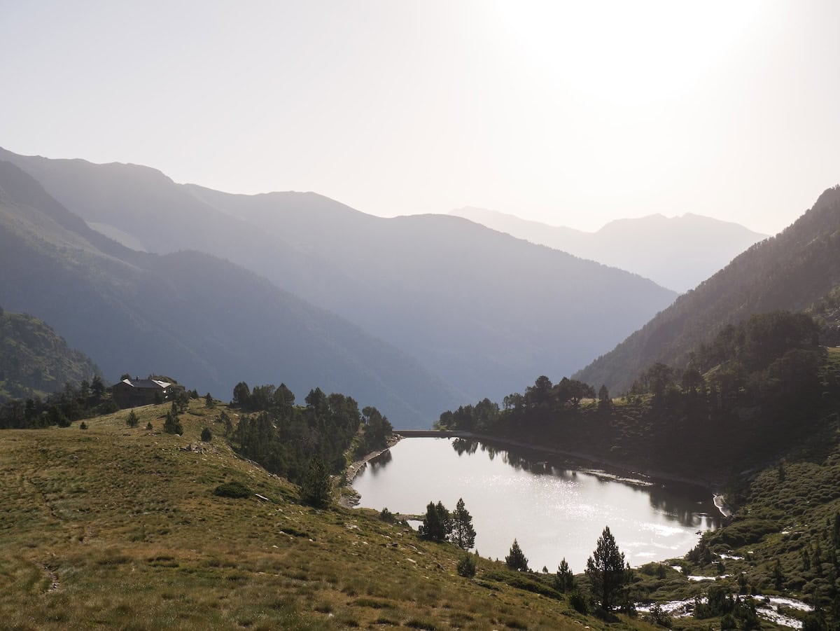
L’Illa hut to Juclar hut, 19.4 km hike, 1350 m+, 1527 m-
It was shaping up to be a long day, so we had a quick breakfast and said goodbye to L’Illa hut. We started with a gentle climb and soon reached L’Illa Lake. This dam was built between 1947 and 1955, and back then, the workers who constructed it stayed in the unguarded section of L’Illa hut. Today, the lake’s waters help power Andorra’s hydroelectric plant.
We knew we had to follow the red-and-white marks. The problem is that in L’Illa Lake, the marks diverge and go in two different directions. We took the wrong one… adding about an hour to the hike 🥲 That’s why carrying a map and paying attention to Wikiloc is helpful, as getting lost around this area is easy.
Once back on track, we left L’Illa Lake behind and started climbing to Pessons Peak, the highest point of this stage. The views were super beautiful.
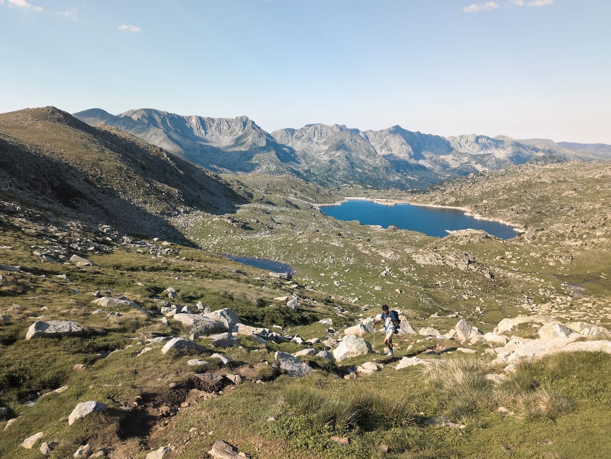
Soon after, we reached the top of Pessons Peak (2.862 m), and we had views of the entire Pessons Cirque. This granite glacial cirque is home to the largest lake complex in Andorra and is surrounded by peaks almost 3000 m high. This is one of the best views of the entire route, so take time to enjoy it!
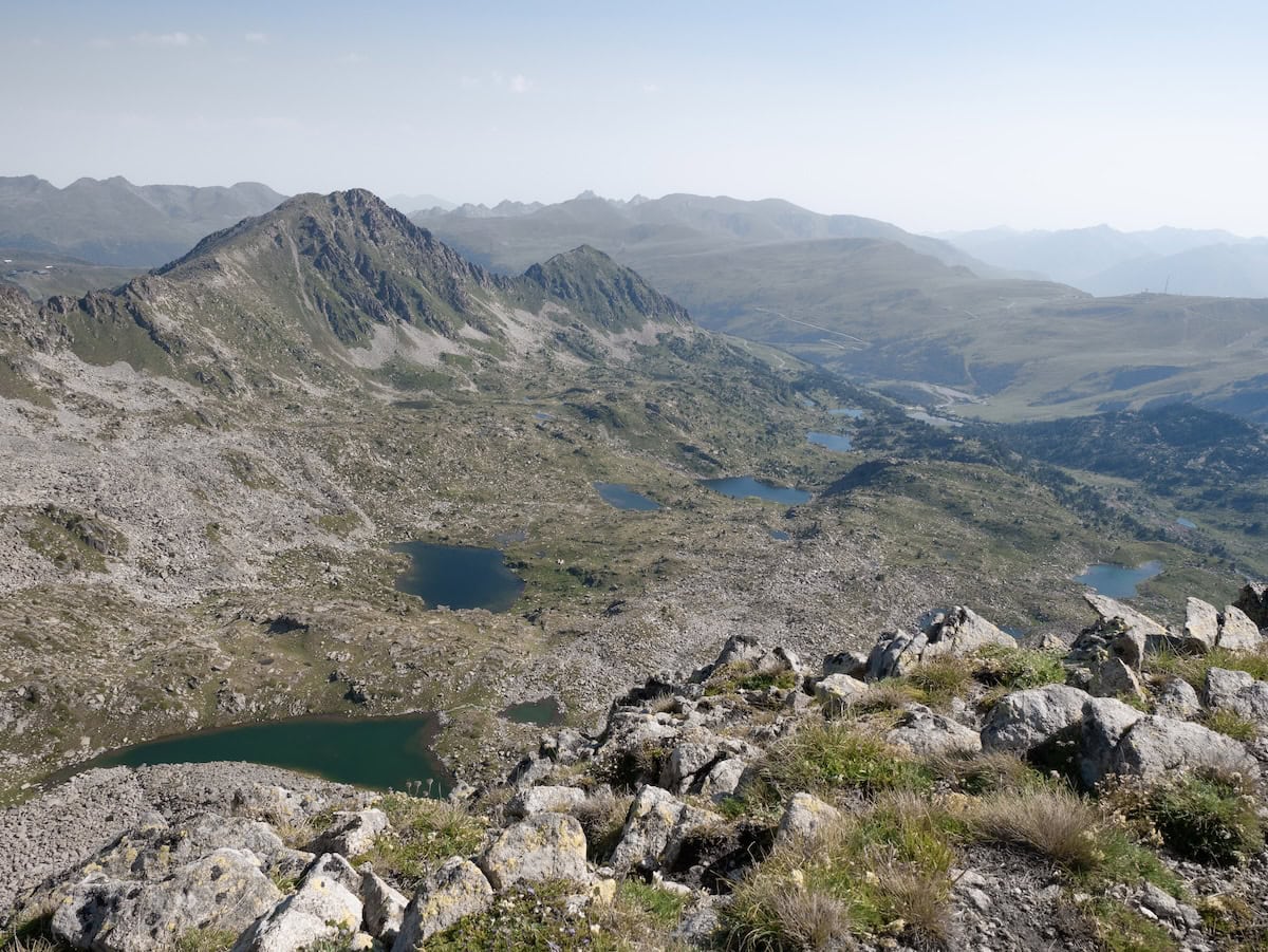
And then, we started the descent. The path followed the ridge for a while and then passed by six lakes (it doesn’t reach the highest one). So, although the descent is long, the views and the lakes make you forget about it!
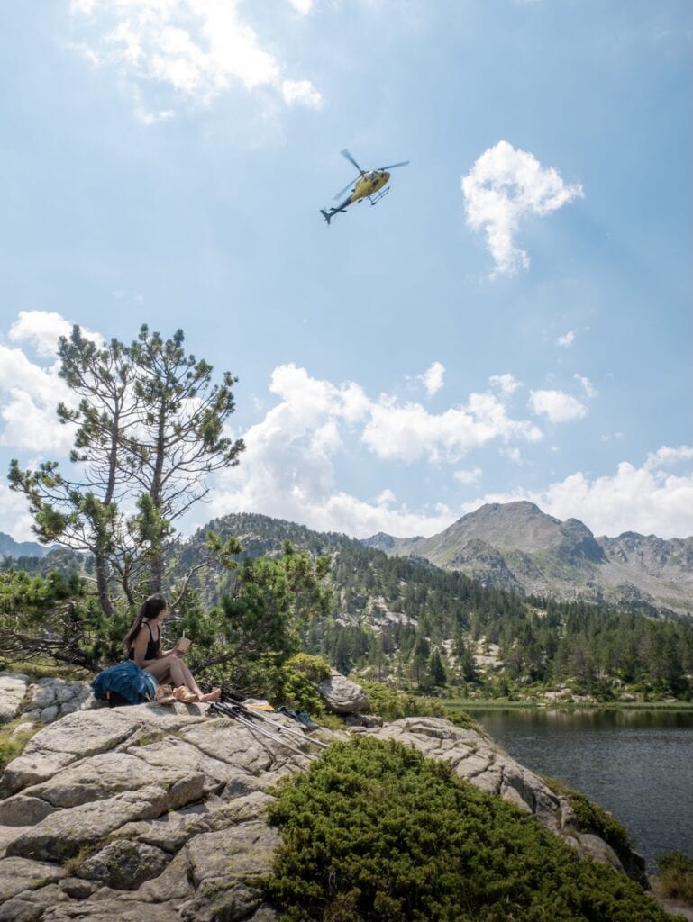
When we reached the lowest lake, we enjoyed lunch on the shore. It was really sunny, and we were super hungry, so we couldn’t ask for anything else! On this lake, you’ll also find a restaurant, in case you want to get a cold drink or some food.
- The helicopter flew above us while we enjoyed lunch
- Enjoying a couscous salad in the Pessons Lakes
With our bellies full and happy, we kept going. The next 5 km felt a bit dull since we were hiking through the Grandvalira ski resort, where the landscape wasn’t as wild or untouched. But we listened to some music and an audiobook, and we soon were on the road that connects Andorra with France. Only 10 km left to Juclar hut!
✂️ Want to shorten this route?
If you’re feeling exhausted, here is your only chance to shorten the route. Because it’s the only spot where you can catch a bus. Once you cross the road and head back into the mountains, there’s no turning back. You’ll have to hike the remaining 10 km with 650 m of elevation gain.
To cut the hike short, continue to the bus stop Bordes d’Envalira (nº 182) and take the L4 line towards Andorra La Vella. Get off at Vall d’Incles stop (nº 164), where a 6-km hike with 550 m of elevation gain will take you to Juclar hut. Check out the Wikiloc route (it’s for snowshoes, but the trail is the same).
We crossed the road and started the ascent to Ortafà III Peak (2.595 m). The trail wasn’t difficult, but we could feel the fatigue after climbing 626 m over 3 km. When we got to the peak (which was more like a hill), we were super tired. We took a short break and continued hiking as the clouds started to roll out, and it looked like a thunderstorm could start at any moment.
It was time to descend through a beautiful green meadow until the mountain pass Pas de les Vaques. From here, we had amazing views of the Siscaró Lake, which we reached in less than 1 km.
That part of the hike was super green, and even though it wasn’t sunny, it was beautiful. It was also really quiet. Since we had left the Pessons Lake, we hadn’t crossed paths with a single soul.
The trail followed the Siscaró River for a bit, and then it was time to cross the river and tackle the final 2 km that separated us from our destination.
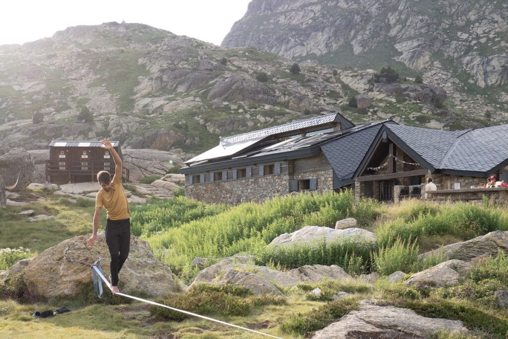
The terrain became a bit rockier, but we were distracted by the incredible views of the Incles Valley. We finally stumbled upon the Juclar Lake, Andorra’s largest lake, and reached the hut right next to it.
Juclar hut has a true mountain hut feel. We’ve been there several times, and although it’s not a super fancy hut, we love the vibes and how friendly everyone is.
6-person bedroom at Juclar hut
- Juclar hut
There’s no WiFi (which we actually loved!), but there is a great terrace where we enjoyed a cold drink and a hammock to relax in. And the surroundings are breathtaking.
The food was delicious, and dinner was a blast. We met some awesome Catalan people with whom we had nothing in common, yet we had a great time.
And so the second day ended, and it was time to rest. We had a room for ourselves, giving us a break from hearing people snoring, which was much appreciated!
Day 3 – Crossing Andorra’s most famous valleys
Juclar hut to Sorteny hut, 16.9 km hike, 1425 m+, 1771 m-
After a great night’s sleep, we had breakfast and started hiking early. The light when we left the hut was beautiful, and we could enjoy a peaceful moment at Juclar Lake, watching the mountain reflect on the water.
The trail was pleasant and comfortable. Along the way, we passed two small lakes surrounded by rocky peaks. We were still a bit asleep, and it felt like we were in a dream.
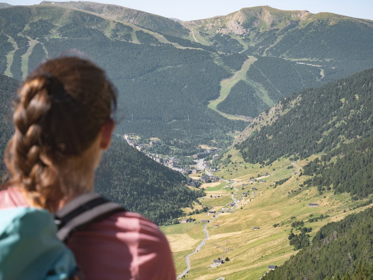
Soon, we reached a flat trail with incredible views of the Incles Valley. This is Andorra’s most famous valley and one of the most picturesque, with its stone houses, pasture fields, and the river crossing. From here, you can also spot the iconic X shape of Grandavlira’s ski slopes.
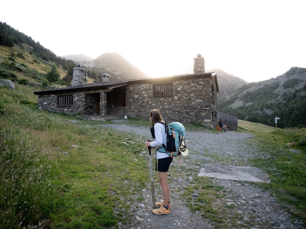
Then, it was time to descend until meeting the Manegar River. We crossed it through a little wooden bridge and started climbing for 2 km until reaching the Cabana Sorda Lake and the non-guarded hut with the same name. We took a break next to this emerald-green lake and had a chocolate bar to recharge our energy for the climb ahead.
✂️ Want to shorten this route?
If you’re feeling tired, here’s your chance to shorten the route. Descend from the Cabana Sorda Lake to the entrance of the Incles Valley (the last section of this Wikiloc route, from km 8 to 12). The hike is 4 km with 540 m of elevation loss. Then, continue to the Vall d’Incles bus stop (nº 164) and take the L3 or L4 line towards Andorra La Vella. Get off at the bus stop Consell de la Terra (nº 706). Walk one minute to the bus stop Dama de Gel (nº 709) and take the L6 bus to Ordino (get off at Càmping Ansalonga stop). Once there, take a final bus to the Sorteny parking lot. From there, it’s an easy 2-km hike to Sorteny hut (just follow the wide track next to the info point).
That way, instead of hiking the remaining 13 km with 920 m of elevation gain, you’ll hike 6 km with 240 m of elevation gain.
Keep in mind that this last bus only stops in Sorteny from the 1st of July to the 1st of September. If you want to shorten the route outside those dates, you can take the same bus and get off in El Serrat. This will add 2 km to the hike.
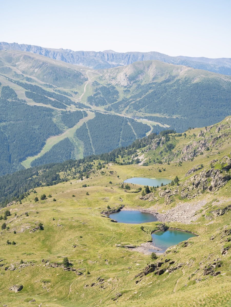
The next 2 km were hard as the path became steeper and steeper. Luckily, the views of Grandavalira’s ski slopes and Querol i Salamandres Lakes were really nice.
We finally finished one of the two toughs climb of the day and reached the mountain pass that separates Incles Valley from Ransol Valley. Time to descend again!
After 3 km, we reached the Coms de Jan hut, a non-guarded hut with a fountain outside (it was super sunny and hot, so the fountain was much appreciated!). We freshened up and took a break for lunch in the shade of the hut.
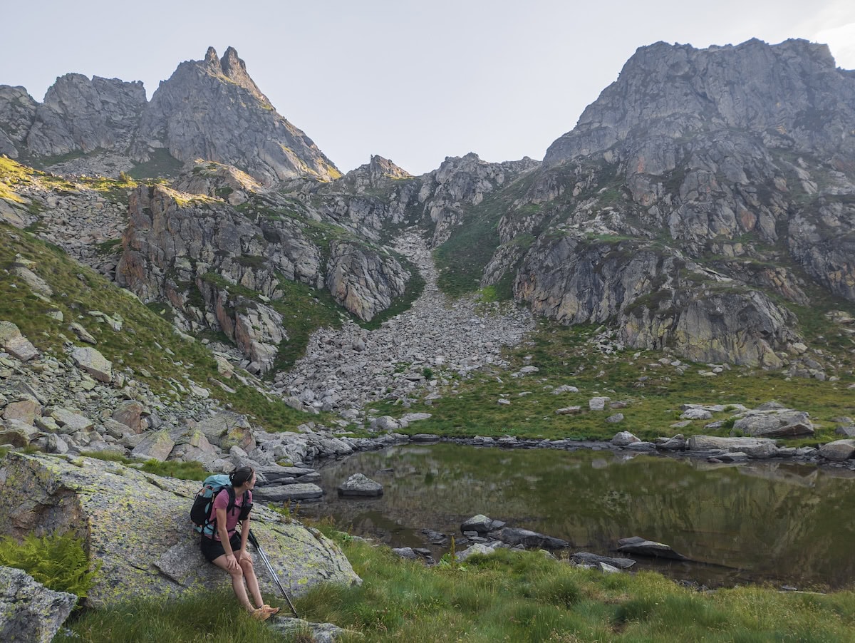
It was time to tackle the last climb of the day, and it was a hard one! The terrain wasn’t difficult, but it was long, and we were already pretty tired. Along the way, we had views of Mort Lake (translated as Death Lake, though it was actually super beautiful and not creepy at all 😅).
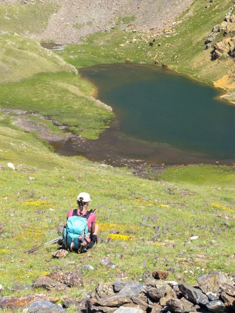
Halfway up, we passed by another alpine lake, Ransol Lake. The views from here were impressive, and we could see mountain peaks in every direction. The trees had completely disappeared, and instead, there was only green grass, rocky screes, and some alpine lakes.
Only 1 km separated us from the route’s highest point. Along the way, we had views of yet another alpine lake, Meners de la Coma Lake. And we finally made it to the highest point: the mountain pass Collada dels Meners (2.720 m). This mountain pass separates the Ransol Valley from the Sorteny Valley, and the views on both sides were breathtaking.
The toughest part of the day was over. We still had 5 km to reach the Sorteny hut, but at least they were all downhill! And it was a pleasant one.
Sorteny was declared a Biosphere Reserve by UNESCO in 2020, and you could really tell why. The area was full of colourful wildflowers, and the views were incredible.
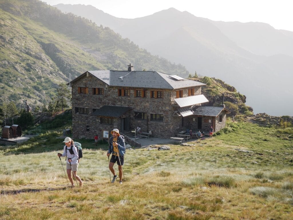
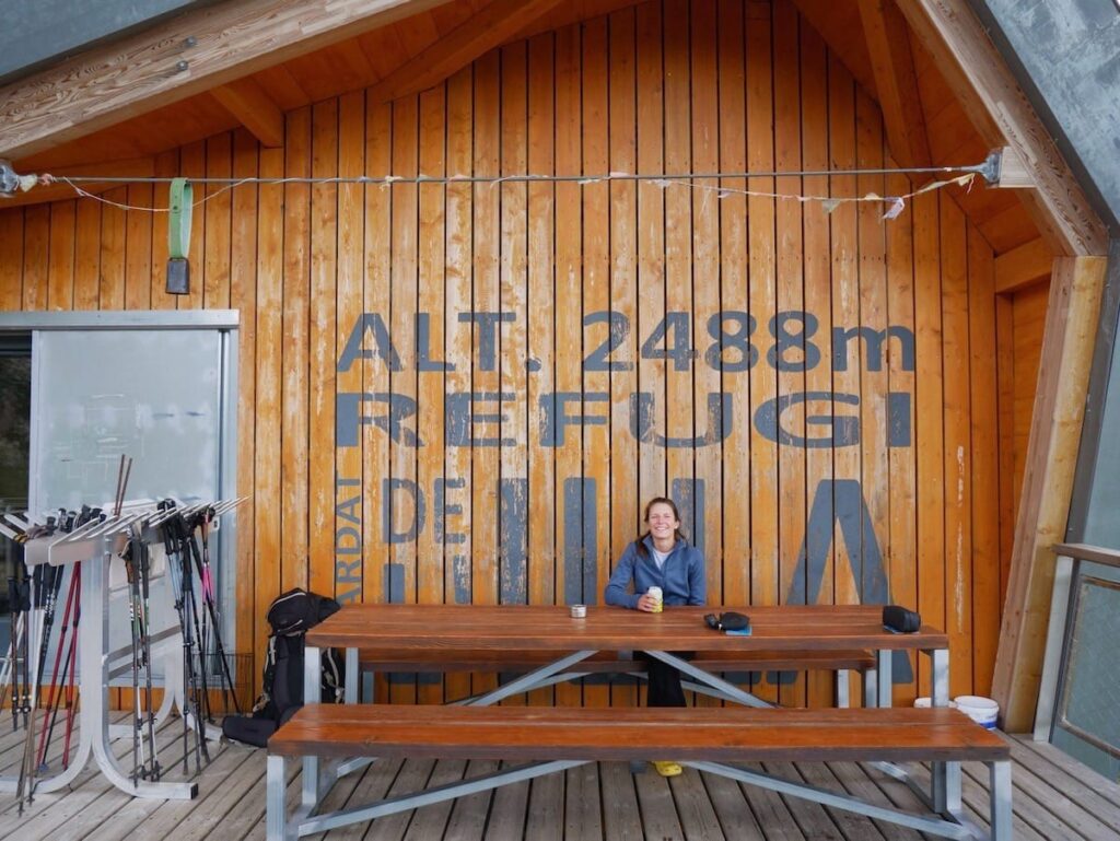
After more than 9 hours of hiking, we finally made it to the Sorteny hut! And, of course, the first thing we did was grab an ice cream and a cold drink.
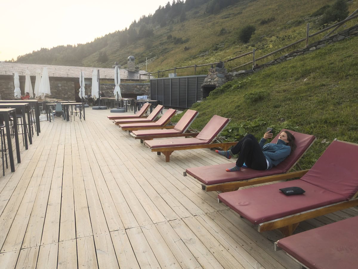
This hut feels more like a hotel than a traditional mountain refuge. It’s managed by the Grandvalira Ski Resorts team, so it doesn’t have the same family-run atmosphere as Juclar or Comapedrosa. That said, the service was excellent, the hot showers were a treat, and the overall vibe was really welcoming. We especially loved hanging out on the terrace, which has incredible views!
Day 4 – The toughest stage
Sorteny hut to Comapedrosa hut, 21.9 km hike, 1904 m+, 1608 m-
This was, without any doubt, the hardest day of all. We left Sorteny hut early in the morning and started the hike, descending through a wide, gentle path. Along the way, we passed by a botanical garden and some sculptures known as Estipagencs. These are metal bars with spiked sides, initially used to secure windows, now an emblem of the parish of Ordino.
Here, we left the main wide path and took a little one that descended through the forest.
✂️ Want to shorten this route?
If today’s stage feels too long and you’d like to shorten it, keep walking on the wide path instead of going through the forest. In less than two minutes, you’ll reach the Sorteny parking lot, where you can take a bus to Llorts. This will save you 6 km.
Keep in mind that this bus only stops in Sorteny from the 1st of July to the 1st of September. If you want to shorten the route outside those dates, you can take the same bus in El Serrat and get off at Llorts. This will shorten the hike by 4 km.
The trail followed the Rialb River and passed through El Serrat, a tiny mountain village, and Les Salines, a rural housing development. It then crossed the main road and passed by an abandoned iron mine until reaching the picturesque village of Llorts.
And then, it was time for the hardest climb of the whole route through one of Andorra’s most isolated and untouched valleys.
The climb was 5 km with 1.177 m of elevation gain. It started through a lush forest, which then gave way to green meadows as we gained altitude. The path climbed non-stop, and it was pretty tough as our legs were tired from the previous days.
From this point forward, the shade disappeared, and we hiked under the intense sun for the next five hours. We had burnt the day before, so we highly recommend using sunscreen, a hat/cap, and even long sleeves. We just had one long-sleeved shirt (which was the one I used as a pyjama), and I spent the last three days hiking with it to avoid the sun touching my skin 😅
Soon, we reached the Angonella River, and we kept climbing all the way to the Angonella Lake. The route doesn’t pass exactly by the lake, but is close by. If you still have energy, we recommend checking it out.
We sat under the only tree shade we could find and enjoyed a sandwich and some snacks before tackling the last section of the climb. We were completely alone.
We kept climbing under the midday sun. The climb wasn’t technically challenging except for the last part, which was a scree with some loose rocks. It wasn’t difficult, but you need to pay attention so you don’t slip.
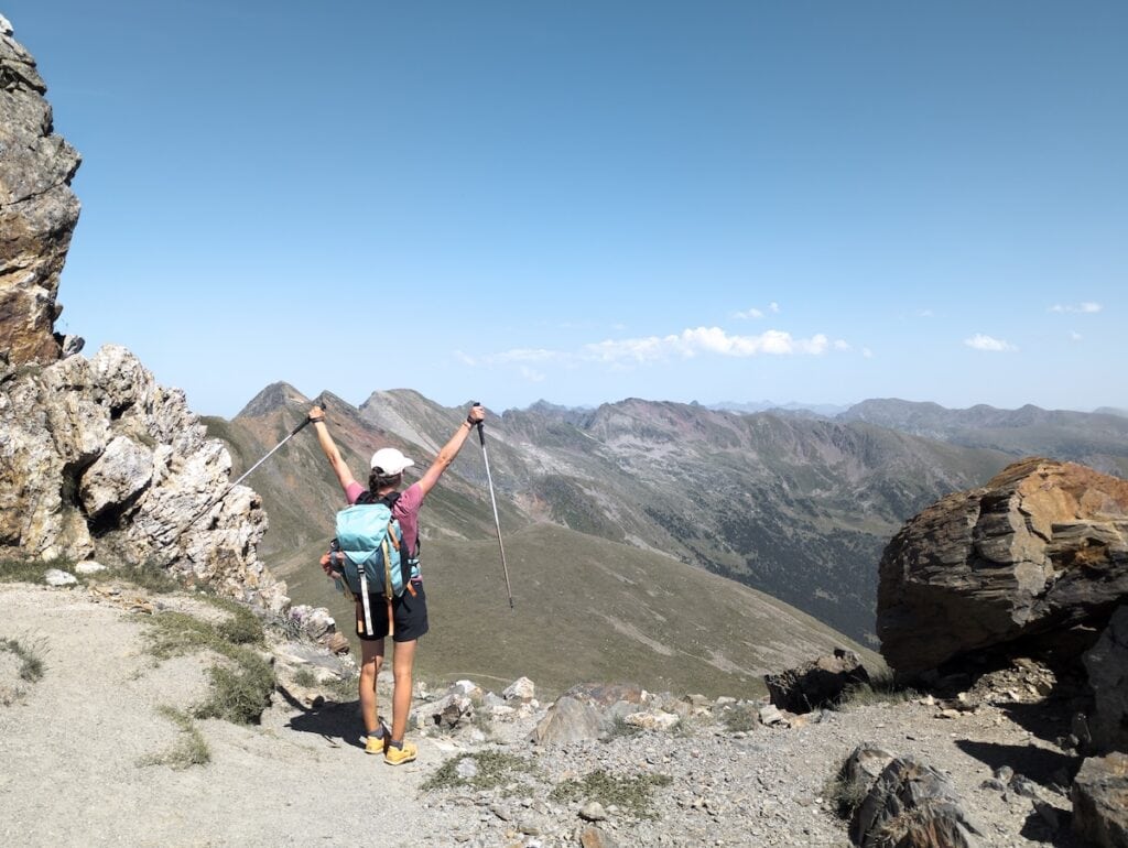
Then, we finally reached the mountain ridge that marks the entrance of the Comapedrosa Natural Park. Its name comes from Andorra’s highest peak, Comapedrosa, which is 2.942 m.
The views from here were spectacular. We could spot the Comapedrosa Peak (among many other peaks!), the village of Arinsal, and the Arinsal ski resort. It felt like we were on top of the world.
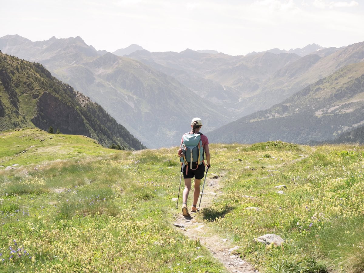
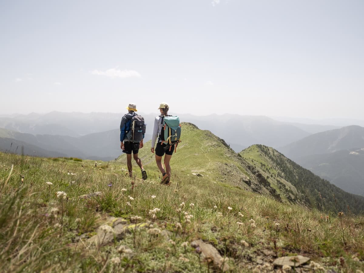
The following km were super nice as they followed the wide grassy mountain ridge with incredible views on both sides.
We passed by Clot del Cavall Peak (2.578 m) and then started the descent. We did a little detour from the trail to check the non-guarded hut known as Refugi de les Fonts, where we stopped for lunch. The hut is pretty isolated, and it has a fountain, which is great for a refreshing drink.
The path continued descending, and as we lost altitude, it flattened, and the landscape changed to a beautiful, lush forest. Soon, we reached Pla de l’Estany, a breathtaking glacial cirque with a non-guarded hut and a lake. There are usually horses roaming around, which makes the landscape even more scenic.
From here, we kept descending through the forest and then joined a broader path that took us all the way to the Moixó fountain. We were pretty exhausted by then, but we still had 3 km to reach the hut (and they were all uphill!).
After drinking some cold water from the fountain and soaking our hats, we tackled the final stretch. The truth is, the climb was beautiful, as it follows the Pollós and Comapedrosa Rivers. We really enjoyed the lush vegetation and the little waterfalls, and we couldn’t believe it when we finally saw the Comapedrosa hut after 25 km!
The hut was one of our favourites. It was spacious and rustic, and the staff was very friendly. Also, the food was to die for! We really enjoyed the macaroni bolognese, the meat stew, and the wine. And they had my favourite dessert: chocolate mousse! That was the best way to end a hard day.
Day 5 – Back to civilisation
Comapedrosa hut to Escaldes Engordany, 21.4 km hike, 716 m+, 1922 m-
The last day started with a much-needed breakfast after the not-so-good sleep (as someone in the room snored all night 🥲). This section was also pretty long, but it was mostly downhill except for the first 2 km.
We left early in the morning, and the light was beautiful. The climb was gentle, and the views were spectacular. After one km, the trail got a bit steeper, but we were still fresh, so we tackled it without any problem.
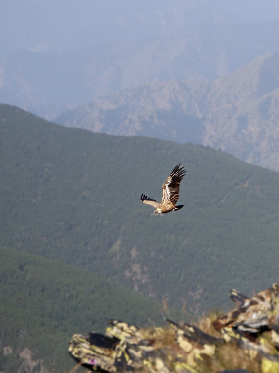
Soon, we reached the mountain pass Portella de Sanfons, a natural border between Andorra and Catalonia. We were lucky to spot a bearded vulture just when we arrived, so we sat down for a while to see if we could spot more. And we did! We saw four or five of them flying over the mountains. They were so elegant!
We really enjoyed the next km of the hike, which was a gentle descent with views of many rocky peaks. On our left, we could see the ski resort of Arinsal and, right in front of us, the Alt de la Capa Peak. Although the chairlifts and human structures made the landscape less wild, we still found it breathtaking.
The path then descended through one of the sloping sides of the Alt de la Capa Peak, which was super green.
After 2 km, we reached Coll de la Botella, a lookout with a nice sculpture known as Tormenta en una tassa de tè (storm in a teacup). The path then followed the road for less than 1 km before entering the ski resort of Pal, right next to a restaurant.
✂️ Want to shorten the route?
If you want to shorten the route, this is one of the points where you can. Once in the restaurant, keep walking on the road for 500m. Then, you’ll follow a path that unwinds through the forest all the way to the village of Pal (Wikiloc trail).
Once in Pal, go to the bus stop on the main road and take the M3 line. Get off at Serra de l’Honor and take the L5 line, which will take you to Escaldes or Andorra La Vella (choose the stop depending on where you’re staying).
The following 4 km cross the ski resort through its beautiful forests. Along the way, we crossed a couple of ski slopes and stopped for lunch right next to the bike park, where we could watch some riders practising downhill mountain biking. Pal Bike Park is one of the best bike parks in the world, and people from all over the world come here to try it, especially in summer.
- Forests in Pal
- Crossing the forests of Pal ski resort
After devouring lunch, we kept walking through the forest until we reached the mountain pass, Collada Montaner. Here, there was a beautiful meadow with lots of colourful wildflowers.
The descent from here to the village of Sispony was pretty monotonous. It was nearly 7 km long, and it felt like it never ended. We found it a bit long, and we were pretty tired. But we finally made it to Sispony, where we stopped for a snack.
The trail then left the village behind and wound through another forest, passing a river and ending at a large roundabout. This part was a bit steep, especially at the end.
✂️ Want to shorten the route?
If you’re ready to call it a day, you can catch a bus at the roundabout (L’Obac de Sispony, stop nº 401). Take line L5 or line L6 to reach Escaldes-Engordany or Andorra la Vella (choose the stop closest to your accommodation).
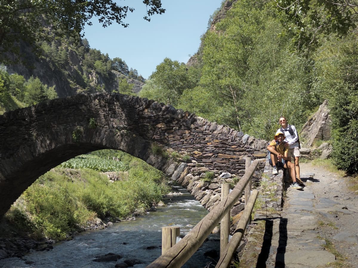
We were back to civilisation! We could see cars, human constructions, and houses again. But we still had a 3-km hike along a really nice path, known as Camí Ral, that links La Massana with Escaldes Engordany. Along the path, you pass by a little chapel known as Sant Antoni de la Grella and a stone bridge.
👌 Our tip
A few meters after the stone bridge, there is a wooden structure. This is a selfie point! Put your phone there, set the timer, and you’ll get a picture like the one below.
Finally, we arrived at the tourism office of Escaldes, the starting point of this adventure five days ago. We had finished the Coronallacs hike!
We showed them the forfeit with all the stamps, grabbed our gifts, and hurried to a bar to celebrate it with a cold drink!
Would we recommend Coronallacs?
Absolutely! It’s one of the most beautiful (and the most challenging!) hiking routes we’ve done.
We knew parts of the trail from day hikes we’d done before, but we really loved connecting them. It gave us a whole picture of the mountains and valleys in Andorra, discovering remote mountain passes and isolated forests along the way.
The landscapes were incredible, and we loved how varied the itinerary was, with charming villages, rocky peaks, and lush forests. Also, we love mountain lakes, and this route had a fair share of them!
- Coma dels Meners Lake
- Pessons Peak
 Camí Ral
Coronallacs is not a route for someone who wants to get started with hut-to-hut hiking (for that, we recommend La Travessa dels 3 Refugis). But you’ll love it if you’re a seasoned hiker with experience in high altitudes.
All in all, Coronallacs is perfect for experienced hikers who want to enjoy a multi-day hike but would like the comforts of staying in a hut, carrying less weight, and eating delicious and abundant food!
Remember to follow Leave No Trace practices. Be kind to fellow hikers, hut wardens, and the local communities. And hike on!
More hut-to-hut hiking routes in the Pyrenees
Check our “Hut-to-hut hiking in the Pyrenees: Seven stunning routes + Essential info” guide to discover more thru-hikes in the Pyrenees. We hope you enjoy them!

Really enjoyed reading about this hike. We’ve done the tour de Mont Blanc Haute Route
This seems as if not a little more strenuous
Thank you Sarb, glad you enjoyed it! Yes, I think the stages are a little bit longer and some have a bit more elevation gain, but as I mention, there’s always the option to take the bus and shorten the hikes a bit 🙂
Hello,
Are there any technical steep section where we have to use chains ?
Hey Amit! No, there aren’t.
Felicitats als dos! Molt bona info de la ruta!
I molt bon blog també!
Endavant amb el projecte i ànims!
Moltíssimes gràcies Marc! 🙂
Just finished this hike. Really appreciated the detailed information from your blog. Very helpful. It seems that your route deviated slightly from the current official route. We wondered when you did your hike and if the route has changed since then?
Congratulations on finishing the hike! So glad to hear the blog was helpful.
We did the Coronallacs route in August 2024, and the only part where our track differed a bit from the current official route was on the descent from Clot del Cavall Peak to the Carnisser mountain pass (day 4). Our route passed by Refugi de les Fonts, while the official trail takes a slightly different path there.
Were there any other sections where you noticed differences?
Considering this hike but cannot start until late September (Sept 28 onwards). Are the huts open? How is the snow situation at the upper altitudes and passes? I assume it is not the busy season
Hi Satish,
Here’s what I know about the huts:
– L’Illa hut: Open until the 1st of November
– Juclar hut: Open from June 1 to September 30, although there is the possibility of opening outside these dates under reservation. So, you should get in touch with them to ask about it.
– Sorteny hut: Open until the end of October.
– Comapedrosa hut: Open from June to September. Outside these dates, opening by reservation. So, you should get in touch with them to ask about it.
There isn’t any snow at the end of September. The first snowfall is usually beginning of Nov.
Hope this helps! 🙂