

Insane rock formations, charming tiny villages, wonderful accommodations, and delicious food – El Gran Paseo de los Puertos de Beceite is an incredible multi-day hike in one of Spain’s most isolated regions, three hours from Barcelona.
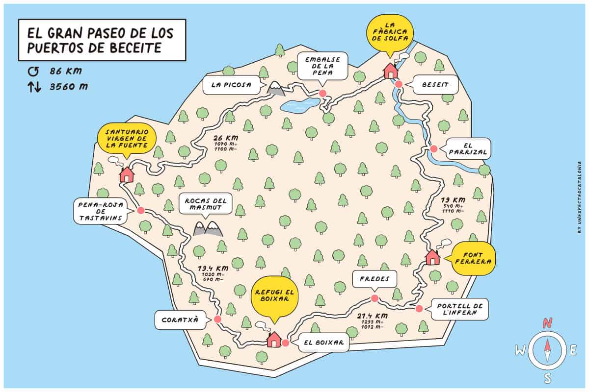
El Gran Paseo de los Puertos de Beceite (literally “The Great Walk of the Beceite Mountains”) is 86 km long and can be completed in 4 and a half days.
The circular journey links three villages and one mountain hut between Aragon, Valencia and Catalonia, so you’ll be hiking in three Spanish regions! During the hike, you stay in a mix of places: one hotel, a sanctuary from the 14th century and two mountain huts.
But, besides amazing landscapes and accommodations, the hike also has a historical side: the route follows the steps of two botanists who came here foraging in the 19th century.
If you’re into stunning landscapes, rich culture, history, and delicious food, this route is for you. The terrain is pretty easy, as it doesn’t take you into high-altitude mountains, and the best part? You don’t have to carry a heavy backpack! Your gear gets transported between accommodations, making it perfect for lightweight backpackers or anyone new to multi-day hikes.
We hiked El Gran Paseo de los Puertos de Beceite in September 2024, and it truly was a surprise. We didn’t know the area, so we had low expectations, and now, we can’t wait to go back.
Here are our review, tips, and photos to help you plan your El Gran Paseo de los Puertos de Beceite adventure.
Things to know before hiking El Gran Paseo de los Puertos de Beceite
Technical details
🥾 Total distance: 86 km
🟠 Difficulty: Moderate (the days are long, but the terrain isn’t technically difficult)
⬆️ Cumulative elevation gain: 3560 m
⏱ Duration: 4 days
🗓 Recommended season: You can hike it all year round, but the best time to enjoy it is spring and autumn. Summers are pretty hot, and winters can be cold, although it doesn’t snow in the area.
We recommend this route to people who are in good shape, used to hiking, and willing to hike 19-22 km each day with an average elevation gain of 900 m.
If you don’t have experience on long hikes, this is a great route to get started. The organisation transports your gear, so you can hike with a small backpack, making it much easier than other multi-day hikes where you must carry everything. Also, the terrain is easy, mostly through forest, and you don’t need to scramble or walk through big blocks of rock at any point.
🥾 Want to make this hike longer?
You can also turn this hike into a 7-day adventure by combining it with Estels del Sud, another beautiful hike in the neighbouring Els Ports Natural Park. We highly recommend it if you have the time because Els Ports is stunning! Just let the organizers know, and they’ll arrange everything for you.
Where does the route start?
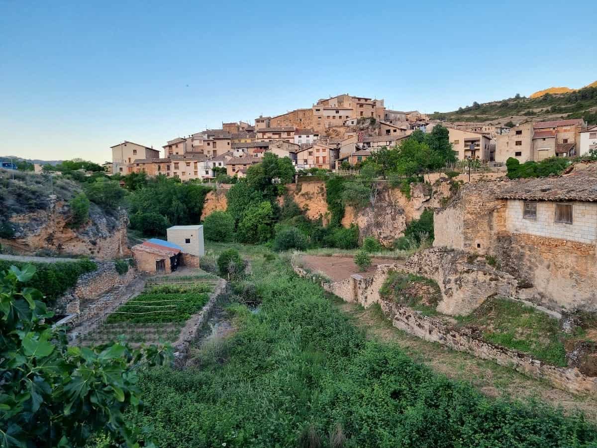
The official starting point is in the village of Beseit (Beceite in Spanish).
It takes about 3 hours to drive from Barcelona to Beseit and 2 h 45 min from Valencia. There’s free parking right in the village.
Reaching El Gran Paseo de los Puertos de Beceite by public transport
From Barcelona, it’s possible to reach Beceite by bus. The journey takes around 4 hours 15 min, and there are a couple of buses a day.
Which direction is best to follow?
As it’s a circular track, it could be done clockwise and counterclockwise.
The official route is designed to go counterclockwise, and that’s the way we did it. We recommend it too, since the climbs after the Pena Reservoir and Portell de l’Infern are much better going uphill. Doing them downhill would be pretty exhausting.
Here’s a map with the various mountain huts, their altitude, elevation gain, and distance between them to help you better plan your approach to this route.
How many days do you recommend?
El Gran Paseo de los Puertos de Beceite is designed to be completed in 4 days. All stages are between 19 and 26 km with more than 500 m of elevation gain.
We highly recommend spending the first night in Beseit, as we did, because the restaurant at the hotel where we stayed was incredible! So, we designated one day to travel, explore the village of Beseit (which is very pretty), and sleep there. This was the best option for eating well and resting before starting the hike.
To us, the best way to plan this hike is:
- Day 1: Travelling from your destination to Beseit and spending the night there
- Day 2: Hiking the first stage (Beseit to Pena-Roja de Tastavins)
- Day 3: Hiking the second stage (Pena-Roja de Tastavins to El Boixar)
- Day 4: Hiking the fourth stage (El Boixar to Font Ferrera hut)
- Day 5: Hiking the fifth stage (Font Ferrera hut to Beseit)
👌 Our tip
If you’re driving to Beseit, you can easily head back to Barcelona or your next stop after the hike. But if you’re using public transport, Day 5 can be a bit rushed since the last bus leaves Beseit in the early afternoon. So, it’s a good idea to add an extra night in Beseit to make things more relaxed.
Is the route marked?
Some parts of the route follow the GR marks, which are red and white lines. But some other parts aren’t marked at all.
Following the track at some points can be tricky, like when descending to the Pena Reservoir. So, it’s crucial to pack a map of the area and also download the GPS track of the route. You’ll get a map of the route when booking the hike online.
🧭 Wikilock track
Here’s the Wikilock track of the route. We also have the tracks divided by days:
The accommodations on El Gran Paseo de los Puertos de Beceite
The four accommodations along El Gran Paseo de los Puertos de Beceite were honestly one of our favourite parts of the route.
Each one was very special and unique in its own way, and we loved the variety of styles and luxury.
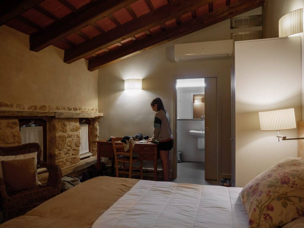
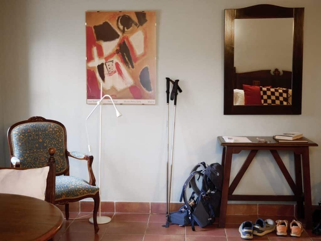
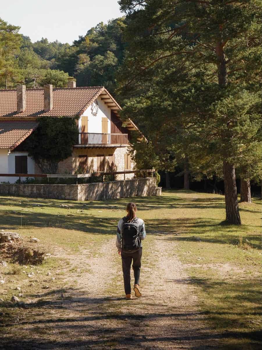
The first accommodation was La Fàbrica de Solfa, an old paper mill turned into a cosy family-run hotel. The decor was rustic, the rooms spacious, and the food was SO good! The staff was super friendly, too.
Next up was Santuario Virgen de la Fuente, a 14th-century sanctuary that’s now a small hotel with just five rooms. We’d never stayed in a sanctuary before (this one isn’t used for religious purposes anymore), and it was a great experience! We had dinner in the cloister, relaxed by the fireplace, and explored a chapel with Gothic ceiling paintings. The woman in charge also explained to us many fascinating facts about the place.
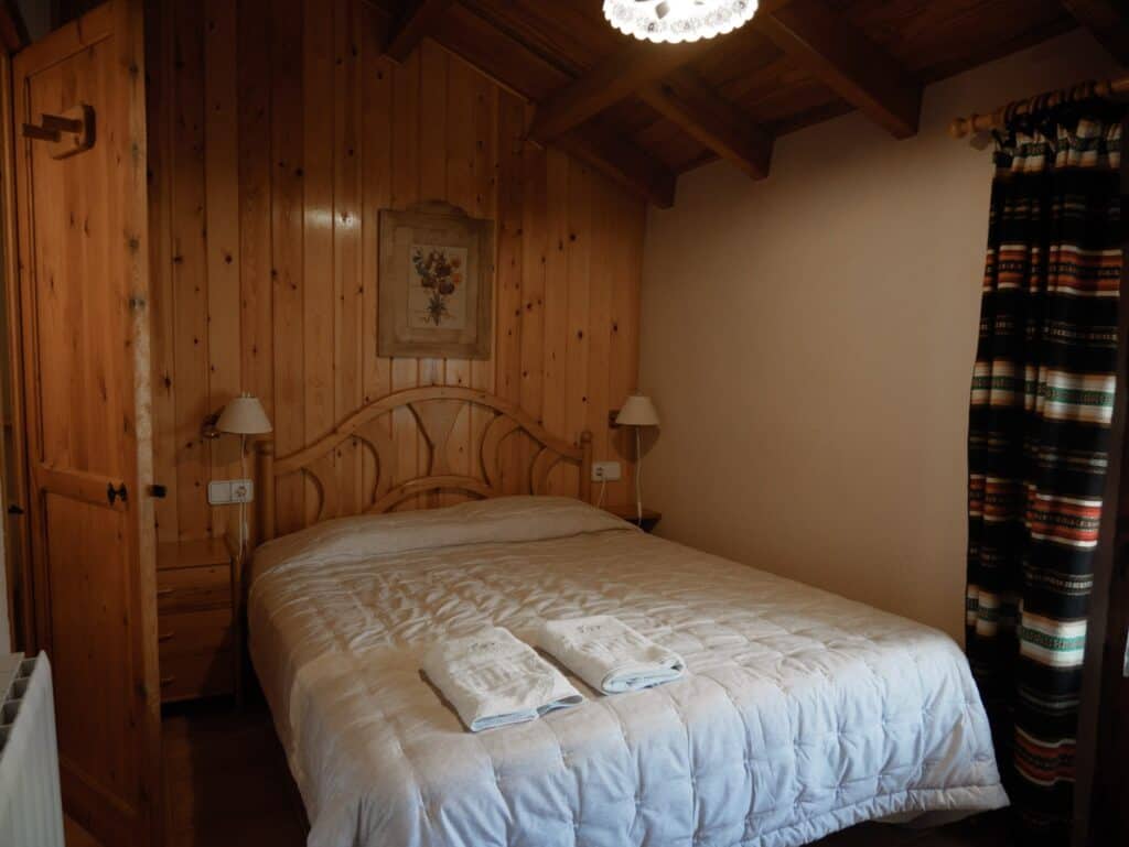
The third accommodation was Refugi El Boixar, a mountain hut in the middle of the small village El Boixar. Joel, the owner, welcomed us like family from the moment we arrived, and he’s an awesome cook!
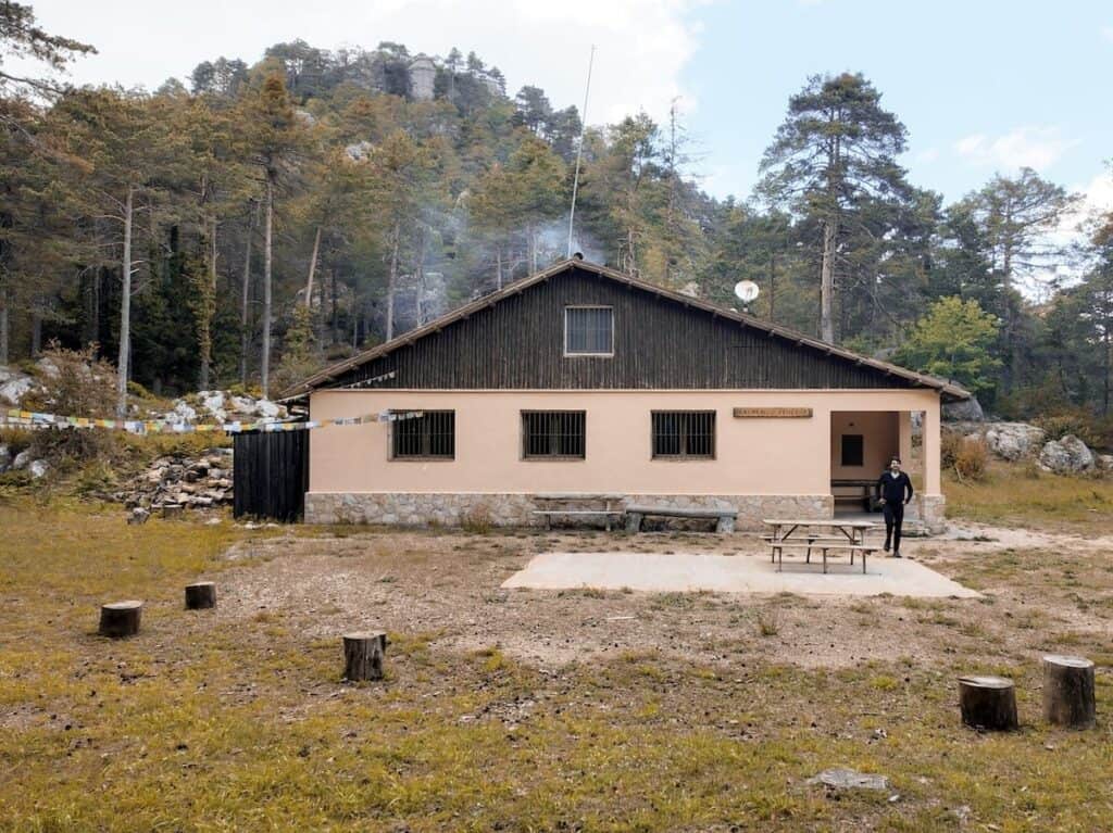
And the last one was Refugi Font Ferrera, another mountain hut, this time in the middle of the forest. This one resembles more the idea you might have of a mountain hut, with basic facilities but all the necessary things to spend a comfy night. Here, you leave your backpack at the entrance and eat meals at communal tables (which was great to meet people!). Moisès, the owner, made sure everyone had a great time and served up delicious food and even some rice and coffee liquor shots!
Remember that the two huts aren’t mountain hotels, so their schedules and rules need to be respected. For example, dinners usually start at 8 pm, so they recommend arriving before 7 pm.
All the accommodations except for Font Ferrera have double rooms. At Font Ferrera, you’ll be sharing one of the two dorm-style rooms with others, but it’s usually not crowded.
⚠️ Important!
Don’t forget to pack bed linens for Font Ferrera! They provide blankets and pillows, but you’ll need to bring your own sheets or a sleeping bag.
 La Fàbrica de Solfa
- Santuario Virgen de la Fuente
- Refugi El Boixar
 Refugi Font Ferrera
Cost of hiking El Gran Paseo de los Puertos de Beceite and how to book it
Use the El Gran Paseo de los Puertos de Beceite organisation website to book the hike.
The cost of the hike is 460 € and includes:
🛌 Four nights with half-board
🧳 Luggage transport between accommodations
🎽 A shirt
🗺️ A map of the route
💬 A briefing meeting
On the first day, during the briefing, Alberto (the route’s designer) will walk you through the itinerary and share some history, along with a few tips to keep in mind.
⚠️ Important!
Remember to bring cash. The Font Ferrera hut doesn’t accept card payments, so having some money with you is important if you want to enjoy a cold drink after a long day of hiking!
Weather and gear recommendations
The area where this route takes place has hot summers, cool winters, and mild spring and autumn seasons. It’s warmer than the Pyrenees and doesn’t get much rain.
When we were there, it was pretty windy for a couple of days, which the locals said was totally normal. So, it’s a good idea to pack a windbreaker and a jumper or fleece layer.
We also suggest bringing a waterproof jacket, pants, and a backpack cover. You can keep these in your main luggage and move them to your daypack if rain is forecast.
For your daypack (20 L), it’s wise to add a few safety items, like an emergency blanket and a first aid kit.
Pack sunglasses, a hat (or a cap), and sunscreen (reef-friendly!). There are several sections of the route where there isn’t a single shade.
It’s also essential to take a bag with you to put all the trash there. You can throw it at the accommodations or the villages you find along the route. Please take care of the environment and leave no trace.
And finally, we highly recommend packing earplugs! Just in case your neighbour starts snoring in the Font Ferrera hut. And a set of clothes only for the accommodation. There is nothing like reaching the accommodation all sweaty, taking a shower, and putting on some clean, warm, and cosy clothes!
🌦️ Where to check the weather
You check the weather forecast for the days you’re hiking on the local Meteo website.
Phone service
There’s no phone service in some parts of the route, so it’s a good idea to let your family or friends know you’re on this hike so they don’t freak out if you go silent for hours 😂. But don’t worry—all the accommodations have WiFi.
If there’s an emergency, you can call 112, which has good coverage along the hike.
Food
🍽 Breakfast and dinner
Breakfast and dinner are included in the price of the route, and after a full day of hiking, dinner is something to really look forward to!
The truth is that we loved all the food we ate during this hike, which was mainly local products. Joel cooked us some mushrooms he’d picked the previous year, and Javi from La Fábrica de Solfa treated us to a delicious fig jam made from figs in his own garden.
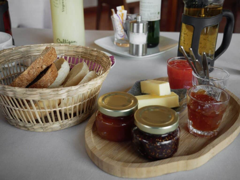
Dinners were three courses and super filling. Breakfasts were usually bread with cheese, cured meats, and homemade jams, plus coffee and tea.
- Breakfast at Santurario Virgen de la Fuente
- Dinner at Santurario Virgen de la Fuente
- Dinner at El Boixar
- Dinner at La Fàbrica de Solfa
⚠️ Important!
If you have a food allergy or dietary requirements (vegetarian, vegan, gluten-free, etc.), please say so when booking the hike. The accommodations will accommodate your requests and make the necessary changes.
However, remember that sometimes the hut’s resources are limited, and the special meals can be less varied. For example, vegetarians may only be able to choose between cheese or jam for breakfast. In contrast, non-vegetarians have more options, such as various cured meats.
🥪 Lunch
You can buy lunch at various places along the route: you’ll find grocery stores in Beseit and Pena-Roja de Tastavins, and you can also buy a picnic at El Boixar and Font Ferrera huts.
🥜 Snacks
We also recommend you bring some extra snacks for the route, like nuts or energy bars. Think about foods that don’t spoil quickly and take up little space.
If you don’t want to bring them from home, you can also buy them in Beseit or Pena-Roja de Tastavins.
Water
When it comes to water, we recommend you take two reusable water bottles of 0.75-1 L with you. You can refill the water bottles in all the accommodations.
We recommend ensuring you have enough water before leaving the huts (both for drinking and refreshing yourself when it’s really hot).
⚠️ Important!
Swimming in the rivers and natural pools is strictly forbidden, except for the ones designated as a swimming space. You’ll find signs on those.
Gran Paseo de los Puertos de Beceite route
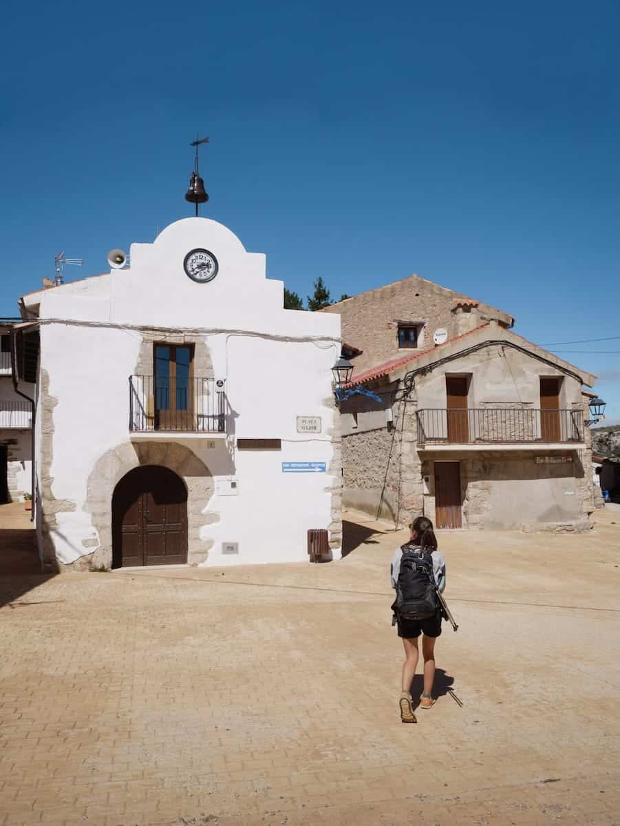
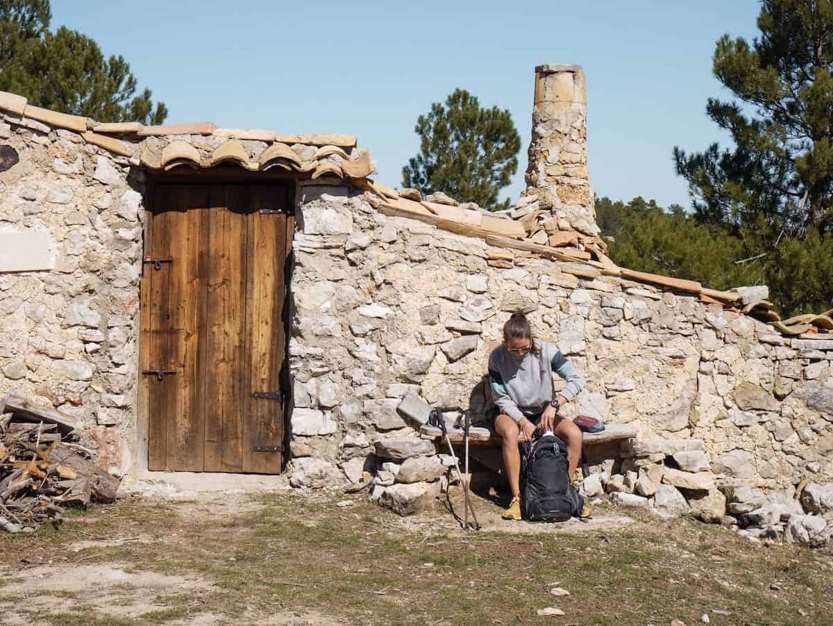
Day 1 – Exploring Beseit and getting ready
We reached Beseit by car and got to the village around 5 pm. We checked in La Fàbrica de Solfa and then went to explore the charming village and buy some snacks at the grocery store.
Around 8 pm, Alberto (the route’s organiser) explained the hike, walked us through the parts we had to pay attention to, and mentioned some interesting historical facts.
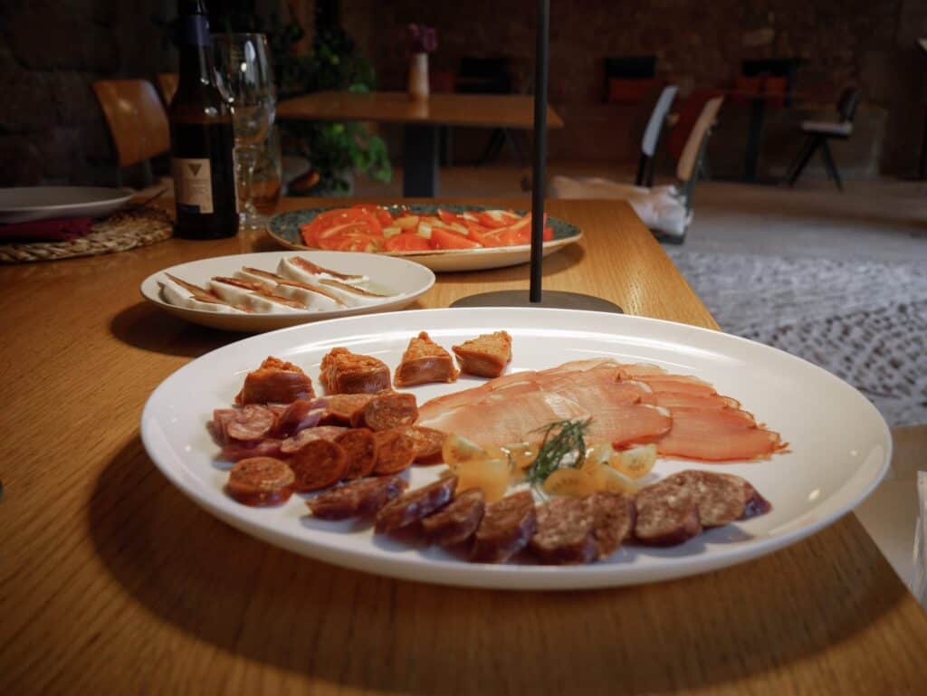
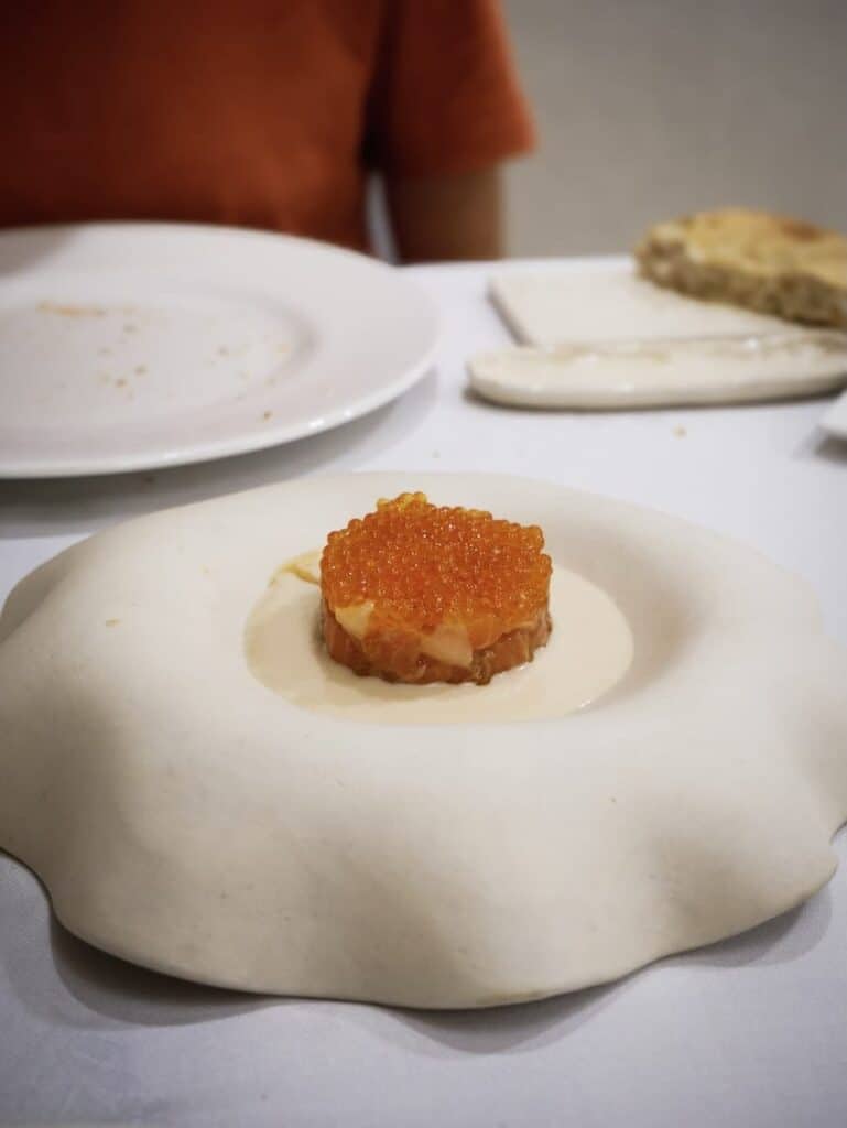
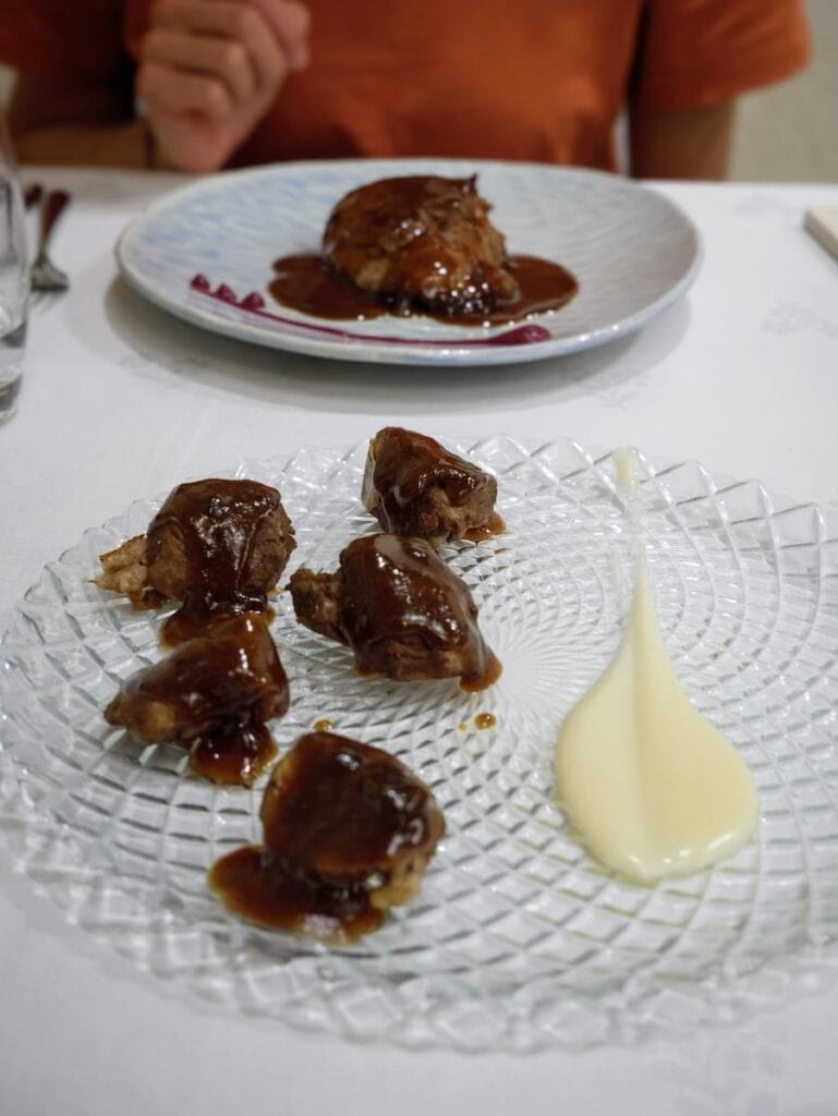
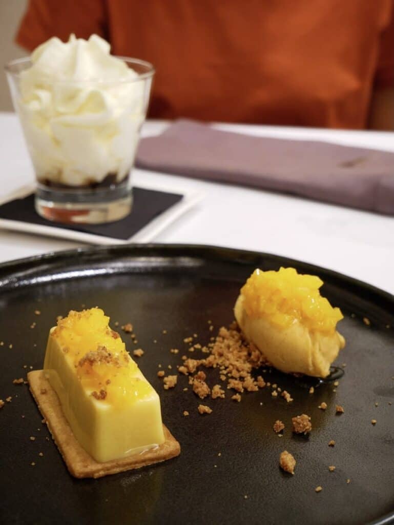
With everything clear, it was time to eat! The service and food were exceptional. We could choose several dishes from a menu, and we enjoyed delicious Serrano ham, a trout tartare, Bluefin tuna cheek, Duroc pork stewed with green curry, and peach and cinnamon crumble and a piña colada as dessert.
 Trout tartare
- Durok pork stewed with green curry
- The delicious desserts
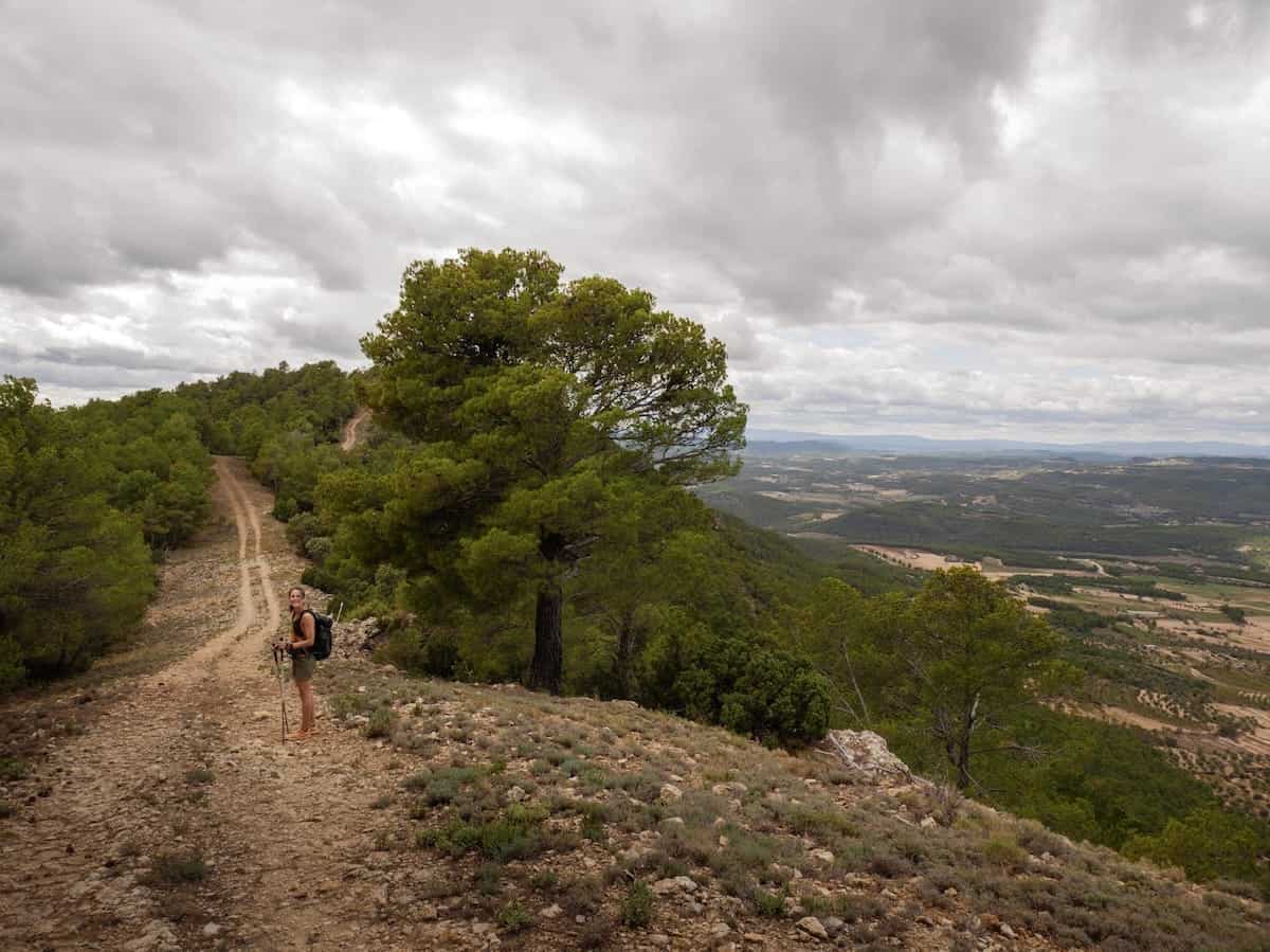
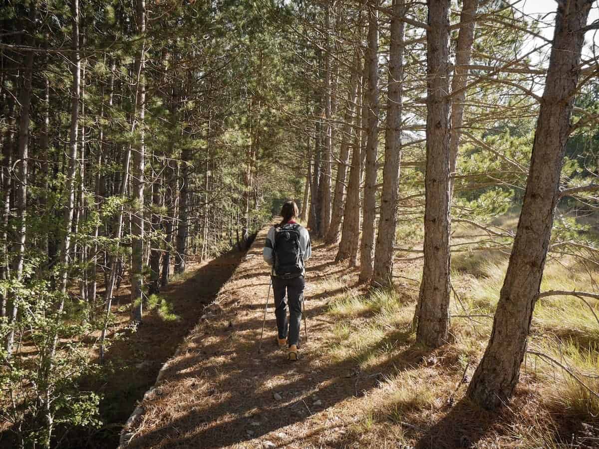
Day 2 – The longest one (with amazing views!)
Beseit to Pena-roja de Tastavins, 26 km hike, 1070 m+, 1100 m-
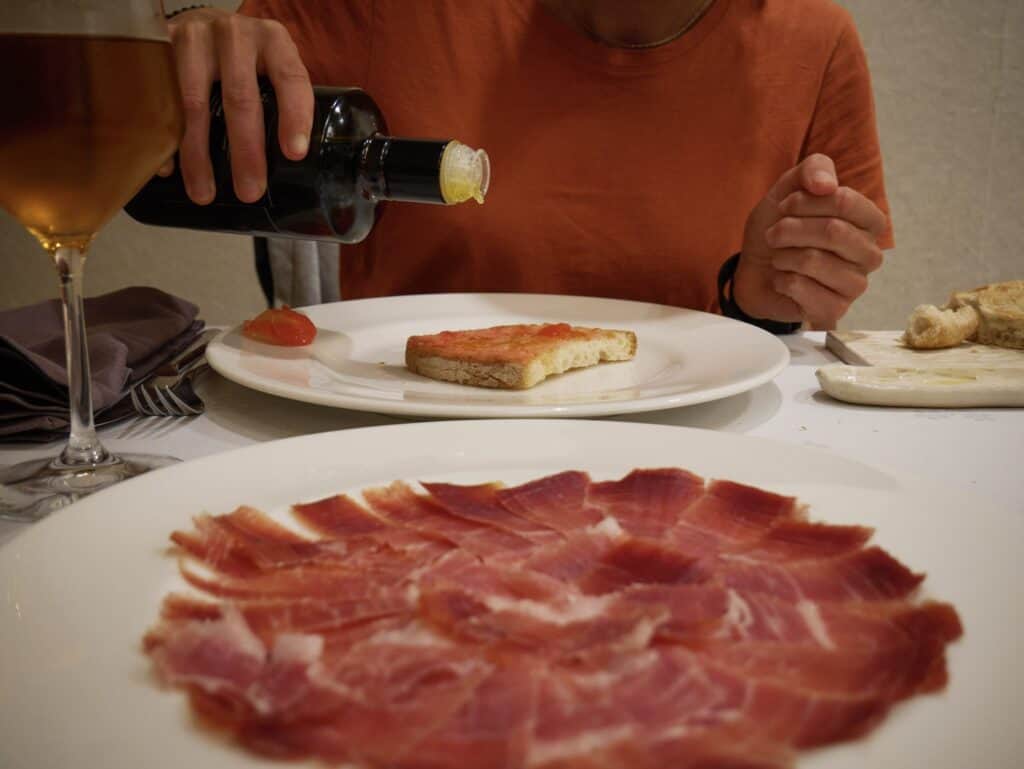
After a great night’s sleep, we kicked off the day with an excellent breakfast: pa amb tomàquet (bread rubbed with tomato, Catalan style!), cured meats, cheeses, an omelette, homemade jams, local pastries, fruit, and fresh orange juice.
Once we finished, we grabbed our daypacks and started the longest stage of the hike. The day was cloudy and a bit windy but still warm.
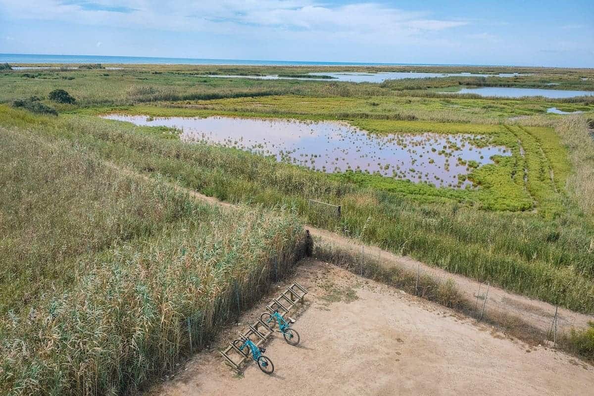
Leaving Beseit behind, we began to climb. Soon, we had stunning views of the Pena Reservoir and a mountain with a curious shape that locals call La Caixa (The Box). We could also see La Picosa, the mountain behind the reservoir that we’d soon be climbing!
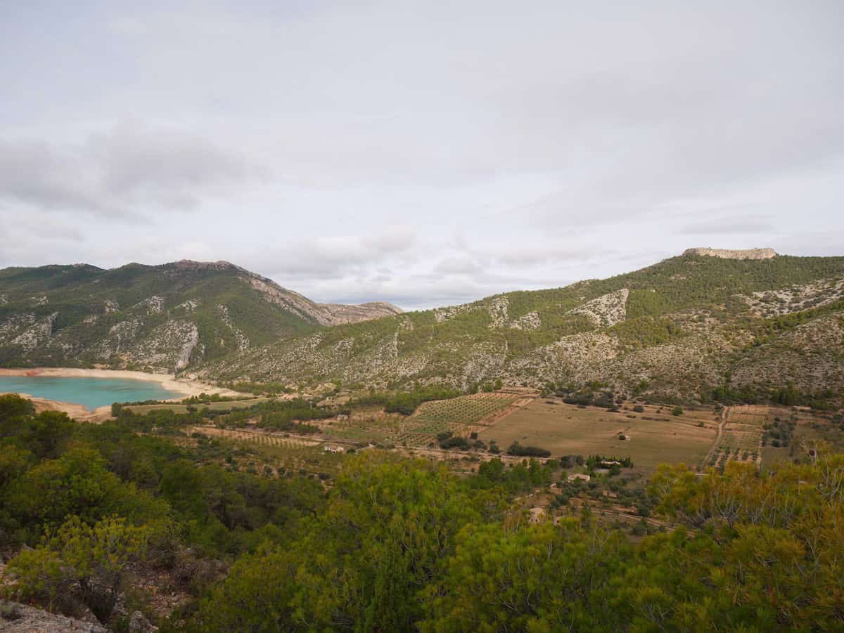
After soaking in the views, we descended to the reservoir, took a quick break, and picked some blackberries. The trail continued through a cool tunnel and then followed a stream.
Next up was the toughest climb of the day: a 450 m ascent to La Picosa Peak. Luckily, the amazing views distracted us from how tired we were, and before long, we reached the highest point.
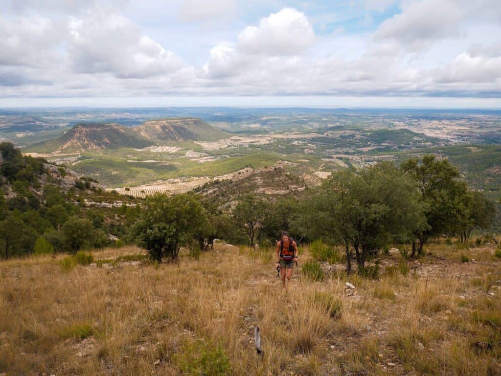
After about half an hour of climbing, the trail levelled out and followed the mountain ridge for a while. The ridge wasn’t rugged or exposed. It was wide and easy to walk along.
Don’t forget to check out the views on both sides; they’re breathtaking!
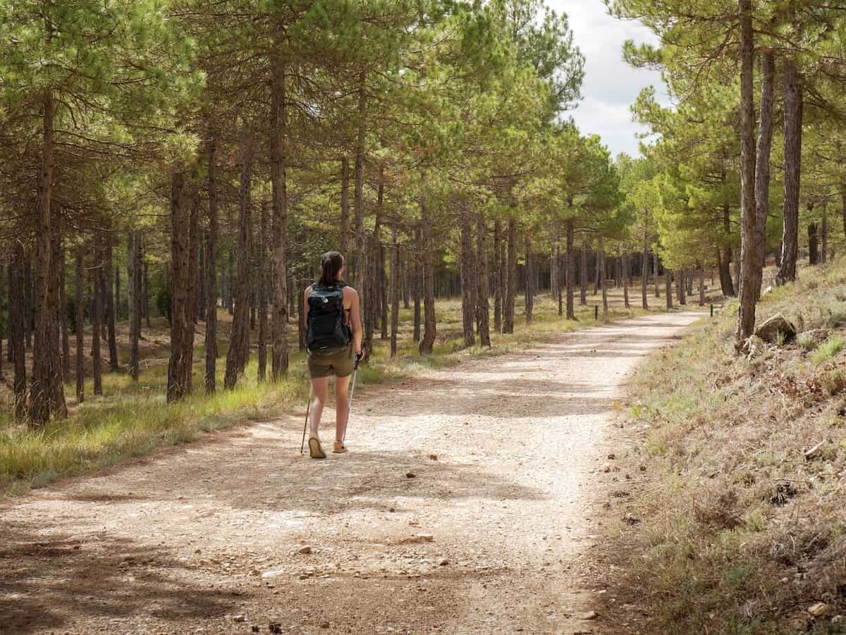
After about four km, we left the ridge and entered a forest, where we stopped for lunch. The trail was mostly a wide path through the forest, though there was a short section with asphalt.
Then, it was time to descend through the lush forest. The terrain was nice and easy, and we made quick progress while chatting and enjoying the greenery.
Once the descent was over, we joined a wide path and soon came across the abandoned village of Los Prados. The houses were in ruins, and with the cloudy weather, the place had a bit of a spooky vibe.
Here, the vegetation got pretty thick, and the trail wasn’t very clear, so make sure to follow the navigation app closely to avoid getting lost.
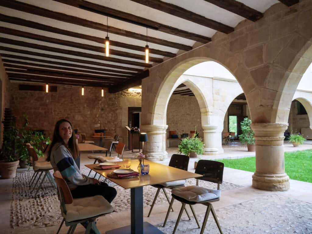
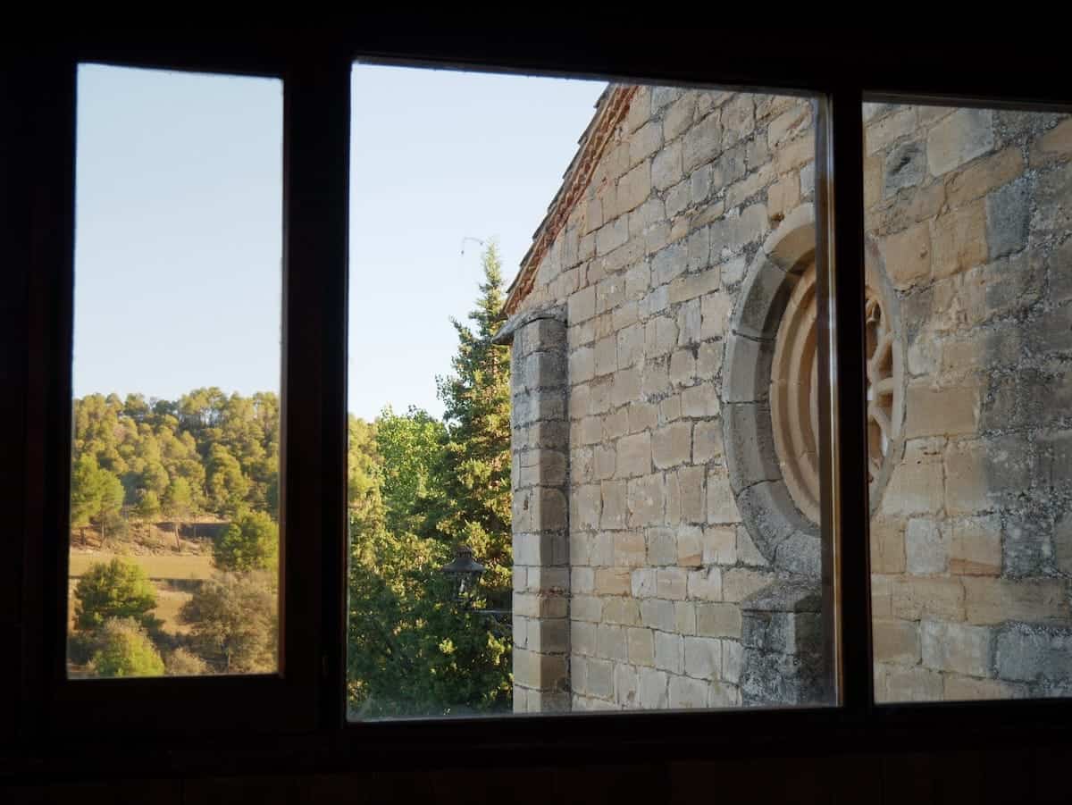
We crossed the Los Prados River (which didn’t have much water) and continued along the path with the river on our right for about three more km. It felt like a long stretch, but we kept going and finally reached the beautiful Virgen de la Fuente sanctuary, where we’d be spending the night.
✂️ Want to shorten this section?
You can skip the climb to La Picosa Peak by taking an alternate path that goes around the reservoir. This option significantly reduces the elevation gain.
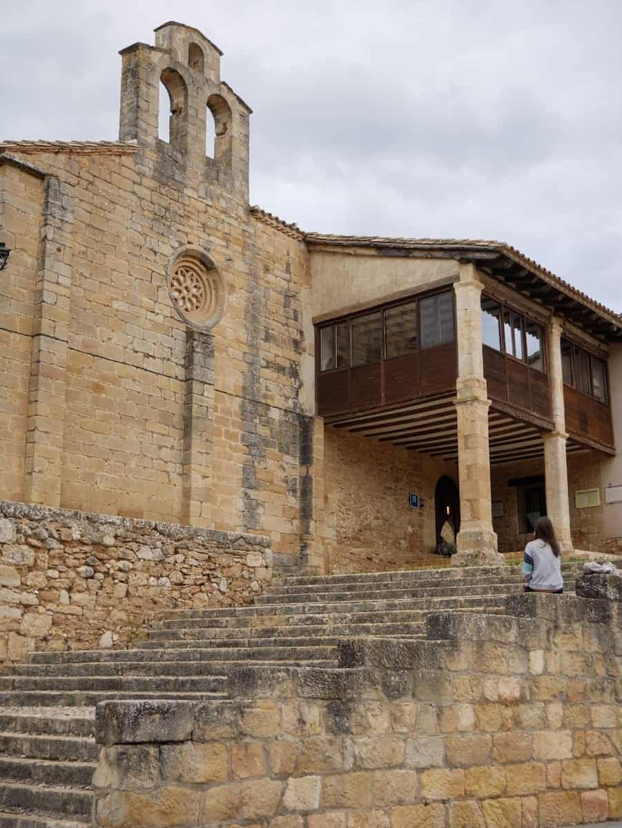
This sanctuary was built in the 14th century, and because so many pilgrims visited, it was turned into a small lodging with just five rooms.
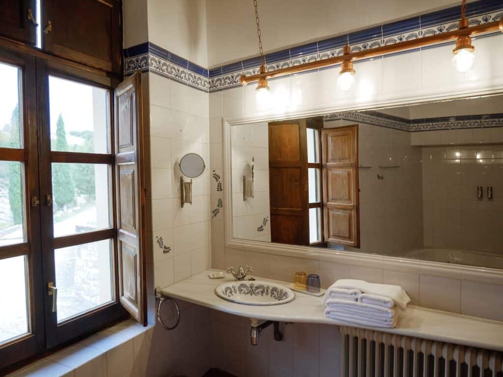
We stayed in the suite, and it was amazing. The room was spacious, with rustic decor, and the bathroom was huge. As soon as we saw there was a bath, we filled it up and spent a relaxing evening soaking. Such a perfect way to unwind after a long day of hiking!
We then explored the surroundings and read for a while near the fireplace in the cosy living room.
- The spa-like bath
- Suite room
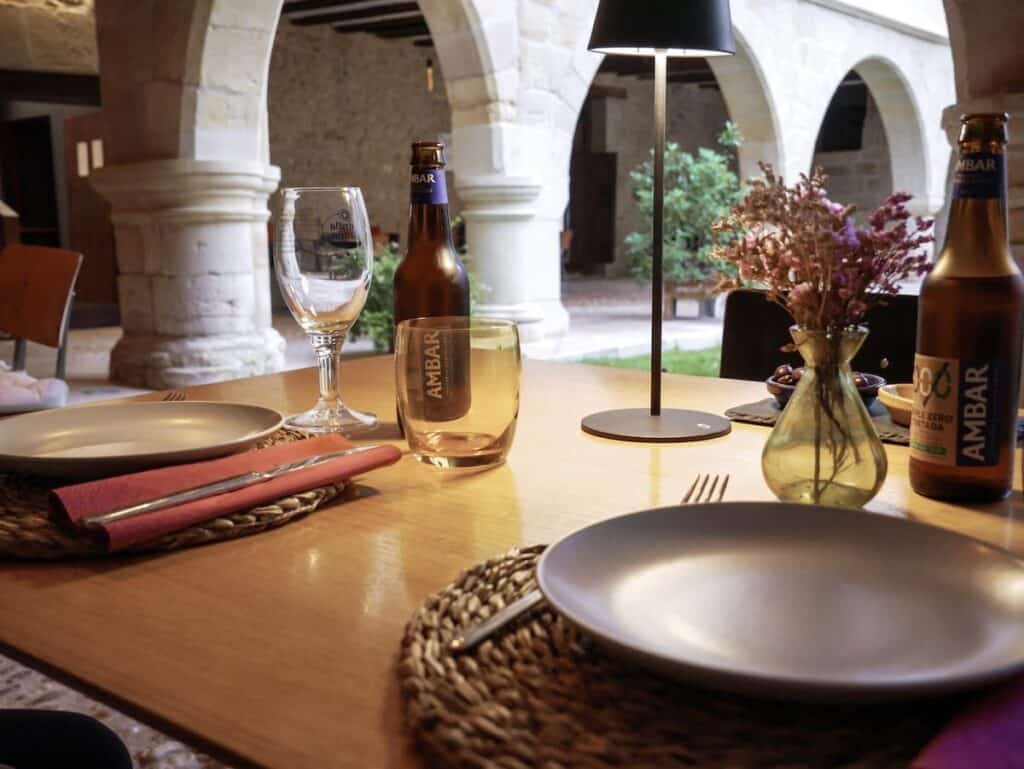
But the best part was still to come: dinner. Since it wasn’t too cold, we ate outside in the beautiful cloister. They served us a delicious three-course meal, starting with cured meats, cheese, anchovies, and a fresh tomato salad, followed by an incredibly tender meat stew, and finishing with cheesecake for dessert.
And then we chatted for a while over tea with the woman in charge. She shared a lot about the area and the sanctuary and took us to see the little sanctuary’s chapel, which still has Gothic paintings on the ceiling.
All in all, it was the perfect way to wrap up a long day of hiking.
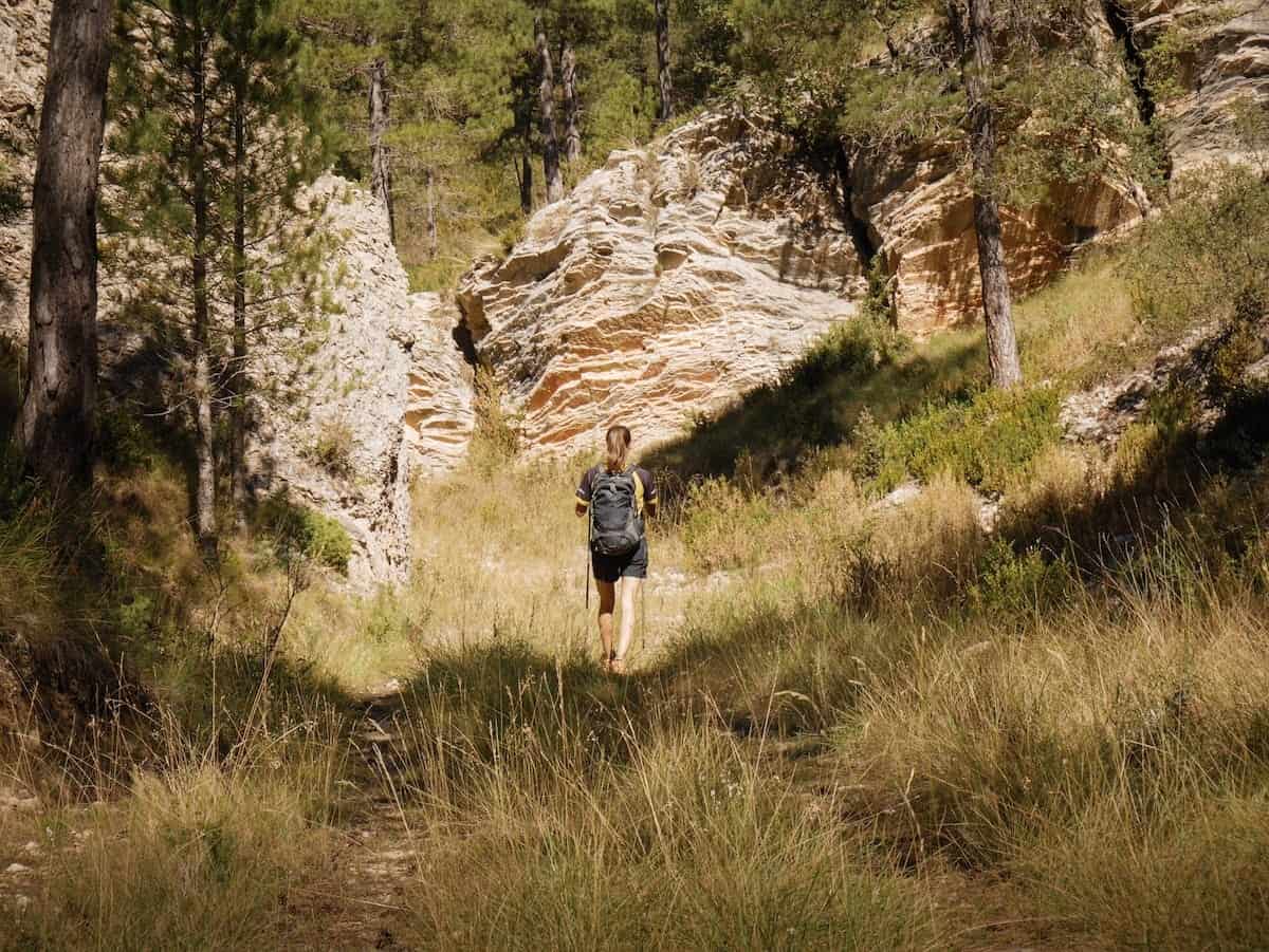
Day 3 – Beautiful landscapes and isolated villages
Pena-roja de Tastavins to El Boixar, 19.4 km hike, 1020 m+, 570 m-
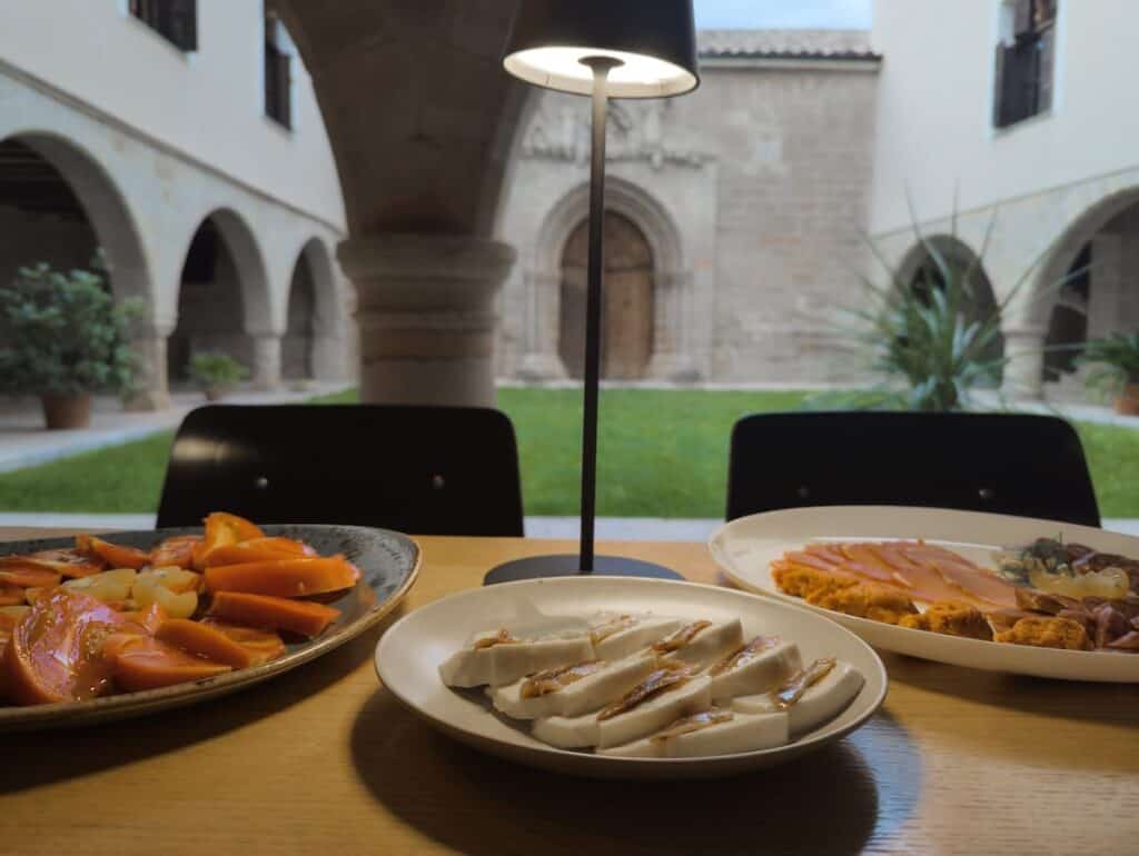
The third day was all about variety. It started with another delicious breakfast in the sanctuary’s dining room, this time with a great view of the chapel.
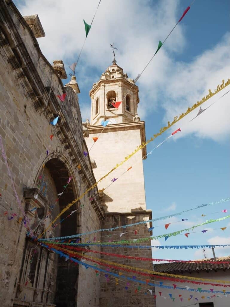
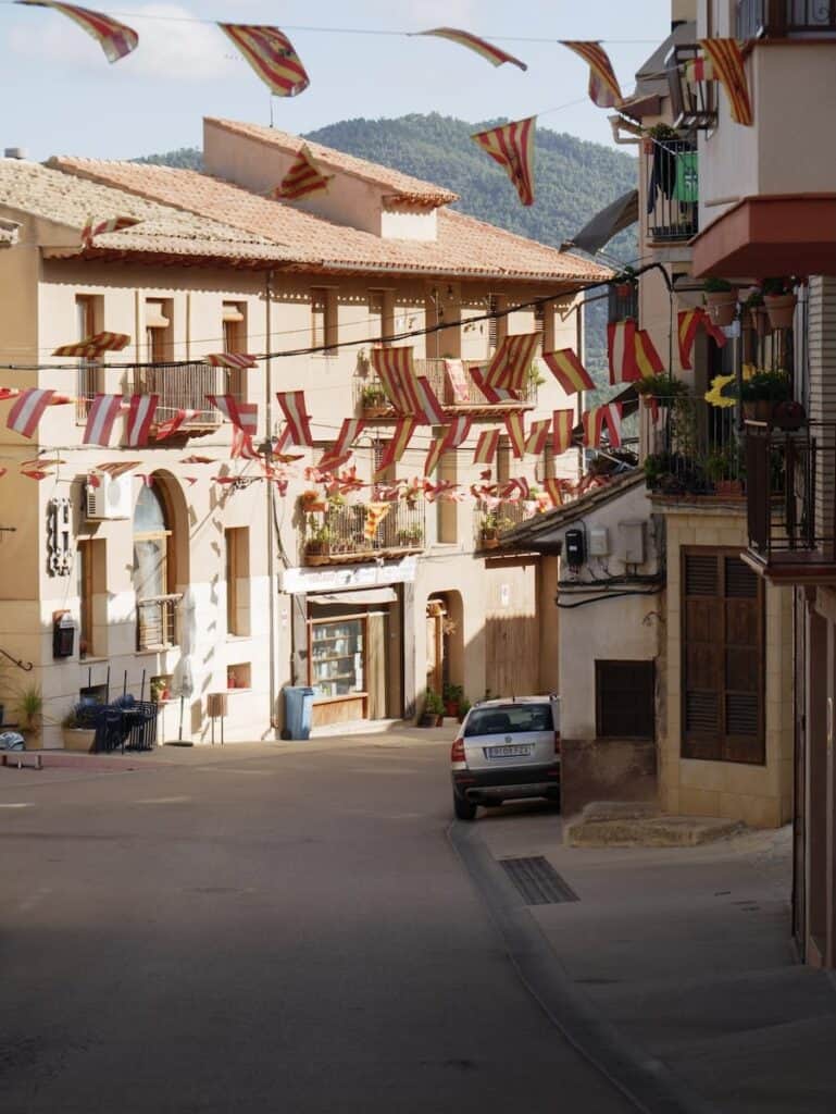
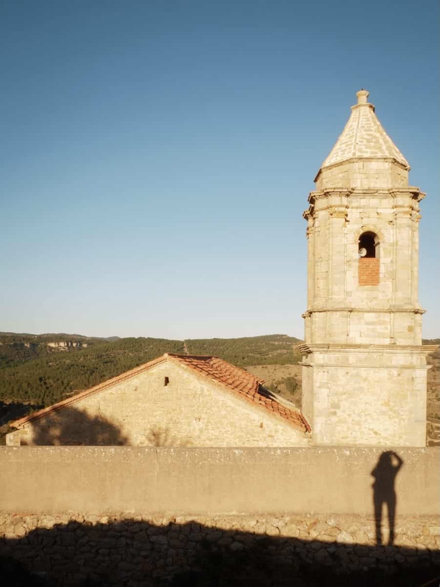
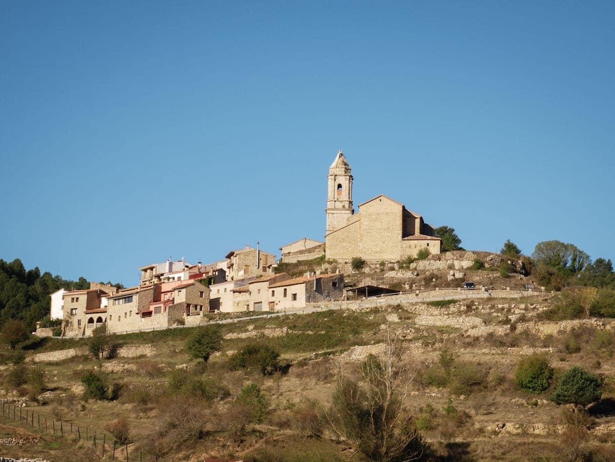
After breakfast, we hit the trail and soon reached the village of Pena-roja de Tastavins. The neighbours were celebrating a summer street party, and the streets were decked out with flags and pennants.
We popped into the village grocery store to grab some lunch, then wandered through the charming narrow streets and visited the impressive church.
👌 Our tip
If you like natural and organic cosmetics, we recommend doing a quick 4-min detour to Matarrania. It’s a small factory with a shop where you can pick up organic soaps, sunscreen, serums, lotions, and more. It makes for a great souvenir or gift for friends and family. You could also drive there after finishing the whole hike (it’s a 30-min drive from Beseit), so you don’t have to carry everything while walking 😅
- Church in Pena-Roja de Tastavins
- There was a street party going on when we were in the village
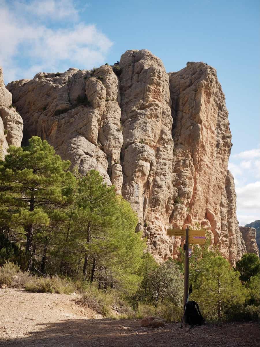
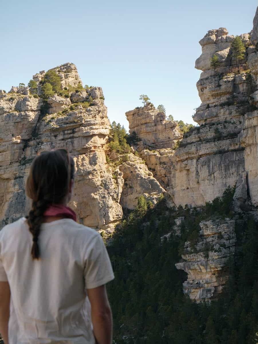
The trail then led us out of the village, gradually climbing until we spotted Rocas del Masmut, an impressive rock formation with massive walls. After a few minutes, we arrived at a lookout point. The views of the rocks and the surrounding landscape from there were mind-blowing!
We kept going and soon came across a cross called Creu del Llop (Wolf’s Cross). Next to it, there was a panel with a poem telling the story of a young shepherd who was killed by a wolf. As the poem ends, this cross serves as a reminder of how tough life used to be in these parts.
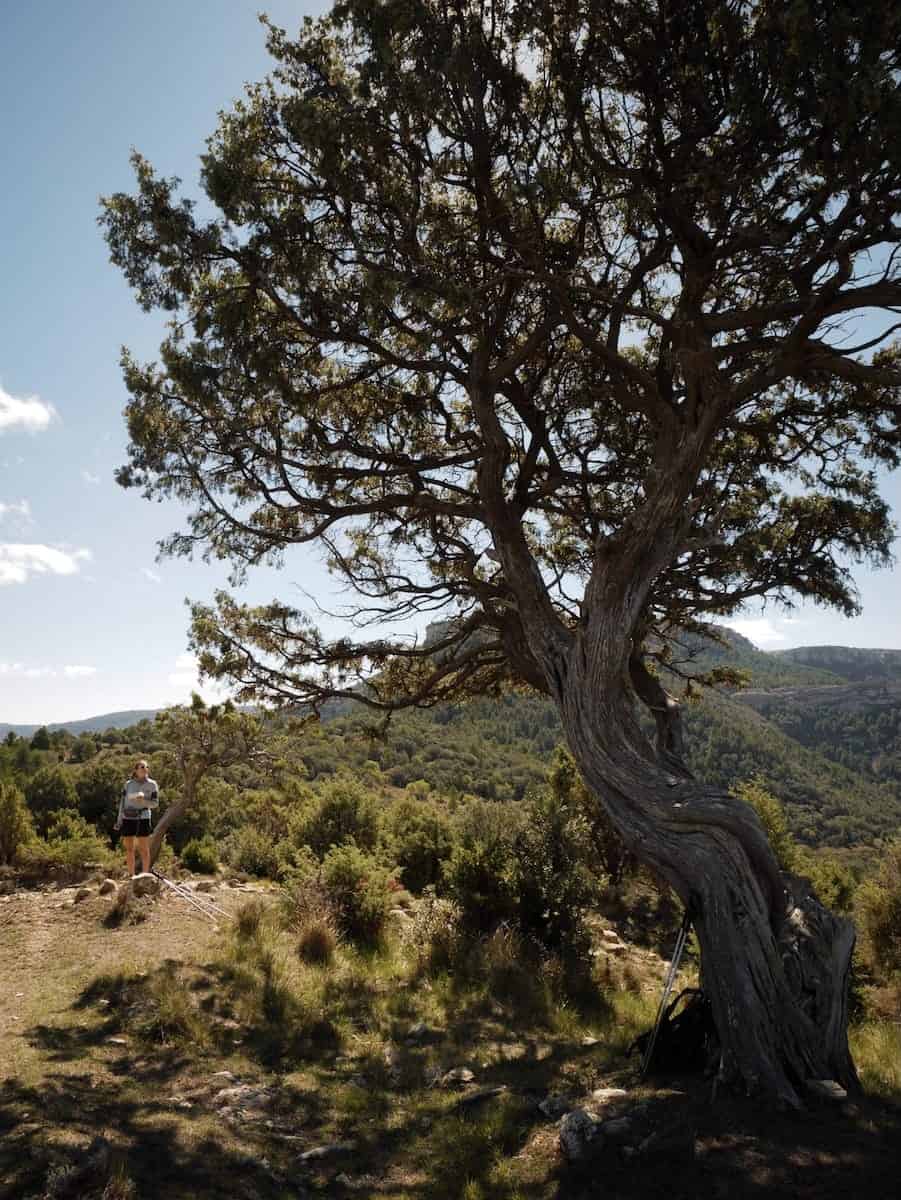
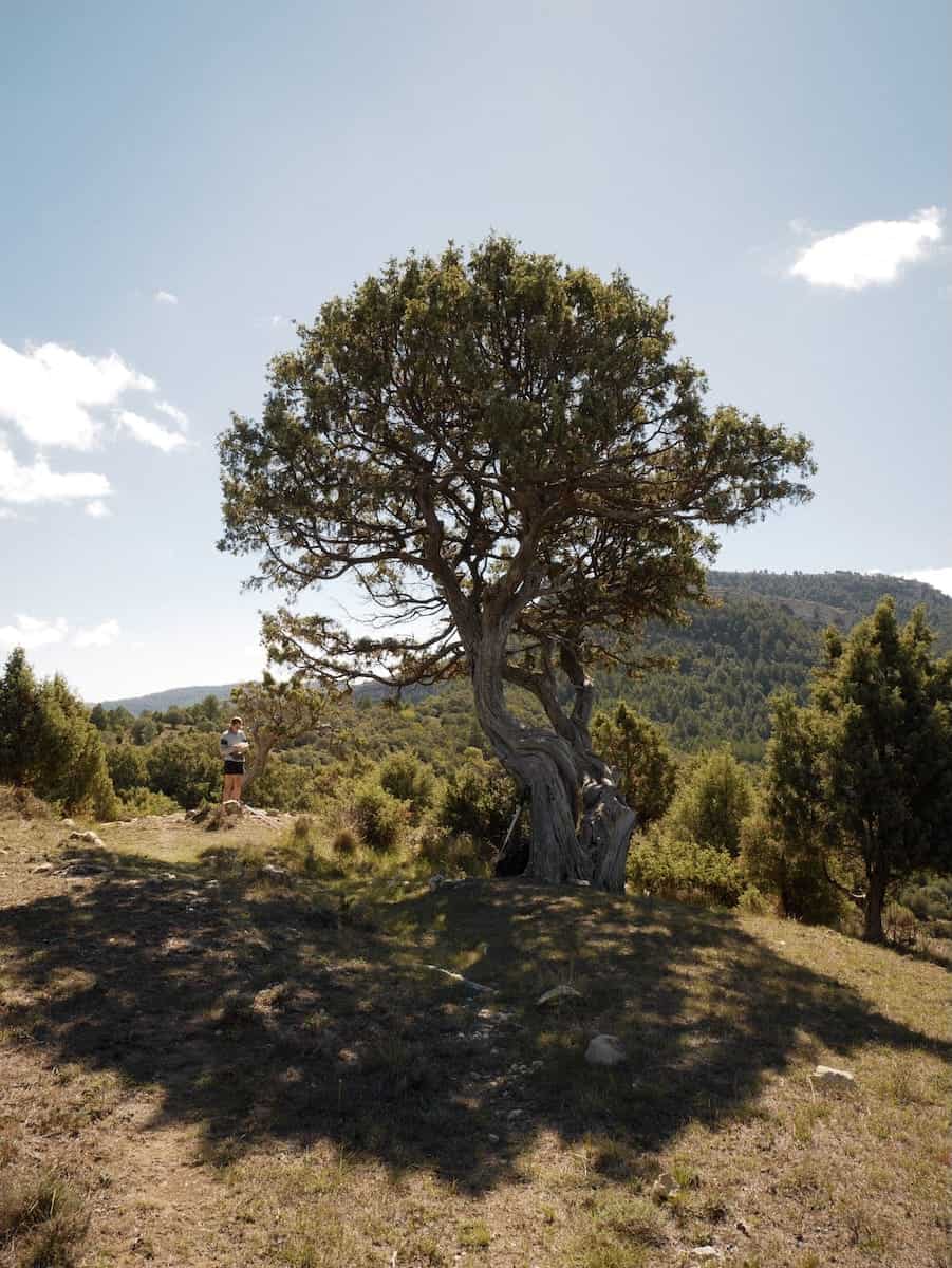
Not far away, another little surprise awaited us: a massive juniper tree. The spot felt magical, so we decided to take a break to relax in its shade and enjoy the peaceful silence.
From there, the trail unwinded through forests filled with the scents of thyme and pine. It was so good!
Before long, we spotted the imposing rock formation La Puntassa, which we skirted around to the left. We continued through endless forests for another 5 km we finally reached our next stop: Coraxà. This tiny village is one of Valencia’s highest villages, and it’s nearly abandoned. It has a restaurant, but it was closed when we were there. In fact, we didn’t see a single soul around.
After finishing our lunch, it was time to tackle the final stretch. The trail descended via stone stairs, and soon, the vegetation became wilder. We crossed a road and then took a path on the right that climbed all the way to El Boixar.
⚠️ Important!
Keep an eye on the navigation app, as it’s easy to miss the path on the right when you’re walking along the road. But if you do miss it, no worries! The road also leads to El Boixar.
El Boixar is a small village with less than ten inhabitants but a wonderful mountain hut! Refugi El Boixar had everything we needed after a long day of hiking: a hot shower, cold drinks, a cosy double room, and a relaxing living room to chill.
Before sunset, we wandered around the village, exploring its beautiful streets and charming church.
👌Our tip
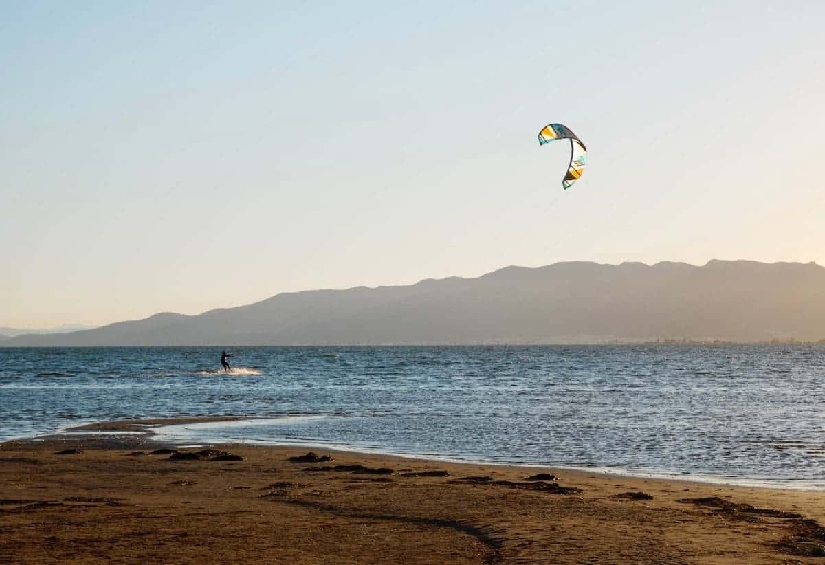
If you explore the village, don’t forget to go to this grass meadow. The views from there are superb, and you can even see the Mediterranean Sea! Also, the spot is so peaceful. No big buildings, no noise, no traffic, just nature.
The delicious and abundant dinner that Joel cooked, the game of chess after dinner, and the hut’s comfy bed were all we needed to recover and get ready for another day of hiking.
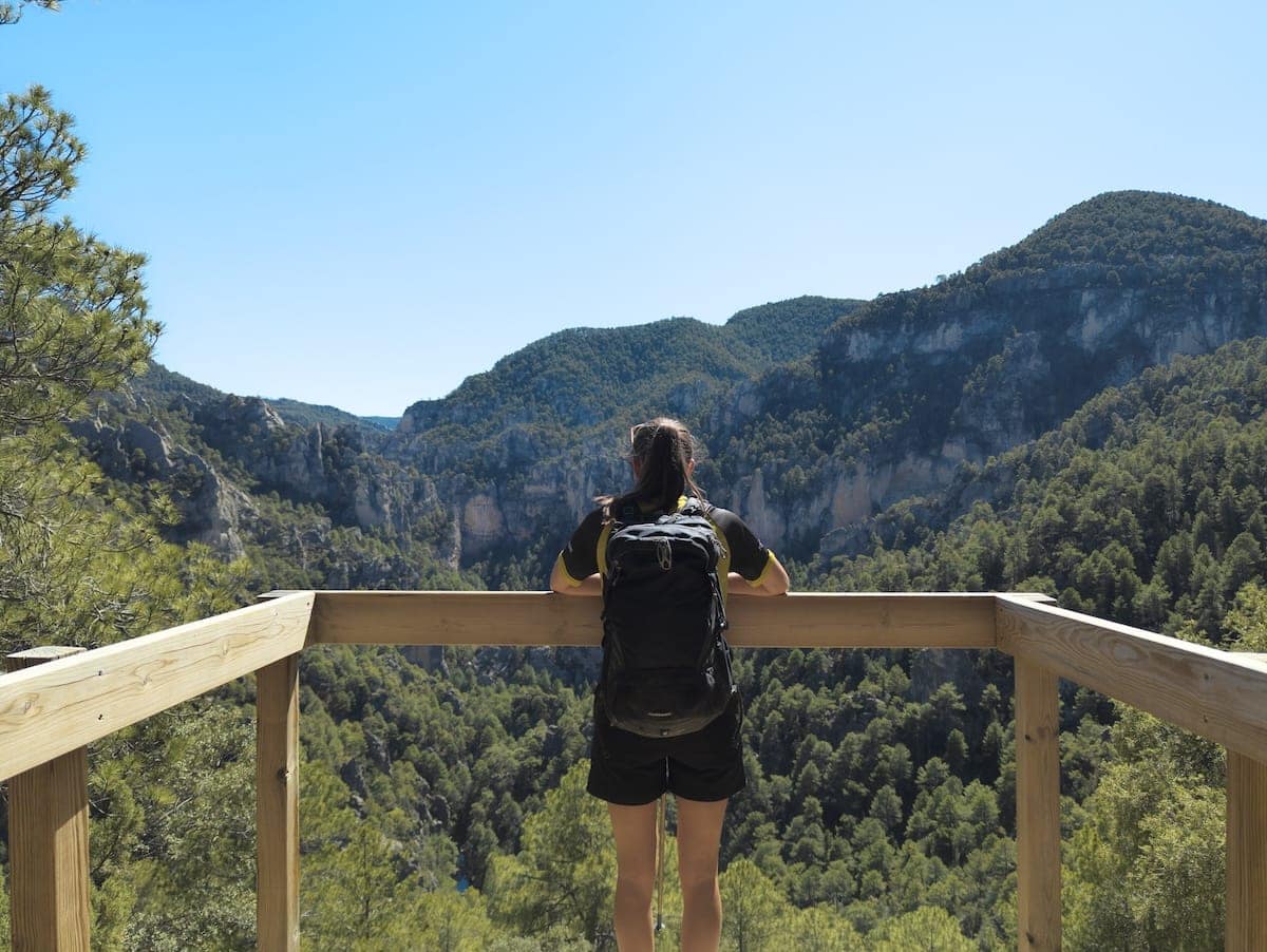
Day 4 – Insane rock formations
El Boixar to Font Ferrera hut, 21.4 km hike, 1293 m+, 1012 m-
This was the toughest day.
After a wonderful breakfast, we set off through a beautiful forest, heading toward the tiny village of Fredes. Along the way, we enjoyed some great views of El Boixar.
The trail was comfortable, mostly flat, except for a few small climbs. The morning light filtering through the forest was magical.
Once we reached Fredes, we took a quick break to drink some water and explore the village before heading down into a canyon following the signs “Portell de l’Infern”.
After a while, the path became narrower and rockier as we started descending toward an abandoned countryside house. The views were already spectacular, but we had no idea what was coming next!
The trail kept descending, and soon, we began spotting some impressive rock formations. Before we knew it, we were standing in awe, admiring the dramatic landscape at a place called Portell de l’Infern (the Gates of Hell). The sheer scale of the formations made us feel SO small. It was absolutely breathtaking.
Next, we continued descending through a pine and boxwood forest until we reached the bottom of the canyon. Unfortunately, a caterpillar plague had killed most of the boxwoods, though we didn’t see any caterpillars (you might in spring, so it’s worth asking the organisers about it).
And, of course, what goes down must come up! We then faced a steep climb, the toughest of the whole route, but it was absolutely worth it. From the top, we had stunning views of the Mediterranean Sea and the Valencia region. We could even see the Delta de l’Ebre, a national park since 1983.
Afterward, we took a little detour to a nearby country house, Mas del Perarie, and had lunch there. We devoured the omelette sandwiches Joel had made for us and topped it off with some chocolate for dessert.
We then followed a paved path for a while before branching off toward “Tossal de Cervera,” a nearby mountain you can tackle if you’ve still got some energy!
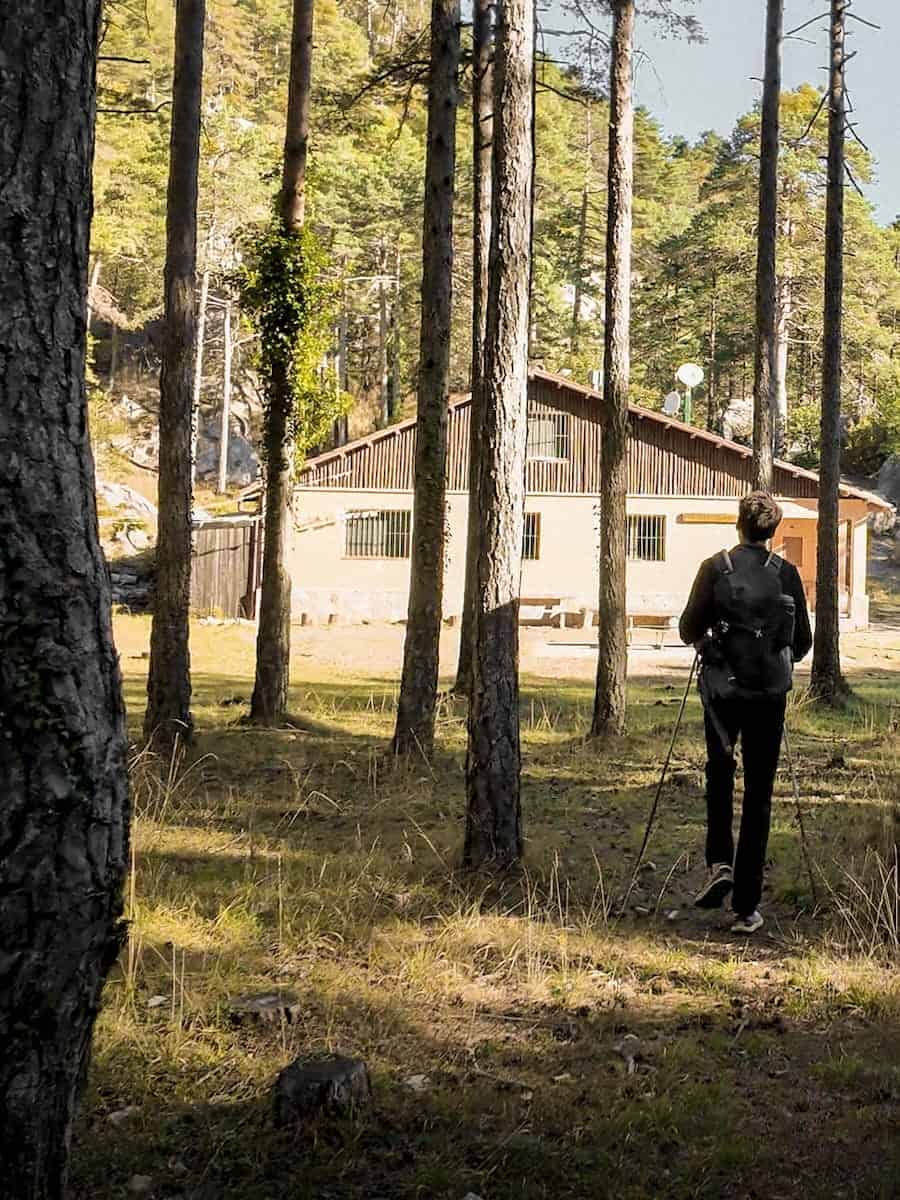
And finally, after walking through the forests for a while, we spotted the Font Ferrera hut.
⛰️ Additional peak to add to this section
You can climb El Negrell Peak (1.345 m) when hiking this section, which we highly recommend for the incredible views! If you decide to go for it, just add about an hour and a half to two hours to your total hiking time.
We made it to Font Ferrera hut in time for a much-needed shower and cold drink! After that, we played some board games and did a bit of reading, and before we knew it, it was time for dinner.
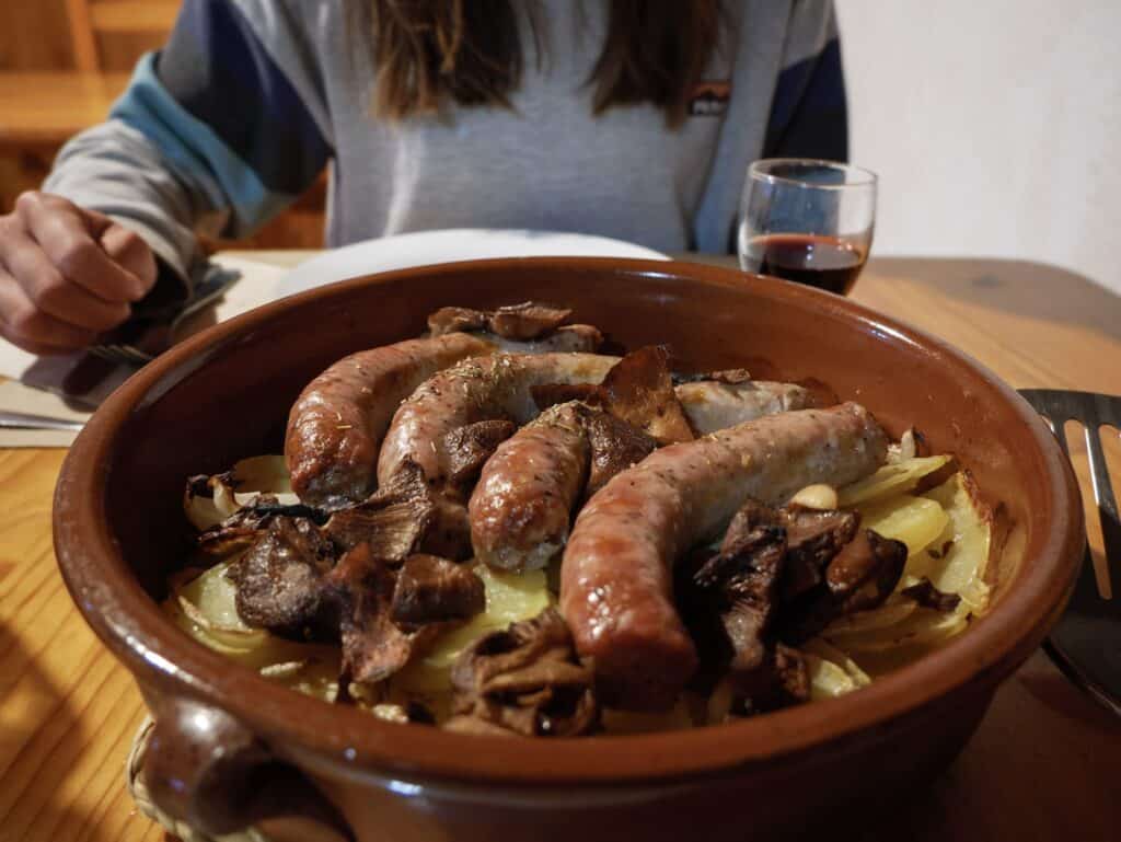
Moisès, the one in charge of the hut, served us a delicious meal: pasta, a meat stew with mushrooms, and chocolate mousse for dessert. He even brought out some rice liquor (typical from the area) and coffee liquor!
And so the fourth day ended, and it was time to rest up for the final day.
Day 5 – Goodbye to El Gran Paseo
Font Ferrera hut to Beseit, 19 km hike, 540 m+, 1110 m-
The last day of El Gran Paseo de los Puertos de Beceite was the easiest, as it was mostly downhill.
We left the Font Ferrera hut early in the morning and started our walk on a comfortable path. After about three km, we came across what looked like a house straight out of a fairytale. It’s called Xalet del Rei (King’s House), and we could see why! Its location was perfect, right next to a stream and surrounded by trees.
At this point, you have two options. The original trail, which we followed, turns left and climbs up towards La Coscollosa Peak.
The other option is to continue straight, following the Coscollosa Canyon, and eventually enter the walkways of El Parrizal. We think this option is more scenic, as you walk along the bottom of the canyon, surrounded by impressive rocky walls. However, it’s a popular day hike, so you’ll likely encounter more people compared to the quieter alternative.
⚠️ Important!
You can only follow the Coscollosa Canyon route if the river is dry (which has been the case in recent years due to drought). When we were there in 2024, the route was fine, but if there’s been a lot of rain or the river’s flow increases, you’ll need to choose the other path.
The climb wasn’t marked, so we used Wikiloc to guide us. Along the way, we found some almonds and took a quick break to snack on them.
The next section of the trail was easy, mostly winding through the forest. Soon, the trees cleared, giving us a view of La Picosa, the mountain we had climbed on the first day. We knew we were getting closer!
After walking with these amazing views for a while, we arrived at Corral del Quinto, a small hut where we stopped for a break.
The path led mostly through the forest, with a few steep sections where having hiking poles really came in handy.
After an unexpected climb and another steep descent, we arrived at a lookout with stunning views of El Parrizal Canyon. And we still had two more lookouts ahead to soak in those views!
The trail then led us through a tunnel and down a staircase, and soon we were at the bottom of the canyon. We joined the crowd of people returning from the famous walkway, following the river for about one km until we reached a parking lot.
Next to the parking lot, there’s a bar where you can stop for a cold drink before tackling the final stretch to Beseit.
From here to Beseit, the path first climbed up to an old, now-ruined country house and then descended all the way into Beseit. We had made it!
We grabbed our main luggage from La Fàbrica de Solfa, and we went for a drink to celebrate the end of the hike.
Would we recommend El Gran Paseo de los Puertos de Beceite?
Absolutely! This hike is perfect for discovering off-the-beaten-path places and escaping the hustle and bustle of everyday life. Along the trail, we saw no more than 10 people (except at the accommodations and the El Parrizal section), so it really felt like it was just us and nature.
The landscapes were very different from the Pyrenees but still stunning. We loved walking through endless forests and admiring the impressive rock formations along the way. We also liked that the route passes through various villages, so it mixes culture and history with nature.
As we mentioned, El Gran Paseo de los Puertos de Beceite is perfect if you want to get started with multi-day hikes, as you don’t have to carry much, the terrain is comfortable, and you’ll sleep well since most rooms are private.
A bonus from this route is that the accommodation and the food are amongst the best we’ve experienced on a multi-day hike. Plus, the staff was super friendly, and we learned so much about the area.
Overall, El Gran Paseo de los Puertos de Beceite is ideal for hikers who want to enjoy a multi-day hike but also like the comforts of staying in nice accommodations, carrying less weight and eating delicious and hearty meals!
Remember to practise Leave No Trace. Be kind to fellow hikers, hut wardens and the local communities. And hike on!

Quin espectacle de crònica! És per a posar-la a alguna revista! Mil gràcies per tot, ens heu ajudat molt en la difusió de la nostra ruta!