

This getaway will take you to the neighbour country: Andorra. More precisely, to the little mountain village of Arinsal.
The itinerary includes a stunning hike in which you’ll climb the highest peak of Andorra, stay in 3 different countries (yes, you heard us right!), and see more than 5 lakes.
And would it be a perfect escape without being spoiled with delicious food? We’ve picked a cute cafeteria and an Argentinian restaurant that will keep you fuelled for the adventures ahead!
⚠️ Read before doing the hike!
- The track presents no technical difficulties, except for the steep and exposed climb up to Medacorba Peak. If you aren’t used to scrambling or are afraid of heights, we recommend skipping the climb to this peak.
- The area is quite isolated, and you’re unlikely to encounter other people, so we recommend being well-prepared and comfortable hiking in remote areas.
- This route can be covered in snow up until the beginning of July. We don’t recommend doing it in June, unless you have experience and carry crampons.
- Allow at least 10 hours for the hike.
Suggested 1-day itinerary in Andorra
Breakfast ☕️
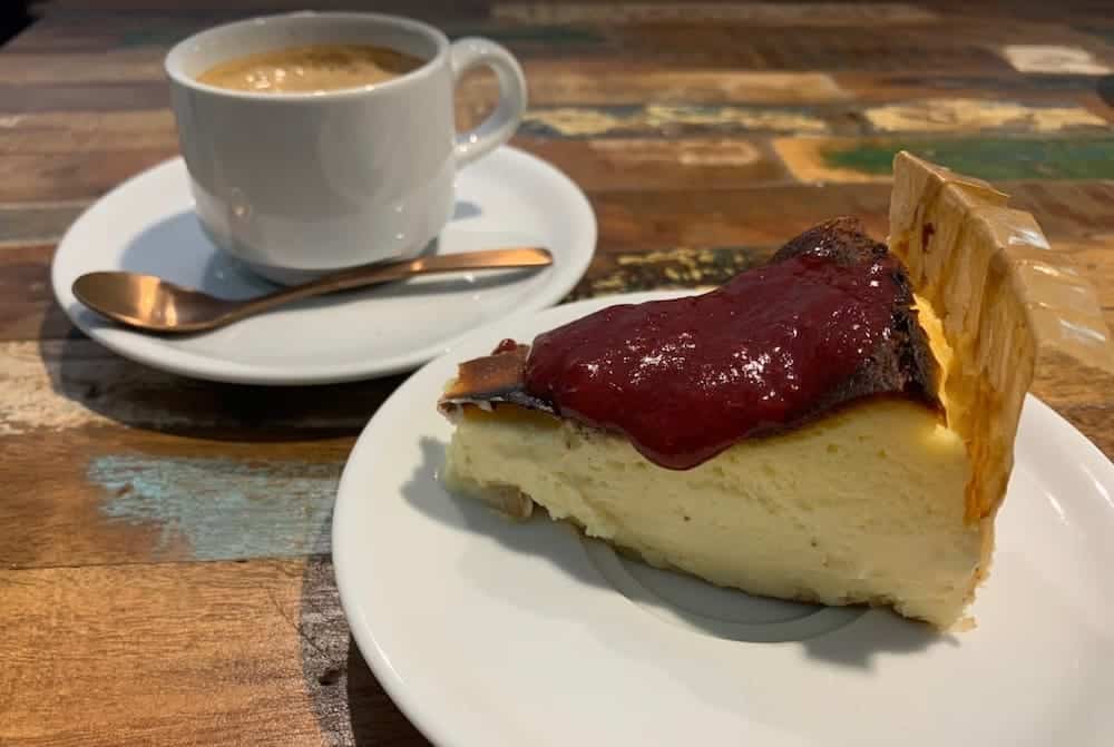
Start the day with a delicious breakfast at Oolong Coffee and Brunch. Here, you’ll find toast with avocado, cured meats, cheese, or ham, cakes, and smoothies. They also serve a wide selection of special teas.
If it isn’t too cold outside, we can’t recommend sitting on the terrace overlooking the river to enjoy the food.
We suggest getting there when they open, at 8 am, because you have a long journey ahead!
Also, it would be nice to ask for a sandwich to take away so you have something to eat for lunch during the hike. You can also buy something in the nearby supermarket if you prefer eating nuts, bars, or fruit.
Morning and afternoon 🏔
Once your belly is full and happy, it’s time to head to the mountains. Your destination is the Comapedrosa natural park.
The circular hike we propose is 16.26 km long, with an elevation gain of 1836 m.
If you think this hike is too much, no worries. There are several ways to shorten it so you can enjoy some beautiful spots in the Comapedrosa natural park.
🧭 Wikiloc track
The route is signed with red and white striped marks and with yellow circle marks. However, we can’t recommend enough taking a map with you or downloading the Wikiloc track of the route. Pay special attention when climbing the Medacorba Peak, as it’s easy to get confused and lose the trail.
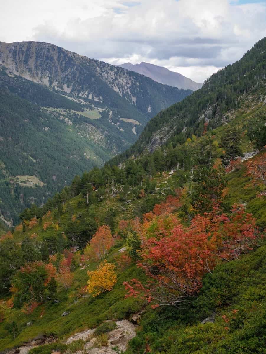
The hike starts after crossing the tunnel that links Arinsal with the Comapedrosa Natural Park. From there, you start climbing steadily, following a wide track that will later turn into a mountain path. After a while, you find yourself away from civilisation and lost in the mountains.
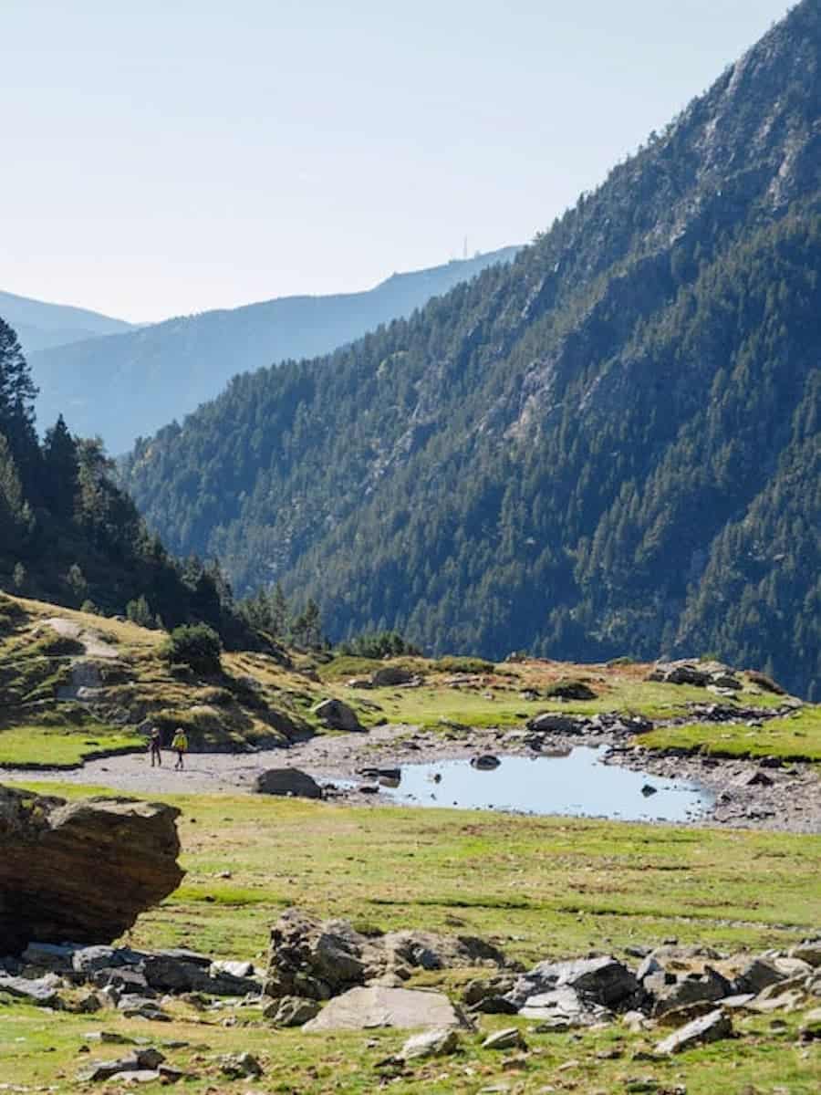
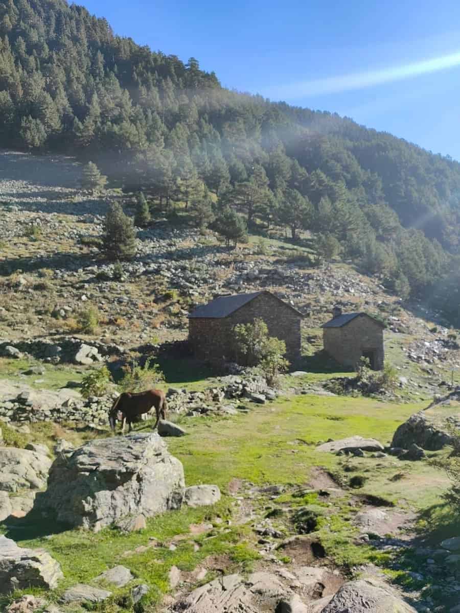
The first stunning spot is the Pla de l’Estany, a meadow with a hut and a little lake. From there, the views of Arinsal are breathtaking.
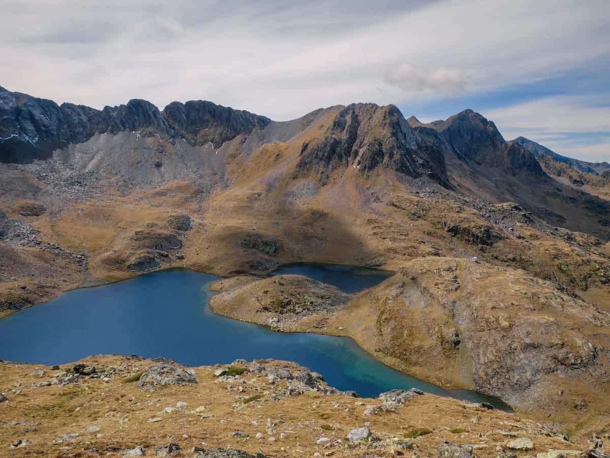
The trail continues to climb, eventually reaching three lakes known as Estanys Forcats. It had snowed the day before when we were there, leaving the mountains sparkled in white.
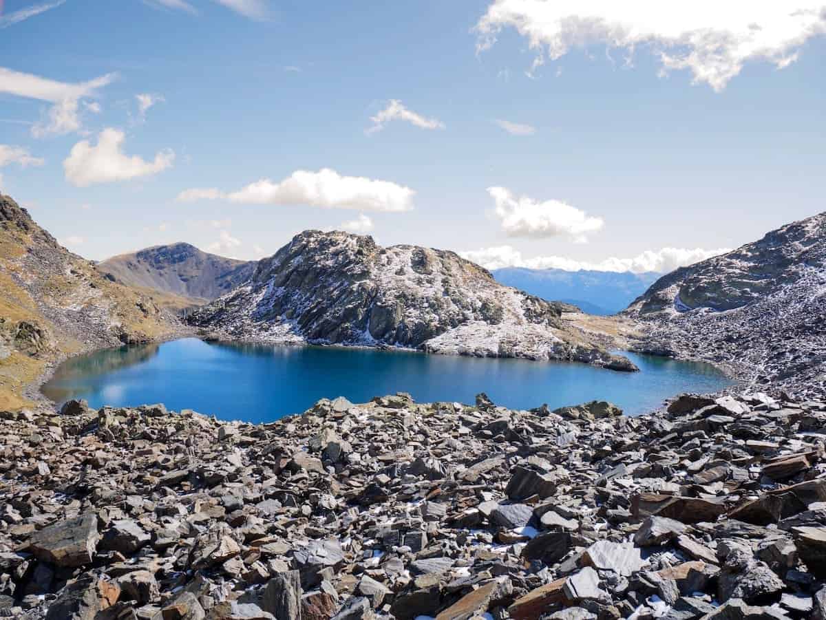
As the trail gains altitude, the lakes become smaller and smaller, and the views become more and more impressive. You can spot Arinsal in the distance, surrounded by high peaks.
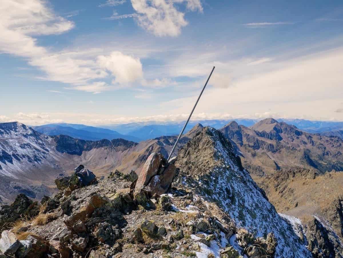
And then comes the first summit of this hike: Medacorba. The climb up to this peak is steep and exposed, and you’ll need to scramble to get there.
As a curious fact, this peak is a natural border between Andorra, Catalonia, and France. So, you’ll be standing on the border of 3 countries! Plane pilots use this peak to orient themselves when flying from Spain to France and vice versa.
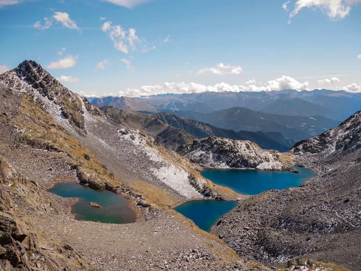
The 360º views from the top are SO beautiful. On one side, you have the Estanys Forcats (Andorra). If you turn right, you can admire the beautiful Estanys de Baiau (Catalonia). And, if you keep turning right, you spot the Étang de Médécourbe (France). Isn’t that cool?
After resting and admiring the views, it’s time to continue. Descend the peak following the same path, and once at the Estanys Forcats mountain pass, follow the red and white striped marks to the Estanys de Baiau.
Those are two emerald lakes, with a little hut nearby. It’s a perfect spot to enjoy a picnic and grab some energy for the final climb of the day.
Time to leave Catalonia behind and return to Andorra by crossing the mountain pass known as Portella de Baiau. Make sure you’re wearing proper mountain shoes because the rocks at this pass are a bit decomposed, making it easy to slip.
Once on top, you can quickly spot the highest point of Andorra: the Comapedrosa summit. The peak is 2.942 m high and has a cross on top. Now that you have admired it, it’s time to climb it!
From the top, you can enjoy panoramic views of mountain peaks stretching for km and km. Yes, you’ve made it to Andorra’s highest spot!
The way down the summit is done following the same path. From here, it is finally all descending!
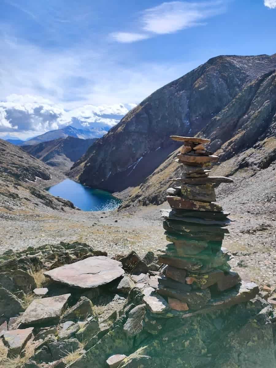
Not long after descending the peak, you come across the Estany Negre, a gorgeous, crystal-clear lake.
Keep walking along the river, admiring little waterfalls, until finally coming across the track from the beginning. Walk for 1.5 km more, and you will see the tunnel that takes you back to civilisation again.
Well done, that was a good exercise!
Shorter versions of this hike
You have 5 options:
1. Hike to the Estanys Forcats: 5.6 km one way. The way back is done following the same trail.
2. Hike to the Pic de Medacorba: 6.5 km one way. The way back is done following the same trail. Not suitable for those afraid of scrambling or heights.
3. Hike to the Pic de Comapedrosa: Climb the highest peak in Andorra. The track is 6.9 km one way.
4. Hike to the Pla de l’Estany hut: 3.5 km one way. The way back is done following the same trail.
5. Hike to the Comapedrosa hut: 3.7 km one way. The way back is done following the same trail.
Evening 🍻
Time to relax! You can stroll along the narrow streets of Arinsal surrounding the church to see cute stone houses or sit in a bar and grab a cold beer. You deserve it!
Dinner 🍽
And now, yes, time for dinner! Your next destination, the restaurant Surf, will delight you with delicious Argentinean meats and dishes.
If you like meat, the “Parrillada Argentina” is to die for! It mixes various types of meat together with fries and salad. Take into account that the portions are huge! With the parrillada for 2 people, you can easily eat 3 or 4.
If you’re a vegetarian, there are several options you can choose from, such as veggie empanadas, soups, salads, and pizzas.


If you still have energy (wow!), you can grab a drink at the same place you had dinner. The other option is to go and enjoy a good night’s sleep!
If you follow this itinerary, we’d love you to leave a comment and let us know how your experience was.

We followed the directions on this post. We are experienced hikers and in good shape. It is a great hike! But, we need to warn readers that the final climb up to pic de medecorbe and back is steep and exposed and is not suitable for people not used to serious scrambling. Also, allow enough time – it took us 10 1/2 hours which is guidebook pace (fast!)
Hi Paul, we’re glad you liked the hike! The views and the lakes are beautiful. And thanks for your opinion: it’s true that the hike is long and the climb up to Medacorba is challenging (we’ve just added some more info about that). Enjoy the rest of your time in Andorra 🙂
We did this hike on the 14th of June. It’s a great hike indeed, but I must warn other hikers (and perhaps you might want to mention this in the article as well) to check the trail conditions beforehand, as we couldn’t find any information about them prior to our hike.
Based on the pictures in the article and the fact that we were hiking during summer, we were expecting a challenging but manageable hike. Unfortunately, after Estanys Forcats, everything was covered in snow. We couldn’t follow the trail because the markings were not visible. Also, hiking in the melting snow required much more energy, making it difficult to maintain balance and avoid sliding down into the valley. Moreover, since we couldn’t always stay on the trail (because we couldn’t tell where it was due to the snow), there were times where we stepped on what seemed like a few centimeters of snow, only to fall through into meter-deep holes hidden underneath.
We were so exhausted that after Portella de Baiau, we decided to start descending without reaching Coma Pedrosa, even though we are experienced hikers with plenty of scrambling experience. Additionally, during the entire hike, we only encountered one person, so in case of an emergency, you’re essentially on your own.
Overall, it’s a great hike but can be very dangerous if you are not prepared for these conditions.
Hi Mark, thanks for the comment. Yes, it snowed a lot last May, that’s why you found a lot of snow at higher altitudes. We did it in September, so there wasn’t any. Thanks for letting us know. We have updated the post with this info.
I hiked this trail alone on June 5, 2025. It took me just under 12 hours and my GPS showed total distance of 20.3 km (12.6 miles) and elevation gain of 2120 meters (6,956 ft). I started and ended the hike at the Hotel Yomo Patagonia in Arinsal. I hiked the trail clockwise, reaching Coma Pedrosa peak first in about 5 hours and Medecourbe Peak about 3 hours later (I skipped the long exposed narrow ridge just north of the peak due to time constraints and probably a bit of fear).
There was still a good amount of snow cover on the highest 1/3 of the trail (from around Estany Negre to around Cabanya Estany Forcats). At times, I was able to go a bit off trail and remain on dry ground, but I still ended up having to walk probably 800m+ overall directly on the snow, which was generally firm (my foot would sink in about 2-3 cm (1 inch) with each step), although I was stabbing the snow in front of me aggressively with my trekking poles with each step to check for soft spots (I fell in to about knee depth two times). Some of the snow crossings, especially the section just after Medecourbe Peak, required walking horizontally across long, steep snow-covered slopes that had lakes of semi-frozen water below, which I was very cautious to avoid sliding into. I also witnessed a large (200kg?) rock spontaneously break loose from above and tumble/slide across the trail in this section, which definitely caught my attention (I heard/saw this happen from a good distance away).
During my 12-hour hike, I saw other hikers only three times, plus I saw what looked like a yellow rescue-type helicopter apparently doing a routine visual check of the area for about 15-20 minutes at around 4pm.
There was a substantial amount of runoff water from snow melting higher in the mountains, which made me worry about the integrity of the remaining snow I had to walk across (due to the potential of running water melting it from below). In total, I probably did about 20 stream crossings, most of which were easy but a few of which required a lot of concentration.
I’d say that waterproof boots are a must along with trekking poles (for balance, load reduction on the legs, and for testing snow integrity). I also had waterproof pants, which helped a lot. The lower parts of the trail were warm (hiking pants and a t-shirt sufficed), but near the peaks, the wind chill was bit above freezing and I used mid-weight gloves, a t-shirt, sweater, and windproof jacket, and a wool beanie hat.
My other observation was that there were a good number of loose rocks on the scrambling sections, including some larger ones that I expected to be stable, so I’d advise caution when selecting hand and foot placements.
The scenery and solitude on the trail were phenomenal, but there’s basically no help to be had if you run into trouble. With the right preparation and food/water/clothes/gear, it’s a challenging and rewarding hike. I’d guess that by July, the amount of snow will be greatly reduced, which would make following the trail much easier and safer and would probably allow the hike to be completed 1-2 hours faster.
For reference, I’m a 48 year-old male (tall/skinny runner) who’s in good shape but not an elite athlete, and I have hiking experience but no technical climbing skills.
Hi Jason, thanks for sharing your experience. We’ve updated the post with the info you’ve shared. June is a tricky month because the conditions in the mountain change a lot depending on the snowfall in May, and this year, it snowed quite a lot. We’re glad you enjoyed the hike and found it beautiful despite the challenge.